Clinton is a town in, and the parish seat of, East Feliciana Parish, Louisiana, United States. The town was named for New York Governor DeWitt Clinton. The population was 1,653 at the 2010 census. It is part of the Baton Rouge Metropolitan Statistical Area.
| Name: | Clinton town |
|---|---|
| LSAD Code: | 43 |
| LSAD Description: | town (suffix) |
| State: | Louisiana |
| County: | East Feliciana Parish |
| Elevation: | 226 ft (69 m) |
| Total Area: | 2.76 sq mi (7.14 km²) |
| Land Area: | 2.74 sq mi (7.10 km²) |
| Water Area: | 0.02 sq mi (0.04 km²) |
| Total Population: | 1,340 |
| Population Density: | 489.05/sq mi (188.83/km²) |
| Area code: | 225 |
| FIPS code: | 2215990 |
| GNISfeature ID: | 2406280 |
| Website: | www.townofclintonla.com |
Online Interactive Map
Click on ![]() to view map in "full screen" mode.
to view map in "full screen" mode.
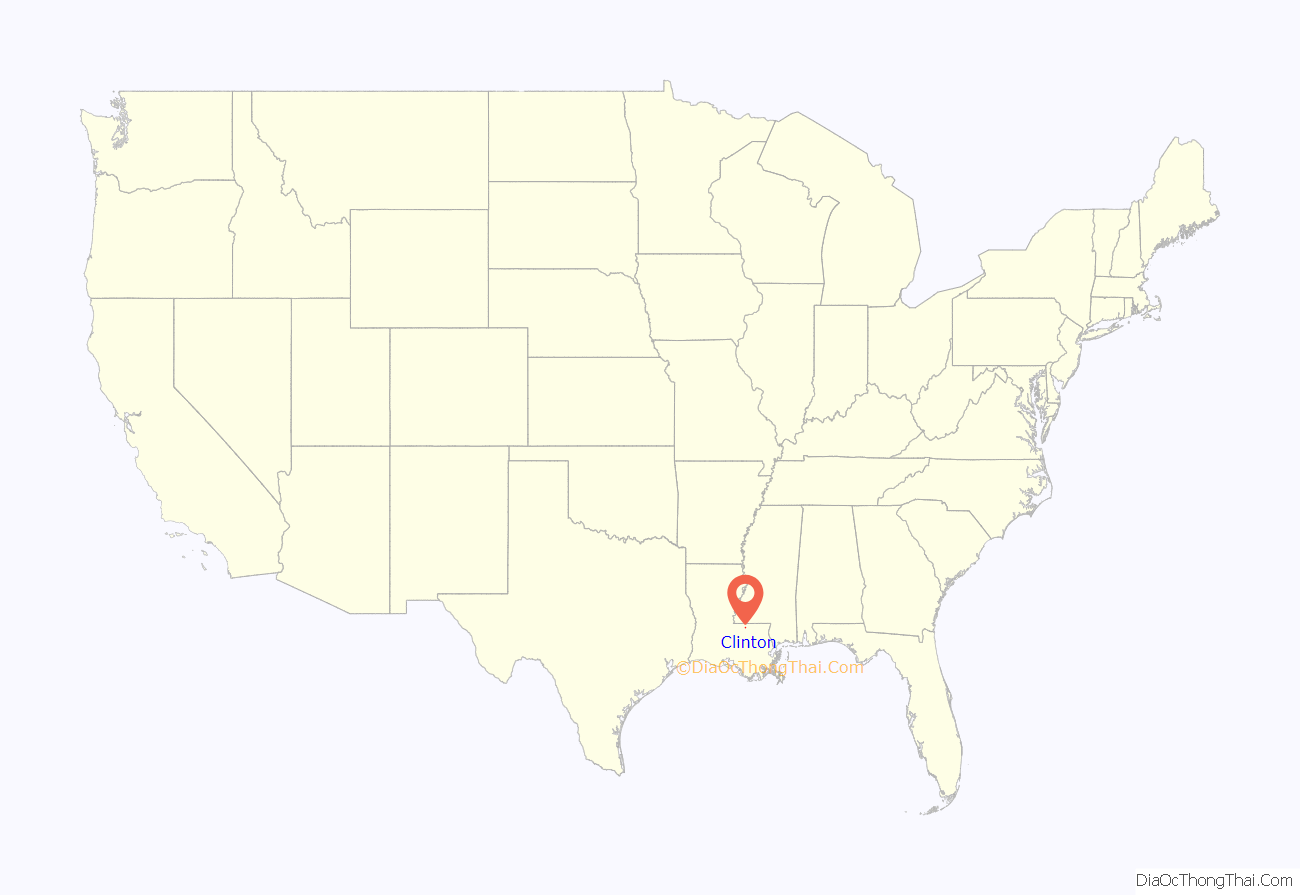
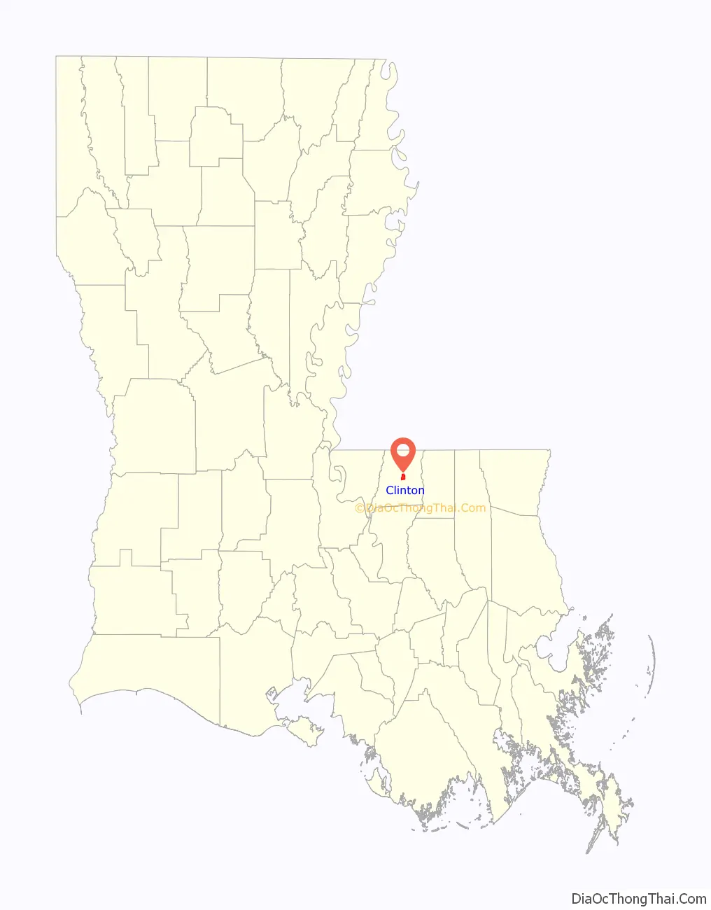
Clinton location map. Where is Clinton town?
History
In 1824, when Feliciana Parish was split into East and West, Clinton became the seat of East Feliciana Parish’s government, replacing the town of Jackson in this capacity.
In mid October 1948, an Air Force transport plane with 34 people aboard made a forced landing near the town, killing four.
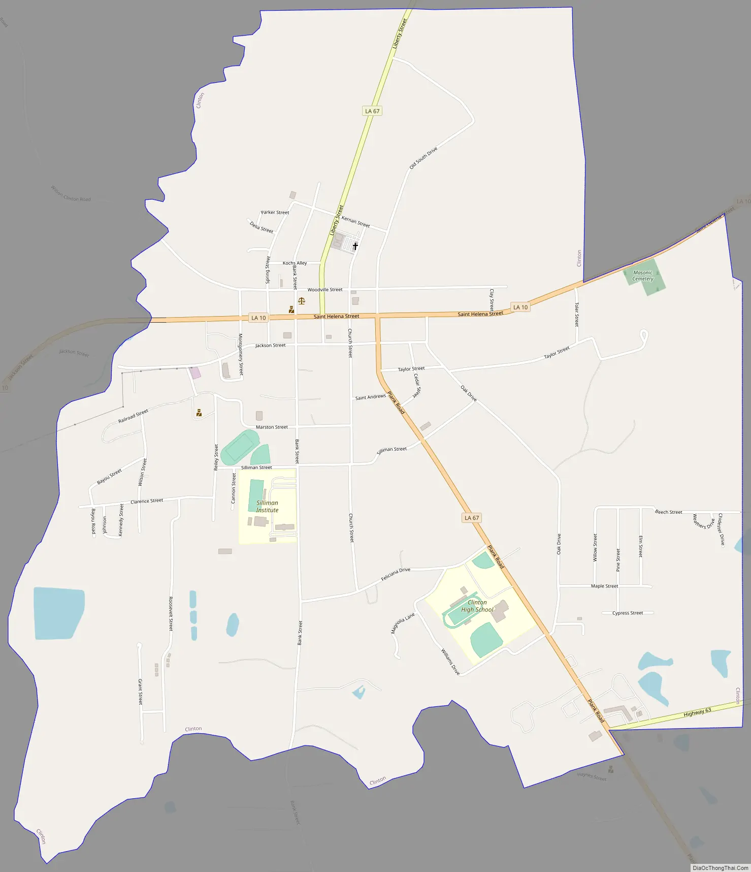
Clinton Road Map
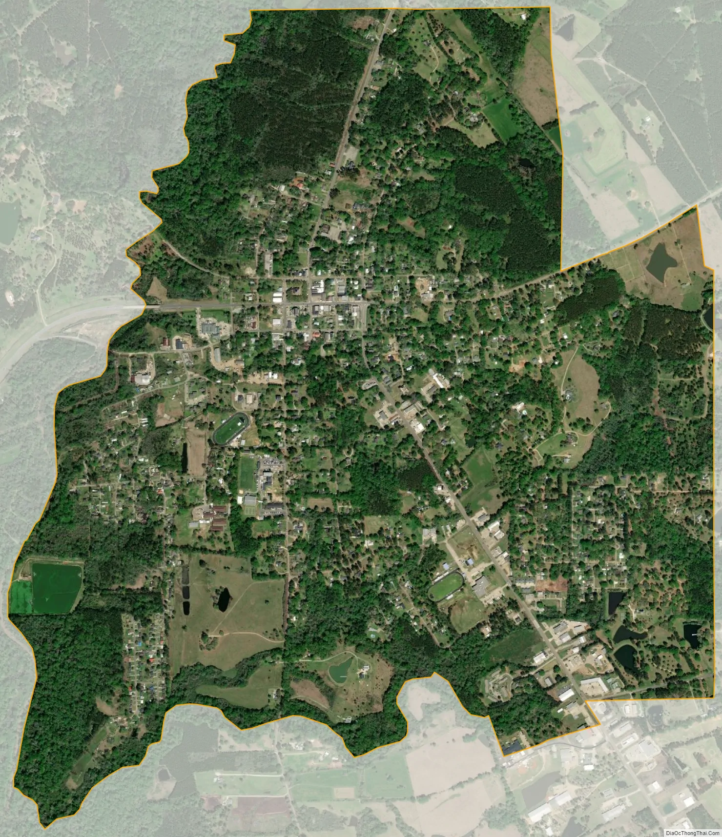
Clinton city Satellite Map
Geography
Clinton is located at 30°51′47″N 91°0′57″W / 30.86306°N 91.01583°W / 30.86306; -91.01583 (30.863050, -91.015789).
According to the United States Census Bureau, the town has a total area of 2.8 square miles (7.3 km), of which 2.7 square miles (7.0 km) is land and 0.04 square miles (0.10 km) (0.72%) is water.
See also
Map of Louisiana State and its subdivision:- Acadia
- Allen
- Ascension
- Assumption
- Avoyelles
- Beauregard
- Bienville
- Bossier
- Caddo
- Calcasieu
- Caldwell
- Cameron
- Catahoula
- Claiborne
- Concordia
- De Soto
- East Baton Rouge
- East Carroll
- East Feliciana
- Evangeline
- Franklin
- Grant
- Iberia
- Iberville
- Jackson
- Jefferson
- Jefferson Davis
- La Salle
- Lafayette
- Lafourche
- Lincoln
- Livingston
- Madison
- Morehouse
- Natchitoches
- Orleans
- Ouachita
- Plaquemines
- Pointe Coupee
- Rapides
- Red River
- Richland
- Sabine
- Saint Bernard
- Saint Charles
- Saint Helena
- Saint James
- Saint John the Baptist
- Saint Landry
- Saint Martin
- Saint Mary
- Saint Tammany
- Tangipahoa
- Tensas
- Terrebonne
- Union
- Vermilion
- Vernon
- Washington
- Webster
- West Baton Rouge
- West Carroll
- West Feliciana
- Winn
- Alabama
- Alaska
- Arizona
- Arkansas
- California
- Colorado
- Connecticut
- Delaware
- District of Columbia
- Florida
- Georgia
- Hawaii
- Idaho
- Illinois
- Indiana
- Iowa
- Kansas
- Kentucky
- Louisiana
- Maine
- Maryland
- Massachusetts
- Michigan
- Minnesota
- Mississippi
- Missouri
- Montana
- Nebraska
- Nevada
- New Hampshire
- New Jersey
- New Mexico
- New York
- North Carolina
- North Dakota
- Ohio
- Oklahoma
- Oregon
- Pennsylvania
- Rhode Island
- South Carolina
- South Dakota
- Tennessee
- Texas
- Utah
- Vermont
- Virginia
- Washington
- West Virginia
- Wisconsin
- Wyoming


