Downsville is a village in Lincoln and Union parishes in the U.S. state of Louisiana. The population as of the 2010 census was 143, an increase from 118 in the 2000 census.
The Lincoln Parish portion of Downsville is part of the Ruston Micropolitan Statistical Area, while the Union Parish portion is part of the Monroe Metropolitan Statistical Area Downsville is made up of many communities. Downtown Downsville, Holmesville, Point- Wilhite, Mt.Ararat Baptist Church Community. There are several more.
Downsville was named for U.S. Senator Solomon W. Downs.
| Name: | Downsville village |
|---|---|
| LSAD Code: | 47 |
| LSAD Description: | village (suffix) |
| State: | Louisiana |
| County: | Lincoln Parish, Union Parish |
| Elevation: | 253 ft (77 m) |
| Total Area: | 0.74 sq mi (1.93 km²) |
| Land Area: | 0.74 sq mi (1.93 km²) |
| Water Area: | 0.00 sq mi (0.00 km²) |
| Total Population: | 120 |
| Population Density: | 161.29/sq mi (62.30/km²) |
| Area code: | 318 |
| FIPS code: | 2221450 |
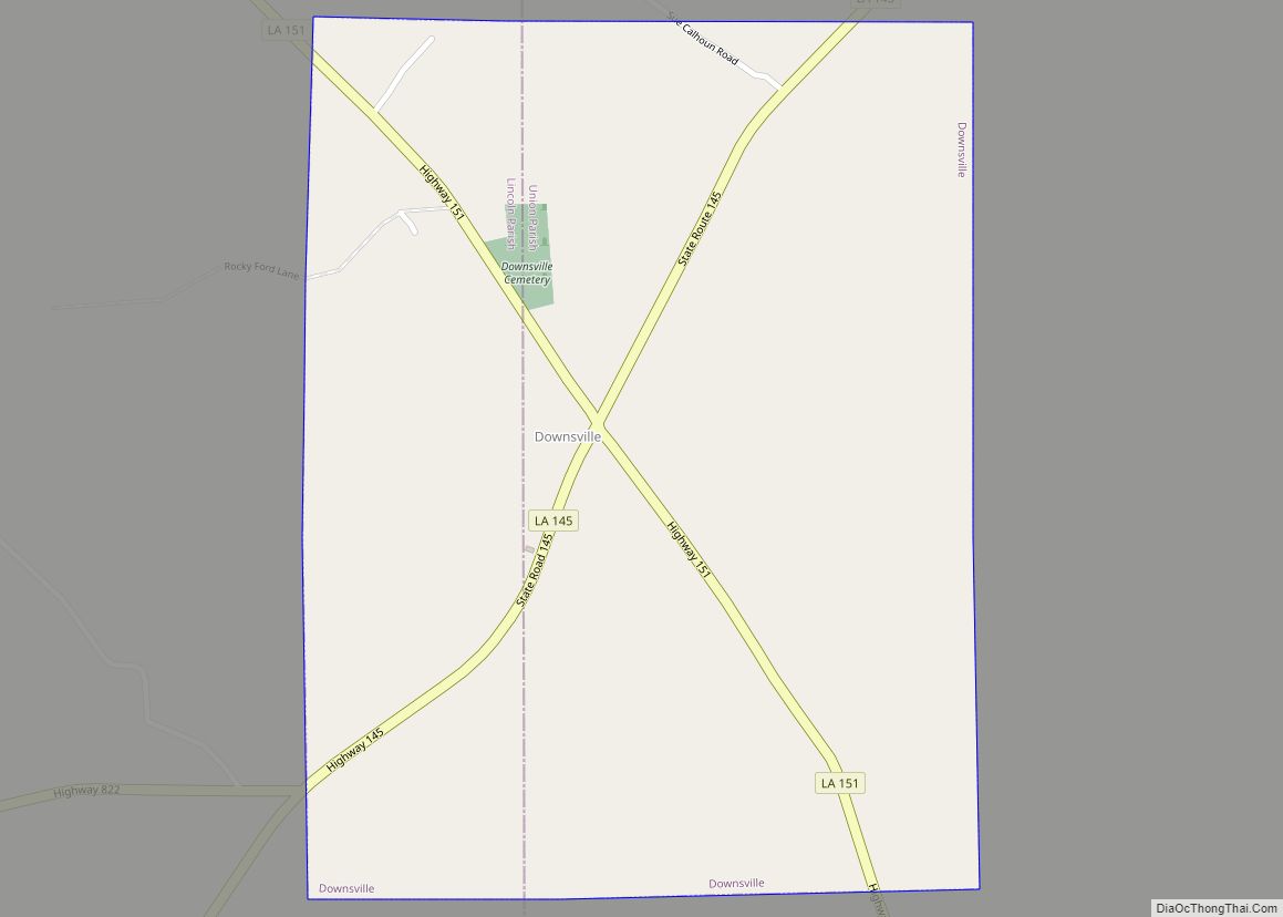
Online Interactive Map
Click on ![]() to view map in "full screen" mode.
to view map in "full screen" mode.
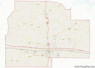
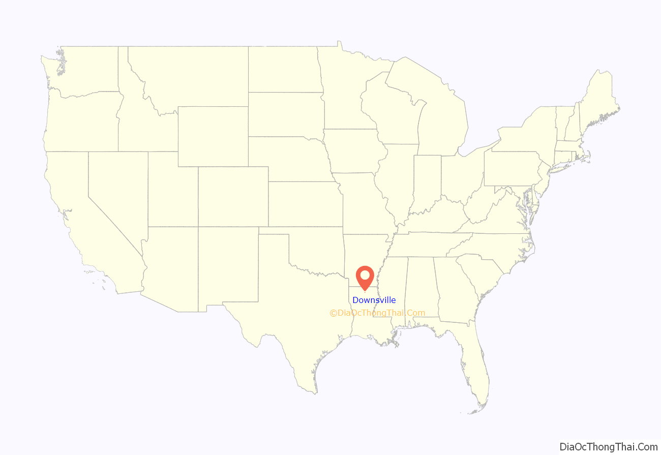
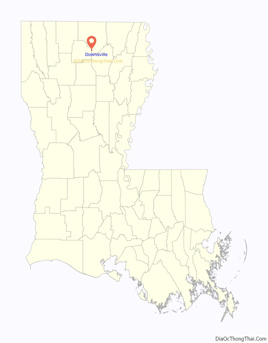
Downsville location map. Where is Downsville village?
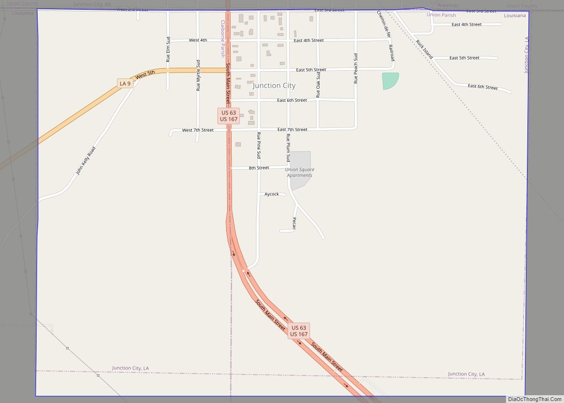
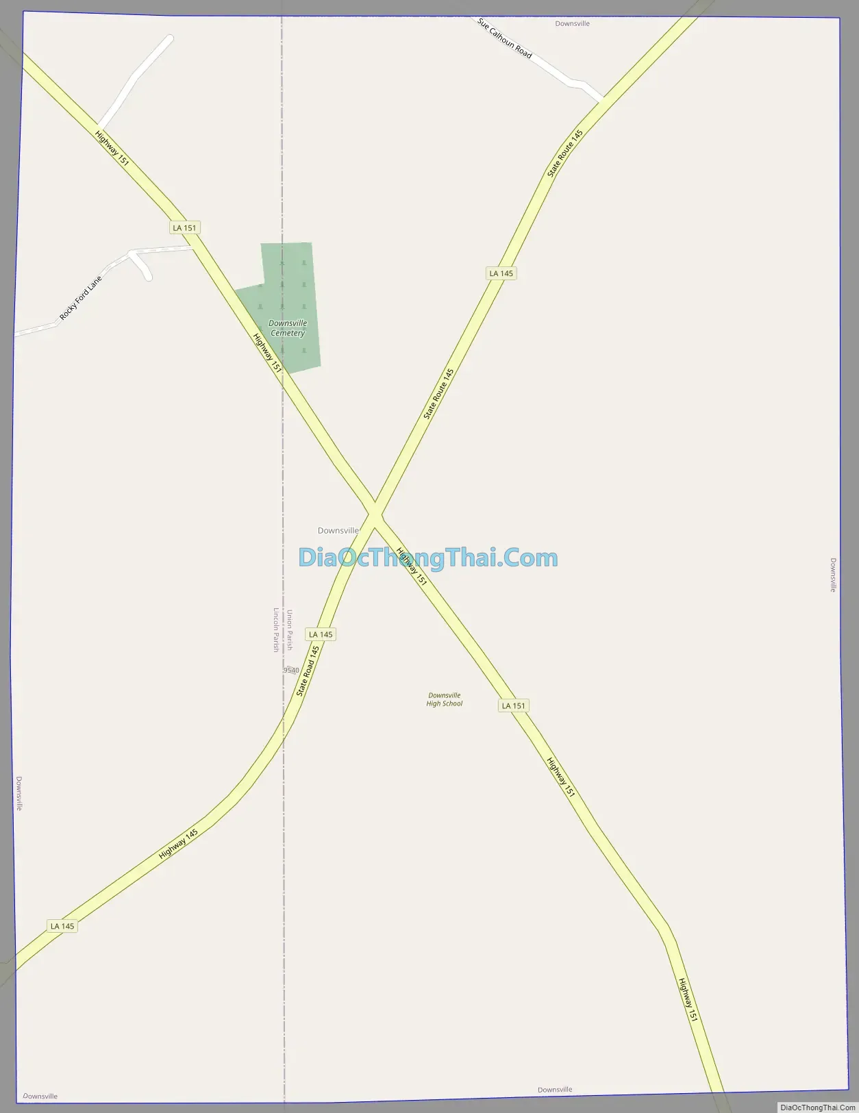
Downsville Road Map
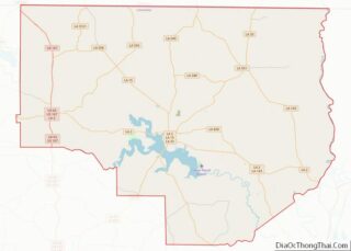
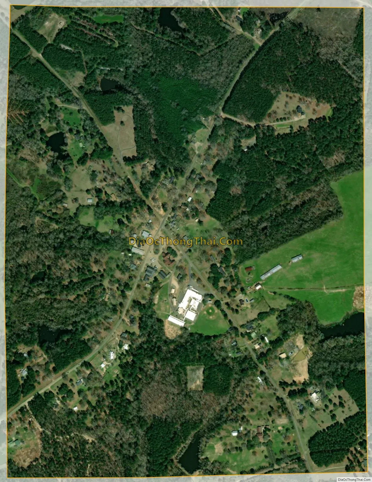
Downsville city Satellite Map
Geography
Downsville is located at 32°37′38″N 92°24′52″W / 32.62722°N 92.41444°W / 32.62722; -92.41444 (32.627112, -92.414483).
According to the United States Census Bureau, the village has a total area of 0.8 square miles (1.9 km), all land.
See also
Map of Louisiana State and its subdivision:- Acadia
- Allen
- Ascension
- Assumption
- Avoyelles
- Beauregard
- Bienville
- Bossier
- Caddo
- Calcasieu
- Caldwell
- Cameron
- Catahoula
- Claiborne
- Concordia
- De Soto
- East Baton Rouge
- East Carroll
- East Feliciana
- Evangeline
- Franklin
- Grant
- Iberia
- Iberville
- Jackson
- Jefferson
- Jefferson Davis
- La Salle
- Lafayette
- Lafourche
- Lincoln
- Livingston
- Madison
- Morehouse
- Natchitoches
- Orleans
- Ouachita
- Plaquemines
- Pointe Coupee
- Rapides
- Red River
- Richland
- Sabine
- Saint Bernard
- Saint Charles
- Saint Helena
- Saint James
- Saint John the Baptist
- Saint Landry
- Saint Martin
- Saint Mary
- Saint Tammany
- Tangipahoa
- Tensas
- Terrebonne
- Union
- Vermilion
- Vernon
- Washington
- Webster
- West Baton Rouge
- West Carroll
- West Feliciana
- Winn
- Alabama
- Alaska
- Arizona
- Arkansas
- California
- Colorado
- Connecticut
- Delaware
- District of Columbia
- Florida
- Georgia
- Hawaii
- Idaho
- Illinois
- Indiana
- Iowa
- Kansas
- Kentucky
- Louisiana
- Maine
- Maryland
- Massachusetts
- Michigan
- Minnesota
- Mississippi
- Missouri
- Montana
- Nebraska
- Nevada
- New Hampshire
- New Jersey
- New Mexico
- New York
- North Carolina
- North Dakota
- Ohio
- Oklahoma
- Oregon
- Pennsylvania
- Rhode Island
- South Carolina
- South Dakota
- Tennessee
- Texas
- Utah
- Vermont
- Virginia
- Washington
- West Virginia
- Wisconsin
- Wyoming