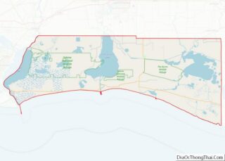
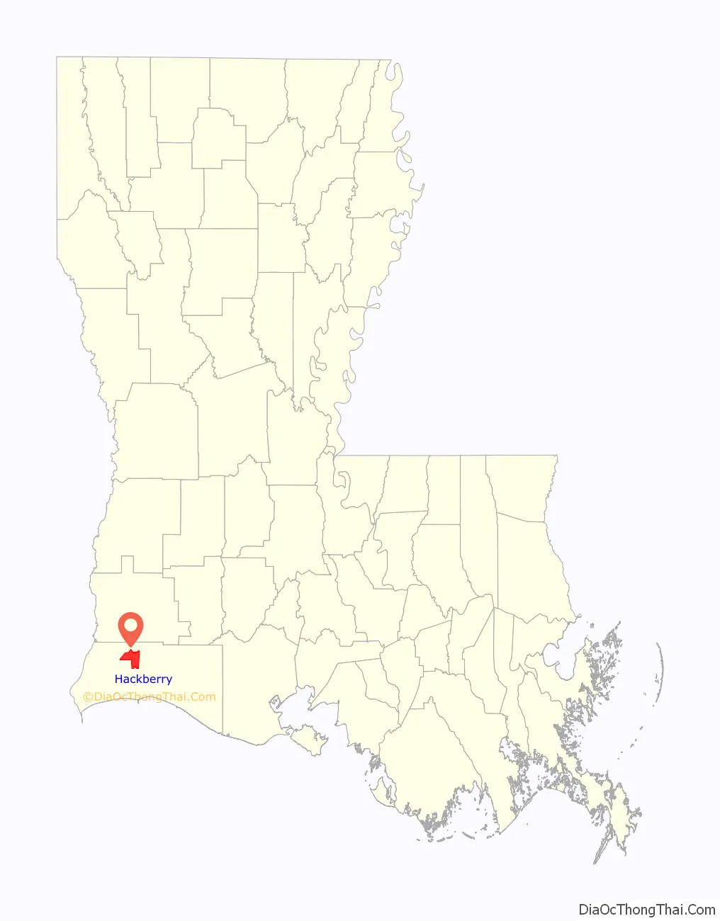
Hackberry is an unincorporated community and census-designated place (CDP) in Cameron Parish, Louisiana, United States. The population was 1,261 at the 2010 census, down from 1,699 in 2000. The losses were due to extensive damage from hurricanes Rita and Ike in 2005 and 2008, respectively. It is part of the Lake Charles Metropolitan Statistical Area.
| Name: | Hackberry CDP |
|---|---|
| LSAD Code: | 57 |
| LSAD Description: | CDP (suffix) |
| State: | Louisiana |
| County: | Cameron Parish |
| Elevation: | 8 ft (2 m) |
| Total Area: | 34.48 sq mi (89.32 km²) |
| Land Area: | 28.07 sq mi (72.72 km²) |
| Water Area: | 6.41 sq mi (16.60 km²) |
| Total Population: | 926 |
| Population Density: | 32.98/sq mi (12.73/km²) |
| Area code: | 337 |
| FIPS code: | 2232405 |
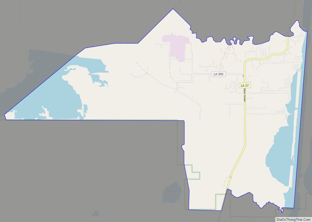
Online Interactive Map
Click on ![]() to view map in "full screen" mode.
to view map in "full screen" mode.
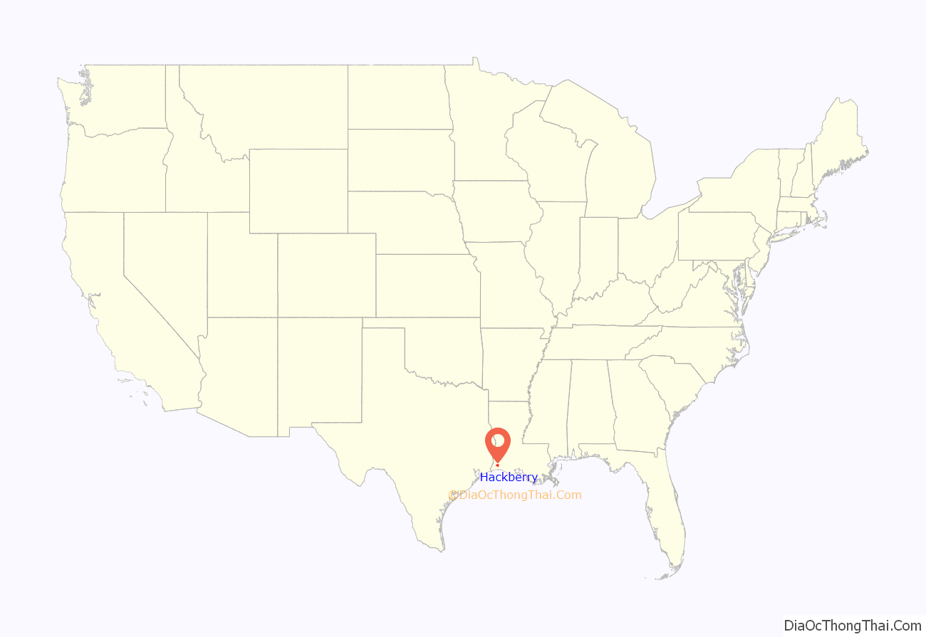
Hackberry location map. Where is Hackberry CDP?
History
The community of Hackberry was heavily damaged by Hurricane Ike in September 2008. Ike’s 22-foot (6.7 m) storm surge crawled 60 miles (97 km) inland and devastated Hackberry. The small community was flooded by the high storm surge and all structures (houses, churches, buildings, etc.) were affected. Flooding caused by the hurricane killed many cattle and other farm animals. The community also suffered severe damage in Hurricane Rita, in 2005, and again suffered severe damage due to the landfall of Category 4 Hurricane Laura in the late evening and early morning of August 27, 2020, Hackberry being within the eye-wall of the storm.
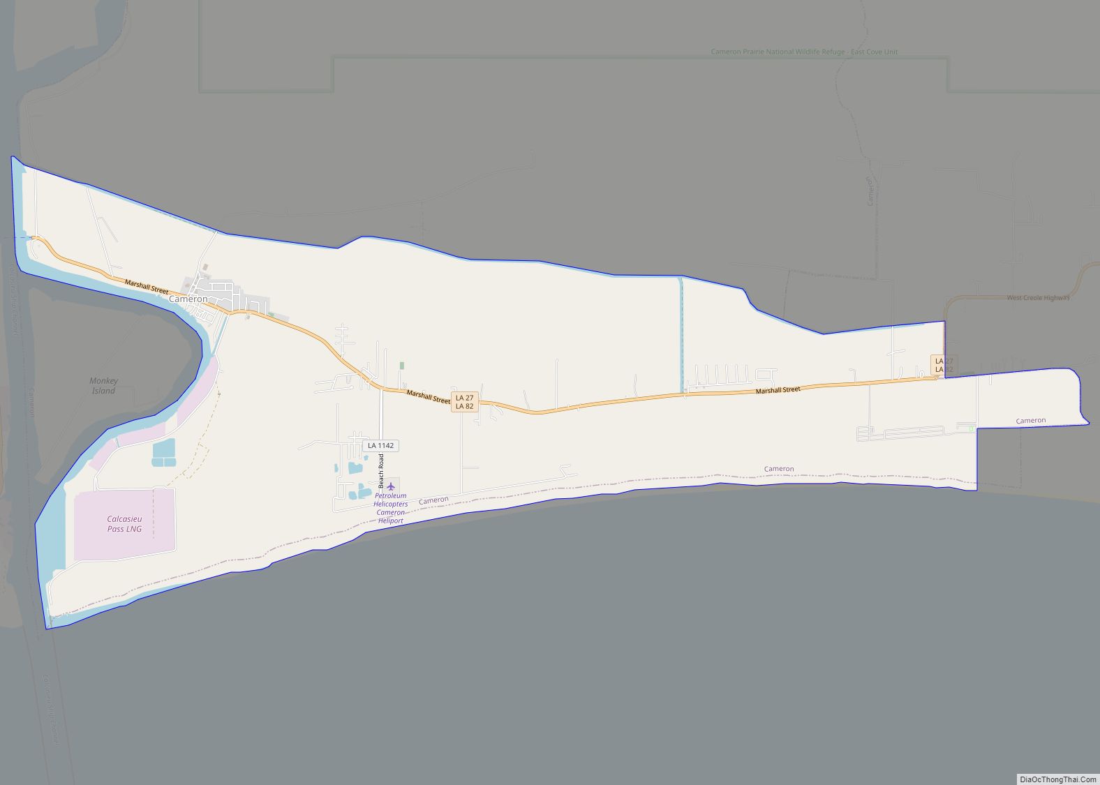
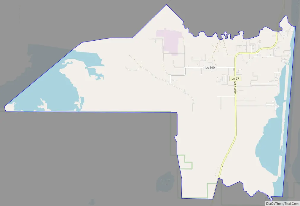
Hackberry Road Map
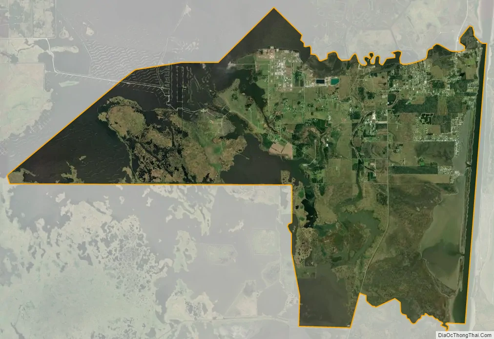
Hackberry city Satellite Map
Geography
Hackberry is located in north-central Cameron Parish at 29°59′11″N 93°23′50″W / 29.98639°N 93.39722°W / 29.98639; -93.39722 (29.986485, -93.397190), at an elevation of 8 feet (2.4 m) above sea level on the west side of Calcasieu Lake. Louisiana State Highway 27 passes through the CDP, leading north 17 miles (27 km) to Sulphur and south 20 miles (32 km) to Holly Beach on the Gulf of Mexico.
According to the United States Census Bureau, the Hackberry CDP has a total area of 34.5 square miles (89.3 km), of which 28.1 square miles (72.7 km) is land and 6.4 square miles (16.6 km), or 18.59%, is water.
Climate
The climate in this area is characterized by hot, humid summers and generally mild to cool winters. According to the Köppen Climate Classification system, Hackberry has a humid subtropical climate, abbreviated “Cfa” on climate maps.
See also
Map of Louisiana State and its subdivision:- Acadia
- Allen
- Ascension
- Assumption
- Avoyelles
- Beauregard
- Bienville
- Bossier
- Caddo
- Calcasieu
- Caldwell
- Cameron
- Catahoula
- Claiborne
- Concordia
- De Soto
- East Baton Rouge
- East Carroll
- East Feliciana
- Evangeline
- Franklin
- Grant
- Iberia
- Iberville
- Jackson
- Jefferson
- Jefferson Davis
- La Salle
- Lafayette
- Lafourche
- Lincoln
- Livingston
- Madison
- Morehouse
- Natchitoches
- Orleans
- Ouachita
- Plaquemines
- Pointe Coupee
- Rapides
- Red River
- Richland
- Sabine
- Saint Bernard
- Saint Charles
- Saint Helena
- Saint James
- Saint John the Baptist
- Saint Landry
- Saint Martin
- Saint Mary
- Saint Tammany
- Tangipahoa
- Tensas
- Terrebonne
- Union
- Vermilion
- Vernon
- Washington
- Webster
- West Baton Rouge
- West Carroll
- West Feliciana
- Winn
- Alabama
- Alaska
- Arizona
- Arkansas
- California
- Colorado
- Connecticut
- Delaware
- District of Columbia
- Florida
- Georgia
- Hawaii
- Idaho
- Illinois
- Indiana
- Iowa
- Kansas
- Kentucky
- Louisiana
- Maine
- Maryland
- Massachusetts
- Michigan
- Minnesota
- Mississippi
- Missouri
- Montana
- Nebraska
- Nevada
- New Hampshire
- New Jersey
- New Mexico
- New York
- North Carolina
- North Dakota
- Ohio
- Oklahoma
- Oregon
- Pennsylvania
- Rhode Island
- South Carolina
- South Dakota
- Tennessee
- Texas
- Utah
- Vermont
- Virginia
- Washington
- West Virginia
- Wisconsin
- Wyoming