New Llano is a town in Vernon Parish, Louisiana, United States. The population was 2,504 at the 2010 census. It is part of the Fort Polk South Micropolitan Statistical Area.
Originally known as Stables, the town was renamed when 200 members of the Socialist commune Llano del Rio Cooperative Colony in California relocated to this site in 1917, giving the town its present name. It continued to function as a socialist commune with citizens pooling and sharing resources and wealth until 1937.
| Name: | New Llano town |
|---|---|
| LSAD Code: | 43 |
| LSAD Description: | town (suffix) |
| State: | Louisiana |
| County: | Vernon Parish |
| Elevation: | 217 ft (66 m) |
| Total Area: | 2.71 sq mi (7.01 km²) |
| Land Area: | 2.67 sq mi (6.92 km²) |
| Water Area: | 0.04 sq mi (0.09 km²) |
| Total Population: | 2,213 |
| Population Density: | 827.60/sq mi (319.59/km²) |
| Area code: | 337 |
| FIPS code: | 2254175 |
| Website: | www.townofnewllano.com |
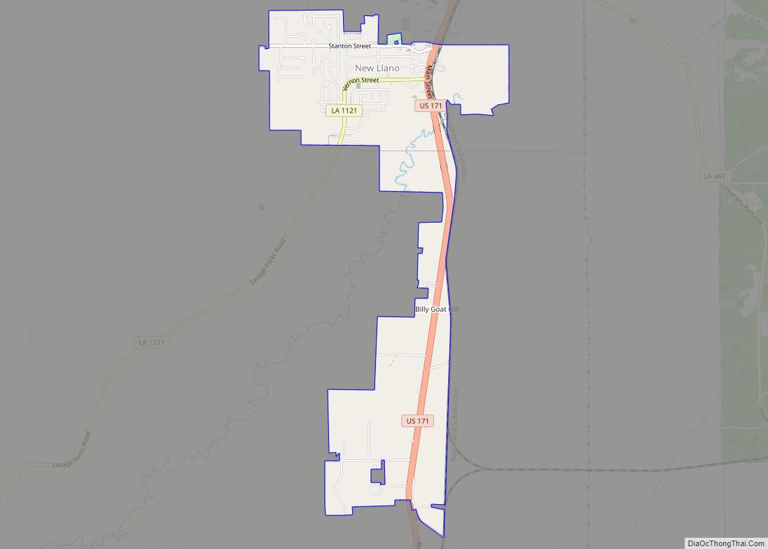
Online Interactive Map
Click on ![]() to view map in "full screen" mode.
to view map in "full screen" mode.
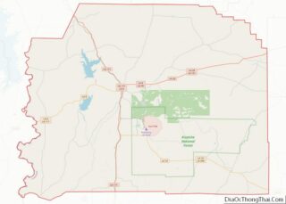
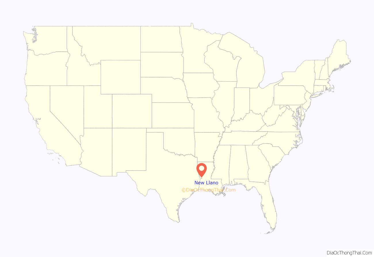
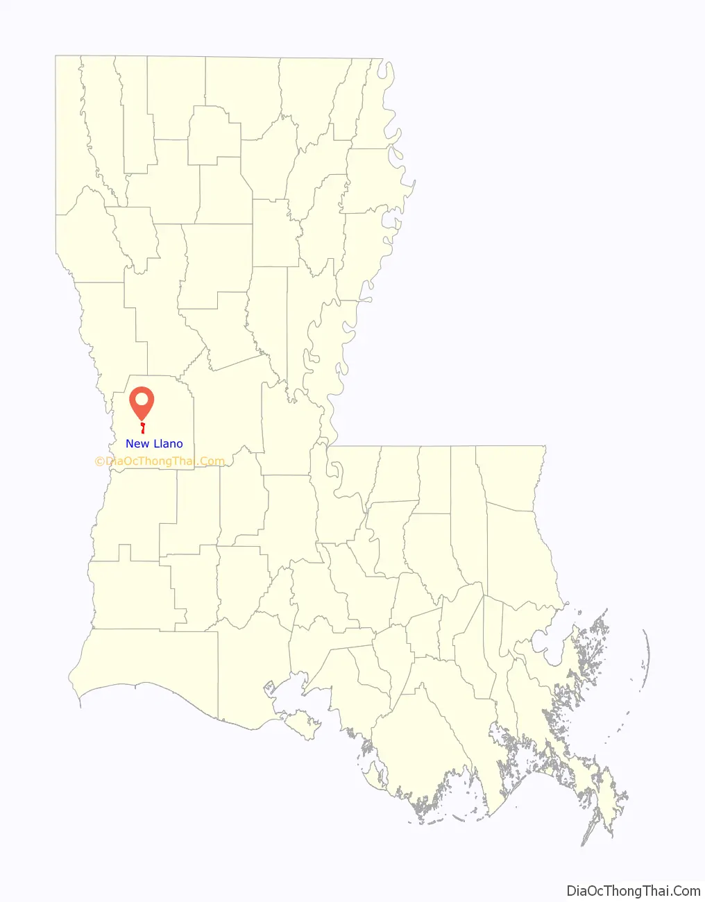
New Llano location map. Where is New Llano town?
History
The New Llano Cooperative Colony was founded in 1917 when Job Harriman relocated, with other commune members of the Llano del Rio colony, to 20,000 acres of cut-over land two miles south of Leesville. The location chosen was the Gulf Lumber Company sawmill town named Stables. The mill had burned in 1913 and again in 1916. After the sawmill burned the second time it was not rebuilt because the stumpage reserves were depleted. The land, was sold on contract to the Cooperative Colony.
The colony attempted to achieve self-sufficiency through community ownership of a newspaper, broom factory, sawmill, ice plant, and sheet metal factory. There was also a school, infirmary, hospital, and recreational facilities. The colony closed in 1937.
New Llano has developed a reputation as a “speed trap.” Local media has covered allegations of predatory ticket-writing.[1]
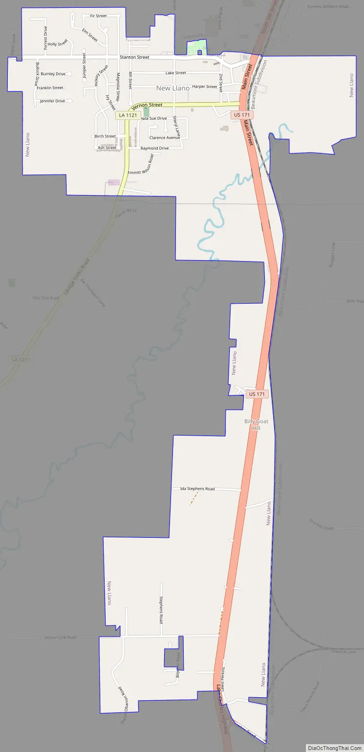
New Llano Road Map
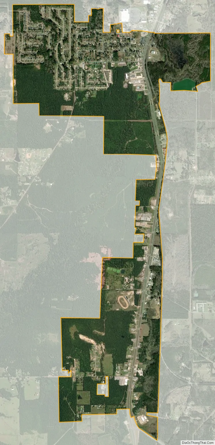
New Llano city Satellite Map
Geography
According to the United States Census Bureau, the town has a total area of 1.0 square mile (2.5 km), all land.
See also
Map of Louisiana State and its subdivision:- Acadia
- Allen
- Ascension
- Assumption
- Avoyelles
- Beauregard
- Bienville
- Bossier
- Caddo
- Calcasieu
- Caldwell
- Cameron
- Catahoula
- Claiborne
- Concordia
- De Soto
- East Baton Rouge
- East Carroll
- East Feliciana
- Evangeline
- Franklin
- Grant
- Iberia
- Iberville
- Jackson
- Jefferson
- Jefferson Davis
- La Salle
- Lafayette
- Lafourche
- Lincoln
- Livingston
- Madison
- Morehouse
- Natchitoches
- Orleans
- Ouachita
- Plaquemines
- Pointe Coupee
- Rapides
- Red River
- Richland
- Sabine
- Saint Bernard
- Saint Charles
- Saint Helena
- Saint James
- Saint John the Baptist
- Saint Landry
- Saint Martin
- Saint Mary
- Saint Tammany
- Tangipahoa
- Tensas
- Terrebonne
- Union
- Vermilion
- Vernon
- Washington
- Webster
- West Baton Rouge
- West Carroll
- West Feliciana
- Winn
- Alabama
- Alaska
- Arizona
- Arkansas
- California
- Colorado
- Connecticut
- Delaware
- District of Columbia
- Florida
- Georgia
- Hawaii
- Idaho
- Illinois
- Indiana
- Iowa
- Kansas
- Kentucky
- Louisiana
- Maine
- Maryland
- Massachusetts
- Michigan
- Minnesota
- Mississippi
- Missouri
- Montana
- Nebraska
- Nevada
- New Hampshire
- New Jersey
- New Mexico
- New York
- North Carolina
- North Dakota
- Ohio
- Oklahoma
- Oregon
- Pennsylvania
- Rhode Island
- South Carolina
- South Dakota
- Tennessee
- Texas
- Utah
- Vermont
- Virginia
- Washington
- West Virginia
- Wisconsin
- Wyoming