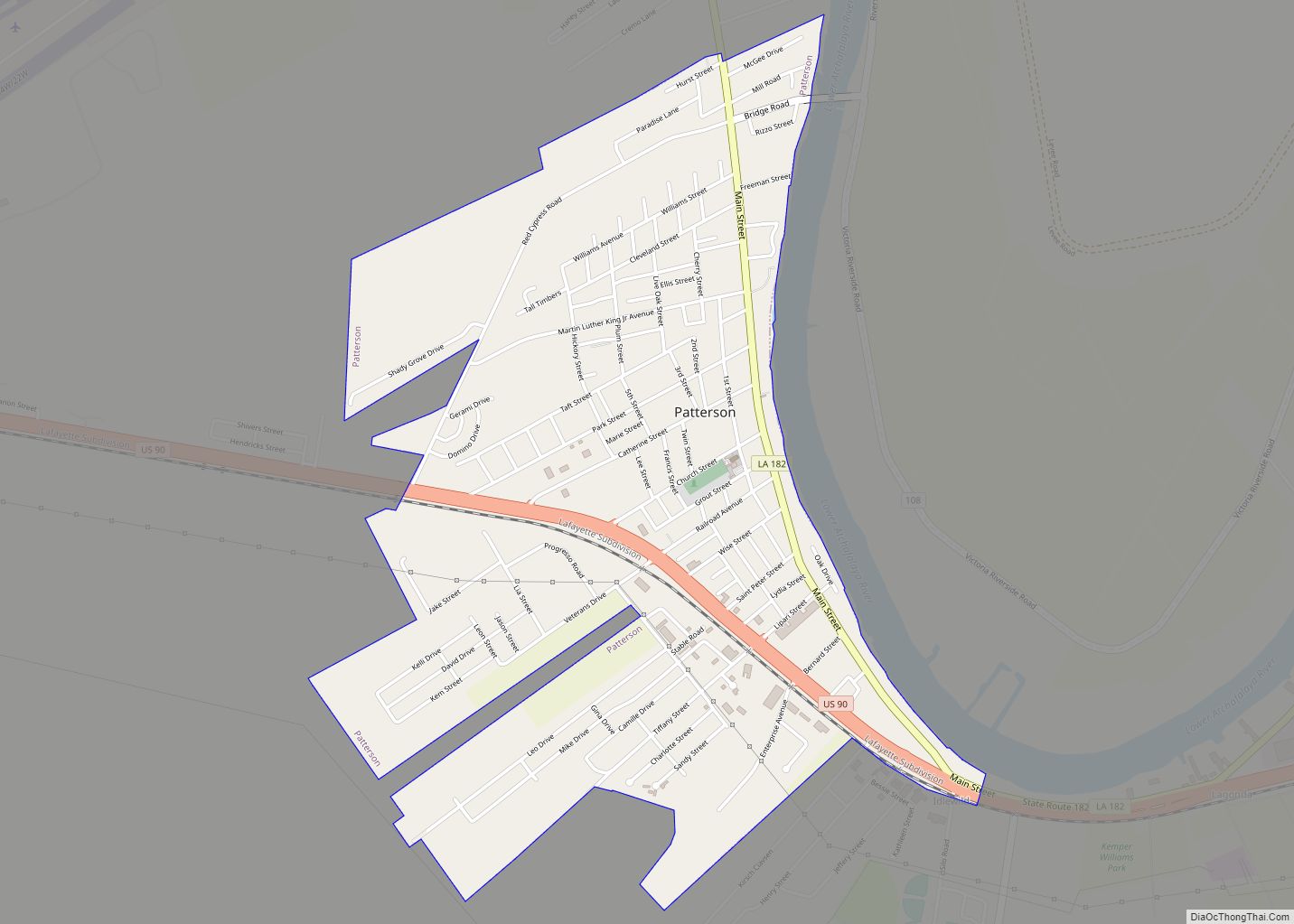
Patterson is a city in St. Mary Parish, Louisiana, United States. The population was 6,112 at the 2010 census. It is part of the Morgan City Micropolitan Statistical Area.
| Name: | Patterson city |
|---|---|
| LSAD Code: | 25 |
| LSAD Description: | city (suffix) |
| State: | Louisiana |
| County: | St. Mary Parish |
| Elevation: | 10 ft (3 m) |
| Total Area: | 2.52 sq mi (6.54 km²) |
| Land Area: | 2.52 sq mi (6.54 km²) |
| Water Area: | 0.00 sq mi (0.00 km²) |
| Total Population: | 5,931 |
| Population Density: | 2,349.84/sq mi (907.38/km²) |
| Area code: | 985 |
| FIPS code: | 2259340 |
| Website: | cityofpattersonla.gov |
Online Interactive Map
Click on ![]() to view map in "full screen" mode.
to view map in "full screen" mode.
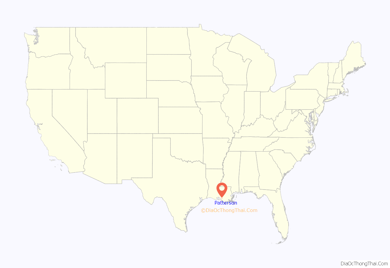
Patterson location map. Where is Patterson city?
History
During the early 19th century, a group of Pennsylvania Dutchmen boarded a sailing vessel in New Orleans and ventured into the Bayou Teche. One of them, Hans Knight, decided to settle his family in what is now Patterson. The community was originally called Dutch Settlement, Dutch Prairie, and Dutch Town.
In 1832, Captain John Patterson, a trader from Indiana, settled there. He built a store and became a prominent citizen. The town was renamed Pattersonville after the captain successfully moved the post office to Dutch Settlement.
Pattersonville was incorporated in 1907 as the Town of Patterson.
James “Jimmy” Robert Wedell (March 31, 1900 – June 24, 1934) was a famous 1930s racing pilot and aircraft designer. Wedell broke the world record for land-plane speed in 1933 when he clocked 305.33 m.p.h. in a Wedell-Williams aircraft of his own design. He won the Thompson Trophy air race in the same year. Wedell’s company, the Wedell-Williams Air Service Corporation, won 14 “distinguished finishes” (top five) in the Thompson and Bendix Trophy races.
James “Jimmie/Jimmy” Robert Wedell was born in Texas City on March 31, 1900 to Robert and Ida Wedell, who operated a tavern in the town. His brother Walter, born on November 14, 1901, was joined later by sisters, Elizabeth and Mary. With the sudden and premature death of both parents, the brothers were on their own from teen years on. The two brothers were both mechanically inclined, especially working with gasoline engines. Another major interest was aviation and flying.
Wedell left school in the ninth grade to open the Black Star Garage behind the family home. He repaired cars and motorcycles and when the first U.S. Army Air Field was established in Texas City in 1913, he learned to fly, and he later taught his brother.
After buying two junked aircraft, the Wedell brothers constructed a new aircraft from the parts and began to fly as exhibition pilots, barnstorming along the Gulf Coast.
During World War I, his brother enlisted in the Navy but Wedell was turned down because of poor eyesight, having lost sight in one eye in a motorcycle accident. After flying in Mexico and the Gulf Coast, the Army hired Jimmy as a civilian instructor of cadet fliers.
After the war, Wedell returned to the Black Star Garage, working as a mechanic, while designing and building racing planes and barnstorming the country. In 1922, the Wedell brothers left for New Orleans where they started an air service and a flying school. They met millionaire Harry P. Williams from Patterson, Louisiana. Williams was in the oil, sugar and lumber businesses and was married to Marguerite Clark, a former star of silent movies. Wedell taught Williams how to fly and they became the best of friends, bonded by their interest in aviation.
Together, they created the Wedell-Williams Air Service Corporation in Patterson with the first enterprise being a passenger service from New Orleans to Houston, Louisiana’s first commercial airline. The company also started their own postal air service and opened a flying school. Continuing his earlier work as a designer, Wedell had a factory built to design and build low-wing monoplanes, starting with the Wedell-Williams Model 22. Patterson is still currently served by the Harry P. Williams Memorial Airport, a general aviation airfield located near the U.S. 90 (future Interstate 49) highway.
(L–R) Jimmy Doolittle, Jimmy Wedell, and Harry Williams. c. 1933
The “44” (Wedell-Williams Model 44) became one of the fastest aircraft flying in the United States, Wedell called it, “hot as a .44 and twice as fast.” During his lifetime, Wedell held more speed and long-distance records than any other racing pilot. Not only the first to fly at over 300 mph in a “land plane”, he also set a “three flags speed” mark, flying from Ottawa, Canada to Washington, and on to Mexico City in 11 hours, 53 minutes. Wedell’s best year in air racing was in 1933, when he won races at every competition he entered.
In 1934, Wedell was involved in not only air racing but also exhibition flying and even flight training. During flight training, he was killed in an accident on June 24, 1934.
Wedell’s death received national attention where he was remembered for his love of speed, his innovations in the design of racing planes, and his reputation for “donating his time and talents to those in need”. His obituaries included a column by Will Rogers and an article in Time magazine. Wedell is buried in the Columbia Cemetery in West Columbia, Texas.
Patterson Road Map
Patterson city Satellite Map
Geography
Patterson is located at 29°41′33″N 91°18′24″W / 29.69250°N 91.30667°W / 29.69250; -91.30667 (29.692466, -91.306569).
According to the United States Census Bureau, the city has a total area of 2.5 square miles (6.5 km), all land.
See also
Map of Louisiana State and its subdivision:- Acadia
- Allen
- Ascension
- Assumption
- Avoyelles
- Beauregard
- Bienville
- Bossier
- Caddo
- Calcasieu
- Caldwell
- Cameron
- Catahoula
- Claiborne
- Concordia
- De Soto
- East Baton Rouge
- East Carroll
- East Feliciana
- Evangeline
- Franklin
- Grant
- Iberia
- Iberville
- Jackson
- Jefferson
- Jefferson Davis
- La Salle
- Lafayette
- Lafourche
- Lincoln
- Livingston
- Madison
- Morehouse
- Natchitoches
- Orleans
- Ouachita
- Plaquemines
- Pointe Coupee
- Rapides
- Red River
- Richland
- Sabine
- Saint Bernard
- Saint Charles
- Saint Helena
- Saint James
- Saint John the Baptist
- Saint Landry
- Saint Martin
- Saint Mary
- Saint Tammany
- Tangipahoa
- Tensas
- Terrebonne
- Union
- Vermilion
- Vernon
- Washington
- Webster
- West Baton Rouge
- West Carroll
- West Feliciana
- Winn
- Alabama
- Alaska
- Arizona
- Arkansas
- California
- Colorado
- Connecticut
- Delaware
- District of Columbia
- Florida
- Georgia
- Hawaii
- Idaho
- Illinois
- Indiana
- Iowa
- Kansas
- Kentucky
- Louisiana
- Maine
- Maryland
- Massachusetts
- Michigan
- Minnesota
- Mississippi
- Missouri
- Montana
- Nebraska
- Nevada
- New Hampshire
- New Jersey
- New Mexico
- New York
- North Carolina
- North Dakota
- Ohio
- Oklahoma
- Oregon
- Pennsylvania
- Rhode Island
- South Carolina
- South Dakota
- Tennessee
- Texas
- Utah
- Vermont
- Virginia
- Washington
- West Virginia
- Wisconsin
- Wyoming
