Reserve is an unincorporated community in St. John the Baptist Parish, Louisiana, United States. It is located on the east bank of the Mississippi River. The population was 9,111 at the 2000 census. For statistical purposes, the United States Census Bureau has defined Reserve as a census-designated place (CDP).
| Name: | Reserve CDP |
|---|---|
| LSAD Code: | 57 |
| LSAD Description: | CDP (suffix) |
| State: | Louisiana |
| County: | St. John the Baptist Parish |
| Elevation: | 13 ft (4 m) |
| Total Area: | 17.1 sq mi (44 km²) |
| Land Area: | 16.1 sq mi (42 km²) |
| Water Area: | 1.0 sq mi (3 km²) |
| Total Population: | 9,111 |
| Population Density: | 530/sq mi (210/km²) |
| ZIP code: | 70084 |
| Area code: | 985 |
| FIPS code: | 2264310 |
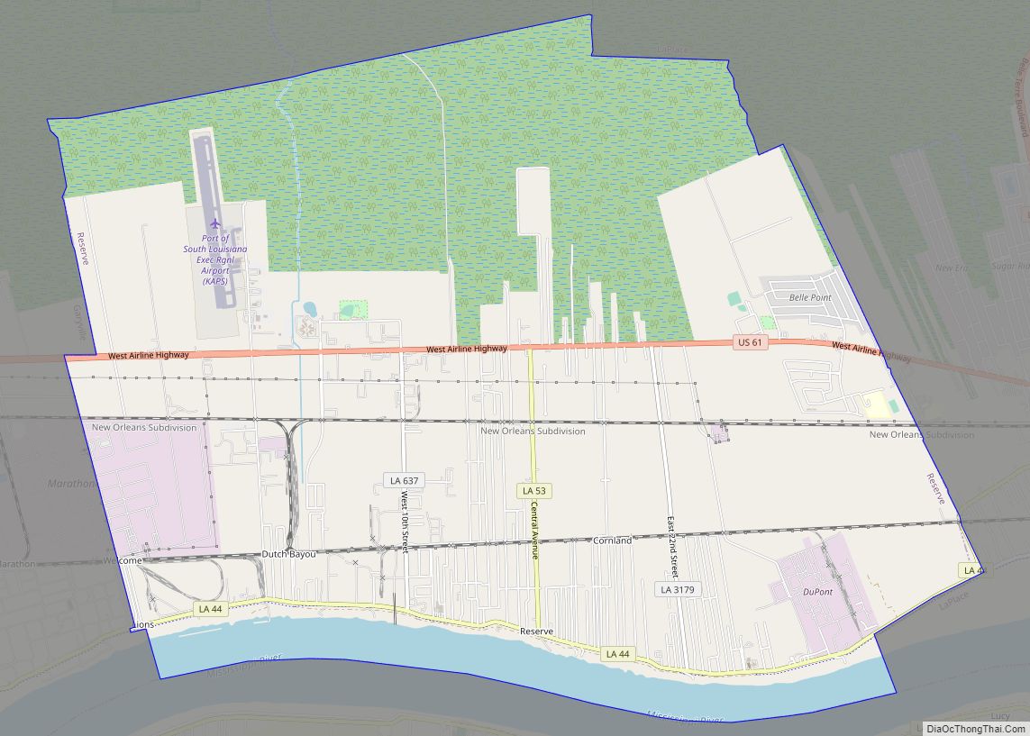
Online Interactive Map
Click on ![]() to view map in "full screen" mode.
to view map in "full screen" mode.
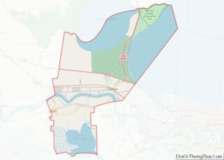
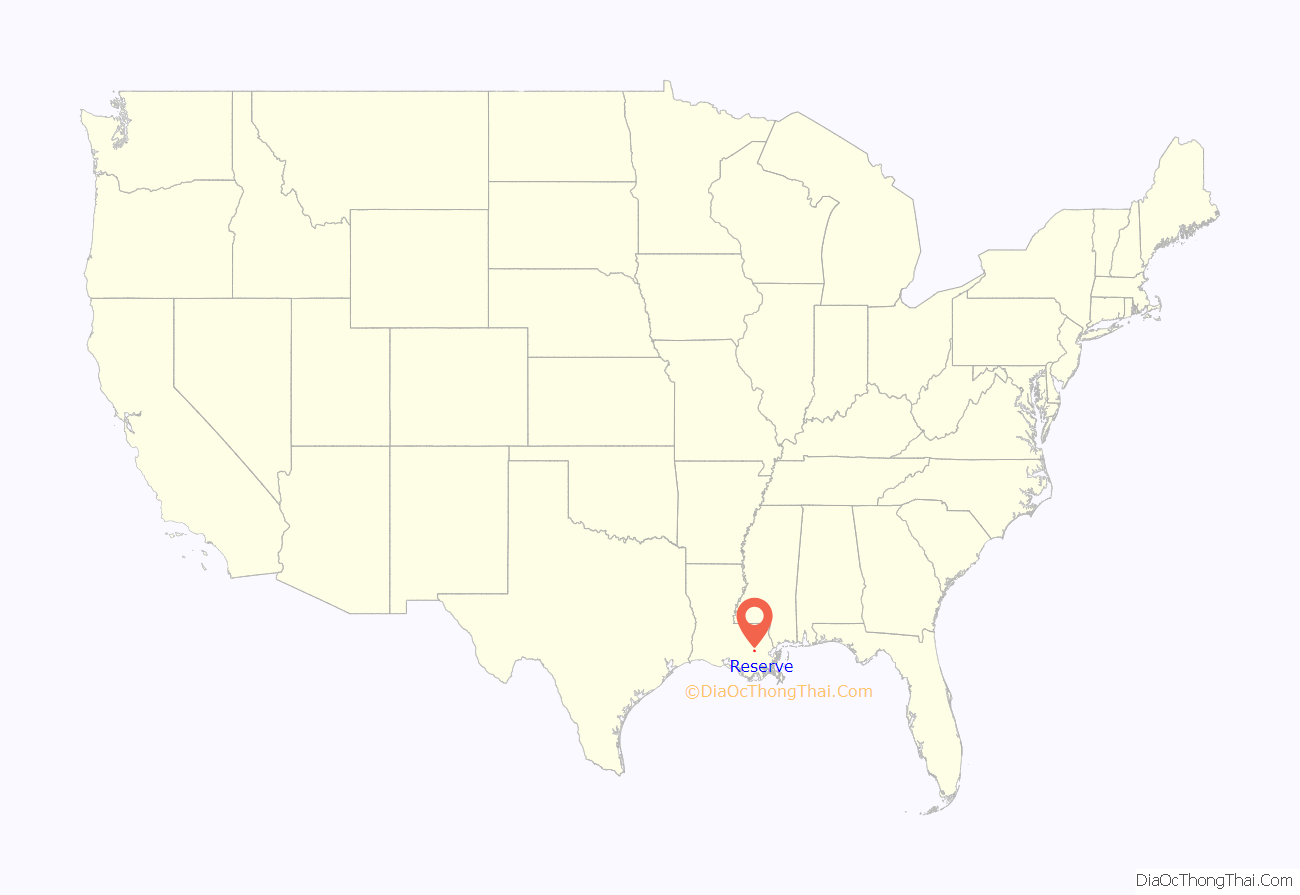
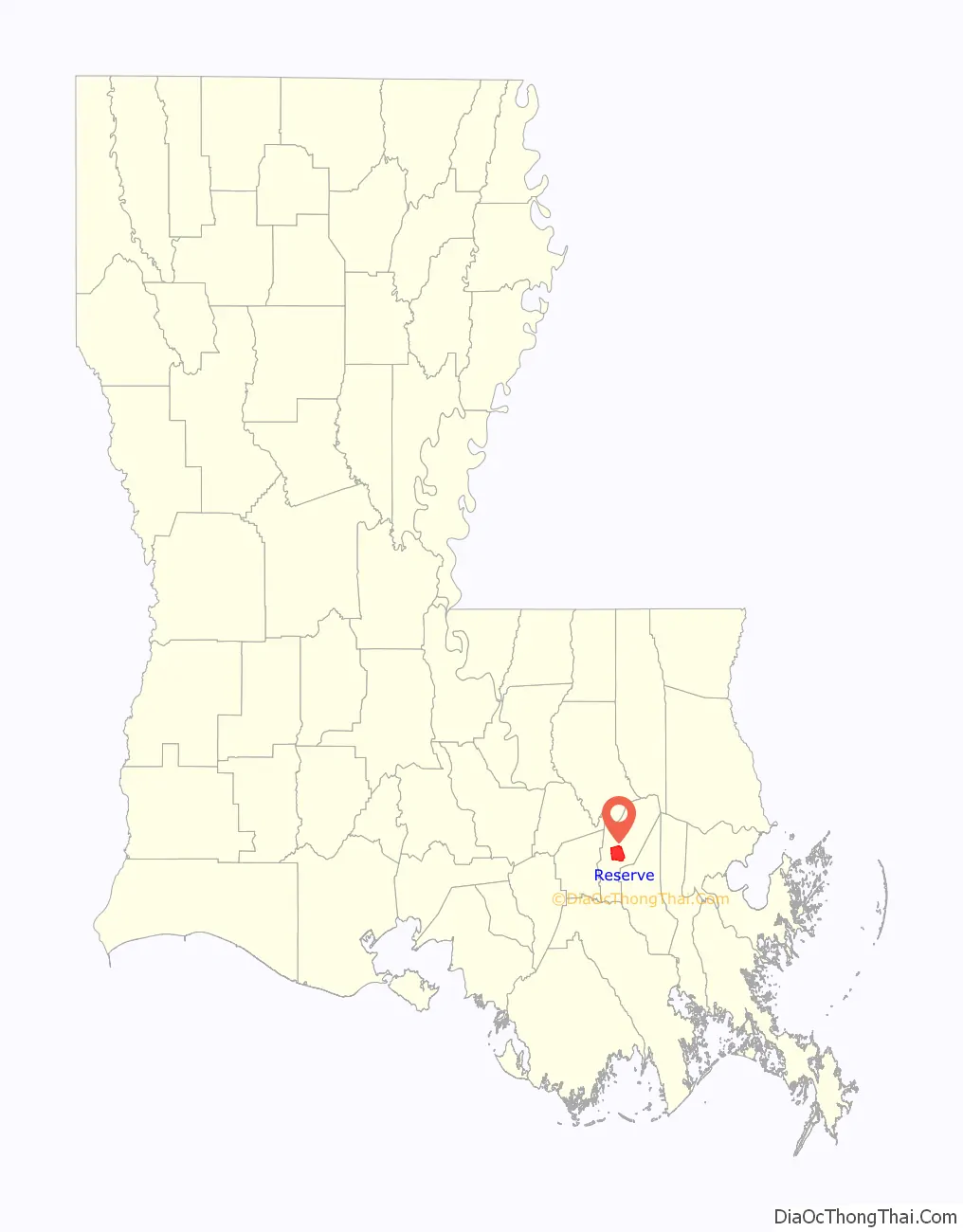
Reserve location map. Where is Reserve CDP?
History
Prior to the name Reserve, this town was once called Bonnet Carre; the town name had been changed by businessman and resident Leon Godchaux by the late 1800s. The Godchaux–Reserve Plantation was built by Leon Godchaux, and the oldest portion of the plantation home dates to 1764, is listed on the National Register of Historic Places (NRHP). In the early 20th century, the plantation at Reserve had the largest sugarcane refinery in the United States, named Godchaux Sugar Refinery.
President William Howard Taft visited Reserve and the Godchaux–Reserve Plantation in 1909, while President Gerald Ford visited Reserve in 1976.
In addition, in 2005 Our Lady of Grace Catholic Church, which dates back to 1937, is listed on the National Register of Historic Places. Our Lady of Grace was built to serve the needs of the African American Catholic Community.
Pontchartrain Works
In 2015, the United States Environmental Protection Agency reported findings of the existence of an extremely high risk of cancer in the region and noted that Reserve was the epicenter of the area of high risk for cancer. The agency identified releases of the chemical compound chloroprene as responsible for the high risk.
This chemical compound was being released from the Pontchartrain Works facility, a manufacturing facility owned and operated for decades by DuPont and sold in 2015 to Denka of Japan. The facility is the only producer of the chemical in the United States.
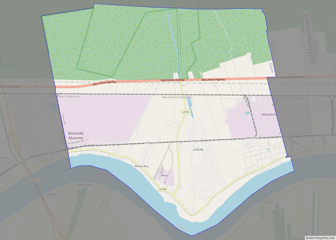
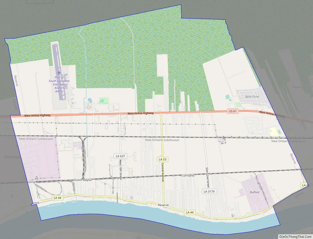
Reserve Road Map
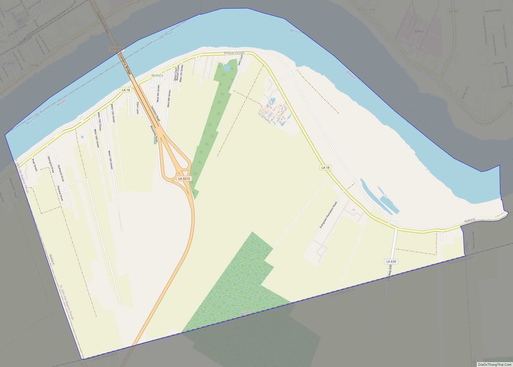
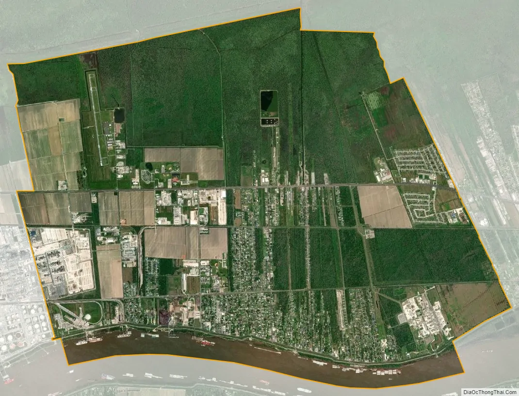
Reserve city Satellite Map
Geography
Reserve is located at 30°3′45″N 90°33′12″W / 30.06250°N 90.55333°W / 30.06250; -90.55333 (30.062566, -90.553296).
According to the United States Census Bureau, the CDP has a total area of 17.1 square miles (44.3 km), of which 16.1 square miles (41.6 km) is land and 1.0 square mile (2.7 km) (6.13%) is water.
See also
Map of Louisiana State and its subdivision:- Acadia
- Allen
- Ascension
- Assumption
- Avoyelles
- Beauregard
- Bienville
- Bossier
- Caddo
- Calcasieu
- Caldwell
- Cameron
- Catahoula
- Claiborne
- Concordia
- De Soto
- East Baton Rouge
- East Carroll
- East Feliciana
- Evangeline
- Franklin
- Grant
- Iberia
- Iberville
- Jackson
- Jefferson
- Jefferson Davis
- La Salle
- Lafayette
- Lafourche
- Lincoln
- Livingston
- Madison
- Morehouse
- Natchitoches
- Orleans
- Ouachita
- Plaquemines
- Pointe Coupee
- Rapides
- Red River
- Richland
- Sabine
- Saint Bernard
- Saint Charles
- Saint Helena
- Saint James
- Saint John the Baptist
- Saint Landry
- Saint Martin
- Saint Mary
- Saint Tammany
- Tangipahoa
- Tensas
- Terrebonne
- Union
- Vermilion
- Vernon
- Washington
- Webster
- West Baton Rouge
- West Carroll
- West Feliciana
- Winn
- Alabama
- Alaska
- Arizona
- Arkansas
- California
- Colorado
- Connecticut
- Delaware
- District of Columbia
- Florida
- Georgia
- Hawaii
- Idaho
- Illinois
- Indiana
- Iowa
- Kansas
- Kentucky
- Louisiana
- Maine
- Maryland
- Massachusetts
- Michigan
- Minnesota
- Mississippi
- Missouri
- Montana
- Nebraska
- Nevada
- New Hampshire
- New Jersey
- New Mexico
- New York
- North Carolina
- North Dakota
- Ohio
- Oklahoma
- Oregon
- Pennsylvania
- Rhode Island
- South Carolina
- South Dakota
- Tennessee
- Texas
- Utah
- Vermont
- Virginia
- Washington
- West Virginia
- Wisconsin
- Wyoming