LaPlace (/ləˈplɑːs/ lə-PLAHSS) is a census-designated place (CDP) in St. John the Baptist Parish, Louisiana, United States, situated along the east bank of the Mississippi River, in the New Orleans metropolitan area. In 2020, it had a population of 28,841.
LaPlace is the southern terminus of Interstate 55, where it joins with Interstate 10, and of US 51, where it terminates at the junction with US 61. LaPlace is located 25 miles (40 km) west of New Orleans.
| Name: | Laplace CDP |
|---|---|
| LSAD Code: | 57 |
| LSAD Description: | CDP (suffix) |
| State: | Louisiana |
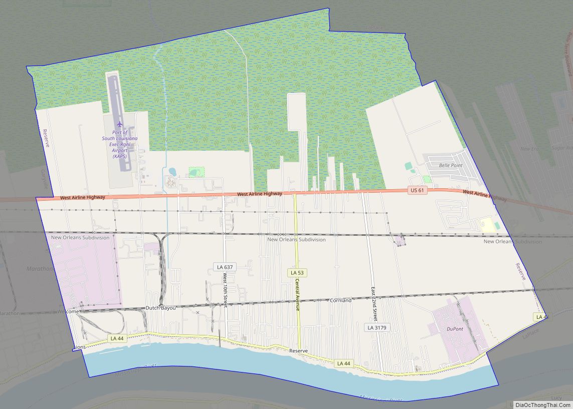
| County: | St. John the Baptist Parish |
| Elevation: | 10 ft (3 m) |
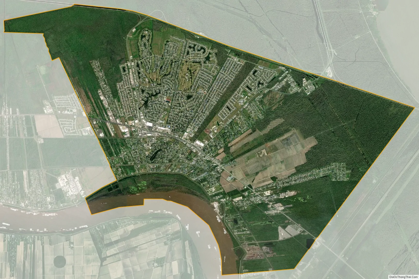
| Total Area: | 22.05 sq mi (57.11 km²) |
| Land Area: | 20.89 sq mi (54.12 km²) |
| Water Area: | 1.16 sq mi (2.99 km²) |
| Total Population: | 28,841 |
| Population Density: | 1,380.28/sq mi (532.92/km²) |
| ZIP code: | 70068 |
| Area code: | 985 |
| FIPS code: | 2242030 |
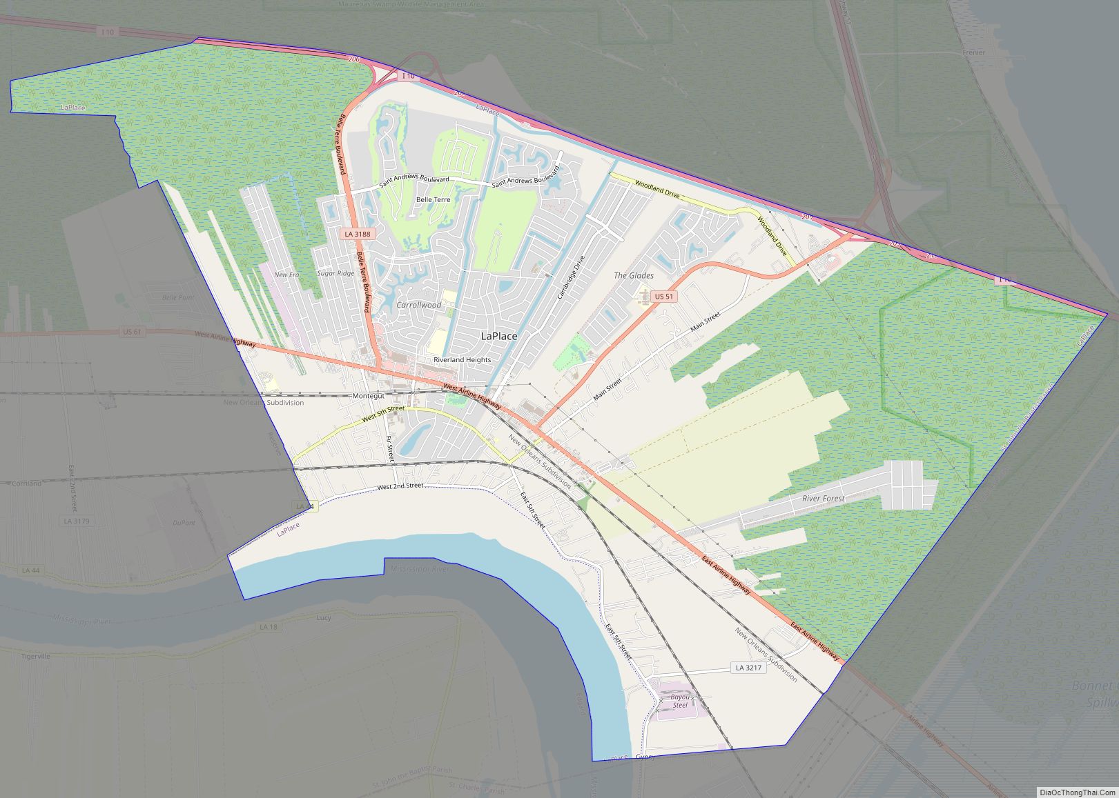
Online Interactive Map
Click on ![]() to view map in "full screen" mode.
to view map in "full screen" mode.
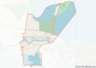
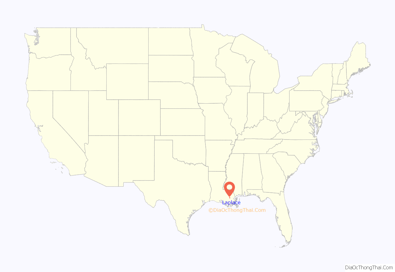
Laplace location map. Where is Laplace CDP?

History
Pre-European
The Chitimacha lived in the region prior to the arrival of European colonists. The tribe’s lands once encompassed the entire Atchafalaya Basin, westward to Lafayette, southward to the Gulf of Mexico and eastward to the New Orleans area. The Chitimacha tribe currently resides on a reservation in St. Mary Parish.
European colonization
Present-day LaPlace was settled by German immigrants in the early 18th century during Louisiana’s French colonial period, as part of a larger settlement on the bank of the Mississippi called Karlstein. Karlstein was one of the four settlements collectively known as the “German Coast” (French: la Côte des Allemands), having been populated by German-speaking immigrants since 1721. French and Acadians intermarried with the Germans, and the area came to be known as Bonnet Carré (French for “square bonnet”). The name Bonnet Carré was inspired by the right-angle turn of the Mississippi river near the settlement and its resemblance to a square bonnet.
1811 Slave Revolt
Manual Andry built Woodland plantation in 1793 and cultivated sugarcane. The crop was lucrative if brutal methods were used, as had been common in Haiti (and had led to a successful slave rebellion there).
In early January 1811, slaves at Woodland Plantation and several nearby plantations attempted the German Coast Uprising. A group of 200-500 slaves armed with guns, axes, and cane knives set out from LaPlace to conquer New Orleans and gain freedom for themselves and others. Local white “militia” men crushed the rebellion within three days, and nearly 100 slaves were either killed in battle, slaughtered by pursuing militia, or executed after summary trials by planter tribunals. Although more slaves may have participated in the Black Seminole rebellion in 1836 and the whole of the Second Seminole War, this is now considered the largest slave rebellion.
Post-Civil War developments
In 1879, pharmacist, planter, and patent medicine purveyor Basile Laplace arrived from New Orleans and established a large plantation in Bonnet Carré. In 1883, he allowed the New Orleans and Baton Rouge Railroad to cut through his land. The settlement’s railroad depot was named after Laplace, then the post office, and eventually the town itself.
In the 1920s, Woodland Plantation was bought by the Montegut family, but the most famous person born there may have been Kid Ory, who was born in an outbuilding and later led a successful New Orleans jazz band.
Weather events
In the period between 1850 and 1883, the levee on the east bank of the Mississippi flooded several times. In 1850, a flood created the Bonnet Carré Crevasse, a levee breach that was more than a mile wide. Several major floods were exacerbated by this crevasse near LaPlace, and one resulted in severe flooding of New Orleans in 1871. The breach was closed in 1883.
In 1983, a violent F4 tornado devastated part of the town.
In 2012, about 5,000 houses were damaged by flooding in LaPlace during Hurricane Isaac.
In February 2016 and again in March 2016, several tornadoes touched down in LaPlace, damaging hundreds of buildings and disrupting power.
LaPlace was badly damaged by Hurricane Ida on August 29, 2021.
Spelling
Despite the spelling used for LaPlace’s namesake, the St. John the Baptist Parish Police Jury decreed in 1971 that the official spelling of the town includes a capital letter “P”.
Andouille
Andouille, a smoked pork sausage that originated in France, is popular in LaPlace and elsewhere in Louisiana, but in the 1970s, then-Governor Edwin Edwards proclaimed LaPlace the “Official Andouille Capital of the World”. Since 1972, LaPlace has held an Andouille Festival every October. On his program Feasting on Asphalt, TV chef Alton Brown visited LaPlace to sample its andouille.
Laplace Road Map
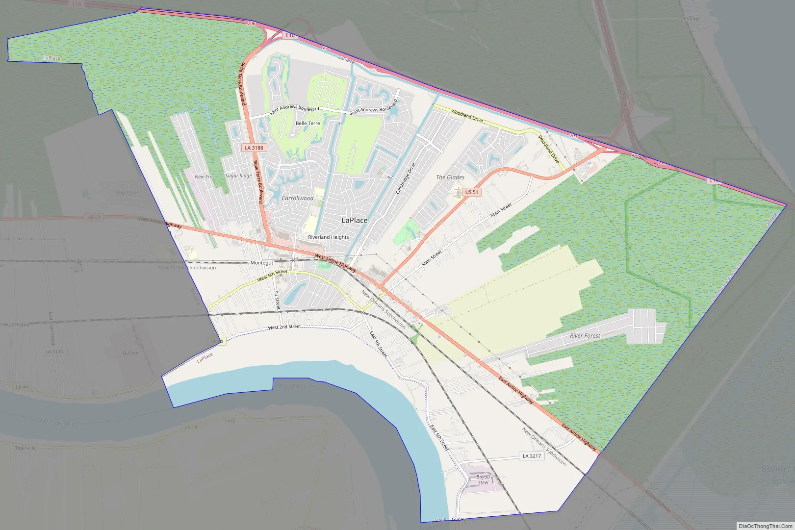
Laplace city Satellite Map
Geography
LaPlace is located at 30°4′30″N 90°29′6″W / 30.07500°N 90.48500°W / 30.07500; -90.48500 (30.075025, -90.484896) and has an elevation of 10 feet (3.0 m).
According to the United States Census Bureau, the CDP has a total area of 22.7 square miles (59 km), of which 21.5 square miles (56 km) is land and 1.2 square miles (3.1 km) (5.29%) is water.
See also
Map of Louisiana State and its subdivision:- Acadia
- Allen
- Ascension
- Assumption
- Avoyelles
- Beauregard
- Bienville
- Bossier
- Caddo
- Calcasieu
- Caldwell
- Cameron
- Catahoula
- Claiborne
- Concordia
- De Soto
- East Baton Rouge
- East Carroll
- East Feliciana
- Evangeline
- Franklin
- Grant
- Iberia
- Iberville
- Jackson
- Jefferson
- Jefferson Davis
- La Salle
- Lafayette
- Lafourche
- Lincoln
- Livingston
- Madison
- Morehouse
- Natchitoches
- Orleans
- Ouachita
- Plaquemines
- Pointe Coupee
- Rapides
- Red River
- Richland
- Sabine
- Saint Bernard
- Saint Charles
- Saint Helena
- Saint James
- Saint John the Baptist
- Saint Landry
- Saint Martin
- Saint Mary
- Saint Tammany
- Tangipahoa
- Tensas
- Terrebonne
- Union
- Vermilion
- Vernon
- Washington
- Webster
- West Baton Rouge
- West Carroll
- West Feliciana
- Winn
- Alabama
- Alaska
- Arizona
- Arkansas
- California
- Colorado
- Connecticut
- Delaware
- District of Columbia
- Florida
- Georgia
- Hawaii
- Idaho
- Illinois
- Indiana
- Iowa
- Kansas
- Kentucky
- Louisiana
- Maine
- Maryland
- Massachusetts
- Michigan
- Minnesota
- Mississippi
- Missouri
- Montana
- Nebraska
- Nevada
- New Hampshire
- New Jersey
- New Mexico
- New York
- North Carolina
- North Dakota
- Ohio
- Oklahoma
- Oregon
- Pennsylvania
- Rhode Island
- South Carolina
- South Dakota
- Tennessee
- Texas
- Utah
- Vermont
- Virginia
- Washington
- West Virginia
- Wisconsin
- Wyoming