Richwood is a town in Ouachita Parish, Louisiana, United States. The Town was incorporated December 31, 1974, under the provision of Louisiana Revised Statute 33:52. The Town operates under a form of government consisting of an elected mayor and a board of alder persons, which has five elected members. The Town provides garbage collection, street maintenance, drainage maintenance, and other health and welfare services, in addition to the administrative services provided to its residents. The population was 3,392 at the 2010 census.
| Name: | Richwood town |
|---|---|
| LSAD Code: | 43 |
| LSAD Description: | town (suffix) |
| State: | Louisiana |
| County: | Ouachita Parish |
| Elevation: | 69 ft (21 m) |
| Total Area: | 2.52 sq mi (6.52 km²) |
| Land Area: | 2.52 sq mi (6.52 km²) |
| Water Area: | 0.00 sq mi (0.00 km²) |
| Total Population: | 3,881 |
| Population Density: | 1,542.53/sq mi (595.66/km²) |
| Area code: | 318 |
| FIPS code: | 2264660 |
| Website: | www.townofrichwood.com |
Online Interactive Map
Click on ![]() to view map in "full screen" mode.
to view map in "full screen" mode.
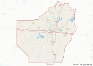
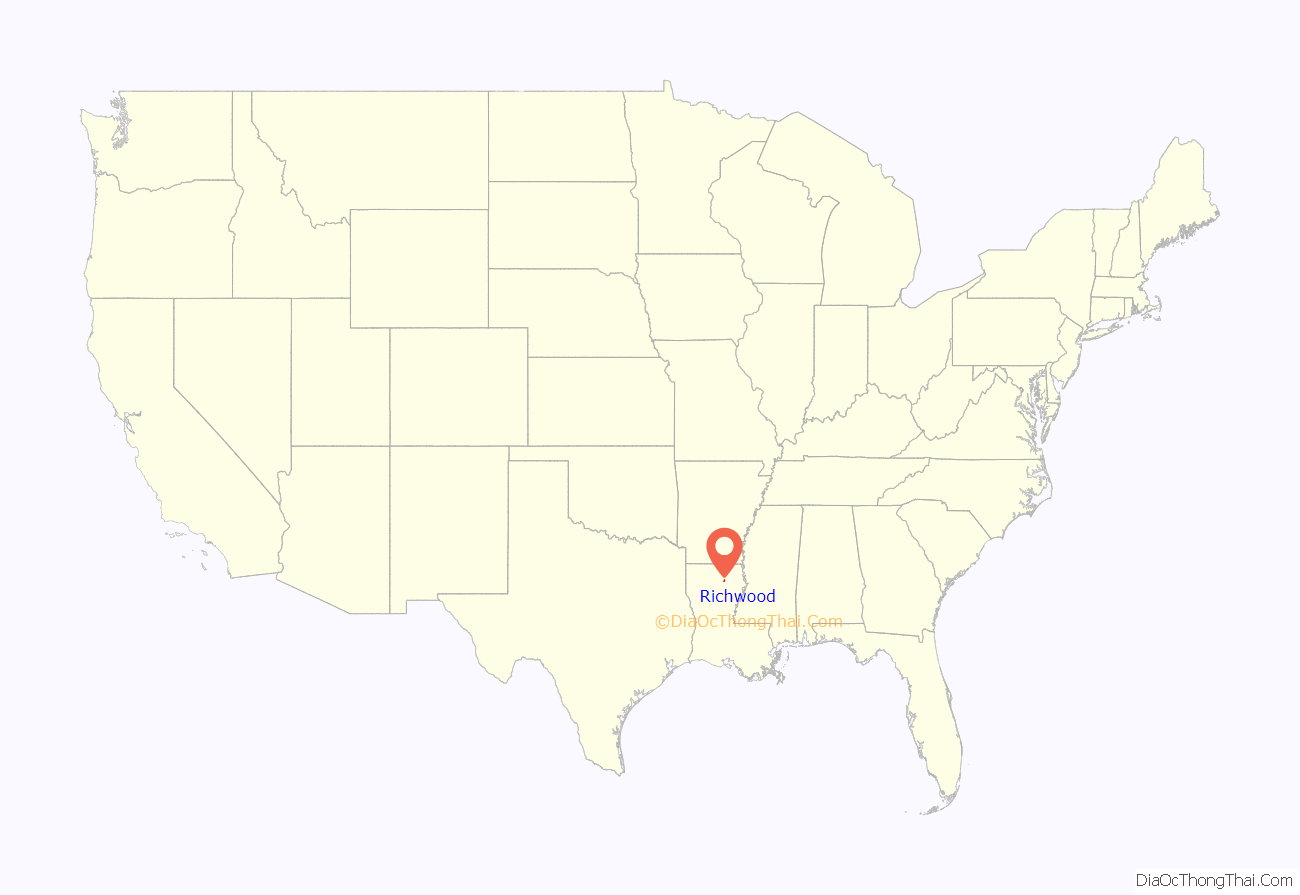
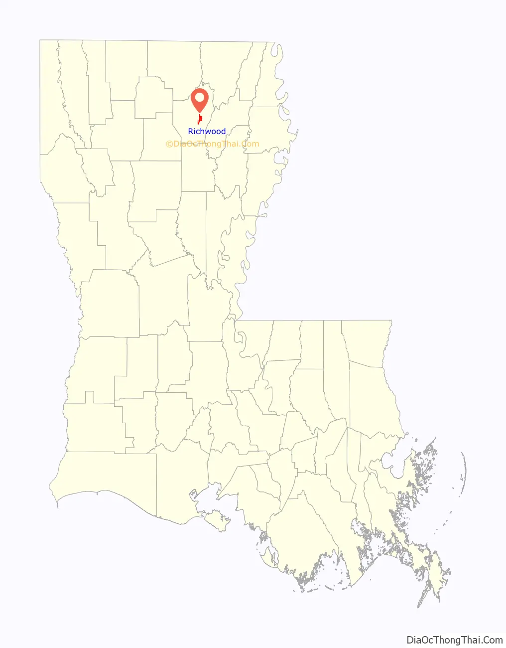
Richwood location map. Where is Richwood town?
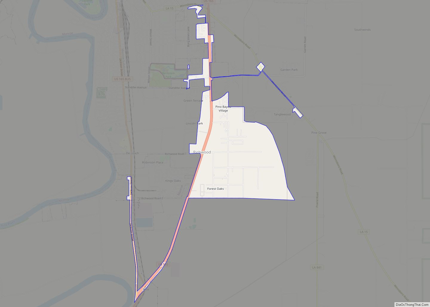
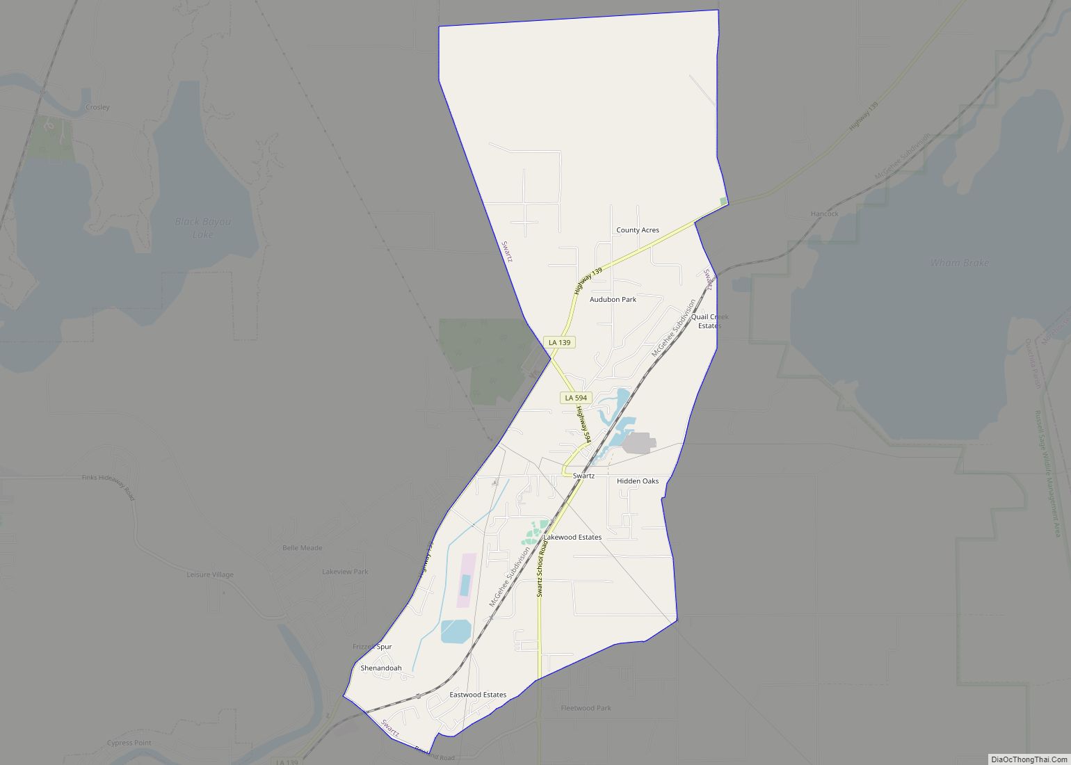
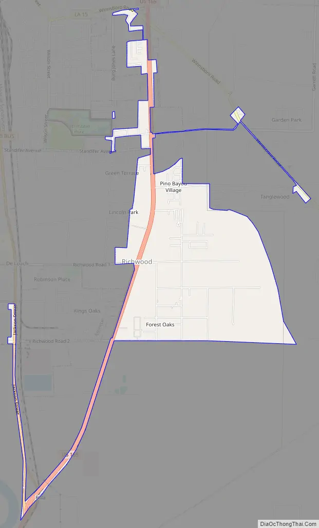
Richwood Road Map
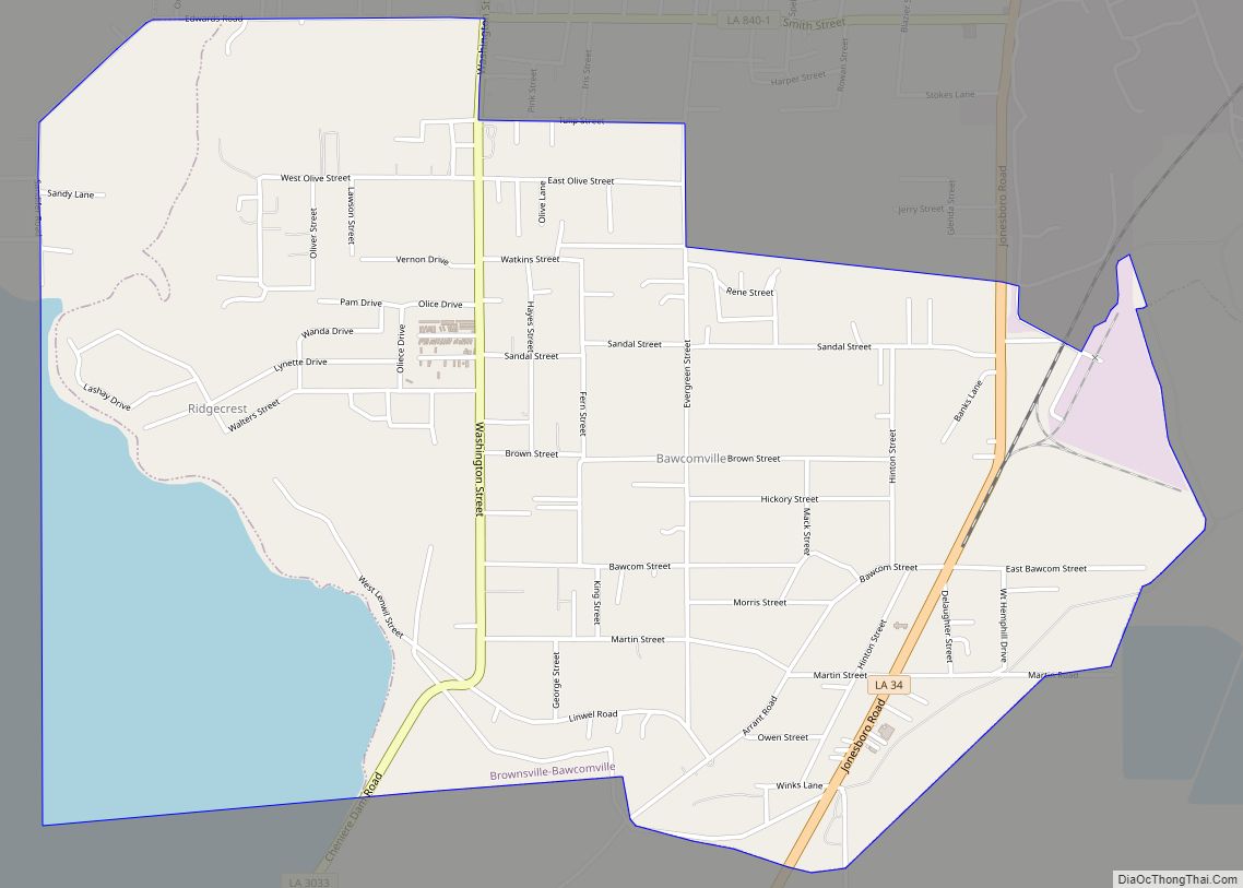
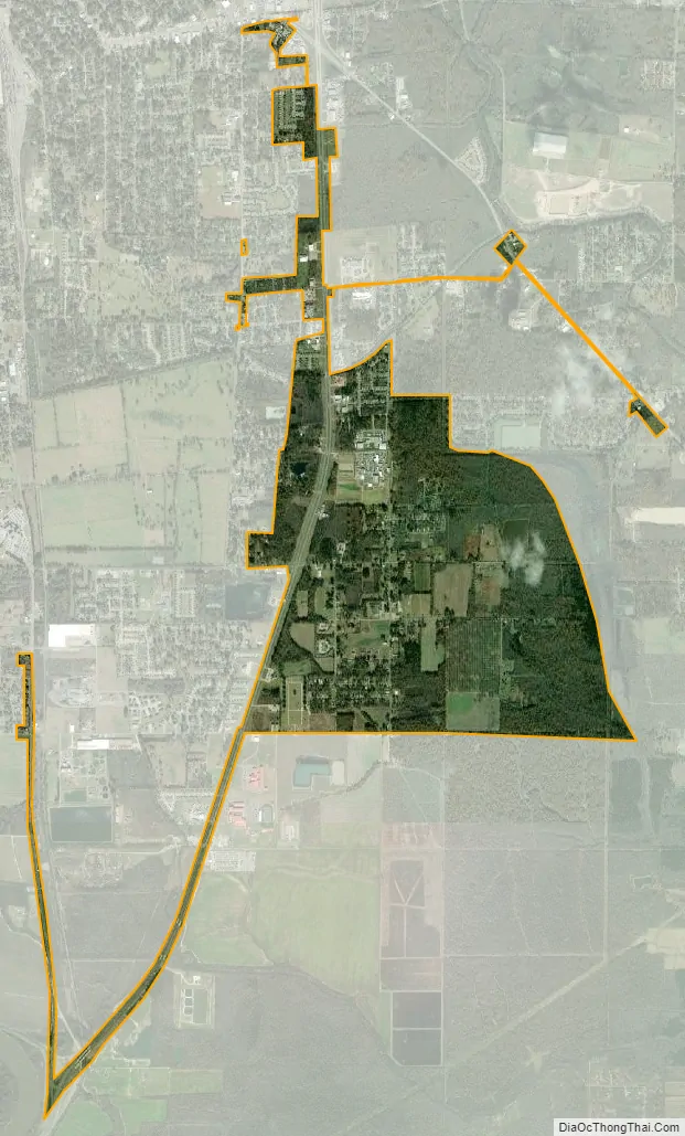
Richwood city Satellite Map
Geography
Richwood is located in the southern portion of Ouachita Parish of Northeast Louisiana at 32°27′35″N 92°4′31″W / 32.45972°N 92.07528°W / 32.45972; -92.07528 (32.459587, -92.075184).
According to the United States Census Bureau, the town has a total area of 2.3 square miles (6.0 km), all land.
See also
Map of Louisiana State and its subdivision:- Acadia
- Allen
- Ascension
- Assumption
- Avoyelles
- Beauregard
- Bienville
- Bossier
- Caddo
- Calcasieu
- Caldwell
- Cameron
- Catahoula
- Claiborne
- Concordia
- De Soto
- East Baton Rouge
- East Carroll
- East Feliciana
- Evangeline
- Franklin
- Grant
- Iberia
- Iberville
- Jackson
- Jefferson
- Jefferson Davis
- La Salle
- Lafayette
- Lafourche
- Lincoln
- Livingston
- Madison
- Morehouse
- Natchitoches
- Orleans
- Ouachita
- Plaquemines
- Pointe Coupee
- Rapides
- Red River
- Richland
- Sabine
- Saint Bernard
- Saint Charles
- Saint Helena
- Saint James
- Saint John the Baptist
- Saint Landry
- Saint Martin
- Saint Mary
- Saint Tammany
- Tangipahoa
- Tensas
- Terrebonne
- Union
- Vermilion
- Vernon
- Washington
- Webster
- West Baton Rouge
- West Carroll
- West Feliciana
- Winn
- Alabama
- Alaska
- Arizona
- Arkansas
- California
- Colorado
- Connecticut
- Delaware
- District of Columbia
- Florida
- Georgia
- Hawaii
- Idaho
- Illinois
- Indiana
- Iowa
- Kansas
- Kentucky
- Louisiana
- Maine
- Maryland
- Massachusetts
- Michigan
- Minnesota
- Mississippi
- Missouri
- Montana
- Nebraska
- Nevada
- New Hampshire
- New Jersey
- New Mexico
- New York
- North Carolina
- North Dakota
- Ohio
- Oklahoma
- Oregon
- Pennsylvania
- Rhode Island
- South Carolina
- South Dakota
- Tennessee
- Texas
- Utah
- Vermont
- Virginia
- Washington
- West Virginia
- Wisconsin
- Wyoming