Roseland is a town in Tangipahoa Parish, Louisiana, United States. The population was 1,123 at the 2010 census. It is the birthplace of Cajun chef and storyteller Justin Wilson.
Roseland is part of the Hammond Micropolitan Statistical Area.
| Name: | Roseland town |
|---|---|
| LSAD Code: | 43 |
| LSAD Description: | town (suffix) |
| State: | Louisiana |
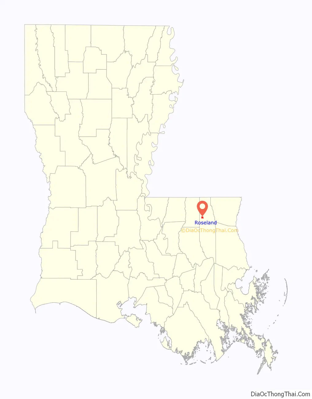
| County: | Tangipahoa Parish |
| Incorporated: | 1738 |
| Elevation: | 131 ft (40 m) |
| Total Area: | 2.27 sq mi (5.87 km²) |
| Land Area: | 2.08 sq mi (5.38 km²) |
| Water Area: | 0.19 sq mi (0.49 km²) |
| Total Population: | 880 |
| Population Density: | 423.89/sq mi (163.70/km²) |
| Area code: | 985 |
| FIPS code: | 2266165 |
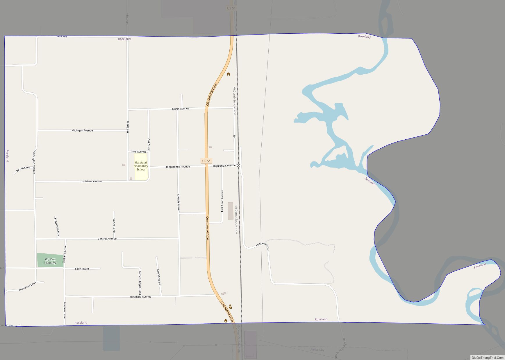
Online Interactive Map
Click on ![]() to view map in "full screen" mode.
to view map in "full screen" mode.
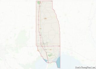
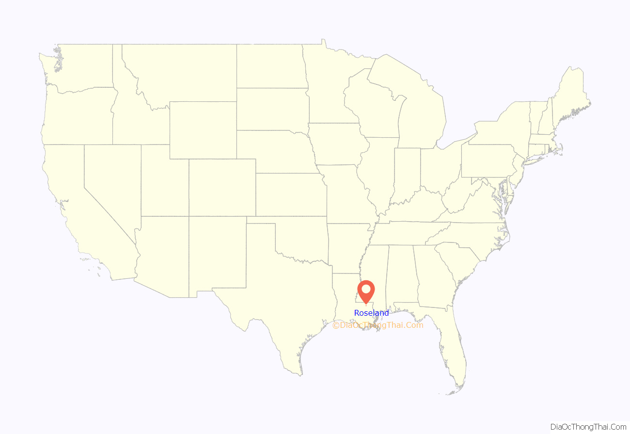
Roseland location map. Where is Roseland town?
History
John Bel Edwards lived on Louisiana Avenue in Roseland when he was elected governor of Louisiana on November 21, 2015. His residence, Egypta Hall, was built in 1888 and was originally a rooming house before being converted into a residence.
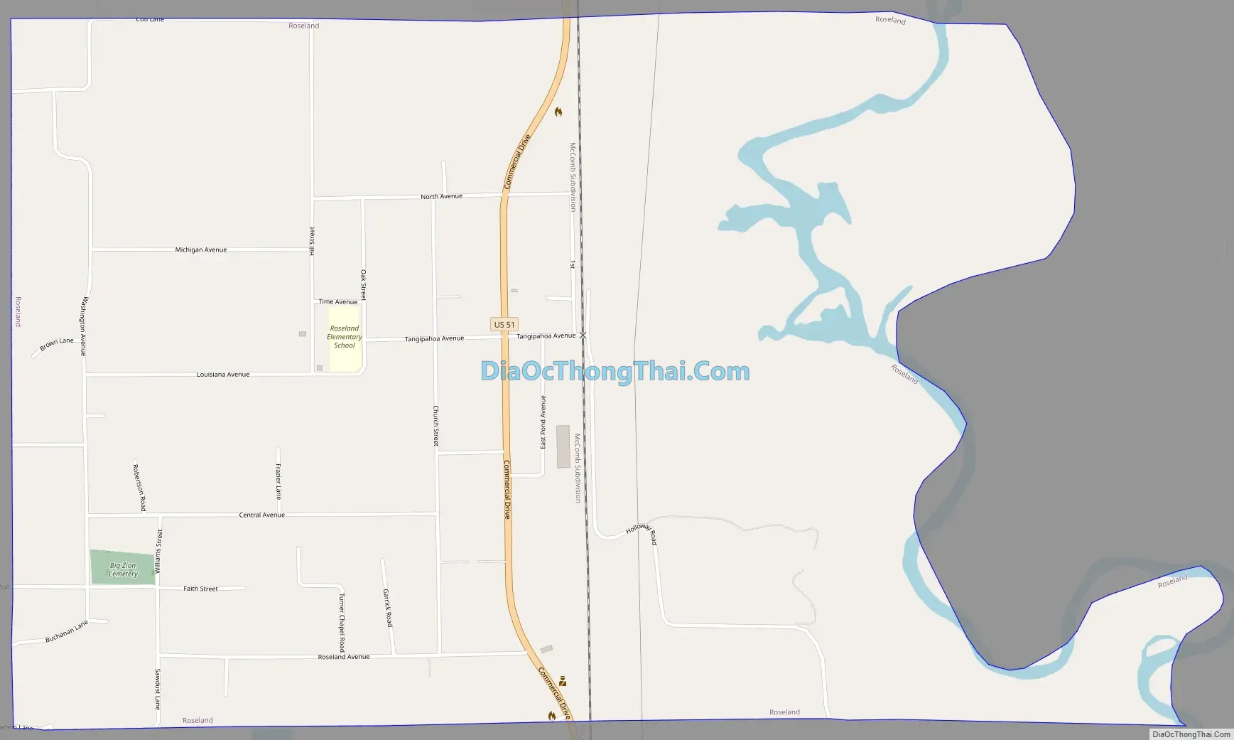
Roseland Road Map
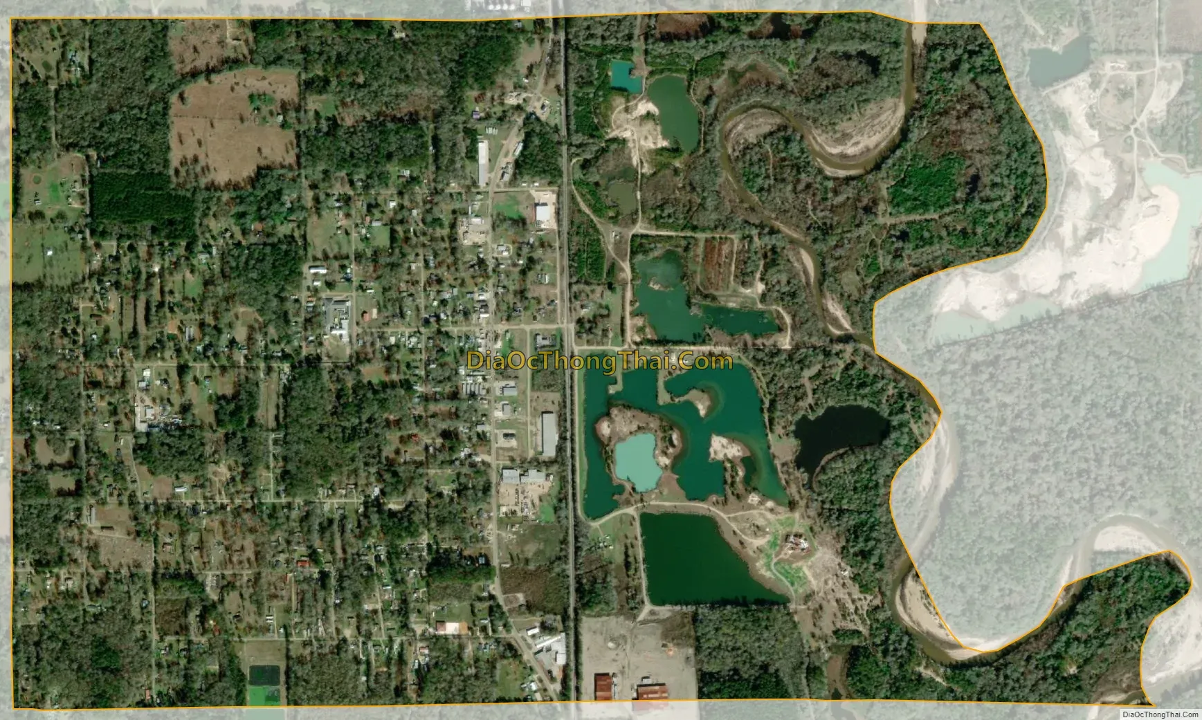
Roseland city Satellite Map
Geography
Roseland is located at 30°45′48″N 90°30′46″W / 30.76333°N 90.51278°W / 30.76333; -90.51278 (30.763352, -90.512875).
According to the United States Census Bureau, the town has a total area of 2.3 square miles (5.9 km), of which 2.1 square miles (5.5 km) is land and 0.1 square mile (0.3 km) (5.75%) is water.
See also
Map of Louisiana State and its subdivision:- Acadia
- Allen
- Ascension
- Assumption
- Avoyelles
- Beauregard
- Bienville
- Bossier
- Caddo
- Calcasieu
- Caldwell
- Cameron
- Catahoula
- Claiborne
- Concordia
- De Soto
- East Baton Rouge
- East Carroll
- East Feliciana
- Evangeline
- Franklin
- Grant
- Iberia
- Iberville
- Jackson
- Jefferson
- Jefferson Davis
- La Salle
- Lafayette
- Lafourche
- Lincoln
- Livingston
- Madison
- Morehouse
- Natchitoches
- Orleans
- Ouachita
- Plaquemines
- Pointe Coupee
- Rapides
- Red River
- Richland
- Sabine
- Saint Bernard
- Saint Charles
- Saint Helena
- Saint James
- Saint John the Baptist
- Saint Landry
- Saint Martin
- Saint Mary
- Saint Tammany
- Tangipahoa
- Tensas
- Terrebonne
- Union
- Vermilion
- Vernon
- Washington
- Webster
- West Baton Rouge
- West Carroll
- West Feliciana
- Winn
- Alabama
- Alaska
- Arizona
- Arkansas
- California
- Colorado
- Connecticut
- Delaware
- District of Columbia
- Florida
- Georgia
- Hawaii
- Idaho
- Illinois
- Indiana
- Iowa
- Kansas
- Kentucky
- Louisiana
- Maine
- Maryland
- Massachusetts
- Michigan
- Minnesota
- Mississippi
- Missouri
- Montana
- Nebraska
- Nevada
- New Hampshire
- New Jersey
- New Mexico
- New York
- North Carolina
- North Dakota
- Ohio
- Oklahoma
- Oregon
- Pennsylvania
- Rhode Island
- South Carolina
- South Dakota
- Tennessee
- Texas
- Utah
- Vermont
- Virginia
- Washington
- West Virginia
- Wisconsin
- Wyoming