Tickfaw was founded in 1852 and is a village in Tangipahoa Parish, Louisiana, United States. The population was 694 at the 2010 census. Tickfaw is part of the Hammond Micropolitan Statistical Area. It was originally inhabited by Italian-American immigrants and continues to have a distinct Italian-American heritage.
| Name: | Tickfaw village |
|---|---|
| LSAD Code: | 47 |
| LSAD Description: | village (suffix) |
| State: | Louisiana |
| County: | Tangipahoa Parish |
| Elevation: | 62 ft (19 m) |
| Total Area: | 1.61 sq mi (4.18 km²) |
| Land Area: | 1.61 sq mi (4.18 km²) |
| Water Area: | 0.00 sq mi (0.00 km²) |
| Total Population: | 635 |
| Population Density: | 393.68/sq mi (151.96/km²) |
| ZIP code: | 70466 |
| Area code: | 985 |
| FIPS code: | 2275670 |
Online Interactive Map
Click on ![]() to view map in "full screen" mode.
to view map in "full screen" mode.
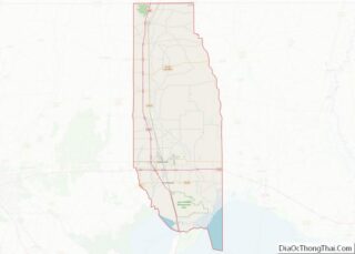
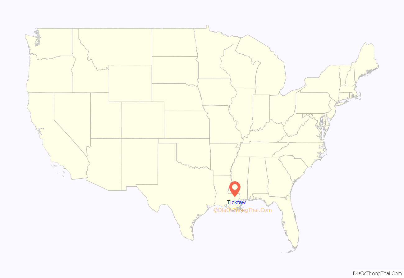
Tickfaw location map. Where is Tickfaw village?
History
Tickfaw is an Indian name which means “Rest Among the Pines.” It derives from a contraction of the Choctaw words tiak “pine” and foha “rest” or “ease”.
The Village was incorporated in 1957 under the leadership of Joe Greco, who later became the first Mayor. The governing body consists of the Mayor, the Board of Aldermen and an elected Chief of Police.
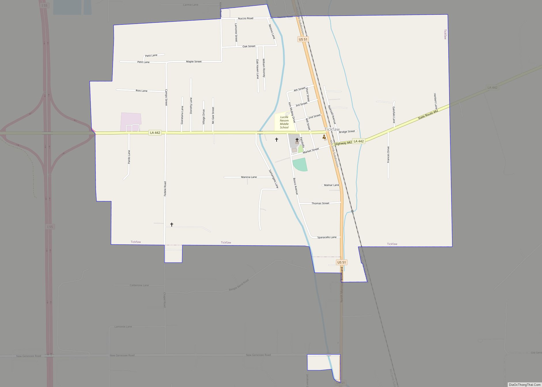
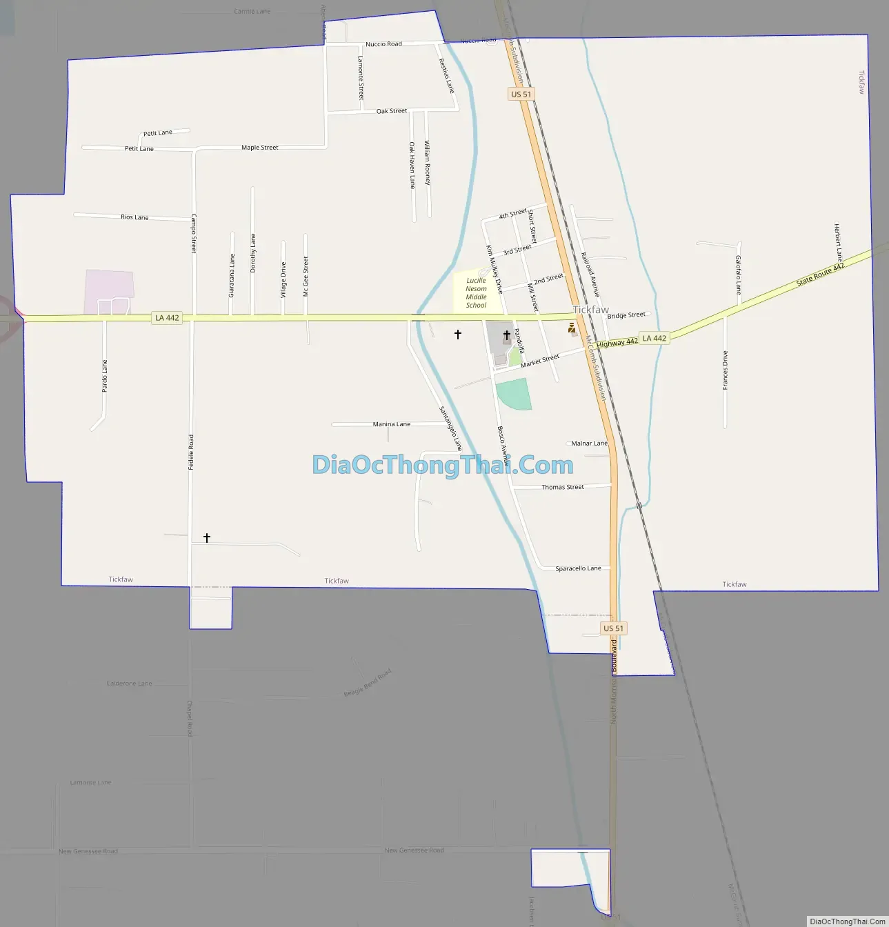
Tickfaw Road Map
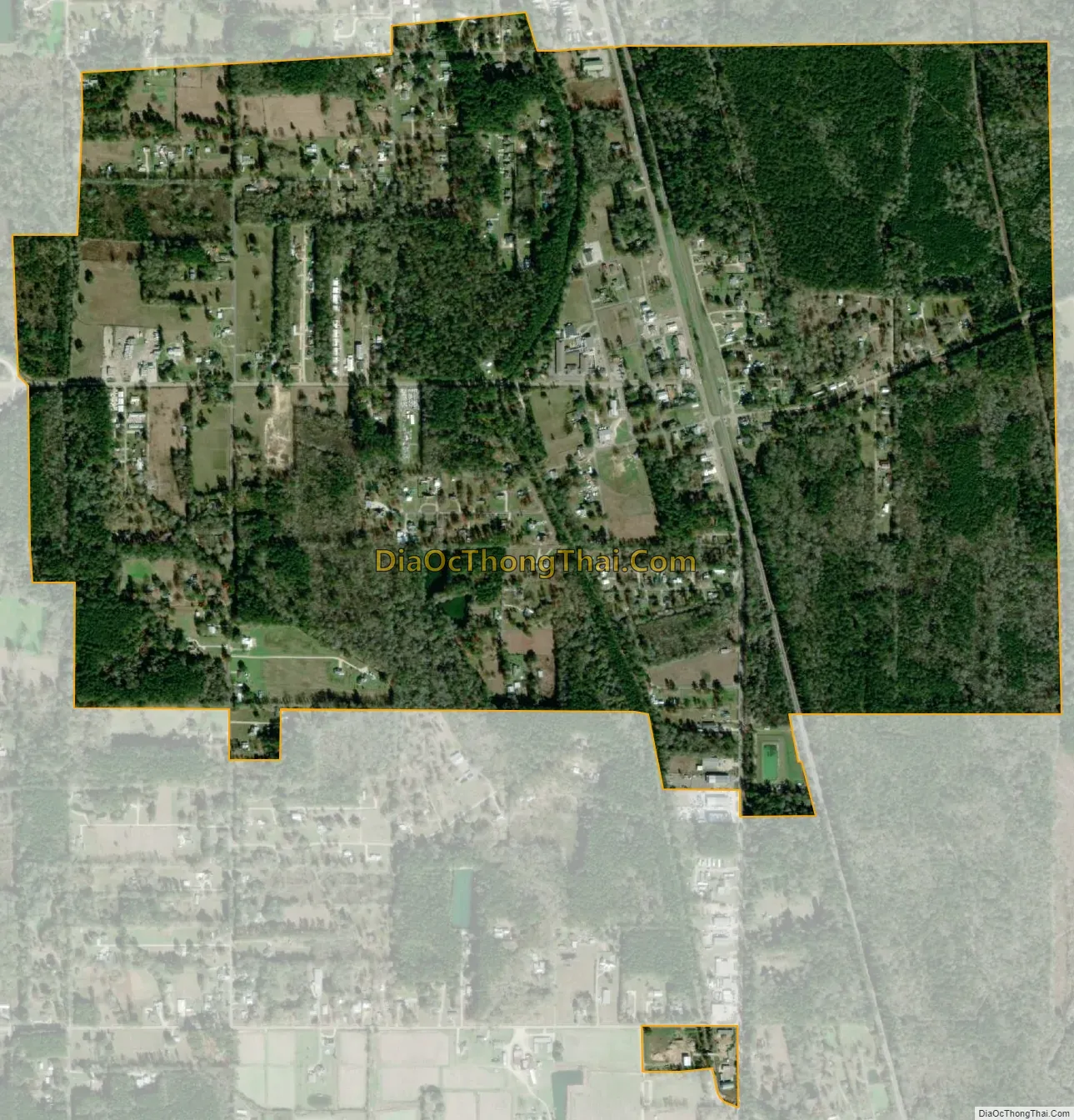
Tickfaw city Satellite Map
Geography
According to the United States Census Bureau, the village has a total area of 1.6 square miles (4.1 km), all land.
See also
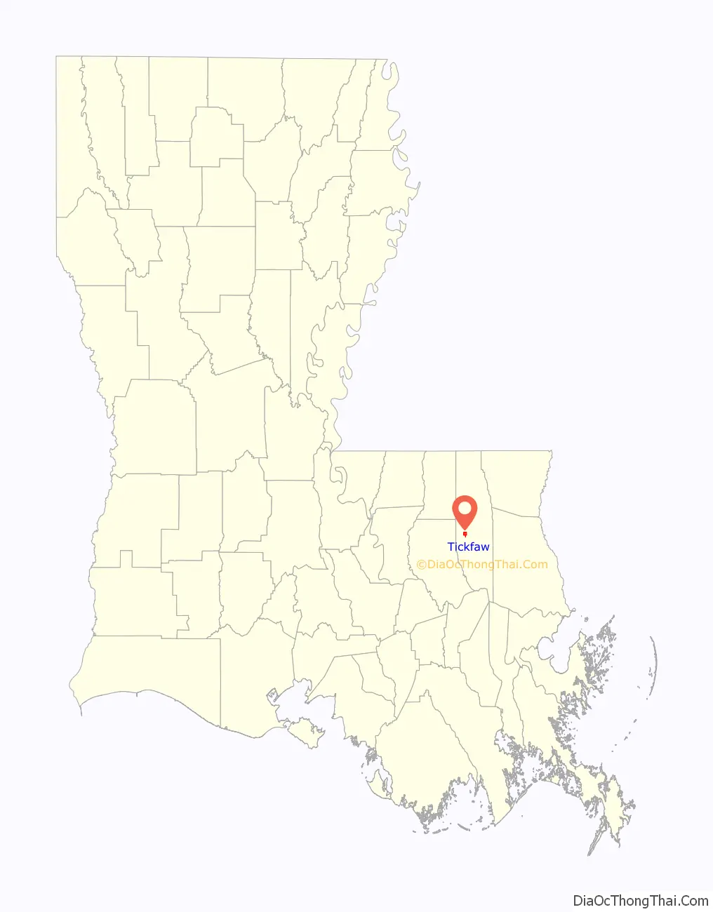
Map of Louisiana State and its subdivision:- Acadia
- Allen
- Ascension
- Assumption
- Avoyelles
- Beauregard
- Bienville
- Bossier
- Caddo
- Calcasieu
- Caldwell
- Cameron
- Catahoula
- Claiborne
- Concordia
- De Soto
- East Baton Rouge
- East Carroll
- East Feliciana
- Evangeline
- Franklin
- Grant
- Iberia
- Iberville
- Jackson
- Jefferson
- Jefferson Davis
- La Salle
- Lafayette
- Lafourche
- Lincoln
- Livingston
- Madison
- Morehouse
- Natchitoches
- Orleans
- Ouachita
- Plaquemines
- Pointe Coupee
- Rapides
- Red River
- Richland
- Sabine
- Saint Bernard
- Saint Charles
- Saint Helena
- Saint James
- Saint John the Baptist
- Saint Landry
- Saint Martin
- Saint Mary
- Saint Tammany
- Tangipahoa
- Tensas
- Terrebonne
- Union
- Vermilion
- Vernon
- Washington
- Webster
- West Baton Rouge
- West Carroll
- West Feliciana
- Winn
- Alabama
- Alaska
- Arizona
- Arkansas
- California
- Colorado
- Connecticut
- Delaware
- District of Columbia
- Florida
- Georgia
- Hawaii
- Idaho
- Illinois
- Indiana
- Iowa
- Kansas
- Kentucky
- Louisiana
- Maine
- Maryland
- Massachusetts
- Michigan
- Minnesota
- Mississippi
- Missouri
- Montana
- Nebraska
- Nevada
- New Hampshire
- New Jersey
- New Mexico
- New York
- North Carolina
- North Dakota
- Ohio
- Oklahoma
- Oregon
- Pennsylvania
- Rhode Island
- South Carolina
- South Dakota
- Tennessee
- Texas
- Utah
- Vermont
- Virginia
- Washington
- West Virginia
- Wisconsin
- Wyoming