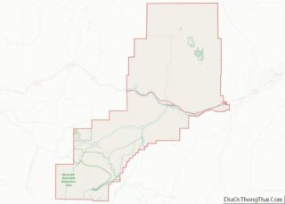
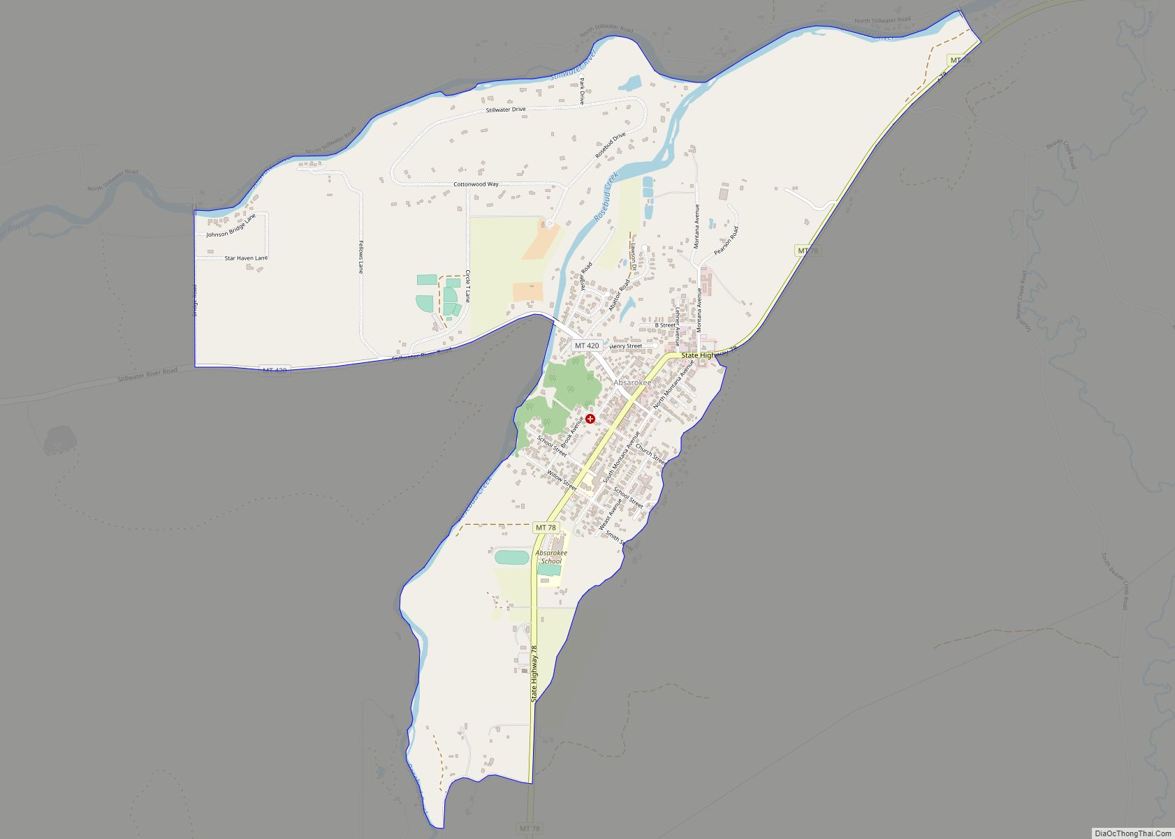
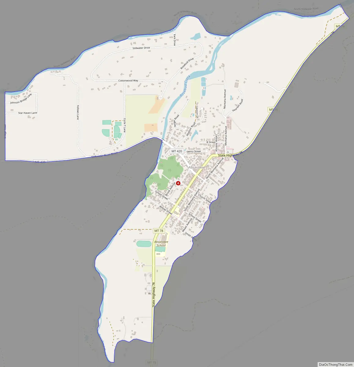
Absarokee (/əbzɔːrˈki/ ub-ZOR-kee) is a census-designated place (CDP) in Stillwater County, Montana, United States, approximately 14 miles (23 km) south of Columbus on Highway 78. It is named after the Crow Indians who formerly inhabited the land. The population was 1,234 at the 2000 census. The Stillwater Mine, operated by the Stillwater Mining Company, is located near Absarokee.
| Name: | Absarokee CDP |
|---|---|
| LSAD Code: | 57 |
| LSAD Description: | CDP (suffix) |
| State: | Montana |
| County: | Stillwater County |
| Elevation: | 4,039 ft (1,231 m) |
| Total Area: | 2.15 sq mi (5.57 km²) |
| Land Area: | 2.14 sq mi (5.54 km²) |
| Water Area: | 0.01 sq mi (0.02 km²) |
| Total Population: | 1,000 |
| Population Density: | 467.07/sq mi (180.34/km²) |
| ZIP code: | 59001 |
| Area code: | 406 |
| FIPS code: | 3000175 |
| GNISfeature ID: | 0801981 |
Online Interactive Map
Click on ![]() to view map in "full screen" mode.
to view map in "full screen" mode.
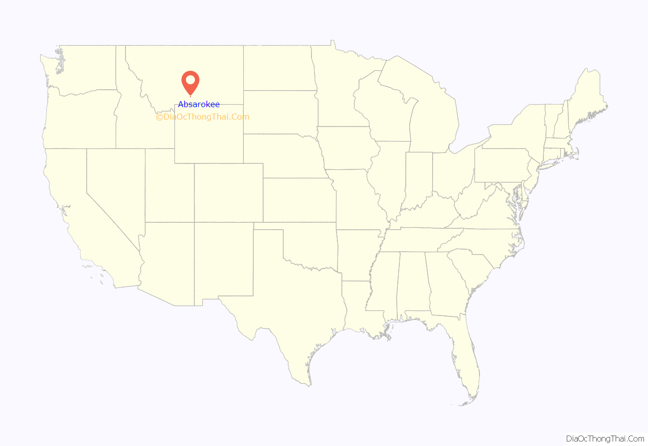
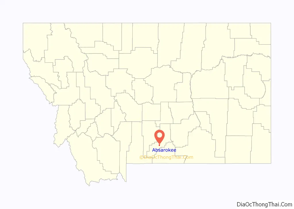
Absarokee location map. Where is Absarokee CDP?
History
Absarokee was founded just north of the Second Crow Agency (sometimes referred to as the Absaroka Agency) in 1892. The Crow Agency was the headquarters of the Crow Tribe’s reservation that was established by the Treaty of Fort Laramie (1868). That original reservation extended to more than 35 million acres with the first Crow Agency located at Fort Parker near modern Livingston, Montana in 1869. As miners encroached, the reservation was reduced to 8 million acres in 1875 with a location south of modern Absarokee established as Second Crow Agency (1875-1884). It was during this time that the Crow were forced to give up nomadic free lifestyles to one totally under the control of the US government. They were not allowed to leave the reservation, bison was replaced with US issued beef rations, and the tribe was hit by several measles and scarlet feaver epidemics. Finally, by 1884 further miner encroachment led to the creation of the third and current Crow Agency 60 miles SE of Billings on the Little Bighorn River. Most of the Absaroka Agency Fort was destroyed in a fire in 1891.
With the Homestead Acts of the 1860s and the westward expansion of the railroad, more settlers came to Montana. Not until October 15, 1892, did the federal government through a Benjamin Harrison proclamation open the land around Absarokee for settlement as part of a 1.8 million-acre land cession agreed to by Crow tribal leaders two years earlier after bowing to political pressure. Eleven days earlier on October 4, Sever Simonson and his family had arrived and established squatter’s rights at the confluence of the Stillwater and East Rosebud Rivers.
Simonson and his nephew, Oliver H. Hovda, built a log hotel and together established a trading post (later the Absarokee Cooperative Trading Co.). This was followed by a saloon, livery stable, and blacksmith shop. A post office was established December 16, 1892 in Simonson’s home, where he served as Absarokee’s postmaster. The two-story home of Hovda, known as the Big Yellow House, built in 1904 by an area rancher, Jacob Wagner, is located on Absarokee’s main street (Woodard Ave.) and is on the National Register of Historic Sites list.
Absarokee was affected by the 2022 Montana floods when the Stillwater River flooded.
Absarokee Road Map
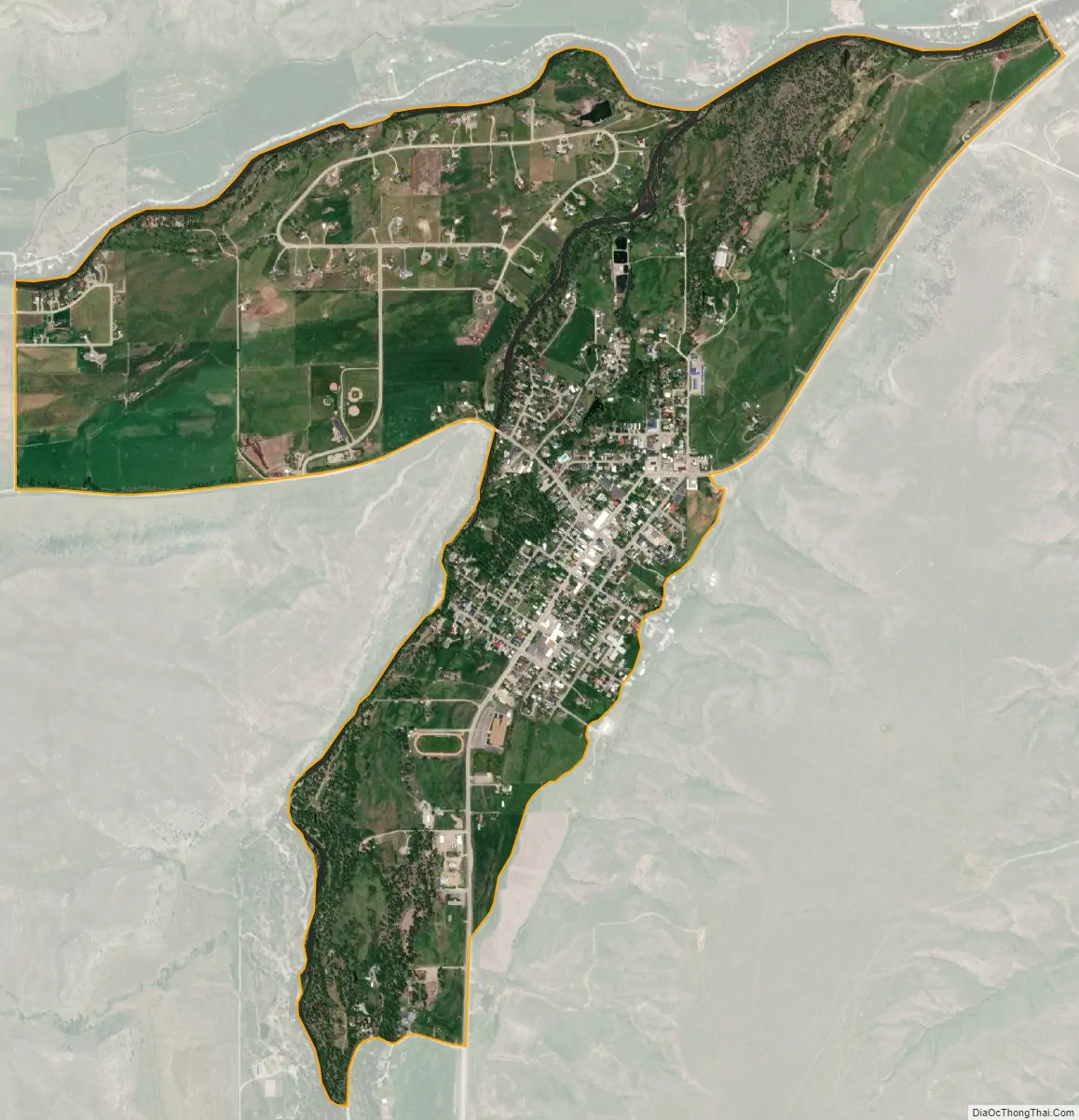
Absarokee city Satellite Map
Geography
Absarokee is located at 45°31′13″N 109°26′38″W / 45.52028°N 109.44389°W / 45.52028; -109.44389 (45.520147, -109.443782) in a valley of the Beartooth Mountain foothills. According to the United States Census Bureau, the CDP has a total area of 2.0 square miles (5.2 km), all land. It is situated in the Rosebud River watershed, approximately three miles north of the confluence of the East Rosebud River, West Rosebud River, and Butcher Creek, and just south of the confluence of the created Rosebud River and the Stillwater River.
Climate
See also
Map of Montana State and its subdivision:- Beaverhead
- Big Horn
- Blaine
- Broadwater
- Carbon
- Carter
- Cascade
- Chouteau
- Custer
- Daniels
- Dawson
- Deer Lodge
- Fallon
- Fergus
- Flathead
- Gallatin
- Garfield
- Glacier
- Golden Valley
- Granite
- Hill
- Jefferson
- Judith Basin
- Lake
- Lewis and Clark
- Liberty
- Lincoln
- Madison
- McCone
- Meagher
- Mineral
- Missoula
- Musselshell
- Park
- Petroleum
- Phillips
- Pondera
- Powder River
- Powell
- Prairie
- Ravalli
- Richland
- Roosevelt
- Rosebud
- Sanders
- Sheridan
- Silver Bow
- Stillwater
- Sweet Grass
- Teton
- Toole
- Treasure
- Valley
- Wheatland
- Wibaux
- Yellowstone
- Alabama
- Alaska
- Arizona
- Arkansas
- California
- Colorado
- Connecticut
- Delaware
- District of Columbia
- Florida
- Georgia
- Hawaii
- Idaho
- Illinois
- Indiana
- Iowa
- Kansas
- Kentucky
- Louisiana
- Maine
- Maryland
- Massachusetts
- Michigan
- Minnesota
- Mississippi
- Missouri
- Montana
- Nebraska
- Nevada
- New Hampshire
- New Jersey
- New Mexico
- New York
- North Carolina
- North Dakota
- Ohio
- Oklahoma
- Oregon
- Pennsylvania
- Rhode Island
- South Carolina
- South Dakota
- Tennessee
- Texas
- Utah
- Vermont
- Virginia
- Washington
- West Virginia
- Wisconsin
- Wyoming