Fairfield is a town in Teton County, Montana, United States. The population was 759 at the 2020 census. Fairfield is the self-proclaimed “Malting Barley Capital of the World” with 83,000 acres (336 km) of irrigated cropland and 56,000 acres (227 km) of non-irrigated cropland in production for the purpose of raising malt barley in the vicinity.
Fairfield began as a station on the Milwaukee and is between Great Falls and Choteau and near Freezeout Lake, (from Cheney’s Names on the Face of Montana, Mountain Press Publishing Company) where as many as 300,000 snow geese and 10,000 tundra swans gather in March. Fairfield serves as a trading center for the farmers of Greenfield Bench. Irrigation now assures crops, but in earlier days a dry summer made the grass scarce and the name “Freeze-out Bench” was applied to the area. “Greenfield Bench” and Fairfield are now descriptive of the hay and grain fields surrounding the town.
Even though the federal government had opened this area of Montana to homesteading in 1862, not until 1909 did settlers really come into the Fairfield area when Congress liberalized this act allowing the settler 320 acres of free land instead of 160. It became apparent, however, that the small homesteads, 160 or 320 acres, made little sense in the vast and dry landscape of Montana. After the Bureau of Reclamation conducted a survey that showed a dam could be built in the Sun River Canyon and water for irrigation in Fairfield area would be feasible were many more settlers attracted to Fairfield. The Gibson Dam was completed in 1929. Today, Greenfield Irrigation District delivers water from Gibson Dam to approximately 83,000 acres surrounding this community.
Fairfield is nicknamed the “Malting Barley Capital of the World”, a trade center for the farming community as well as being home to Busch Agricultural Resources, 3 Rivers Telephone Cooperative and Sun River Electric Cooperative.
| Name: | Fairfield town |
|---|---|
| LSAD Code: | 43 |
| LSAD Description: | town (suffix) |
| State: | Montana |
| County: | Teton County |
| Elevation: | 3,983 ft (1,214 m) |
| Total Area: | 0.31 sq mi (0.81 km²) |
| Land Area: | 0.31 sq mi (0.81 km²) |
| Water Area: | 0.00 sq mi (0.00 km²) |
| Total Population: | 759 |
| Population Density: | 2,417.20/sq mi (934.47/km²) |
| ZIP code: | 59436 |
| Area code: | 406 |
| FIPS code: | 3025225 |
| GNISfeature ID: | 0771287 |
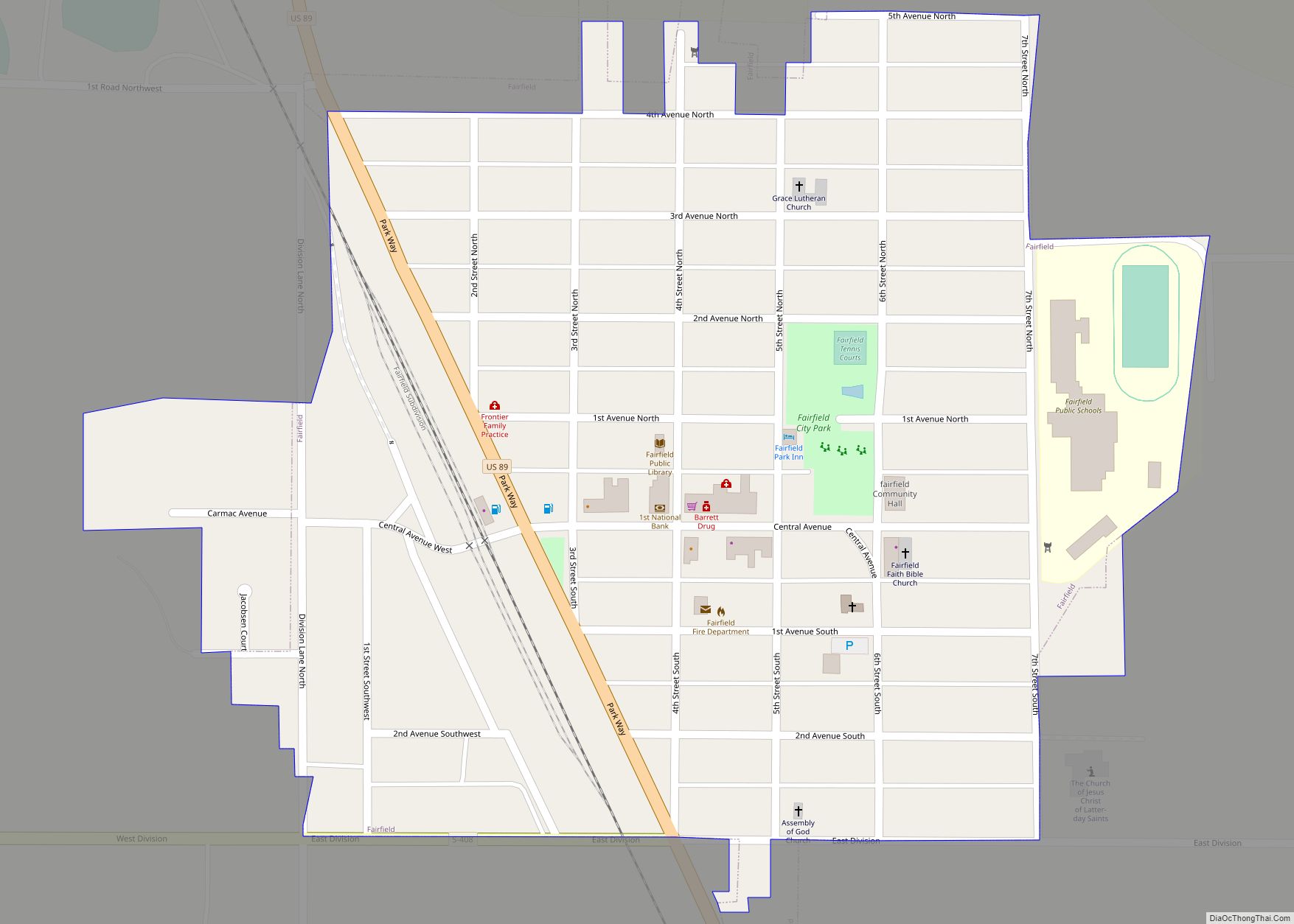
Online Interactive Map
Click on ![]() to view map in "full screen" mode.
to view map in "full screen" mode.
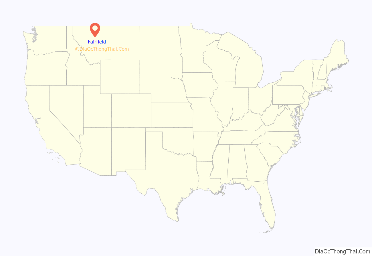
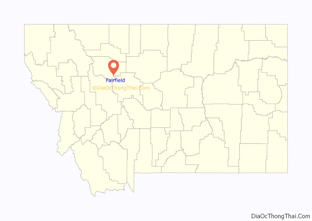
Fairfield location map. Where is Fairfield town?
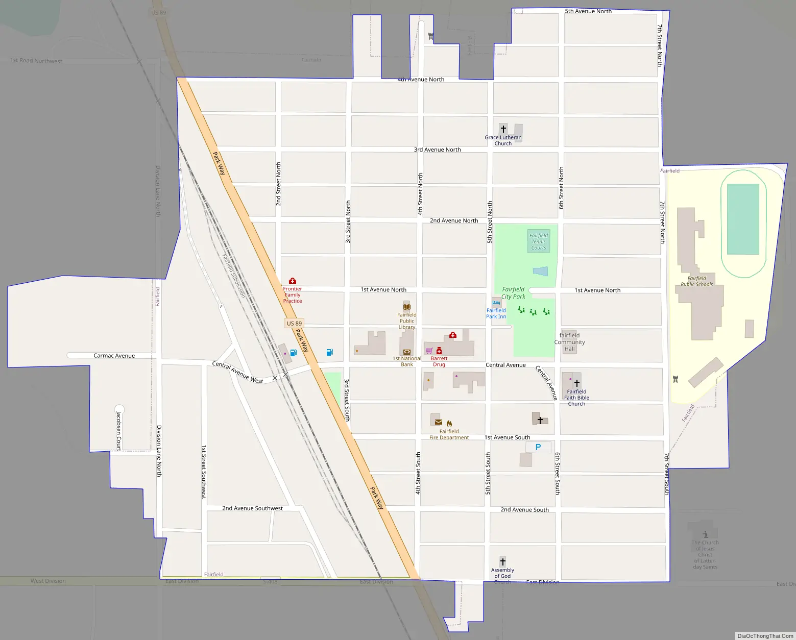
Fairfield Road Map
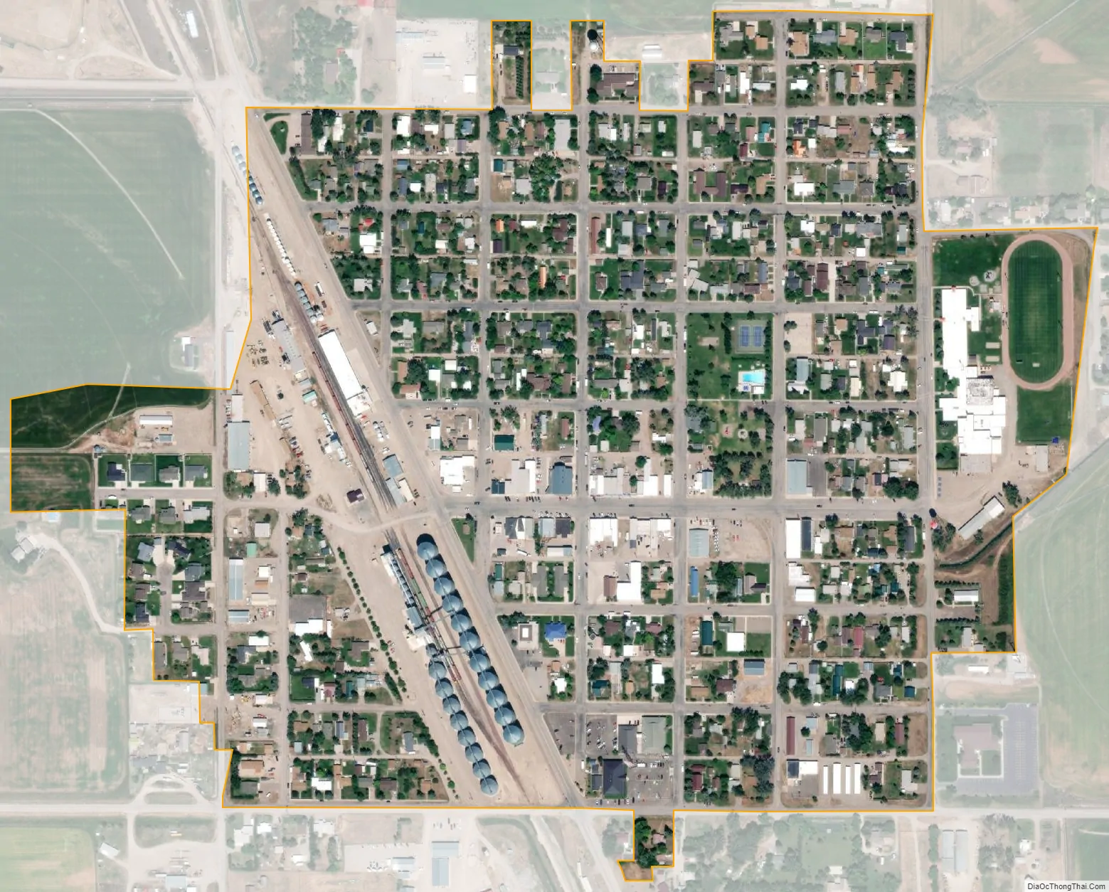
Fairfield city Satellite Map
Geography
Fairfield is located at 47°36′55″N 111°58′51″W / 47.61528°N 111.98083°W / 47.61528; -111.98083 (47.615250, -111.980859).
According to the United States Census Bureau, the town has a total area of 0.31 square miles (0.80 km), all land.
See also
Map of Montana State and its subdivision:- Beaverhead
- Big Horn
- Blaine
- Broadwater
- Carbon
- Carter
- Cascade
- Chouteau
- Custer
- Daniels
- Dawson
- Deer Lodge
- Fallon
- Fergus
- Flathead
- Gallatin
- Garfield
- Glacier
- Golden Valley
- Granite
- Hill
- Jefferson
- Judith Basin
- Lake
- Lewis and Clark
- Liberty
- Lincoln
- Madison
- McCone
- Meagher
- Mineral
- Missoula
- Musselshell
- Park
- Petroleum
- Phillips
- Pondera
- Powder River
- Powell
- Prairie
- Ravalli
- Richland
- Roosevelt
- Rosebud
- Sanders
- Sheridan
- Silver Bow
- Stillwater
- Sweet Grass
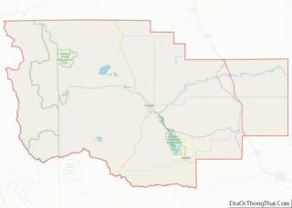
- Teton
- Toole
- Treasure
- Valley
- Wheatland
- Wibaux
- Yellowstone
- Alabama
- Alaska
- Arizona
- Arkansas
- California
- Colorado
- Connecticut
- Delaware
- District of Columbia
- Florida
- Georgia
- Hawaii
- Idaho
- Illinois
- Indiana
- Iowa
- Kansas
- Kentucky
- Louisiana
- Maine
- Maryland
- Massachusetts
- Michigan
- Minnesota
- Mississippi
- Missouri
- Montana
- Nebraska
- Nevada
- New Hampshire
- New Jersey
- New Mexico
- New York
- North Carolina
- North Dakota
- Ohio
- Oklahoma
- Oregon
- Pennsylvania
- Rhode Island
- South Carolina
- South Dakota
- Tennessee
- Texas
- Utah
- Vermont
- Virginia
- Washington
- West Virginia
- Wisconsin
- Wyoming