| Name: | Columbus city |
|---|---|
| LSAD Code: | 25 |
| LSAD Description: | city (suffix) |
| State: | Ohio |
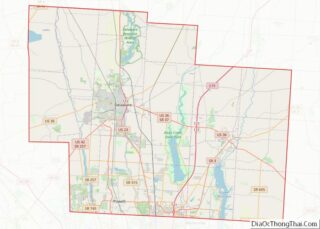
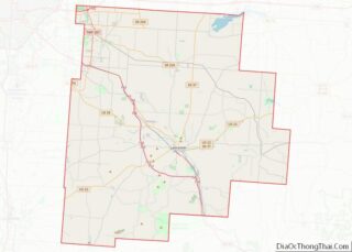
| County: | Delaware County, Fairfield County, Franklin County |
| Incorporated: | February 10, 1816 |
| Elevation: | 781 ft (238 m) |
| Land Area: | 220.40 sq mi (570.82 km²) |
| Water Area: | 5.86 sq mi (15.18 km²) |
| Population Density: | 4,109.64/sq mi (1,586.74/km²) |
| FIPS code: | 3918000 |
| GNISfeature ID: | 1080996 |
| Website: | www.columbus.gov |
Explore the city with this Columbus map collection to find out what makes this city so special. From major roads and surrounding areas to things to do and places to see, this collection will help you get to know the city and its many attractions.
Discover Columbus with this map collection that features major roads, surrounding areas, and things to do. Named after the first European American explorer to reach the Americas, Christopher Columbus, this city is not only the capital of Ohio but also the 14th most populous city in the United States!
Columbus is a haven of experiences with more than 370 parks and nature preserves, more than 345 historic sites, and hundreds of miles of trails. Whether you’re looking for outdoor activities, cultural attractions, or something else, you’re sure to find it in this city.
Navigate your way around the city with this map collection to find out what makes Columbus so special. From major roads and surrounding areas to things to do and places to see, you’ll be able to explore the city and its many attractions with ease.
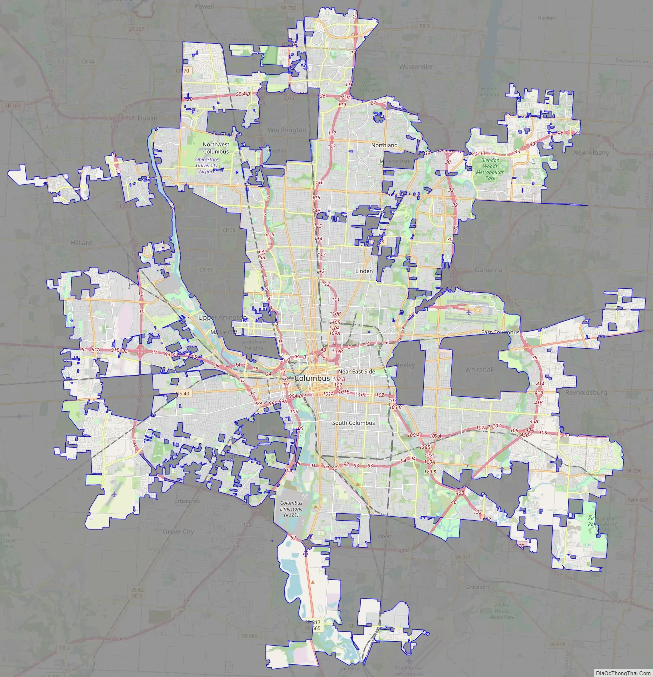
Online Interactive Map
Click on ![]() to view map in "full screen" mode.
to view map in "full screen" mode.
Discover the sights and sounds of our beautiful city with this interactive map. You can find the best things to do and places to go in Columbus, Ohio. Find the best route to your destination, learn about the city, and discover its best attractions on our interactive map.
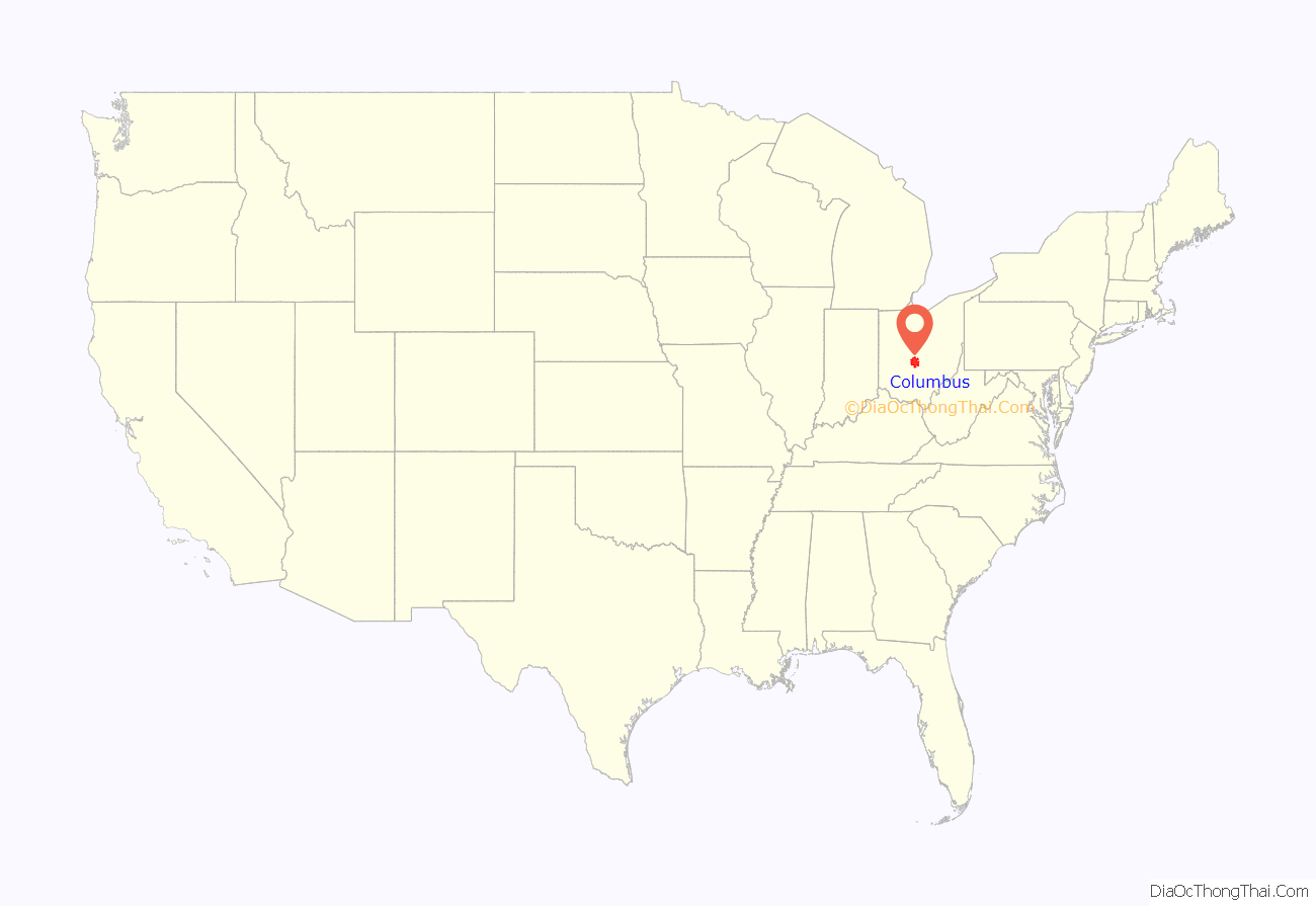
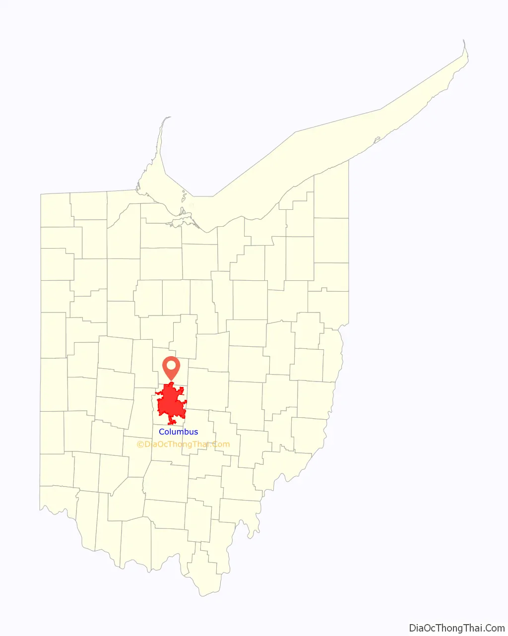
Columbus location map. Where is Columbus city?
History
Ancient and early history
Between 1000 B.C. and 1700 A.D., the Columbus metropolitan area was a center to indigenous cultures known as the Mound Builders, including the Adena, Hopewell and Fort Ancient peoples. Remaining physical evidence of the cultures are their burial mounds and what they contained. Most of Central Ohio’s remaining mounds are located outside of Columbus city boundaries, though the Shrum Mound is maintained, now as part of a public park and historic site. The city’s Mound Street derives its name from a mound that existed by the intersection of Mound and High Streets. The mound’s clay was used in bricks for most of the city’s initial brick buildings; many were subsequently used in the Ohio Statehouse. The city’s Ohio History Center maintains a collection of artifacts from these cultures.
18th century: Ohio Country
The area including modern-day Columbus once comprised the Ohio Country, under the nominal control of the French colonial empire through the Viceroyalty of New France from 1663 until 1763. In the 18th century, European traders flocked to the area, attracted by the fur trade. The area was often caught between warring factions, including American Indian and European interests. In the 1740s, Pennsylvania traders overran the territory until the French forcibly evicted them. Fighting for control of the territory in the French and Indian War (1754-1763) became part of the international Seven Years’ War (1756-1763). During this period, the region routinely suffered turmoil, massacres and battles. The 1763 Treaty of Paris ceded the Ohio Country to the British Empire.
Until just before the American Revolution, Central Ohio had continuously been the home of numerous indigenous villages. A Mingo village was located at the forks of the Scioto and Olentangy rivers, with Shawnee villages to the south and Wyandot and Delaware villages to the north. Colonial militiamen burned down the Mingo village in 1774 during a raid.
After the American Revolution, the Virginia Military District became part of the Ohio Country as a territory of Virginia. Colonists from the East Coast moved in, but rather than finding an empty frontier, they encountered people of the Miami, Delaware, Wyandot, Shawnee and Mingo nations, as well as European traders. The tribes resisted expansion by the fledgling United States, leading to years of bitter conflict. The decisive Battle of Fallen Timbers resulted in the Treaty of Greenville in 1795, which finally opened the way for new settlements. By 1797, a young surveyor from Virginia named Lucas Sullivant had founded a permanent settlement on the west bank of the forks of the Scioto and Olentangy rivers. An admirer of Benjamin Franklin, Sullivant chose to name his frontier village “Franklinton.” The location was desirable for its proximity to the navigable rivers – but Sullivant was initially foiled when, in 1798, a large flood wiped out the new settlement. He persevered, and the village was rebuilt, though somewhat more inland.
After the Revolution, land comprising parts of Franklin and adjacent counties was set aside by the United States Congress for settlement by Canadians and Nova Scotians who were sympathetic to the colonial cause and had their land and possessions seized by the British government. The Refugee Tract, consisting of 103,000 acres (42,000 ha), was 42 miles (68 km) long and 3–4.5 miles (4.8–7.2 km) wide, and was claimed by 67 eligible men. The Ohio Statehouse sits on land once contained in the Refugee Tract.
19th century: state capital, city establishment, and development
After Ohio achieved statehood in 1803, political infighting among prominent Ohio leaders led to the state capital moving from Chillicothe to Zanesville and back again. Desiring to settle on a location, the state legislature considered Franklinton, Dublin, Worthington and Delaware before compromising on a plan to build a new city in the state’s center, near major transportation routes, primarily rivers. As well, Franklinton landowners had donated two 10-acre (4.0 ha) plots in an effort to convince the state to move its capital there. The two spaces were set to become Capitol Square (for the Ohio Statehouse) and the Ohio Penitentiary. Named in honor of Christopher Columbus, the city was founded on February 14, 1812, on the “High Banks opposite Franklinton at the Forks of the Scioto most known as Wolf’s Ridge.” At the time, this area was a dense forestland, used only as a hunting ground.
The city was incorporated as a borough on February 10, 1816. Nine people were elected to fill the municipality’s various positions of mayor, treasurer and several others. Between 1816 and 1817, Jarvis W. Pike served as the first appointed mayor. Although the recent War of 1812 had brought prosperity to the area, the subsequent recession and conflicting claims to the land threatened the new town’s success. Early conditions were abysmal, with frequent bouts of fevers – attributed to malaria from the flooding rivers – and an outbreak of cholera in 1833. It led Columbus to create the Board of Health, now part of the Columbus Public Health department. The outbreak, which remained in the city from July to September 1833, killed 100 people.
Columbus was without direct river or trail connections to other Ohio cities, leading to slow initial growth. The National Road reached Columbus from Baltimore in 1831, which complemented the city’s new link to the Ohio and Erie Canal, both of which facilitated a population boom. A wave of European immigrants led to the creation of two ethnic enclaves on the city’s outskirts. A large Irish population settled in the north along Naghten Street (presently Nationwide Boulevard), while the Germans took advantage of the cheap land to the south, creating a community that came to be known as the Das Alte Südende (The Old South End). Columbus’s German population constructed numerous breweries, Trinity Lutheran Seminary and Capital University.
With a population of 3,500, Columbus was officially chartered as a city on March 3, 1834. On that day, the legislature carried out a special act, which granted legislative authority to the city council and judicial authority to the mayor. Elections were held in April of that year, with voters choosing John Brooks as the first popularly elected mayor. Columbus annexed the then-separate city of Franklinton in 1837.
In 1850, the Columbus and Xenia Railroad became the first railroad into the city, followed by the Cleveland, Columbus and Cincinnati Railroad in 1851. The two railroads built a joint Union Station on the east side of High Street just north of Naghten (then called North Public Lane). Rail traffic into Columbus increased: by 1875, eight railroads served Columbus, and the rail companies built a new, more elaborate station. Another cholera outbreak hit Columbus in 1849, prompting the opening of the city’s Green Lawn Cemetery.
On January 7, 1857, the Ohio Statehouse finally opened after 18 years of construction. Site construction continued until 1861.
Before the abolition of slavery in the Southern United States in 1863, the Underground Railroad was active in Columbus and was led, in part, by James Preston Poindexter. Poindexter arrived in Columbus in the 1830s and became a Baptist preacher and leader in the city’s African-American community until the turn of the century.
During the Civil War, Columbus was a major base for the volunteer Union Army. It housed 26,000 troops and held up to 9,000 Confederate prisoners of war at Camp Chase, at what is now the Hilltop neighborhood of west Columbus. Over 2,000 Confederate soldiers remain buried at the site, making it one of the North’s largest Confederate cemeteries. North of Columbus, along the Delaware Road, the Regular Army established Camp Thomas, where the 18th U.S. Infantry organized and trained.
By virtue of the Morrill Act of 1862, the Ohio Agricultural and Mechanical College – which eventually became the Ohio State University – was founded in 1870 on the former estate of William and Hannah Neil.
By the end of the 19th century, Columbus was home to several major manufacturing businesses. The city became known as the “Buggy Capital of the World,” thanks to the two dozen buggy factories – notably the Columbus Buggy Company, founded in 1875 by C.D. Firestone. The Columbus Consolidated Brewing Company also rose to prominence during this time and might have achieved even greater success were it not for the Anti-Saloon League in neighboring Westerville.
In the steel industry, a forward-thinking man named Samuel P. Bush presided over the Buckeye Steel Castings Company. Columbus was also a popular location for labor organizations. In 1886, Samuel Gompers founded the American Federation of Labor in Druid’s Hall on South Fourth Street, and in 1890, the United Mine Workers of America was founded at the old City Hall. In 1894, James Thurber, who would go on to an illustrious literary career in Paris and New York City, was born in the city. Today, Ohio State’s theater department has a performance center named in his honor, and his childhood home, the Thurber House, is located in the Discovery District and is on the National Register of Historic Places.
20th century
Columbus earned one of its nicknames, “The Arch City,” because of the dozens of wooden arches that spanned High Street at the turn of the 20th century. The arches illuminated the thoroughfare and eventually became the means by which electric power was provided to the new streetcars. The city tore down the arches and replaced them with cluster lights in 1914 but reconstructed them from metal in the Short North neighborhood in 2002 for their unique historical interest.
On March 25, 1913, the Great Flood of 1913 devastated the neighborhood of Franklinton, leaving over 90 people dead and thousands of West Side residents homeless. To prevent flooding, the Army Corps of Engineers recommended widening the Scioto River through downtown, constructing new bridges and building a retaining wall along its banks. With the strength of the post-World War I economy, a construction boom occurred in the 1920s, resulting in a new civic center, the Ohio Theatre, the American Insurance Union Citadel and to the north, a massive new Ohio Stadium. Although the American Professional Football Association was founded in Canton in 1920, its head offices moved to Columbus in 1921 to the New Hayden Building and remained in the city until 1941. In 1922, the association’s name was changed to the National Football League. Nearly a decade later, in 1931, at a convention in the city, the Jehovah’s Witnesses took that name by which they are known today.
The effects of the Great Depression were less severe in Columbus, as the city’s diversified economy helped it fare better than its Rust Belt neighbors. World War II brought many new jobs and another population surge. This time, most new arrivals were migrants from the “extraordinarily depressed rural areas” of Appalachia, who would soon account for more than a third of Columbus’s growing population. In 1948, the Town and Country Shopping Center opened in suburban Whitehall, and it is now regarded as one of the first modern shopping centers in the United States.
The construction of the Interstate Highway System signaled the arrival of rapid suburb development in central Ohio. To protect the city’s tax base from this suburbanization, Columbus adopted a policy of linking sewer and water hookups to annexation to the city. By the early 1990s, Columbus had grown to become Ohio’s largest city in land area and in population.
Efforts to revitalize downtown Columbus have had some success in recent decades, though like most major American cities, some architectural heritage was lost in the process. In the 1970s, landmarks such as Union Station and the Neil House hotel were razed to construct high-rise offices and big retail space. The PNC Bank building was constructed in 1977, as well as the Nationwide Plaza buildings and other towers that sprouted during this period. The construction of the Greater Columbus Convention Center has brought major conventions and trade shows to the city.
21st century
The Scioto Mile began development along the riverfront, an area that already had the Miranova Corporate Center and The Condominiums at North Bank Park.
The 2010 United States foreclosure crisis forced the city to purchase numerous foreclosed, vacant properties to renovate or demolish them – at a cost of tens of millions of dollars. In February 2011, Columbus had 6,117 vacant properties, according to city officials.
Since 2010, Columbus has been growing in population and economy; from 2010 to 2017, the city added 164,000 jobs, which ranked second in the United States. The city is focused on downtown revitalization, with recent projects being the Columbus Commons park, parks along the Scioto Mile developed along with a reshaped riverfront, and developments in the Arena District and Franklinton. In February and March 2020, Columbus reported its first official cases of COVID-19 and declared a state of emergency, with all nonessential businesses closed statewide. There were 69,244 cases of the disease across the city, as of March 11, 2021. Later in 2020, protests over the murder of George Floyd took place in the city from May 28 into August. Columbus and its metro area have experienced growth in the high-tech manufacturing sector, with Intel announcing plans to construct a $20 billion factory and Honda expanding its presence along with LG Energy Solutions with a $4.4 billion battery manufactory facility in Fayette County.
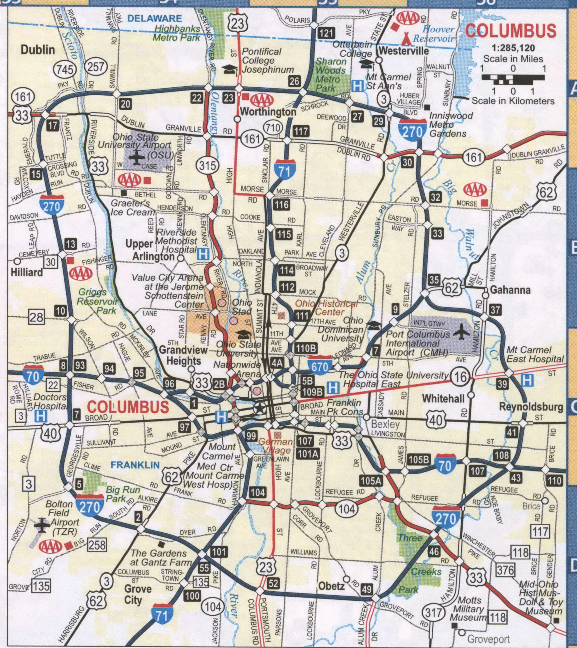
Columbus Road Map
If you are looking for an Ohio map of Columbus, then you have come to the right place. The following map of Columbus, Ohio will help you find your way around and will also give you the best driving directions. Best of all, the map is free. Columbus is located in the central part of the state of Ohio and is the capital of Ohio.
Interstate Highways: I-70, I-71, I-270, I-670
US Highways: 3, 16, 23, 33, 40, 62, 104, 161, 315, 317, 605
Freeways: Innerbelt, South Fwy
Major Roads: 3rd St, 4th St, 5th Ave, Alum Creek Dr, Avery Rd, Belle St, Bethel Rd, Brice Rd, Broad St, Central Ave, Cleveland Ave, College Ave, Dublin Granville Rd, Dublin Rd, Easton Way, Frank Rd, Frantz Rd, Front St, Fulton St, Gender Rd, Glenwood Ave, Hamilton Rd, Harrisburg Pike, Hayden Rd, Hayden Run Rd, High St, Hilliard Rome Rd, Hudson St, Indianola Ave, Jackson Pike, Johnstown Rd, Lancaster Ave, Livingston Ave, London Groveport Rd, Long St, Main St, Morse Rd, Mound St, Nelson Rd, Olentangy River Rd, Refugee Rd, Reynoldsburg New Alban Rd, Rich St, Riverside Dr, Sinclair Rd, Snowden Aly, Spring St, Starling St, Stelzer Rd, Sullivant Ave, Summit St, Town St, Tuttle Crossing Blvd, Washington Blvd, Westerville Rd
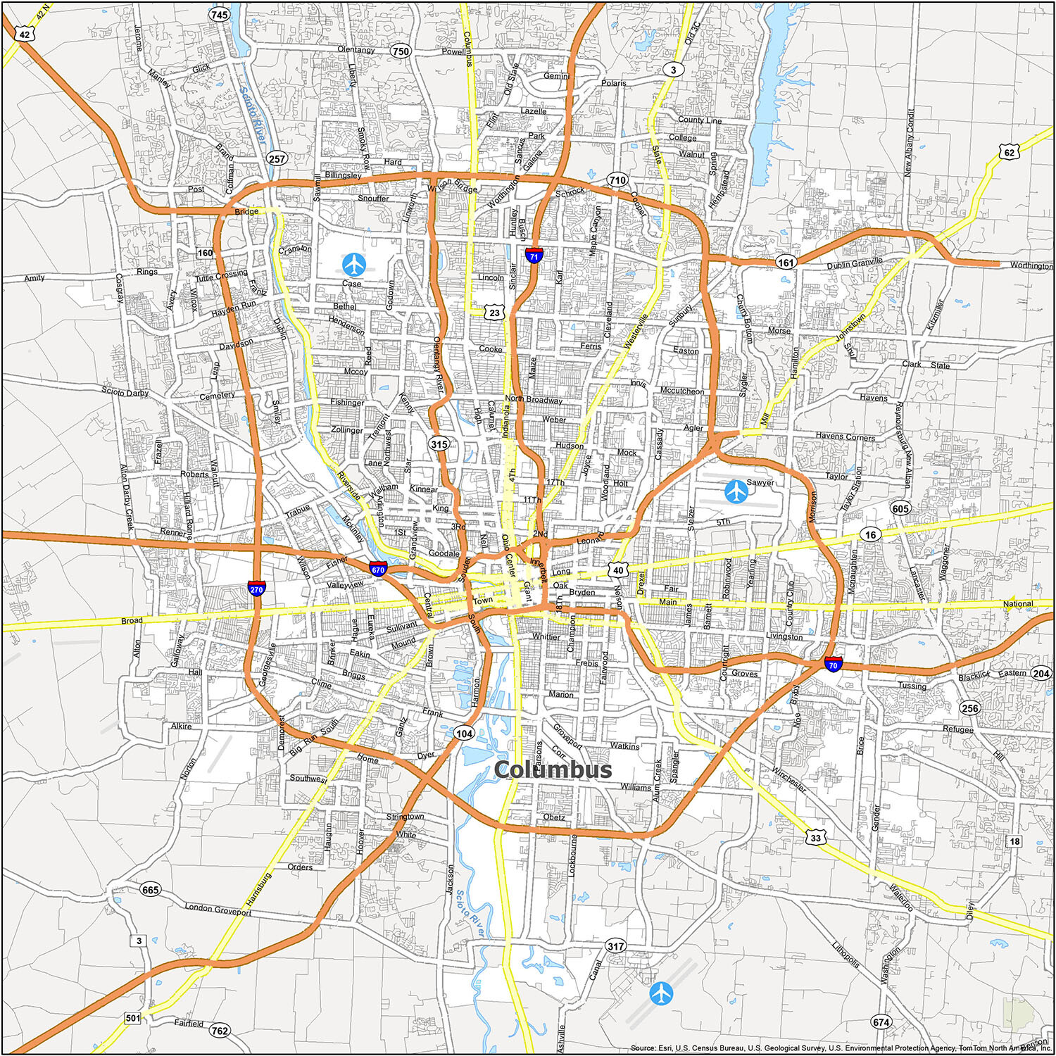
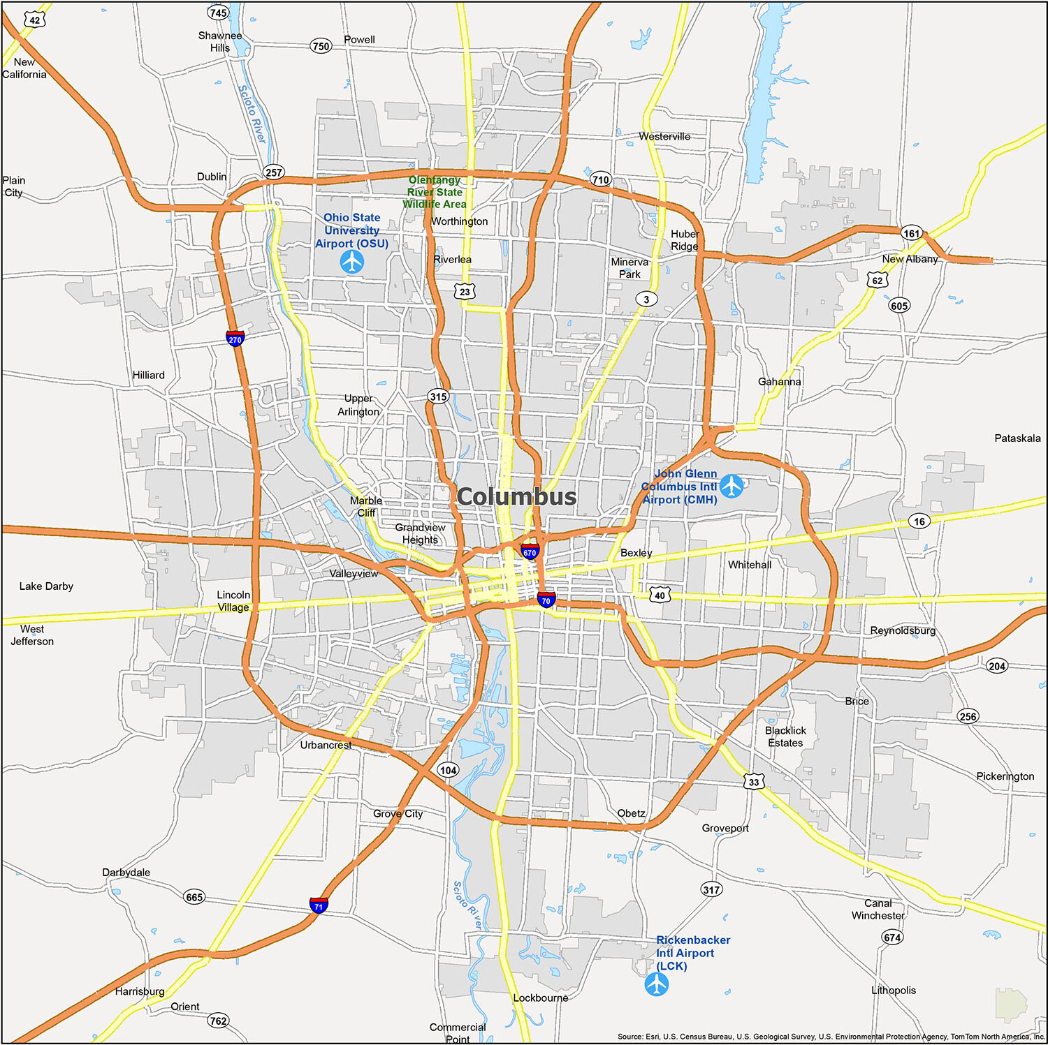
If you’re looking to learn more about the city’s history and culture, there are many great places to visit in Columbus, Ohio. From historic districts to the Columbus Zoo, there is plenty to see in the city. Conveniently discover the city and explore nearby attractions by viewing the city’s points of interest, such as parks, neighborhoods, and rivers like the Scioto River that run through the city.
The John Glenn Columbus International Airport (CMH) is the city’s airport, and the cities and villages of Bexley, Canal Winchester, Columbus, Dublin, Gahanna, Grandview Heights, Grove City, Groveport, Hilliard, New Albany, Pataskala, Pickerington, Powell, Reynoldsburg, Upper Arlington, Westerville, Whitehall, Worthington, and the Census-designated places (CDP) of Blacklick Estates, Darbydale, Huber Ridge, Lake Darby, Lincoln Village, New California, and Orient are all located in Columbus, Ohio.
10 things to do in Columbus city
Columbus, Ohio has something for everyone. Whether you’re looking for a shopping experience, a cultural outing, or a day at the zoo, you’ll find it here. Check out our top 10 picks for your visit to the capital city of Ohio, Columbus.
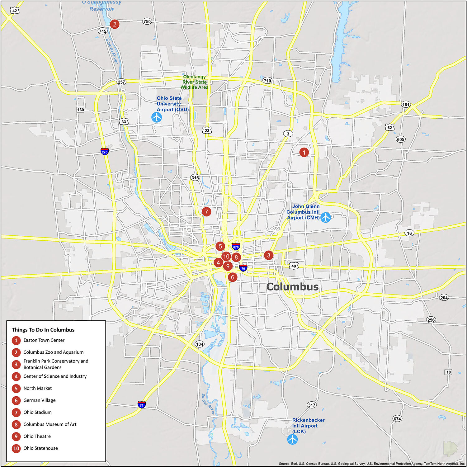
When visiting Columbus, Ohio, there’s so much to explore. From the Easton Town Center to the Franklin Park Conservatory and Botanical Gardens, there are plenty of fascinating historical sites and communities to discover. The Columbus Zoo and Aquarium, Center of Science and Industry, North Market, German Village, Ohio Stadium, Columbus Museum of Art, and Ohio Theatre are some of the city’s major attractions. Whether you’re in town for business or pleasure, you’ll find something to love about Columbus.
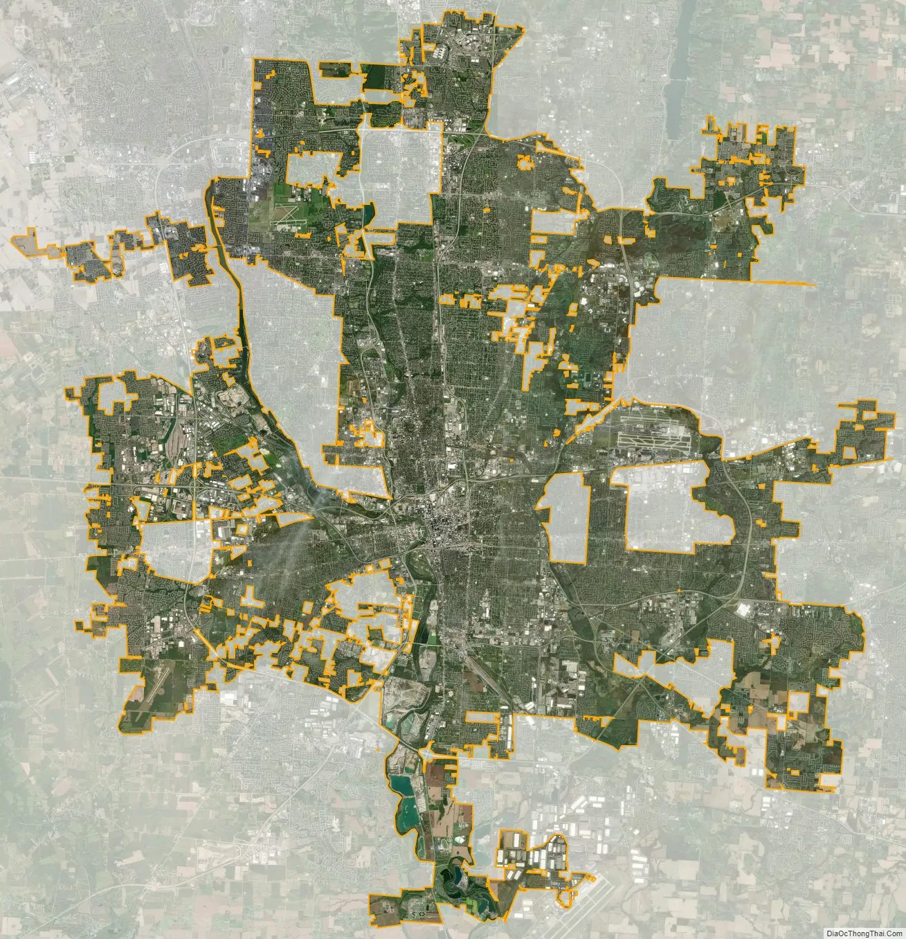
Columbus city Satellite Map
Geography
The confluence of the Scioto and Olentangy rivers is just northwest of Downtown Columbus. Several smaller tributaries course through the Columbus metropolitan area, including Alum Creek, Big Walnut Creek and Darby Creek. Columbus is considered to have relatively flat topography thanks to a large glacier that covered most of Ohio during the Wisconsin Ice Age. However, there are sizable differences in elevation through the area, with the high point of Franklin County being 1,132 ft (345 m) above sea level near New Albany, and the low point being 670 ft (200 m) where the Scioto River leaves the county near Lockbourne. Numerous ravines near the rivers and creeks also add variety to the landscape. Tributaries to Alum Creek and the Olentangy River cut through shale, while tributaries to the Scioto River cut through limestone. The numerous rivers and streams beside low-lying areas in Central Ohio contribute to a history of flooding in the region; the most significant was the Great Flood of 1913 in Columbus, Ohio.
The city has a total area of 223.11 square miles (577.85 km), of which 217.17 square miles (562.47 km) is land and 5.94 square miles (15.38 km) is water. Columbus currently has the largest land area of any Ohio city; this is due to Jim Rhodes’s tactic to annex suburbs while serving as mayor. As surrounding communities grew or were constructed, they came to require access to waterlines, which was under the sole control of the municipal water system. Rhodes told these communities that if they wanted water, they would have to submit to assimilation into Columbus.
Neighborhoods
Columbus has a wide diversity of neighborhoods with different characters, and is thus sometimes known as a “city of neighborhoods.” Some of the most prominent neighborhoods include the Arena District, the Brewery District, Clintonville, Franklinton, German Village, The Short North and Victorian Village.
Climate
The city’s climate is humid continental (Köppen climate classification Dfa) transitional with the humid subtropical climate to the south characterized by warm, muggy summers and cold, dry winters. Columbus is within USDA hardiness zone 6a, now 6b bordering on 7a in the 1991 to 2020 normals chart. Winter snowfall is relatively light, since the city is not in the typical path of strong winter lows, such as the Nor’easters that strike cities farther east. It is also too far south and west for lake-effect snow from Lake Erie to have much effect, although the lakes to the north contribute to long stretches of cloudy spells in winter.
The highest temperature recorded in Columbus is 106 °F (41 °C), which occurred twice during the Dust Bowl of the 1930s: once on July 21, 1934, and again on July 14, 1936. The lowest recorded temperature was −22 °F (−30 °C), occurring on January 19, 1994.
Columbus is subject to severe weather typical to the Midwestern United States. Severe thunderstorms can bring lightning, large hail and on rare occasions tornadoes, especially during the spring and sometimes through fall. A tornado that occurred on October 11, 2006, caused F2 damage. Floods, blizzards and ice storms can also occur from time to time.
See also
Map of Ohio State and its subdivision:- Adams
- Allen
- Ashland
- Ashtabula
- Athens
- Auglaize
- Belmont
- Brown
- Butler
- Carroll
- Champaign
- Clark
- Clermont
- Clinton
- Columbiana
- Coshocton
- Crawford
- Cuyahoga
- Darke
- Defiance
- Delaware
- Erie
- Fairfield
- Fayette
- Franklin
- Fulton
- Gallia
- Geauga
- Greene
- Guernsey
- Hamilton
- Hancock
- Hardin
- Harrison
- Henry
- Highland
- Hocking
- Holmes
- Huron
- Jackson
- Jefferson
- Knox
- Lake
- Lake Erie
- Lawrence
- Licking
- Logan
- Lorain
- Lucas
- Madison
- Mahoning
- Marion
- Medina
- Meigs
- Mercer
- Miami
- Monroe
- Montgomery
- Morgan
- Morrow
- Muskingum
- Noble
- Ottawa
- Paulding
- Perry
- Pickaway
- Pike
- Portage
- Preble
- Putnam
- Richland
- Ross
- Sandusky
- Scioto
- Seneca
- Shelby
- Stark
- Summit
- Trumbull
- Tuscarawas
- Union
- Van Wert
- Vinton
- Warren
- Washington
- Wayne
- Williams
- Wood
- Wyandot
- Alabama
- Alaska
- Arizona
- Arkansas
- California
- Colorado
- Connecticut
- Delaware
- District of Columbia
- Florida
- Georgia
- Hawaii
- Idaho
- Illinois
- Indiana
- Iowa
- Kansas
- Kentucky
- Louisiana
- Maine
- Maryland
- Massachusetts
- Michigan
- Minnesota
- Mississippi
- Missouri
- Montana
- Nebraska
- Nevada
- New Hampshire
- New Jersey
- New Mexico
- New York
- North Carolina
- North Dakota
- Ohio
- Oklahoma
- Oregon
- Pennsylvania
- Rhode Island
- South Carolina
- South Dakota
- Tennessee
- Texas
- Utah
- Vermont
- Virginia
- Washington
- West Virginia
- Wisconsin
- Wyoming