Oak Hills is a census-designated place (CDP) and neighborhood in Washington County, Oregon, United States. The CDP population was 9,050 at the 2000 census. It is on unincorporated land north of Beaverton, west of Cedar Mill, and south/southeast of Bethany. The CDP is roughly bounded by the Sunset Highway on the south, West Union Road on the north, Northwest 174th Avenue on the west, and Northwest 143rd Avenue on the east. The U.S. Postal Service has assigned Beaverton addresses to the area. Fire protection and EMS services are provided through Tualatin Valley Fire and Rescue.
The Oak Hills neighborhood is substantially smaller than the CDP, and is contained within the area bounded by Cornell Road on the south, West Union Road on the north, Bethany Boulevard on the west, and Northwest 143rd Avenue on the east. It was a planned community and was built in the 1960s. The first ten homes were completed in May 1965, the first of about 650 planned, in an area of approximately 250 acres (100 ha). Oak Hills today includes around 650 residences, of which 627 are single-family homes. It is managed by the Oak Hills Homeowners Association (OHHA).
The neighborhood was listed on the National Register of Historic Places in 2013, as the Oak Hills Historic District.
| Name: | Oak Hills CDP |
|---|---|
| LSAD Code: | 57 |
| LSAD Description: | CDP (suffix) |
| State: | Oregon |
| County: | Washington County |
| Elevation: | 236 ft (72 m) |
| Total Area: | 1.56 sq mi (4.03 km²) |
| Land Area: | 1.56 sq mi (4.03 km²) |
| Water Area: | 0.00 sq mi (0.00 km²) |
| Total Population: | 11,903 |
| Population Density: | 7,644.83/sq mi (2,950.99/km²) |
| ZIP code: | 97006 |
| Area code: | 503 and 971 |
| FIPS code: | 4153988 |
| GNISfeature ID: | 1867476 |
Online Interactive Map
Click on ![]() to view map in "full screen" mode.
to view map in "full screen" mode.
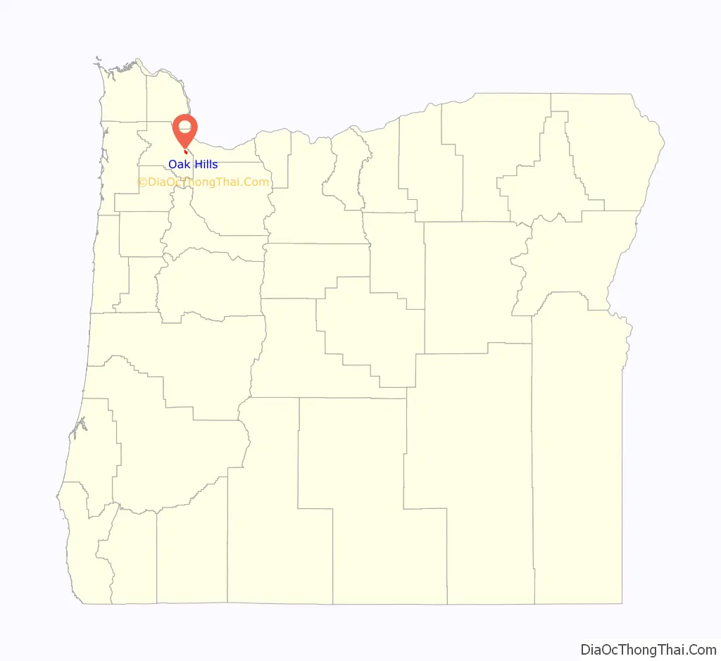
Oak Hills location map. Where is Oak Hills CDP?

Oak Hills Road Map
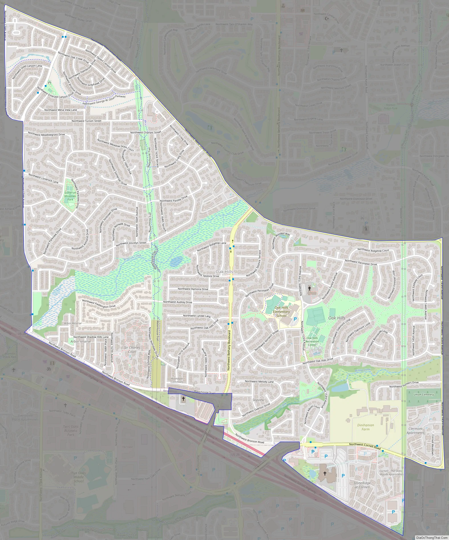
Oak Hills city Satellite Map

Geography
According to the United States Census Bureau, the CDP has a total area of 1.5 square miles (3.9 km), all land.
See also
Map of Oregon State and its subdivision: Map of other states:- Alabama
- Alaska
- Arizona
- Arkansas
- California
- Colorado
- Connecticut
- Delaware
- District of Columbia
- Florida
- Georgia
- Hawaii
- Idaho
- Illinois
- Indiana
- Iowa
- Kansas
- Kentucky
- Louisiana
- Maine
- Maryland
- Massachusetts
- Michigan
- Minnesota
- Mississippi
- Missouri
- Montana
- Nebraska
- Nevada
- New Hampshire
- New Jersey
- New Mexico
- New York
- North Carolina
- North Dakota
- Ohio
- Oklahoma
- Oregon
- Pennsylvania
- Rhode Island
- South Carolina
- South Dakota
- Tennessee
- Texas
- Utah
- Vermont
- Virginia
- Washington
- West Virginia
- Wisconsin
- Wyoming