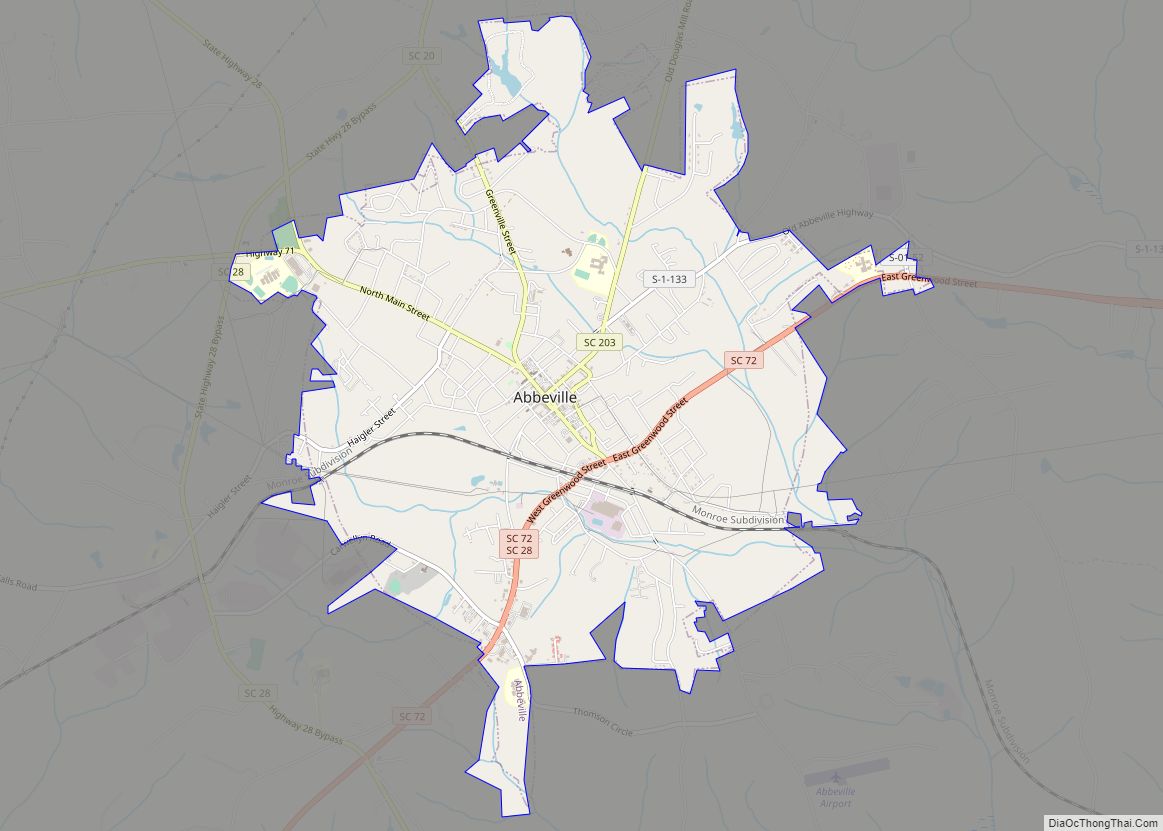
Abbeville is a city and county seat of Abbeville County, in the U.S. state of South Carolina. It is located 86 miles (138 km) west of Columbia and 45 miles (72 km) south of Greenville. Its population was 5,237 at the 2010 census. Settled by French Huguenot settlers, it was named, along with the county, for the French town of the same name.
| Name: | Abbeville city |
|---|---|
| LSAD Code: | 25 |
| LSAD Description: | city (suffix) |
| State: | South Carolina |
| County: | Abbeville County |
| Elevation: | 594 ft (181 m) |
| Total Area: | 6.23 sq mi (16.13 km²) |
| Land Area: | 6.21 sq mi (16.10 km²) |
| Water Area: | 0.01 sq mi (0.03 km²) |
| Total Population: | 4,874 |
| Population Density: | 784.23/sq mi (302.77/km²) |
| ZIP code: | 29620 |
| Area code: | 864 |
| FIPS code: | 4500100 |
| GNISfeature ID: | 1244839 |
| Website: | www.abbevillecitysc.com |
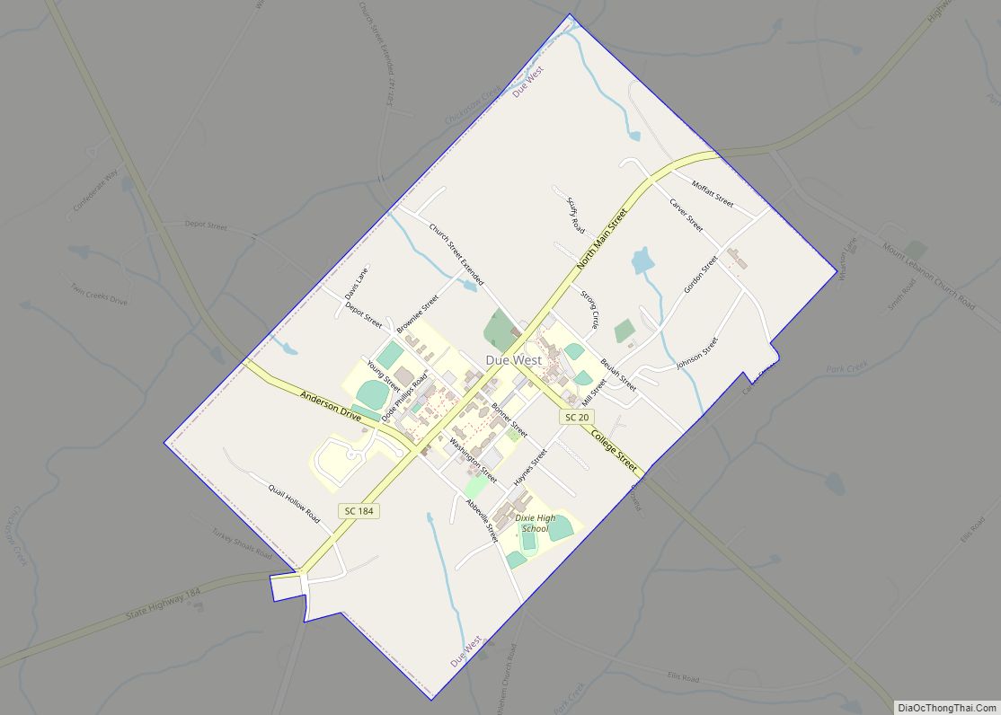
Online Interactive Map
Click on ![]() to view map in "full screen" mode.
to view map in "full screen" mode.
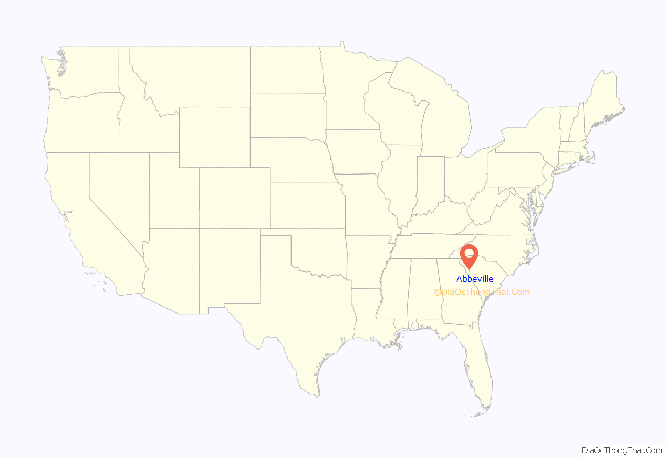
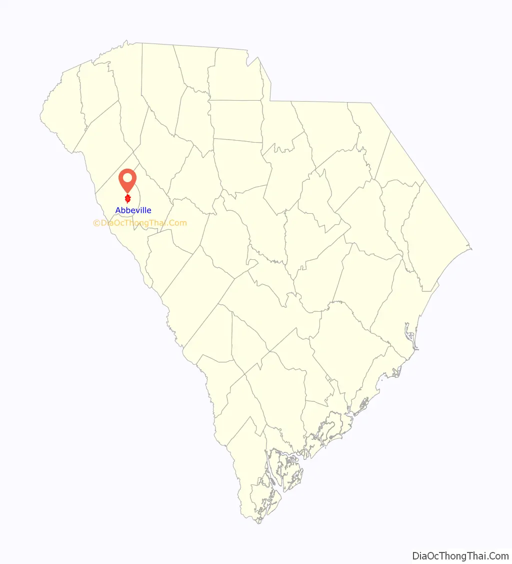
Abbeville location map. Where is Abbeville city?
History
Abbeville was established by French Huguenots in 1764, at a site named by John de la Howe. It was incorporated in 1840.
Famed states’ rights advocate and Vice President John C. Calhoun first practiced law in Abbeville, and he was born on a farm on the outskirts in what is now Mt. Carmel.
Abbeville and the American Civil War
Abbeville has the unique distinction of being both the birthplace and the deathbed of the Confederacy. On November 22, 1860, a meeting was held at Abbeville, at a site since dubbed “Secession Hill”, to launch South Carolina’s secession from the Union; one month later, the state of South Carolina became the first state to secede.
At the end of the Civil War, with the Confederacy in shambles, Confederate President Jefferson Davis fled Richmond, Virginia, and headed south, stopping for a night in Abbeville at the home of his friend Armistead Burt. It was on May 2, 1865, in the front parlor of what is now known as the Burt-Stark Mansion that Jefferson Davis officially acknowledged the dissolution of the Confederate government, in the last official cabinet meeting.
2003 right-of-way standoff
On December 8, 2003, in a 14-hour standoff that stemmed from a land-survey dispute, two Abbeville lawmen were killed by West Abbeville resident Steven Bixby. This siege has been compared by both sympathizers of the Bixbys and law enforcement agents to the events of Waco and Ruby Ridge. In February 2007, Steven Bixby was convicted on 17 counts including the two murders, as well as lesser charges of kidnapping and conspiracy. He was given two death sentences for the murders plus 125 years in prison on the other charges.
Abbeville Road Map
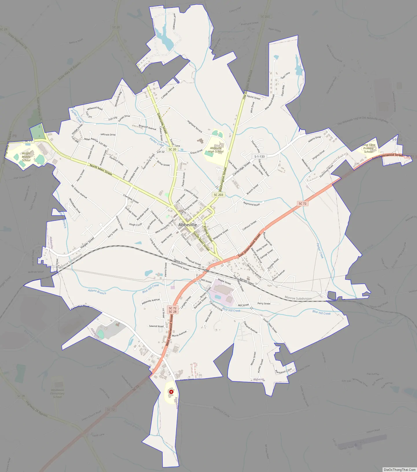
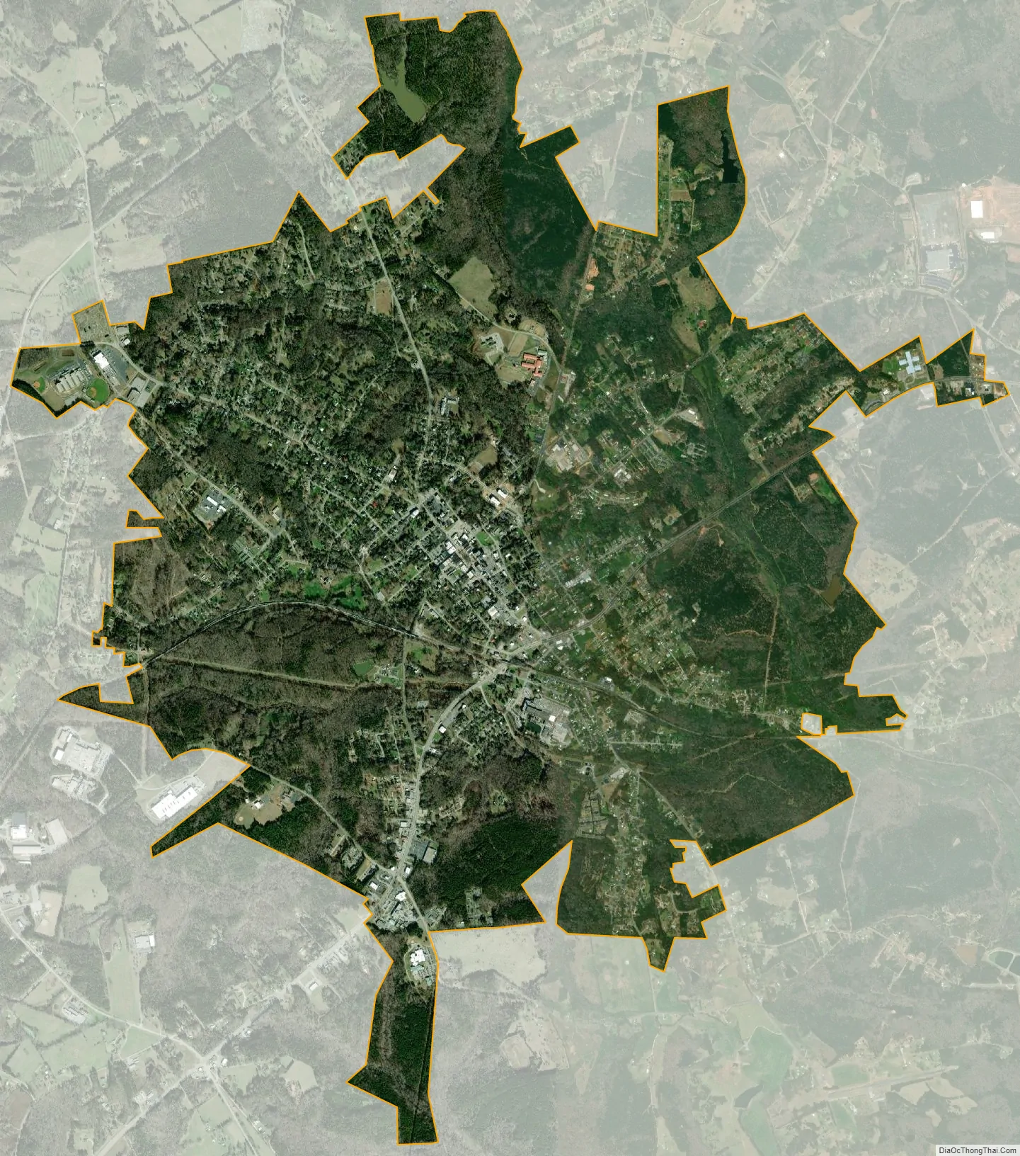
Abbeville city Satellite Map
Geography
Abbeville is located at 34°10′42.7584″N 82°22′39.6732″W / 34.178544000°N 82.377687000°W / 34.178544000; -82.377687000, and is within the Piedmont Upland geographical region.
According to the United States Census Bureau, the city has a total area of 6.1 square miles (15.9 km), of which 0.012 square miles (0.03 km), or 0.19%, is water.
Nearby is the Sumter National Forest.
Climate
Abbeville has a humid subtropical climate (Köppen Cfa). Winters are cool, sometimes cold, and short in duration. Summers are hot and humid. The transitional seasons of spring and fall can vary in temperature but tend to be warm. In the summer highs usually peak in the mid 90s, but temperatures over 100 °F (37.8 °C) occur on occasion, most recently in the summer of 2012 during a heat wave. That year, the all-time record high of 109 °F (42.8 °C) was recorded on July 1. In the winter highs are in the low to mid 50s and lows are right around freezing, seldom dropping below 25 °F (−3.9 °C). Precipitation is well distributed throughout the year. Afternoon thunderstorms are a common occurrence in the summer months and can bring heavy winds and lightning. Snow is rare, falling every few years. On March 31, 1973, an F4 tornado struck Abbeville and killed 7 people, making it the deadliest single tornado in 1973. The area was struck by two tornadoes on April 10, 2009. No fatalities were recorded, but the majority of the city lost power and many buildings sustained significant damage.
See also
Map of South Carolina State and its subdivision:- Abbeville
- Aiken
- Allendale
- Anderson
- Bamberg
- Barnwell
- Beaufort
- Berkeley
- Calhoun
- Charleston
- Cherokee
- Chester
- Chesterfield
- Clarendon
- Colleton
- Darlington
- Dillon
- Dorchester
- Edgefield
- Fairfield
- Florence
- Georgetown
- Greenville
- Greenwood
- Hampton
- Horry
- Jasper
- Kershaw
- Lancaster
- Laurens
- Lee
- Lexington
- Marion
- Marlboro
- McCormick
- Newberry
- Oconee
- Orangeburg
- Pickens
- Richland
- Saluda
- Spartanburg
- Sumter
- Union
- Williamsburg
- York
- Alabama
- Alaska
- Arizona
- Arkansas
- California
- Colorado
- Connecticut
- Delaware
- District of Columbia
- Florida
- Georgia
- Hawaii
- Idaho
- Illinois
- Indiana
- Iowa
- Kansas
- Kentucky
- Louisiana
- Maine
- Maryland
- Massachusetts
- Michigan
- Minnesota
- Mississippi
- Missouri
- Montana
- Nebraska
- Nevada
- New Hampshire
- New Jersey
- New Mexico
- New York
- North Carolina
- North Dakota
- Ohio
- Oklahoma
- Oregon
- Pennsylvania
- Rhode Island
- South Carolina
- South Dakota
- Tennessee
- Texas
- Utah
- Vermont
- Virginia
- Washington
- West Virginia
- Wisconsin
- Wyoming