Bishopville is a town in Lee County, South Carolina, United States. The population was 3,471 at the 2010 census. It is the county seat of Lee County.
| Name: | Bishopville city |
|---|---|
| LSAD Code: | 25 |
| LSAD Description: | city (suffix) |
| State: | South Carolina |
| County: | Lee County |
| Elevation: | 226 ft (69 m) |
| Total Area: | 2.37 sq mi (6.14 km²) |
| Land Area: | 2.34 sq mi (6.05 km²) |
| Water Area: | 0.03 sq mi (0.08 km²) |
| Total Population: | 3,024 |
| Population Density: | 1,293.97/sq mi (499.53/km²) |
| ZIP code: | 29010 |
| FIPS code: | 4506310 |
| GNISfeature ID: | 1220758 |
| Website: | cityofbishopvillesc.com |
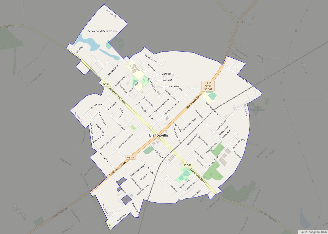
Online Interactive Map
Click on ![]() to view map in "full screen" mode.
to view map in "full screen" mode.
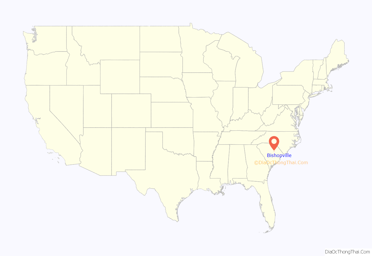
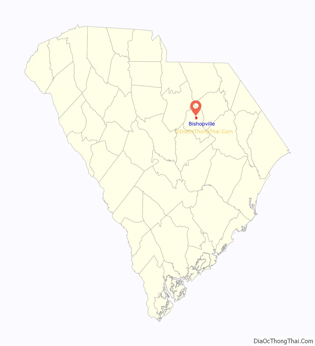
Bishopville location map. Where is Bishopville city?
History
Bishopville was known as Singleton’s Crossroads for more than a decade before it was renamed in honor of Jacques Bishop. The 465 acres (1.88 km) of land had been granted to Jacob Chamber by the state of South Carolina in 1786. Daniel Carter later purchased the property and then sold it to William Singleton in 1790.
The tavern owned and operated by Singleton and his wife sat at the intersection of Mecklenburg Road, now Church Street, and McCallum Ferry Road, now Main Street. This tavern was a stop on the stagecoach route between Georgetown and Charlotte. (Now this intersection involves Highway 15, which at one point was the premier north-south route from New York to Miami.) In 1798, William Singleton died, leaving his wife the owner of the tavern until her death in 1820. A year later in 1821, the property was sold to Bishop. During this time period, the area around present-day Bishopville was said to be composed of mostly wilderness, with only a few scattered, primitive houses.
Lee County was created in 1892 with Bishopville its county seat, but Bishopville did not complete building its courthouse and county jail until February 1902. As a result, county boundaries were delimited along Lynches River, Black River, Scape Ore Swamp, Sparrow Swamp, Long Branch, and Screeches Branch following old roads and artificial limits.
On December 15, 1902, Bishopville celebrated its new significance by hosting speeches and shooting off the old cannon in front of the Lee County Courthouse.
Lee County has historically been a leader in cotton production in the state and is the home of the South Carolina Cotton Museum.
In addition to the Lee County Courthouse, the Ashwood School Gymnasium and Auditorium, Bishopville Commercial Historic District, James Carnes House, Dennis High School, Thomas Fraser House, William Apollos James House, The Manor, Mt. Zion Presbyterian Church, William Rogers House, South Main Historic District, Spencer House, and Tall Oaks are listed on the National Register of Historic Places.
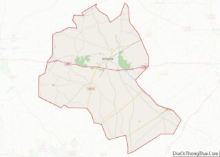
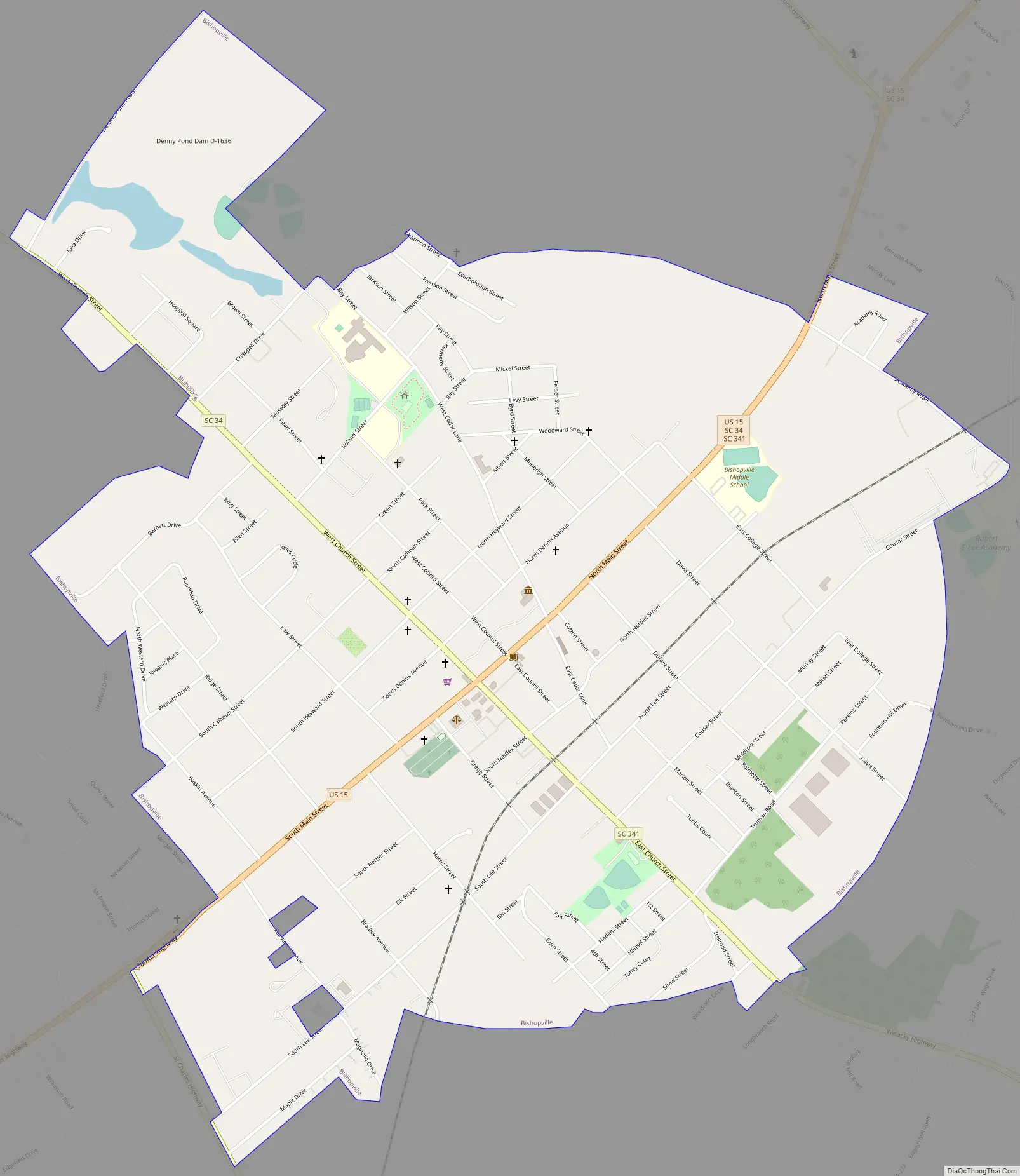
Bishopville Road Map
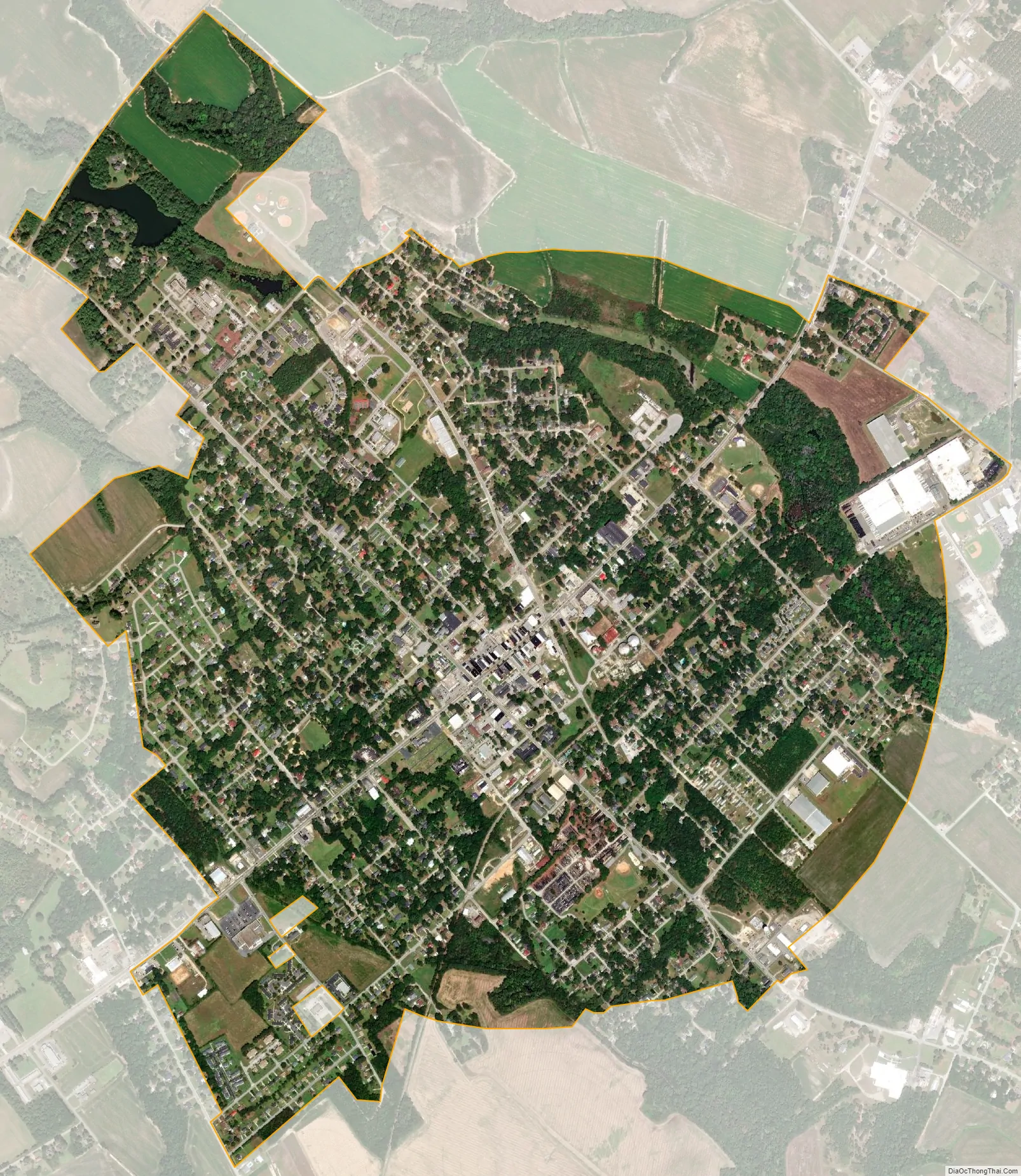
Bishopville city Satellite Map
Geography
Bishopville is located at 34°13′8″N 80°14′56″W / 34.21889°N 80.24889°W / 34.21889; -80.24889 (34.219027, -80.248877) near Lee State Park.
According to the United States Census Bureau, the town has a total area of 2.4 square miles (6.2 km), of which 2.4 square miles (6.2 km) is land and 0.04 square miles (0.10 km) (1.26%) is water.
Major highways
- I-20
- US 15
- SC 34
- SC 154
- SC 341
- SC 441
See also
Map of South Carolina State and its subdivision:- Abbeville
- Aiken
- Allendale
- Anderson
- Bamberg
- Barnwell
- Beaufort
- Berkeley
- Calhoun
- Charleston
- Cherokee
- Chester
- Chesterfield
- Clarendon
- Colleton
- Darlington
- Dillon
- Dorchester
- Edgefield
- Fairfield
- Florence
- Georgetown
- Greenville
- Greenwood
- Hampton
- Horry
- Jasper
- Kershaw
- Lancaster
- Laurens
- Lee
- Lexington
- Marion
- Marlboro
- McCormick
- Newberry
- Oconee
- Orangeburg
- Pickens
- Richland
- Saluda
- Spartanburg
- Sumter
- Union
- Williamsburg
- York
- Alabama
- Alaska
- Arizona
- Arkansas
- California
- Colorado
- Connecticut
- Delaware
- District of Columbia
- Florida
- Georgia
- Hawaii
- Idaho
- Illinois
- Indiana
- Iowa
- Kansas
- Kentucky
- Louisiana
- Maine
- Maryland
- Massachusetts
- Michigan
- Minnesota
- Mississippi
- Missouri
- Montana
- Nebraska
- Nevada
- New Hampshire
- New Jersey
- New Mexico
- New York
- North Carolina
- North Dakota
- Ohio
- Oklahoma
- Oregon
- Pennsylvania
- Rhode Island
- South Carolina
- South Dakota
- Tennessee
- Texas
- Utah
- Vermont
- Virginia
- Washington
- West Virginia
- Wisconsin
- Wyoming