East Gaffney is a census-designated place (CDP) in Cherokee County, South Carolina, United States. The population was 3,085 at the 2010 United States Census.
| Name: | East Gaffney CDP |
|---|---|
| LSAD Code: | 57 |
| LSAD Description: | CDP (suffix) |
| State: | South Carolina |
| County: | Cherokee County |
| Elevation: | 771 ft (235 m) |
| Total Area: | 3.03 sq mi (7.85 km²) |
| Land Area: | 3.02 sq mi (7.83 km²) |
| Water Area: | 0.01 sq mi (0.02 km²) |
| Total Population: | 2,882 |
| Population Density: | 953.04/sq mi (368.00/km²) |
| FIPS code: | 4522075 |
| GNISfeature ID: | 1231253 |
Online Interactive Map
Click on ![]() to view map in "full screen" mode.
to view map in "full screen" mode.
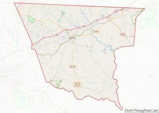
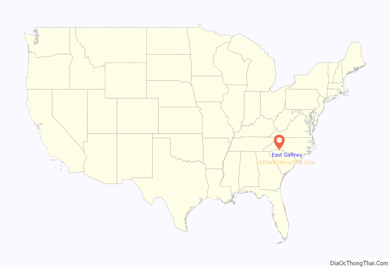
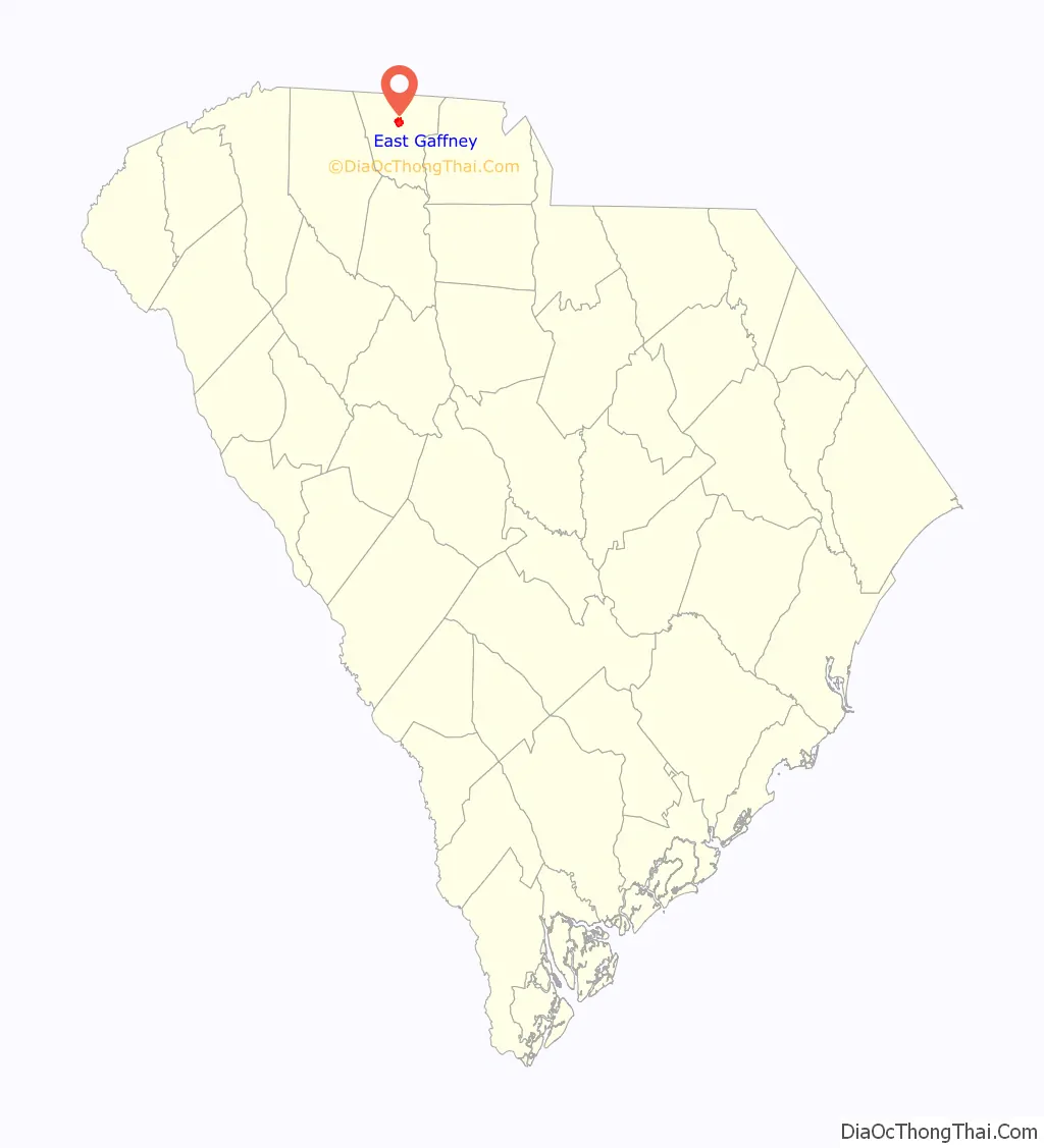
East Gaffney location map. Where is East Gaffney CDP?
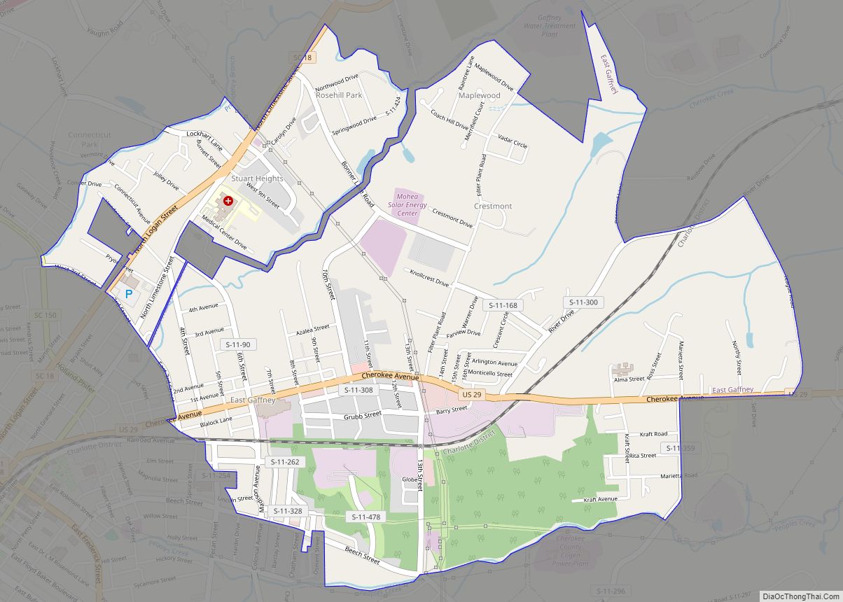
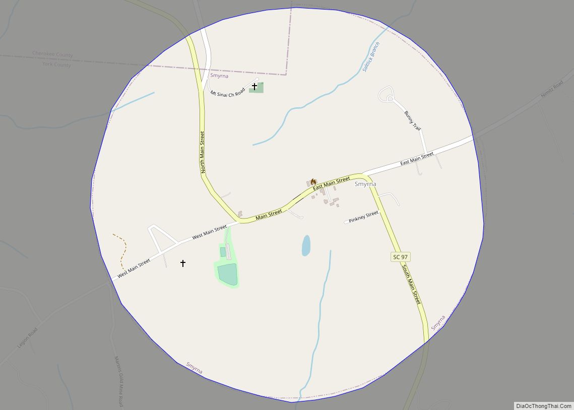
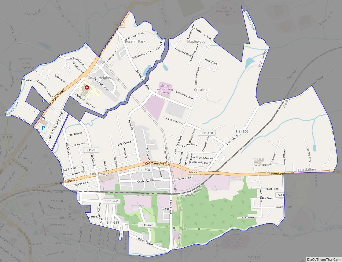
East Gaffney Road Map
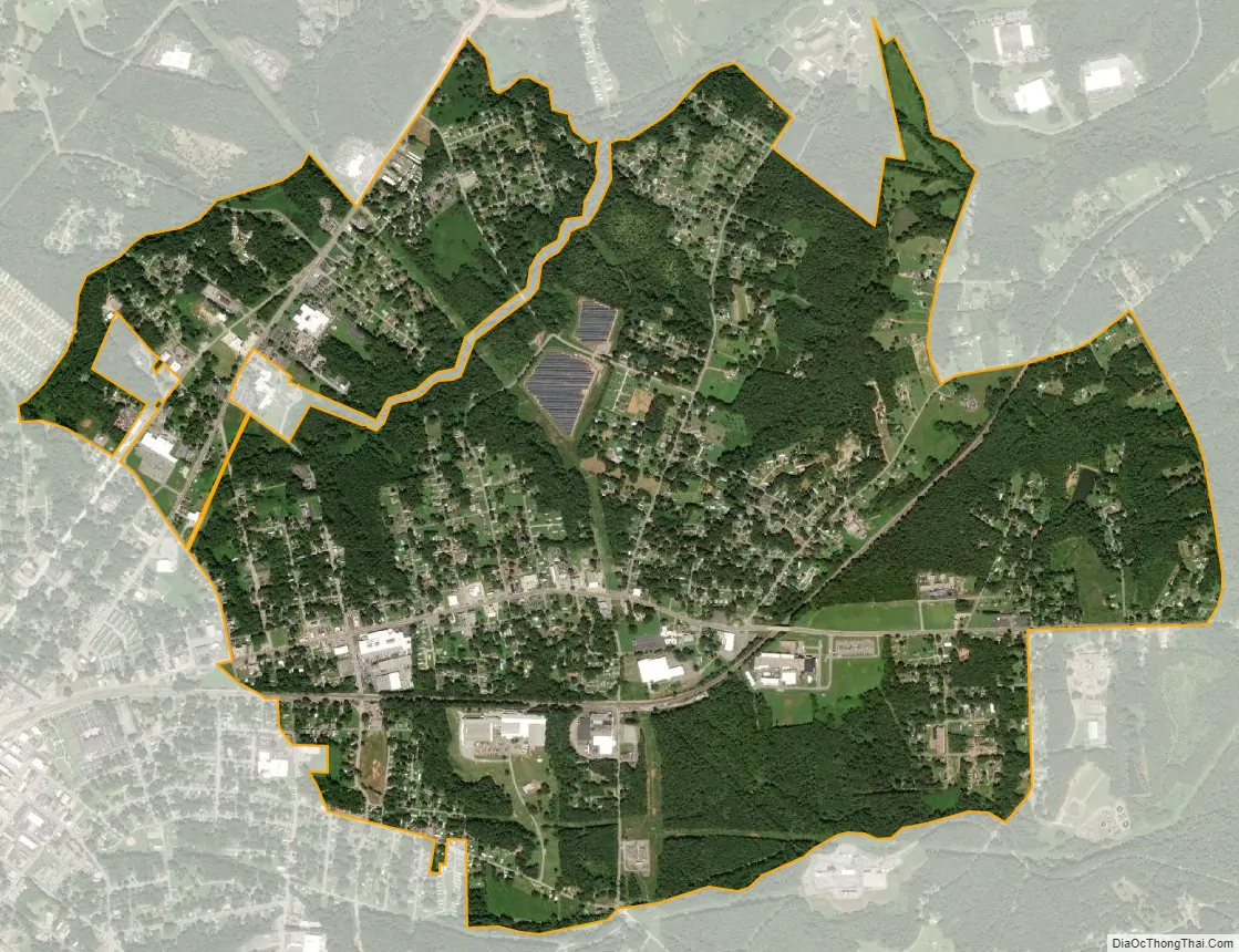
East Gaffney city Satellite Map
Geography
East Gaffney is located in central Cherokee County at 35°4′59″N 81°37′42″W / 35.08306°N 81.62833°W / 35.08306; -81.62833 (35.083060, -81.628302), on the eastern border of the city of Gaffney, the county seat. U.S. Route 29 is the main road through the community, leading west into Gaffney and northeast 7 miles (11 km) to Blacksburg. Interstate 85 passes north of the community, with access from Exit 95.
According to the United States Census Bureau, the CDP has a total area of 3.1 square miles (7.9 km), of which 0.01 square miles (0.02 km), or 0.24%, is water.
See also
Map of South Carolina State and its subdivision:- Abbeville
- Aiken
- Allendale
- Anderson
- Bamberg
- Barnwell
- Beaufort
- Berkeley
- Calhoun
- Charleston
- Cherokee
- Chester
- Chesterfield
- Clarendon
- Colleton
- Darlington
- Dillon
- Dorchester
- Edgefield
- Fairfield
- Florence
- Georgetown
- Greenville
- Greenwood
- Hampton
- Horry
- Jasper
- Kershaw
- Lancaster
- Laurens
- Lee
- Lexington
- Marion
- Marlboro
- McCormick
- Newberry
- Oconee
- Orangeburg
- Pickens
- Richland
- Saluda
- Spartanburg
- Sumter
- Union
- Williamsburg
- York
- Alabama
- Alaska
- Arizona
- Arkansas
- California
- Colorado
- Connecticut
- Delaware
- District of Columbia
- Florida
- Georgia
- Hawaii
- Idaho
- Illinois
- Indiana
- Iowa
- Kansas
- Kentucky
- Louisiana
- Maine
- Maryland
- Massachusetts
- Michigan
- Minnesota
- Mississippi
- Missouri
- Montana
- Nebraska
- Nevada
- New Hampshire
- New Jersey
- New Mexico
- New York
- North Carolina
- North Dakota
- Ohio
- Oklahoma
- Oregon
- Pennsylvania
- Rhode Island
- South Carolina
- South Dakota
- Tennessee
- Texas
- Utah
- Vermont
- Virginia
- Washington
- West Virginia
- Wisconsin
- Wyoming