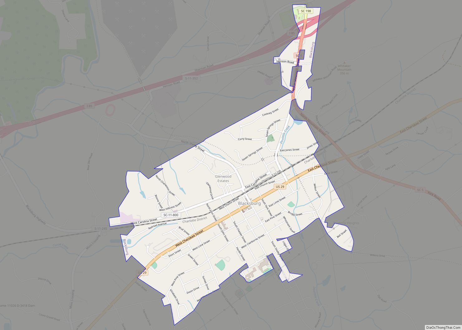
Blacksburg is a small town in Cherokee County, South Carolina, United States. The population was 1,848 at the 2010 census. The communities of Cherokee Falls, Kings Creek, Cashion Crossroads, Buffalo, and Mount Paran are located near the town.
Blacksburg is in Upstate South Carolina on the Interstate 85 corridor about 45 mi (72 km) southwest of Charlotte, North Carolina. It is part of the Greenville-Spartanburg-Anderson Combined Statistical Area (CSA) which has a population of 1,478,648 according to 2018 estimates by the U.S. Census Bureau.
| Name: | Blacksburg town |
|---|---|
| LSAD Code: | 43 |
| LSAD Description: | town (suffix) |
| State: | South Carolina |
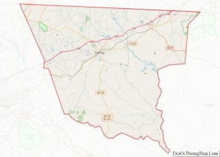
| County: | Cherokee County |
| Incorporated: | 1888 |
| Elevation: | 761 ft (232 m) |
| Land Area: | 1.87 sq mi (4.85 km²) |
| Water Area: | 0.00 sq mi (0.00 km²) |
| Population Density: | 1,009.62/sq mi (389.78/km²) |
| ZIP code: | 29702 |
| FIPS code: | 4506400 |
| GNISfeature ID: | 1246907 |
| Website: | www.townofblacksburgsc.com |
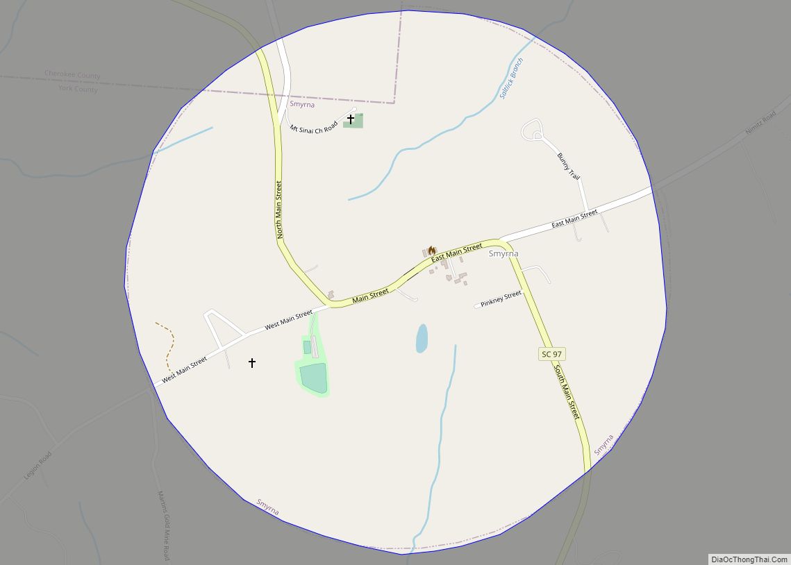
Online Interactive Map
Click on ![]() to view map in "full screen" mode.
to view map in "full screen" mode.
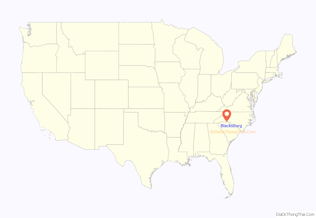
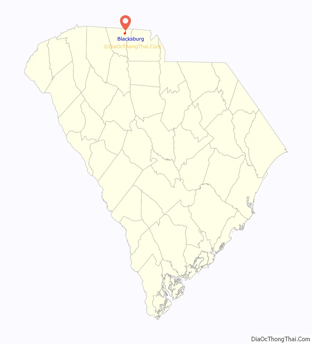
Blacksburg location map. Where is Blacksburg town?
History
Located near the northern border of the state, the present-day site of Blacksburg was first settled by a man named Stark. Mr. Stark, who had lived in Charleston, South Carolina prior to moving to the area, had gotten several people to come along with him on an agriculture venture, but this venture would fail. Those who stayed behind named the area “Stark’s Folly”.
In the late 19th century the Black family, headed by John G. Black, a Confederate veteran, was living in the area and persuaded the C.C. & C. Railroad Company to lay track through the town and build a depot. The town soon became known as “Black’s Station” in honor of John G. Black and was incorporated as Black’s Station town in 1876. The legal town was renamed “Blacksburg” in 1888.
Major John F. Jones of Massachusetts came to live in Blacksburg when hired as superintendent of the C. C. & C. Railroad. He donated his own money to build a school, hotel (the Cherokee Inn), and several other buildings in Blacksburg. He lived in Blacksburg until 1922, when he was appointed the South Carolina Internal Revenue Collector by the President of the United States.
In the 1890s large amounts of iron ore were found in the area, and many people hoping to make a fortune from mining it flocked to the town. Blacksburg became a boom town, and hotels and saloons were built for the new visitors. The town went by the name “Iron City” for a short time. Because of the “iron rush” the town became quite wealthy. It installed the first electric street lights in Upstate South Carolina and perhaps in the entire state. The town was renamed in 1888 as “Blacksburg” but still holds the nickname of “Iron City”.
The Kings Mountain State Park Historic District was listed on the National Register of Historic Places in 2008.
Blacksburg Road Map
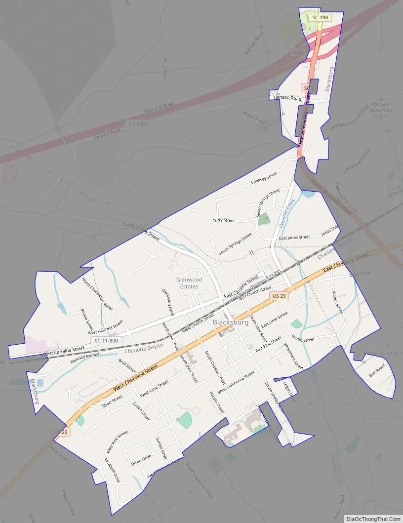
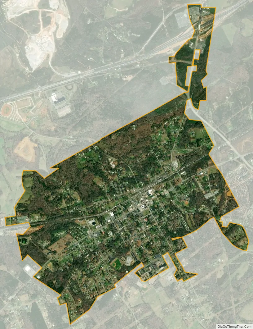
Blacksburg city Satellite Map
Geography
Blacksburg is located in northeastern Cherokee County at 35°7′14″N 81°30′59″W / 35.12056°N 81.51639°W / 35.12056; -81.51639 (35.120676, -81.516291). It is 4 miles (6 km) south of the North Carolina border.
According to the United States Census Bureau, the town has a total area of 1.87 square miles (4.85 km), all land.
Whitaker Mountain is partially in the northern corner of the town, with a summit elevation outside the town limits of approximately 1,169 ft (356 m).
See also
Map of South Carolina State and its subdivision:- Abbeville
- Aiken
- Allendale
- Anderson
- Bamberg
- Barnwell
- Beaufort
- Berkeley
- Calhoun
- Charleston
- Cherokee
- Chester
- Chesterfield
- Clarendon
- Colleton
- Darlington
- Dillon
- Dorchester
- Edgefield
- Fairfield
- Florence
- Georgetown
- Greenville
- Greenwood
- Hampton
- Horry
- Jasper
- Kershaw
- Lancaster
- Laurens
- Lee
- Lexington
- Marion
- Marlboro
- McCormick
- Newberry
- Oconee
- Orangeburg
- Pickens
- Richland
- Saluda
- Spartanburg
- Sumter
- Union
- Williamsburg
- York
- Alabama
- Alaska
- Arizona
- Arkansas
- California
- Colorado
- Connecticut
- Delaware
- District of Columbia
- Florida
- Georgia
- Hawaii
- Idaho
- Illinois
- Indiana
- Iowa
- Kansas
- Kentucky
- Louisiana
- Maine
- Maryland
- Massachusetts
- Michigan
- Minnesota
- Mississippi
- Missouri
- Montana
- Nebraska
- Nevada
- New Hampshire
- New Jersey
- New Mexico
- New York
- North Carolina
- North Dakota
- Ohio
- Oklahoma
- Oregon
- Pennsylvania
- Rhode Island
- South Carolina
- South Dakota
- Tennessee
- Texas
- Utah
- Vermont
- Virginia
- Washington
- West Virginia
- Wisconsin
- Wyoming