Homeland Park is a census-designated place (CDP) in Anderson County, South Carolina, United States. The population was 6,296 at the 2010 census.
| Name: | Homeland Park CDP |
|---|---|
| LSAD Code: | 57 |
| LSAD Description: | CDP (suffix) |
| State: | South Carolina |
| County: | Anderson County |
| Elevation: | 787 ft (240 m) |
| Total Area: | 4.72 sq mi (12.22 km²) |
| Land Area: | 4.71 sq mi (12.20 km²) |
| Water Area: | 0.01 sq mi (0.03 km²) |
| Total Population: | 6,445 |
| Population Density: | 1,368.66/sq mi (528.46/km²) |
| FIPS code: | 4534720 |
| GNISfeature ID: | 1231399 |
Online Interactive Map
Click on ![]() to view map in "full screen" mode.
to view map in "full screen" mode.
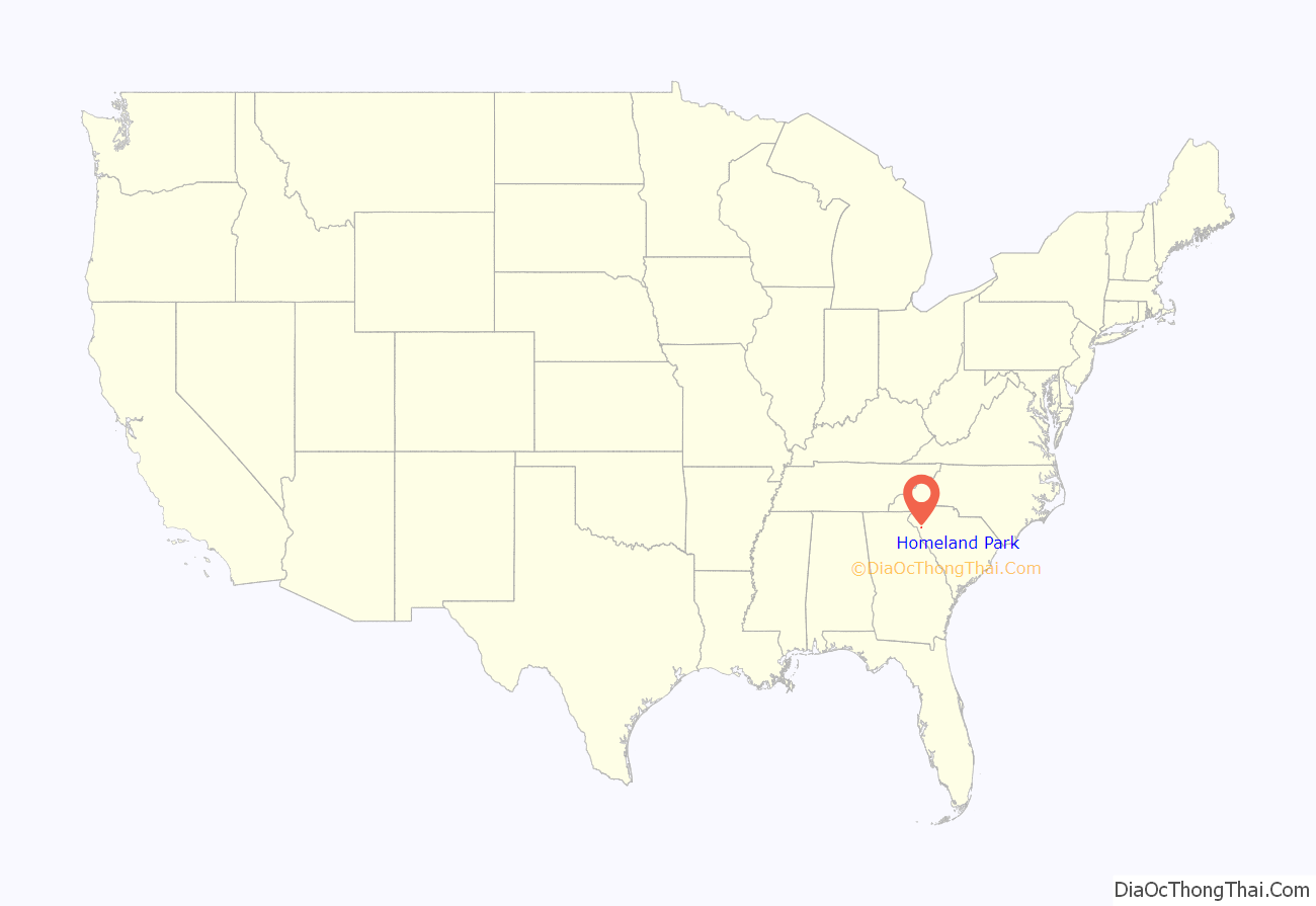
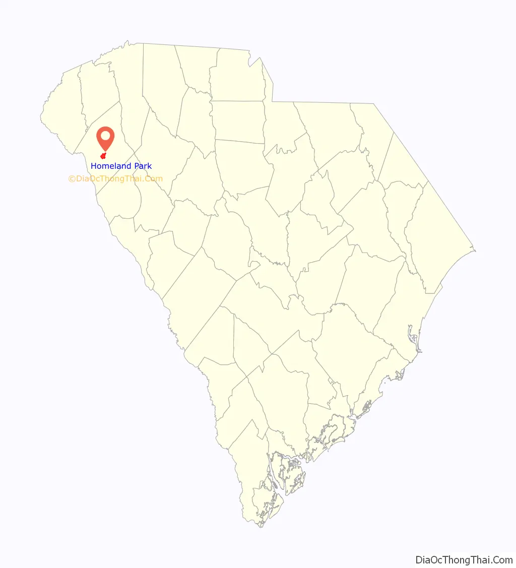
Homeland Park location map. Where is Homeland Park CDP?
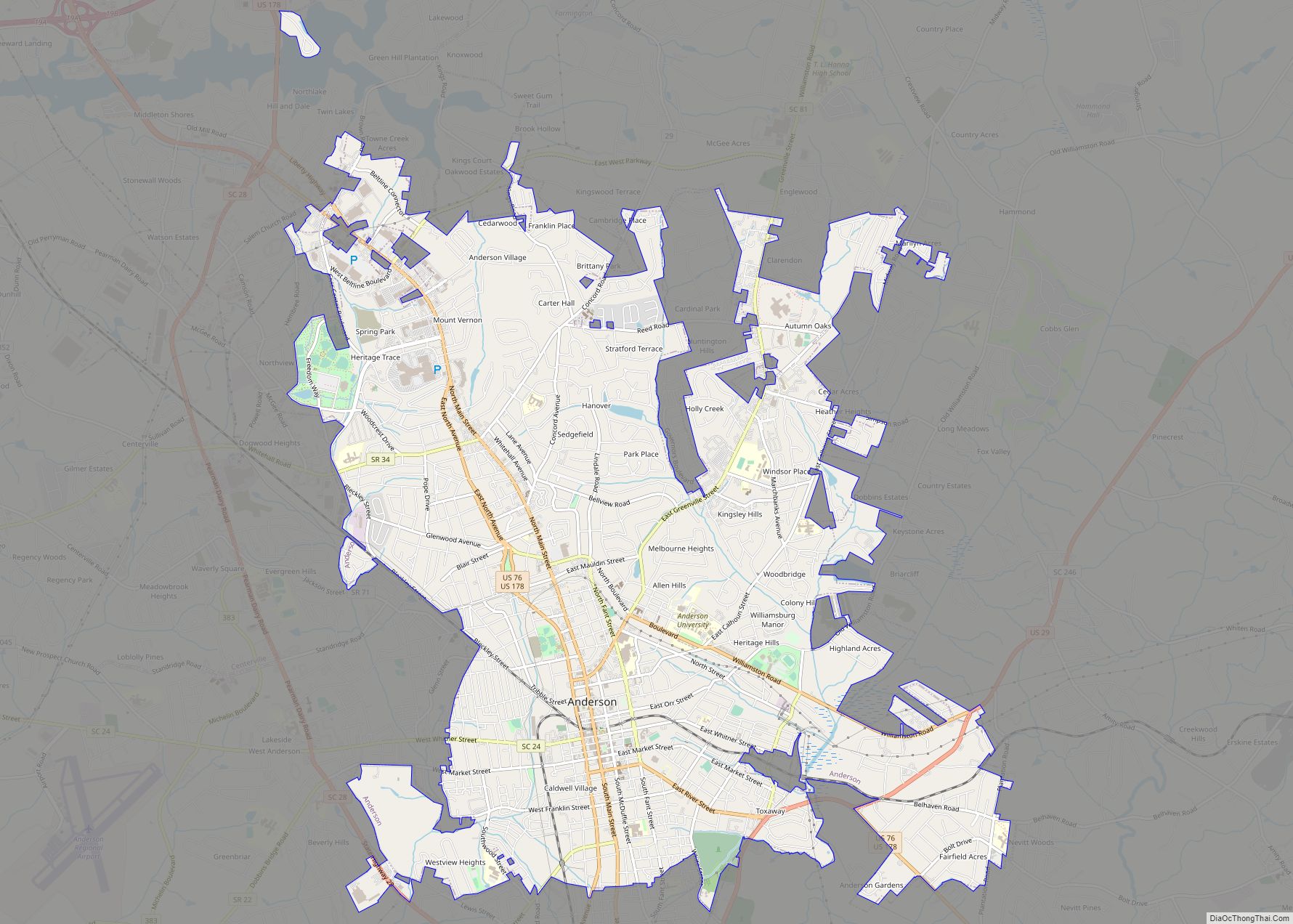
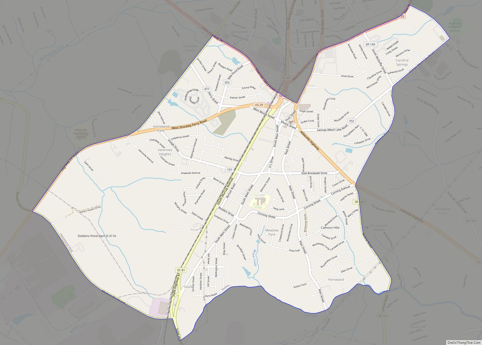
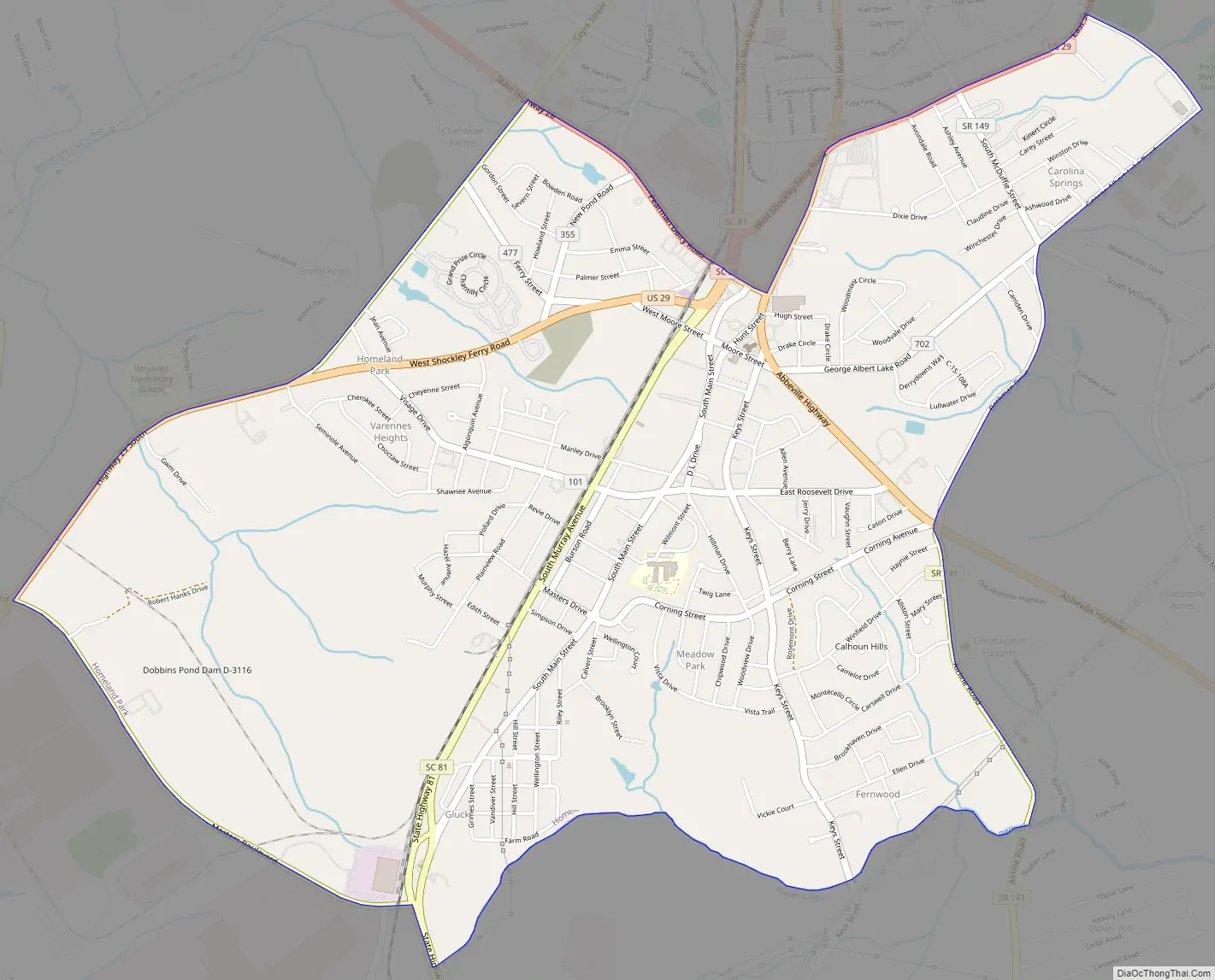
Homeland Park Road Map
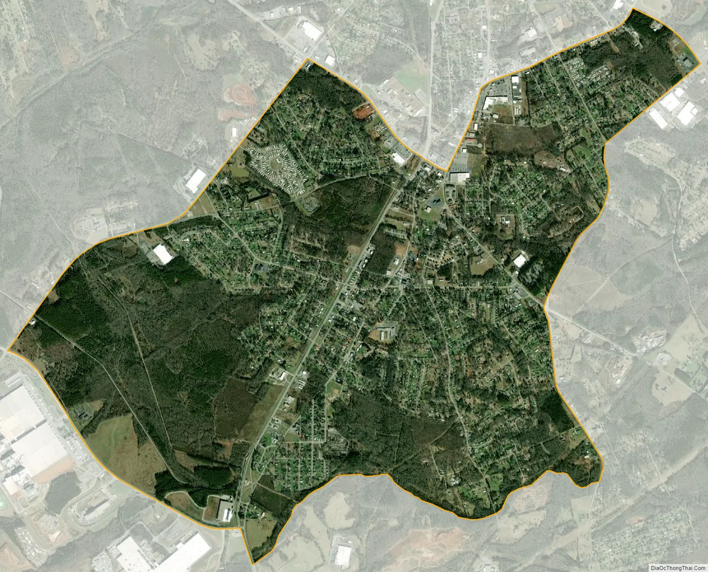
Homeland Park city Satellite Map
Geography
Homeland Park is a suburban area in central Anderson County located at 34°27′54″N 82°39′21″W / 34.46500°N 82.65583°W / 34.46500; -82.65583 (34.465006, -82.655768), south of the city of Anderson, the county seat. South Carolina Highway 81 (S. Murray Avenue) is the main north–south road through the community. U.S. Route 29 leads southwest out of Homeland Park, reaching the Georgia border in 14 miles (23 km).
According to the United States Census Bureau, the CDP has a total area of 4.7 square miles (12.2 km), all land.
See also
Map of South Carolina State and its subdivision:- Abbeville
- Aiken
- Allendale
- Anderson
- Bamberg
- Barnwell
- Beaufort
- Berkeley
- Calhoun
- Charleston
- Cherokee
- Chester
- Chesterfield
- Clarendon
- Colleton
- Darlington
- Dillon
- Dorchester
- Edgefield
- Fairfield
- Florence
- Georgetown
- Greenville
- Greenwood
- Hampton
- Horry
- Jasper
- Kershaw
- Lancaster
- Laurens
- Lee
- Lexington
- Marion
- Marlboro
- McCormick
- Newberry
- Oconee
- Orangeburg
- Pickens
- Richland
- Saluda
- Spartanburg
- Sumter
- Union
- Williamsburg
- York
- Alabama
- Alaska
- Arizona
- Arkansas
- California
- Colorado
- Connecticut
- Delaware
- District of Columbia
- Florida
- Georgia
- Hawaii
- Idaho
- Illinois
- Indiana
- Iowa
- Kansas
- Kentucky
- Louisiana
- Maine
- Maryland
- Massachusetts
- Michigan
- Minnesota
- Mississippi
- Missouri
- Montana
- Nebraska
- Nevada
- New Hampshire
- New Jersey
- New Mexico
- New York
- North Carolina
- North Dakota
- Ohio
- Oklahoma
- Oregon
- Pennsylvania
- Rhode Island
- South Carolina
- South Dakota
- Tennessee
- Texas
- Utah
- Vermont
- Virginia
- Washington
- West Virginia
- Wisconsin
- Wyoming