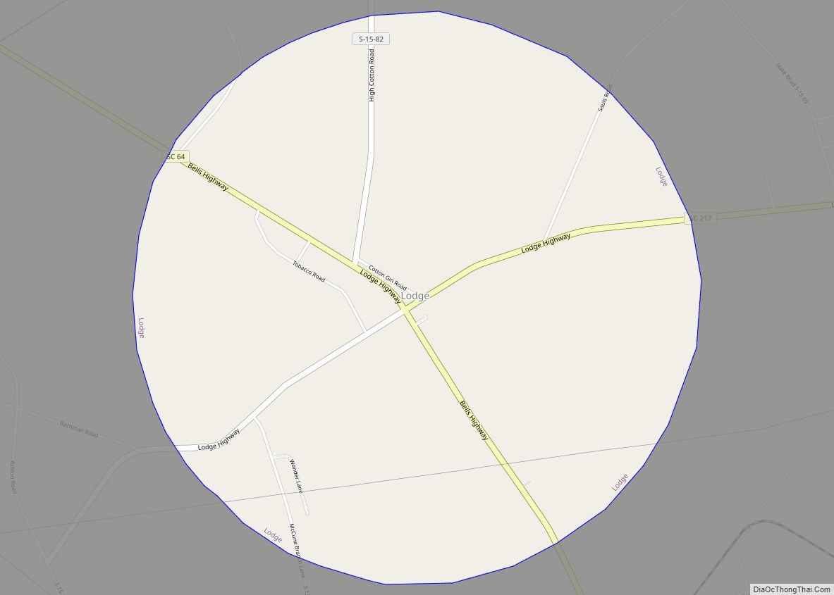
Lodge is a town in Colleton County, South Carolina, United States. The population was 120 at the 2010 census.
| Name: | Lodge town |
|---|---|
| LSAD Code: | 43 |
| LSAD Description: | town (suffix) |
| State: | South Carolina |
| County: | Colleton County |
| Elevation: | 108 ft (33 m) |
| Total Area: | 3.14 sq mi (8.14 km²) |
| Land Area: | 3.14 sq mi (8.14 km²) |
| Water Area: | 0.00 sq mi (0.00 km²) |
| Total Population: | 82 |
| Population Density: | 26.08/sq mi (10.07/km²) |
| ZIP code: | 29082 |
| Area code: | 843, 854 |
| FIPS code: | 4542280 |
| GNISfeature ID: | 1224094 |
Online Interactive Map
Click on ![]() to view map in "full screen" mode.
to view map in "full screen" mode.
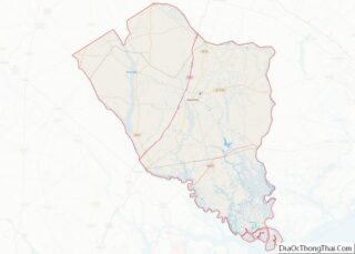
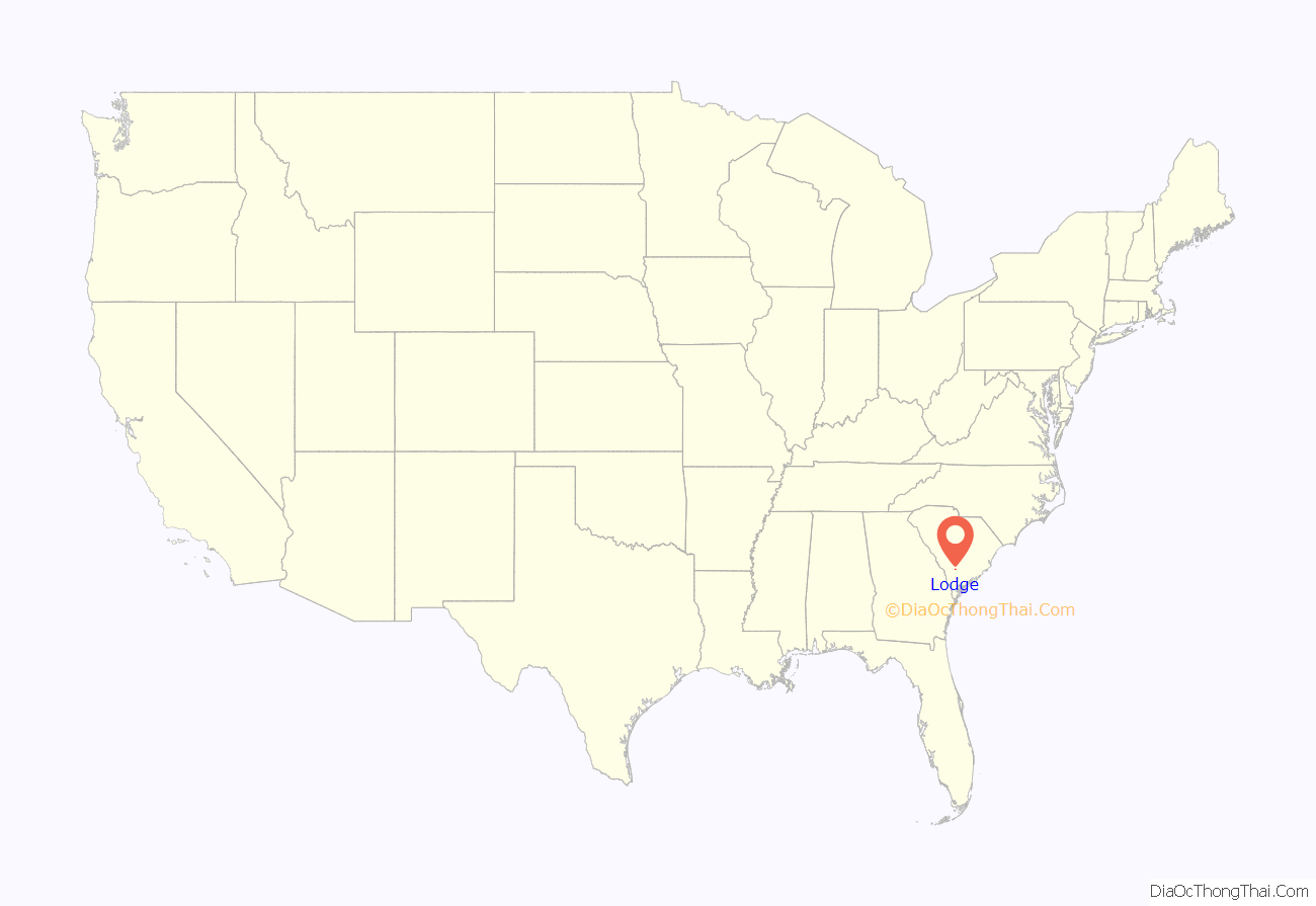
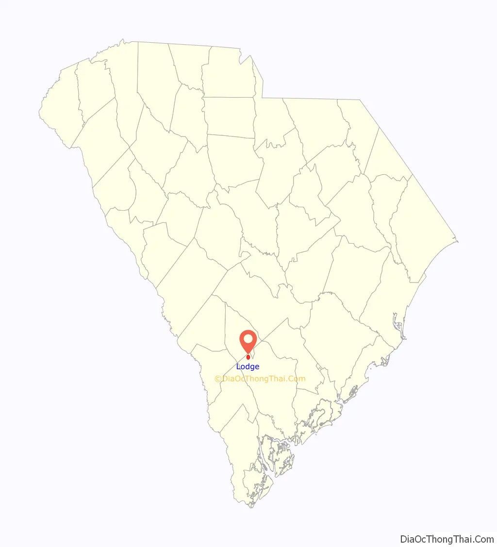
Lodge location map. Where is Lodge town?
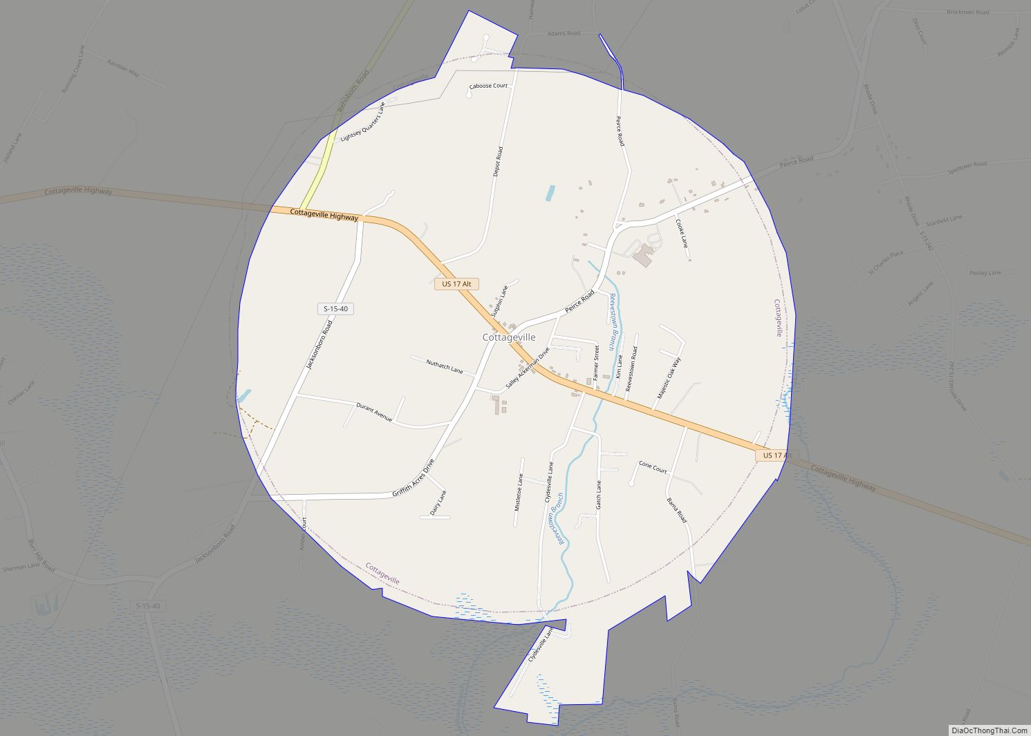
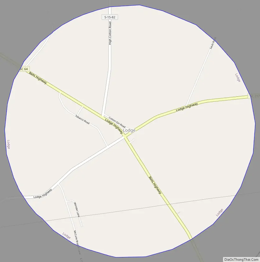
Lodge Road Map
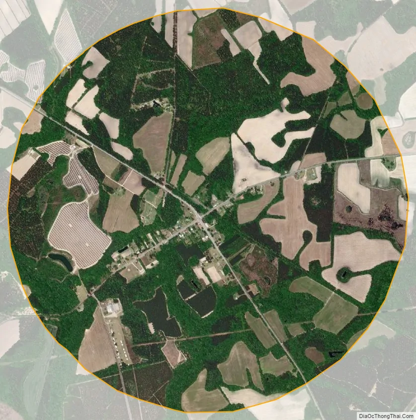
Lodge city Satellite Map
Geography
Lodge is located in northwestern Colleton County at the intersection of South Carolina Highways 64 and 217. SC 64 leads 21 miles (34 km) southeast to Walterboro, the county seat, and 4 miles (6 km) northwest to Ehrhardt, while SC 217 leads east 8 miles (13 km) to Smoaks. According to the United States Census Bureau, Lodge has a total area of 3.1 square miles (8.1 km), all land.
See also
Map of South Carolina State and its subdivision:- Abbeville
- Aiken
- Allendale
- Anderson
- Bamberg
- Barnwell
- Beaufort
- Berkeley
- Calhoun
- Charleston
- Cherokee
- Chester
- Chesterfield
- Clarendon
- Colleton
- Darlington
- Dillon
- Dorchester
- Edgefield
- Fairfield
- Florence
- Georgetown
- Greenville
- Greenwood
- Hampton
- Horry
- Jasper
- Kershaw
- Lancaster
- Laurens
- Lee
- Lexington
- Marion
- Marlboro
- McCormick
- Newberry
- Oconee
- Orangeburg
- Pickens
- Richland
- Saluda
- Spartanburg
- Sumter
- Union
- Williamsburg
- York
- Alabama
- Alaska
- Arizona
- Arkansas
- California
- Colorado
- Connecticut
- Delaware
- District of Columbia
- Florida
- Georgia
- Hawaii
- Idaho
- Illinois
- Indiana
- Iowa
- Kansas
- Kentucky
- Louisiana
- Maine
- Maryland
- Massachusetts
- Michigan
- Minnesota
- Mississippi
- Missouri
- Montana
- Nebraska
- Nevada
- New Hampshire
- New Jersey
- New Mexico
- New York
- North Carolina
- North Dakota
- Ohio
- Oklahoma
- Oregon
- Pennsylvania
- Rhode Island
- South Carolina
- South Dakota
- Tennessee
- Texas
- Utah
- Vermont
- Virginia
- Washington
- West Virginia
- Wisconsin
- Wyoming