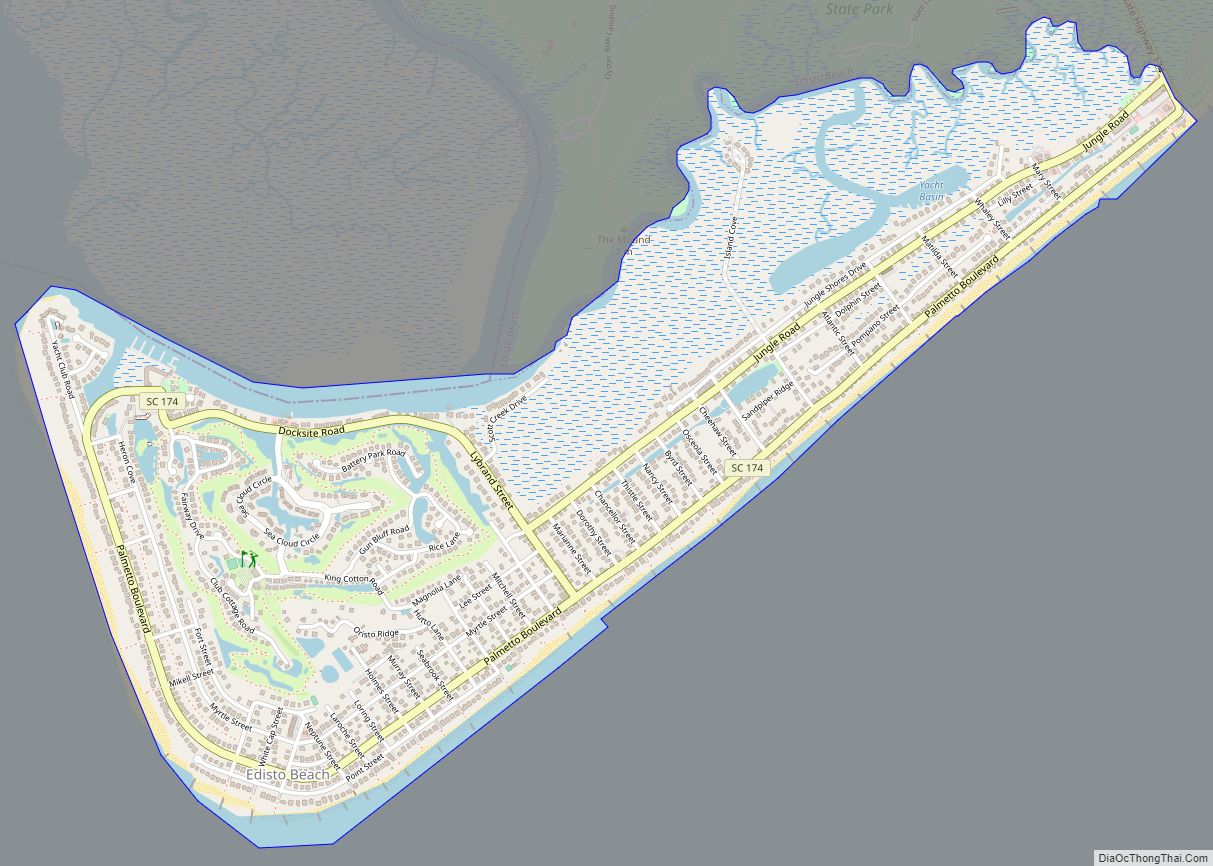
Edisto Beach is a town in Colleton County, South Carolina, United States. Edisto Beach’s population was 414 as of the 2010 census, down from 641 in 2000. The town limits include only the developed coastal area of Edisto Island within Colleton County, while the majority of the island consists of unincorporated land in Charleston County. Due to its status as a bedroom community, Edisto Beach is among the most affluent communities in the state.
| Name: | Edisto Beach town |
|---|---|
| LSAD Code: | 43 |
| LSAD Description: | town (suffix) |
| State: | South Carolina |
| County: | Colleton County |
| Elevation: | 7 ft (2 m) |
| Total Area: | 2.35 sq mi (6.09 km²) |
| Land Area: | 2.14 sq mi (5.53 km²) |
| Water Area: | 0.21 sq mi (0.55 km²) |
| Total Population: | 1,033 |
| Population Density: | 483.39/sq mi (186.65/km²) |
| ZIP code: | 29438 |
| Area code: | 843, 854 |
| FIPS code: | 4523020 |
| GNISfeature ID: | 1231260 |
| Website: | www.townofedistobeach.com |
Online Interactive Map
Click on ![]() to view map in "full screen" mode.
to view map in "full screen" mode.
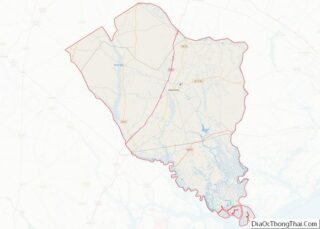
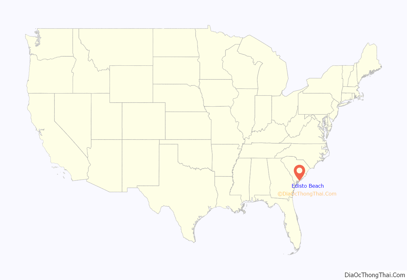
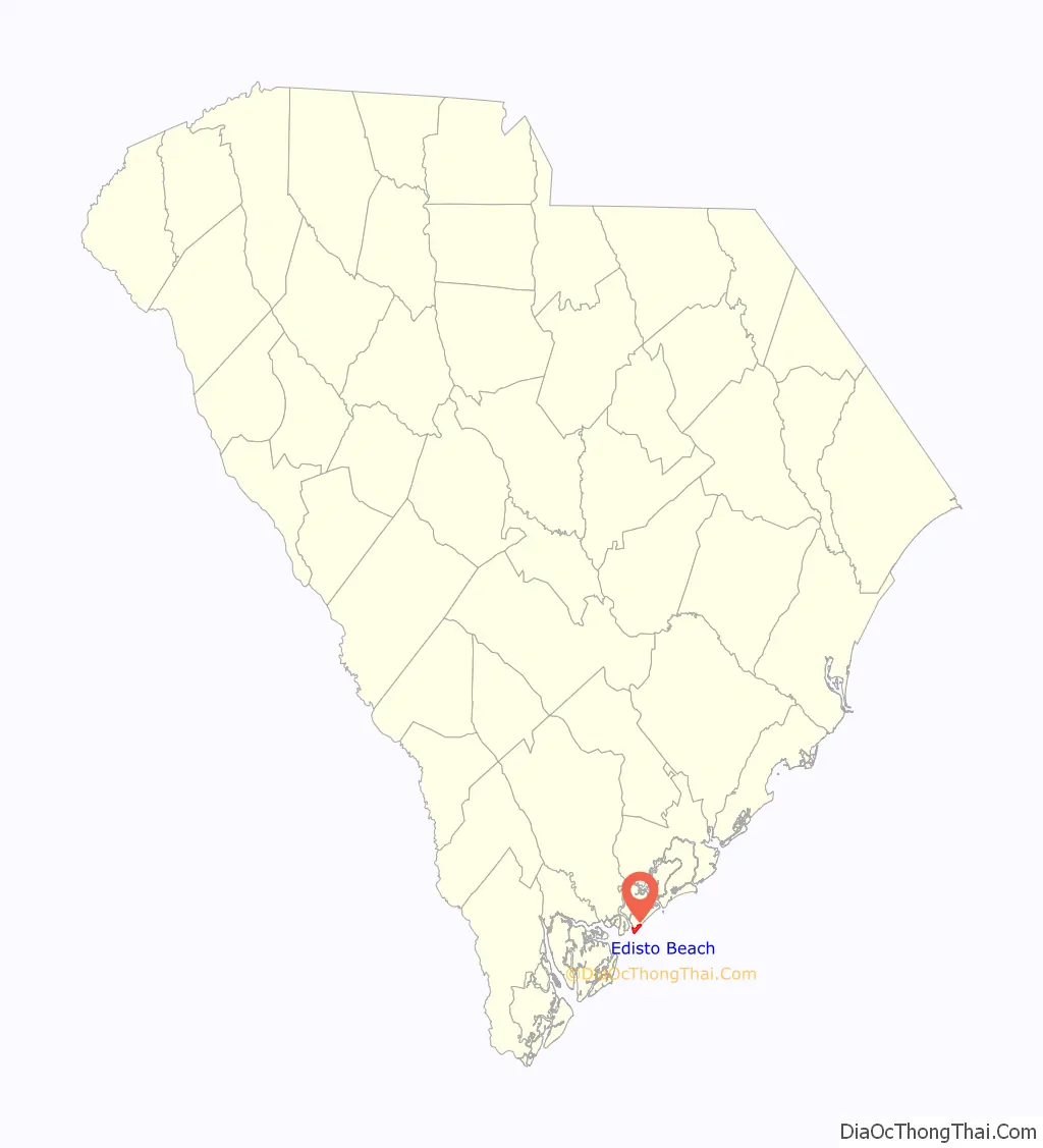
Edisto Beach location map. Where is Edisto Beach town?
History
Edisto Beach was originally settled by the Edistow Indians, but was rediscovered by the Spanish in the late 16th century. Thereafter, commerce on the island began to develop. Rice and indigo were the most common crops during the early settlement years. Later, significant cotton plantations were built and flourished. This industry, fueled by rich land owners and the people they enslaved, prospered until the Civil War.
Although Union soldiers invaded Edisto and Johns Island, Confederate forces were able to retain control of Charleston until 1865, very late in the war.
Initial development was begun in the early 20th century and planned by the island’s owner, John McConkey. However, development stalled when he was murdered. By the 1920s, South Carolina residents began arriving on Edisto Island and Edisto Beach to build crude retreats. In those days, access to the island could be gained only at low tide by driving or riding across the marsh on beds of oyster shells.
Although most homes on the island were destroyed in the 1940s, Hurricane Hugo spared the island in 1989. It has since become a vacation destination, with a section of the island purchased by Wyndham Resorts in 2006 from Fairfield that included a restaurant and golf course. In 2012, Edisto held its first ever road race, attracting close to 200 runners, including the mayor.
Edisto is known for its low tourism and its industrial scarcity.
Edisto Beach Road Map
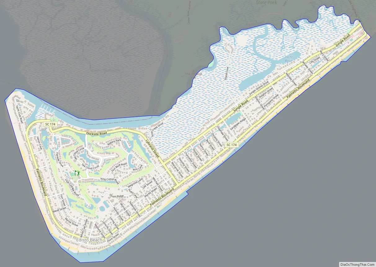
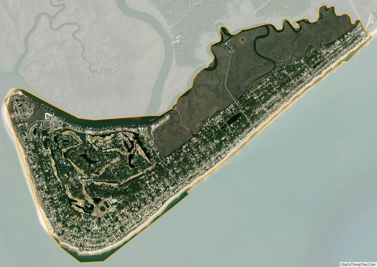
Edisto Beach city Satellite Map
Geography
Edisto Beach is located at the southeastern tip of Colleton County at 32°29′15″N 80°19′28″W / 32.48750°N 80.32444°W / 32.48750; -80.32444 (32.487613, -80.324402). It is separated from the rest of the county by the South Edisto River, the tidal portion of the Edisto River, so that the only road access is via South Carolina Highway 174 through Charleston County. SC 174 leads north across the rest of Edisto Island 24 miles (39 km) to U.S. Route 17 at Osborn. Charleston is 48 miles (77 km) by road northeast of Edisto Beach.
According to the United States Census Bureau, the town has a total area of 2.4 square miles (6.1 km), of which 2.1 square miles (5.5 km) is land and 0.2 square miles (0.6 km), or 9.48%, is water. Edisto Beach State Park borders the town to the north and east.
See also
Map of South Carolina State and its subdivision:- Abbeville
- Aiken
- Allendale
- Anderson
- Bamberg
- Barnwell
- Beaufort
- Berkeley
- Calhoun
- Charleston
- Cherokee
- Chester
- Chesterfield
- Clarendon
- Colleton
- Darlington
- Dillon
- Dorchester
- Edgefield
- Fairfield
- Florence
- Georgetown
- Greenville
- Greenwood
- Hampton
- Horry
- Jasper
- Kershaw
- Lancaster
- Laurens
- Lee
- Lexington
- Marion
- Marlboro
- McCormick
- Newberry
- Oconee
- Orangeburg
- Pickens
- Richland
- Saluda
- Spartanburg
- Sumter
- Union
- Williamsburg
- York
- Alabama
- Alaska
- Arizona
- Arkansas
- California
- Colorado
- Connecticut
- Delaware
- District of Columbia
- Florida
- Georgia
- Hawaii
- Idaho
- Illinois
- Indiana
- Iowa
- Kansas
- Kentucky
- Louisiana
- Maine
- Maryland
- Massachusetts
- Michigan
- Minnesota
- Mississippi
- Missouri
- Montana
- Nebraska
- Nevada
- New Hampshire
- New Jersey
- New Mexico
- New York
- North Carolina
- North Dakota
- Ohio
- Oklahoma
- Oregon
- Pennsylvania
- Rhode Island
- South Carolina
- South Dakota
- Tennessee
- Texas
- Utah
- Vermont
- Virginia
- Washington
- West Virginia
- Wisconsin
- Wyoming