Pacolet is a town in Spartanburg County, South Carolina, United States. The population was 2,235 at the 2010 census.
| Name: | Pacolet town |
|---|---|
| LSAD Code: | 43 |
| LSAD Description: | town (suffix) |
| State: | South Carolina |
| County: | Spartanburg County |
| Elevation: | 781 ft (238 m) |
| Total Area: | 5.85 sq mi (15.15 km²) |
| Land Area: | 5.78 sq mi (14.97 km²) |
| Water Area: | 0.07 sq mi (0.18 km²) |
| Total Population: | 2,274 |
| Population Density: | 393.49/sq mi (151.92/km²) |
| ZIP code: | 29372 |
| Area code: | 864 |
| FIPS code: | 4553845 |
| GNISfeature ID: | 1250004 |
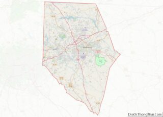
Online Interactive Map
Click on ![]() to view map in "full screen" mode.
to view map in "full screen" mode.
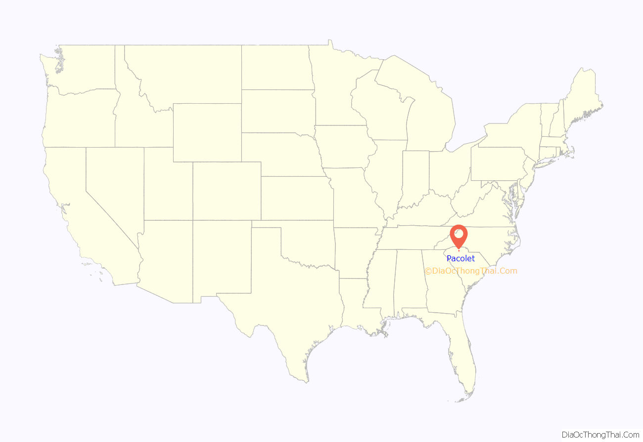
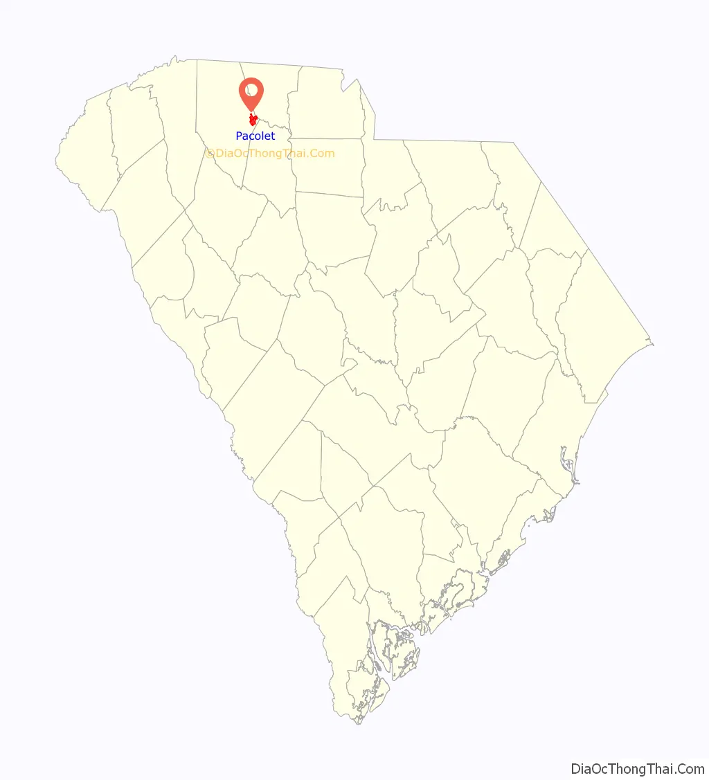
Pacolet location map. Where is Pacolet town?
History
Pacolet had its start in 1859 when the railroad was extended to that point. The name Pacolet may be derived from the Cherokee word meaning “horse”, or it may be named after one Mr. Pacoley, a pioneer French settler.
Historic sites
The Marysville School, Mulberry Chapel Methodist Church, Nuckolls-Jefferies House, Pacolet Mill Office, Pacolet Mills Cloth Room and Warehouse, Pacolet Mills Historic District, and Pacolet Soapstone Quarries are listed on the National Register of Historic Places.
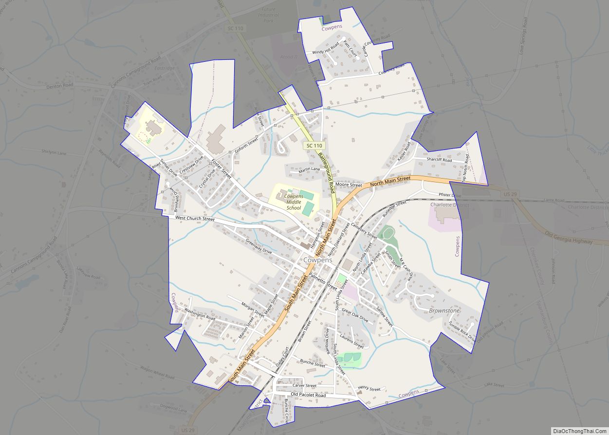
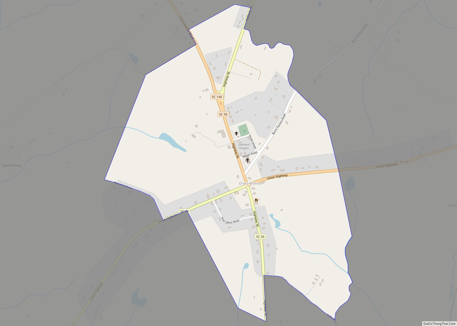
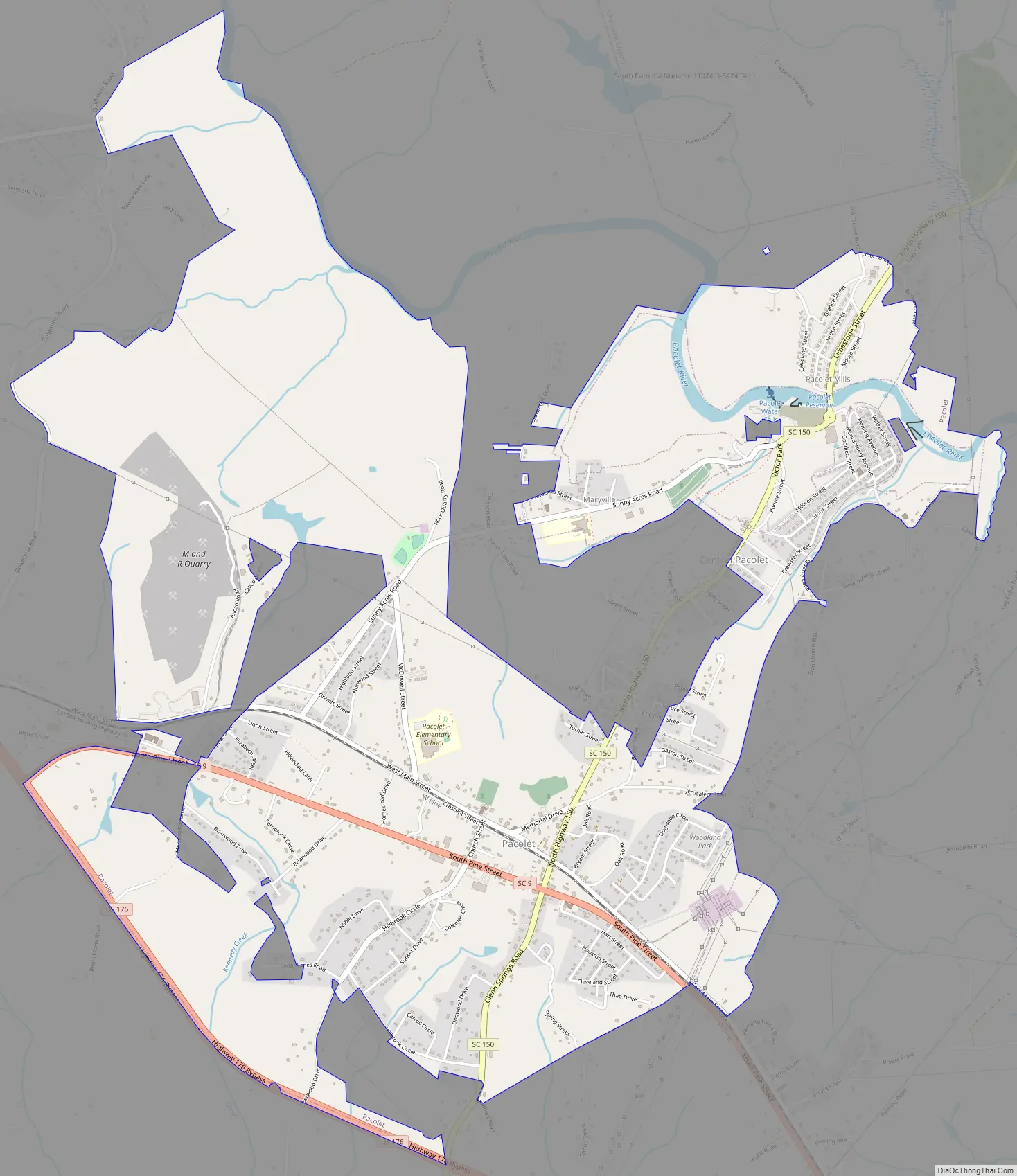
Pacolet Road Map
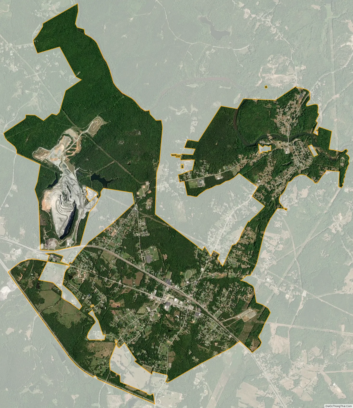
Pacolet city Satellite Map
Geography
According to the United States Census Bureau, the town has a total area of 3.0 square miles (7.8 km), of which 0.34% is water.
See also
Map of South Carolina State and its subdivision:- Abbeville
- Aiken
- Allendale
- Anderson
- Bamberg
- Barnwell
- Beaufort
- Berkeley
- Calhoun
- Charleston
- Cherokee
- Chester
- Chesterfield
- Clarendon
- Colleton
- Darlington
- Dillon
- Dorchester
- Edgefield
- Fairfield
- Florence
- Georgetown
- Greenville
- Greenwood
- Hampton
- Horry
- Jasper
- Kershaw
- Lancaster
- Laurens
- Lee
- Lexington
- Marion
- Marlboro
- McCormick
- Newberry
- Oconee
- Orangeburg
- Pickens
- Richland
- Saluda
- Spartanburg
- Sumter
- Union
- Williamsburg
- York
- Alabama
- Alaska
- Arizona
- Arkansas
- California
- Colorado
- Connecticut
- Delaware
- District of Columbia
- Florida
- Georgia
- Hawaii
- Idaho
- Illinois
- Indiana
- Iowa
- Kansas
- Kentucky
- Louisiana
- Maine
- Maryland
- Massachusetts
- Michigan
- Minnesota
- Mississippi
- Missouri
- Montana
- Nebraska
- Nevada
- New Hampshire
- New Jersey
- New Mexico
- New York
- North Carolina
- North Dakota
- Ohio
- Oklahoma
- Oregon
- Pennsylvania
- Rhode Island
- South Carolina
- South Dakota
- Tennessee
- Texas
- Utah
- Vermont
- Virginia
- Washington
- West Virginia
- Wisconsin
- Wyoming