Cowpens is a town in Spartanburg County, South Carolina, United States. The population was 2,162 at the 2010 census. The town was founded in 1876, and was incorporated in 1880.
| Name: | Cowpens town |
|---|---|
| LSAD Code: | 43 |
| LSAD Description: | town (suffix) |
| State: | South Carolina |
| County: | Spartanburg County |
| Elevation: | 860 ft (262 m) |
| Total Area: | 2.29 sq mi (5.94 km²) |
| Land Area: | 2.29 sq mi (5.94 km²) |
| Water Area: | 0.00 sq mi (0.00 km²) |
| Total Population: | 2,023 |
| Population Density: | 881.48/sq mi (340.35/km²) |
| ZIP code: | 29330 |
| Area code: | 864 |
| FIPS code: | 4517260 |
| GNISfeature ID: | 1247411 |
| Website: | www.townofcowpens.com |
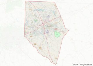
Online Interactive Map
Click on ![]() to view map in "full screen" mode.
to view map in "full screen" mode.
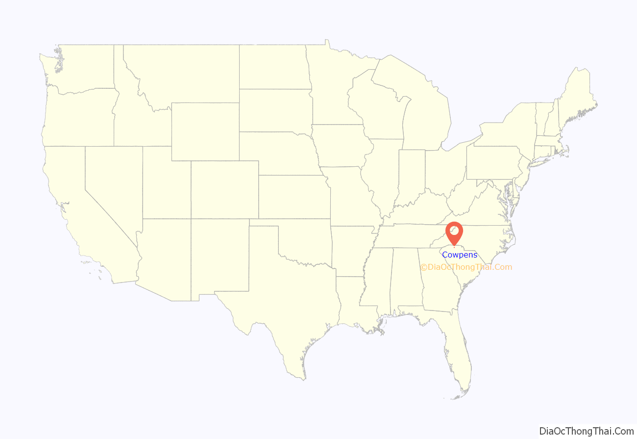
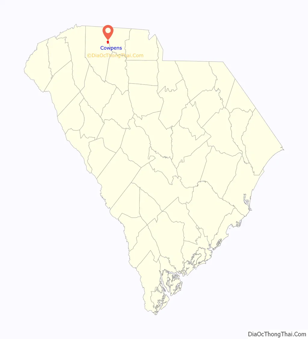
Cowpens location map. Where is Cowpens town?
History
The community was named on account of pens for cattle near the original town site.
During the American Revolutionary War, the Battle of Cowpens was fought on January 17, 1781, resulting in a decisive victory for American Patriot forces over British troops commanded by Banastre Tarleton. The battle site is preserved at Cowpens National Battlefield, located 9 miles (14 km) north of town in Cherokee County, near the town of Chesnee. Two ships of the U.S. Navy have been named USS Cowpens in honor of the battle.
The Cowpens Depot, built in 1896, was listed on the National Register of Historic Places in 1997.
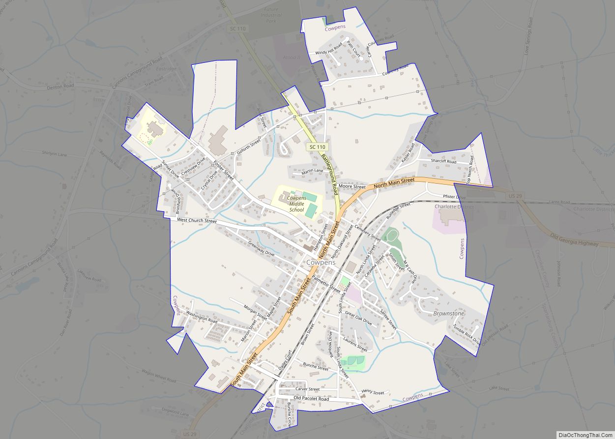
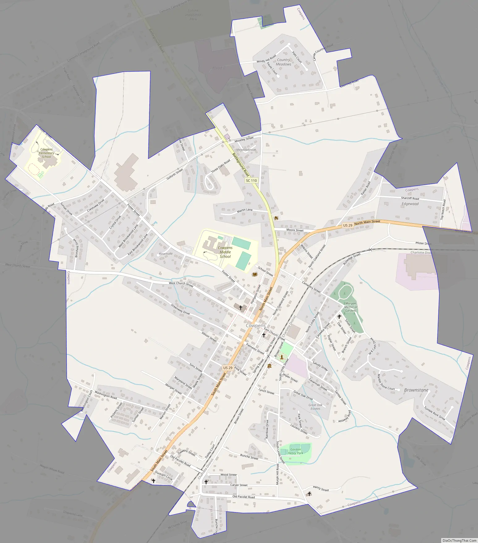
Cowpens Road Map
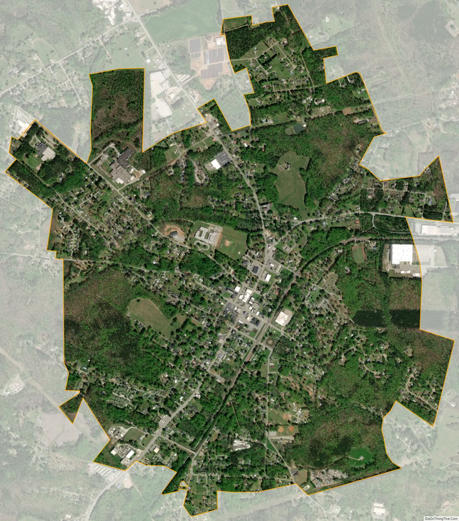
Cowpens city Satellite Map
Geography
Cowpens is located at 35°0′58″N 81°48′15″W / 35.01611°N 81.80417°W / 35.01611; -81.80417 (35.016181, -81.804240). It lies in the upland Carolina Piedmont region, approximately 9 mi (15 km) from the center of the county seat, Spartanburg.
According to the United States Census Bureau, the town has a total area of 2.3 square miles (6.0 km), all land.
See also
Map of South Carolina State and its subdivision:- Abbeville
- Aiken
- Allendale
- Anderson
- Bamberg
- Barnwell
- Beaufort
- Berkeley
- Calhoun
- Charleston
- Cherokee
- Chester
- Chesterfield
- Clarendon
- Colleton
- Darlington
- Dillon
- Dorchester
- Edgefield
- Fairfield
- Florence
- Georgetown
- Greenville
- Greenwood
- Hampton
- Horry
- Jasper
- Kershaw
- Lancaster
- Laurens
- Lee
- Lexington
- Marion
- Marlboro
- McCormick
- Newberry
- Oconee
- Orangeburg
- Pickens
- Richland
- Saluda
- Spartanburg
- Sumter
- Union
- Williamsburg
- York
- Alabama
- Alaska
- Arizona
- Arkansas
- California
- Colorado
- Connecticut
- Delaware
- District of Columbia
- Florida
- Georgia
- Hawaii
- Idaho
- Illinois
- Indiana
- Iowa
- Kansas
- Kentucky
- Louisiana
- Maine
- Maryland
- Massachusetts
- Michigan
- Minnesota
- Mississippi
- Missouri
- Montana
- Nebraska
- Nevada
- New Hampshire
- New Jersey
- New Mexico
- New York
- North Carolina
- North Dakota
- Ohio
- Oklahoma
- Oregon
- Pennsylvania
- Rhode Island
- South Carolina
- South Dakota
- Tennessee
- Texas
- Utah
- Vermont
- Virginia
- Washington
- West Virginia
- Wisconsin
- Wyoming