Pawleys Island is a town in Georgetown County, South Carolina, United States, and the Atlantic coast barrier island on which the town is located.
Pawleys Island’s population was 103 at the 2010 census, down from 138 in 2000. The post office address also includes an unincorporated area on the mainland adjacent to the island, which includes a commercial district along the Ocean Highway (US Route 17) and a residential area between the highway and the Waccamaw River. The town of Pawleys Island, though, is only on the island. The island lies off the Waccamaw Neck, a long, narrow peninsula between the ocean and the river, and is connected to the mainland by two bridges, the North Causeway and the South Causeway. It is on the southern end of The Grand Strand and is one of the oldest resort areas of the US East Coast.
| Name: | Pawleys Island town |
|---|---|
| LSAD Code: | 43 |
| LSAD Description: | town (suffix) |
| State: | South Carolina |
| County: | Georgetown County |
| Elevation: | 3 ft (0.9 m) |
| Total Area: | 0.99 sq mi (2.57 km²) |
| Land Area: | 0.70 sq mi (1.82 km²) |
| Water Area: | 0.29 sq mi (0.75 km²) |
| Total Population: | 130 |
| Population Density: | 185.45/sq mi (71.57/km²) |
| ZIP code: | 29585 |
| Area code: | 843, 854 |
| FIPS code: | 4555015 |
| GNISfeature ID: | 1231638 |
| Website: | www.townofpawleysisland.com, Pawleys Island on Facebook |
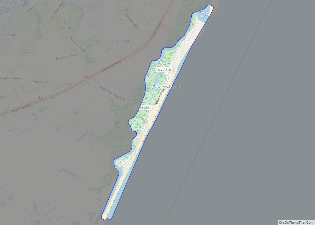
Online Interactive Map
Click on ![]() to view map in "full screen" mode.
to view map in "full screen" mode.
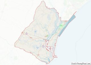
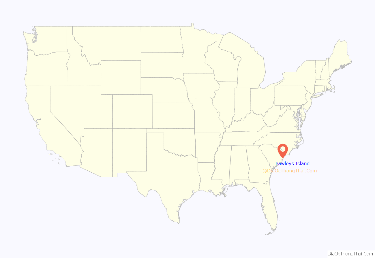
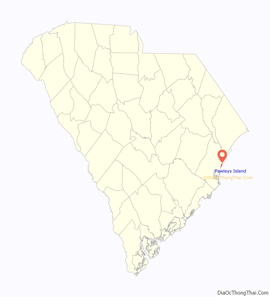
Pawleys Island location map. Where is Pawleys Island town?
History
The earliest known inhabitants of the Pawleys Island area were the Waccamaw and Winyah people, two Native American tribes whose history dates back more than 10,000 years. The ancient Waccamaw lived in communities along the Waccamaw River, an area stretching from Lake Waccamaw in North Carolina to Winyah Bay in Georgetown, South Carolina. Archaeological sites containing Waccamaw shell ‘middens’ (mounds) indicate that clams and oysters were popular foods. The Waccamaw were successful farmers, raising a variety of crops, and were skilled at domesticating animals including deer, chickens, ducks, geese, and other fowl.
The first Europeans in the area arrived from Spain in 1521. European colonization had a devastating impact on the Waccamaw and Winyah people, many of whom were captured and enslaved, starved to death when their farms and hunting grounds were seized, or died from the introduction of European diseases. While the Winyah disappeared by 1720, the Waccamaw and its rich culture still exist today as the Waccamaw Indian People of Conway, South Carolina. The Waccamaw tribe is a founding member of the South Carolina Indian Affairs Commission and has worked for decades with South Carolina governors to improve the lives and status of the state’s first inhabitants.
Pawleys Island’s history as a beach resort began in the early 1700s. Town namesake George Pawley, who inherited the island through a land grant to his father, sold parcels to wealthy rice planters seeking a coastal summer refuge from malaria-causing mosquitoes.
In 1791, President George Washington toured the Grand Strand, traveling The King’s Highway to an unincorporated portion of Pawleys Island to visit the Alstons, who owned several plantations in the area.
With Hurricane Hugo in 1989, some island cottages were swept away and have since been replaced. The island bans commercial or industrial buildings with the exception of a 1970s condominium complex and a few grandfathered inns, including the SeaView Inn and the PCJ Weston House, which is now the Pelican Inn.
The town government was incorporated in 1985. The water temperature is comfortable from May to October, and there is abundant fishing, crabbing, shrimping, and birdwatching most months of the year.
All Saints Church, Cedar Grove Plantation Chapel, and Pawleys Island Historic District are listed on the National Register of Historic Places.
Pawleys Island Road Map
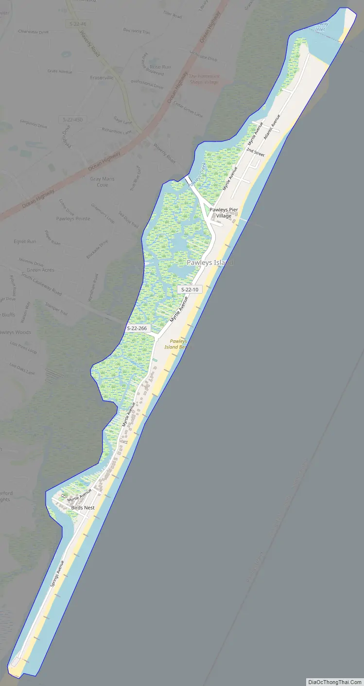
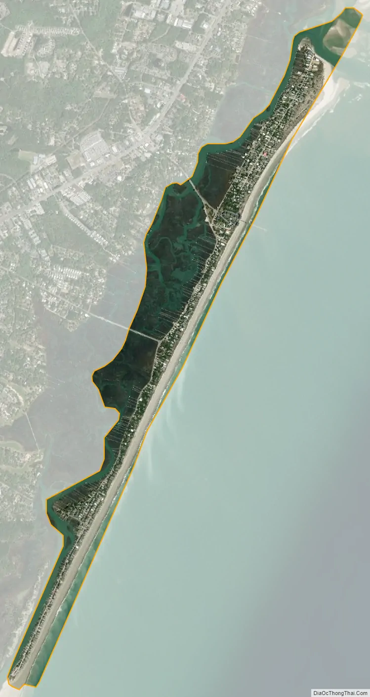
Pawleys Island city Satellite Map
Geography
The Town of Pawleys Island is located just off U.S. Route 17, approximately 10 miles (16 km) east of Georgetown. The island itself, located at 33°25′47″N 79°07′18″W / 33.42972°N 79.12167°W / 33.42972; -79.12167, is a little over three miles (5 km) long and about one-quarter of a mile wide. To the east-southeast lies the Atlantic Ocean. The island is a sandy barrier, with some dunes on the northern end up to about 15 feet (5 m) high. The southern end is very low. Behind the island is a tidal creek/marsh.
According to the United States Census Bureau, the town has a total area of 1.0 square miles (2.6 km), of which 0.7 square mile (1.8 km) is land and 0.3 square mile (0.8 km) (29.29%) is water.
See also
Map of South Carolina State and its subdivision:- Abbeville
- Aiken
- Allendale
- Anderson
- Bamberg
- Barnwell
- Beaufort
- Berkeley
- Calhoun
- Charleston
- Cherokee
- Chester
- Chesterfield
- Clarendon
- Colleton
- Darlington
- Dillon
- Dorchester
- Edgefield
- Fairfield
- Florence
- Georgetown
- Greenville
- Greenwood
- Hampton
- Horry
- Jasper
- Kershaw
- Lancaster
- Laurens
- Lee
- Lexington
- Marion
- Marlboro
- McCormick
- Newberry
- Oconee
- Orangeburg
- Pickens
- Richland
- Saluda
- Spartanburg
- Sumter
- Union
- Williamsburg
- York
- Alabama
- Alaska
- Arizona
- Arkansas
- California
- Colorado
- Connecticut
- Delaware
- District of Columbia
- Florida
- Georgia
- Hawaii
- Idaho
- Illinois
- Indiana
- Iowa
- Kansas
- Kentucky
- Louisiana
- Maine
- Maryland
- Massachusetts
- Michigan
- Minnesota
- Mississippi
- Missouri
- Montana
- Nebraska
- Nevada
- New Hampshire
- New Jersey
- New Mexico
- New York
- North Carolina
- North Dakota
- Ohio
- Oklahoma
- Oregon
- Pennsylvania
- Rhode Island
- South Carolina
- South Dakota
- Tennessee
- Texas
- Utah
- Vermont
- Virginia
- Washington
- West Virginia
- Wisconsin
- Wyoming