Roebuck is a census-designated place (CDP) in Spartanburg County, South Carolina, United States. The population was 2,200 at the 2010 census.
| Name: | Roebuck CDP |
|---|---|
| LSAD Code: | 57 |
| LSAD Description: | CDP (suffix) |
| State: | South Carolina |
| County: | Spartanburg County |
| Elevation: | 748 ft (228 m) |
| Total Area: | 4.31 sq mi (11.16 km²) |
| Land Area: | 4.29 sq mi (11.11 km²) |
| Water Area: | 0.02 sq mi (0.05 km²) |
| Total Population: | 2,357 |
| Population Density: | 549.16/sq mi (212.06/km²) |
| ZIP code: | 29376 |
| Area code: | 864 |
| FIPS code: | 4561720 |
| GNISfeature ID: | 1250459 |
Online Interactive Map
Click on ![]() to view map in "full screen" mode.
to view map in "full screen" mode.
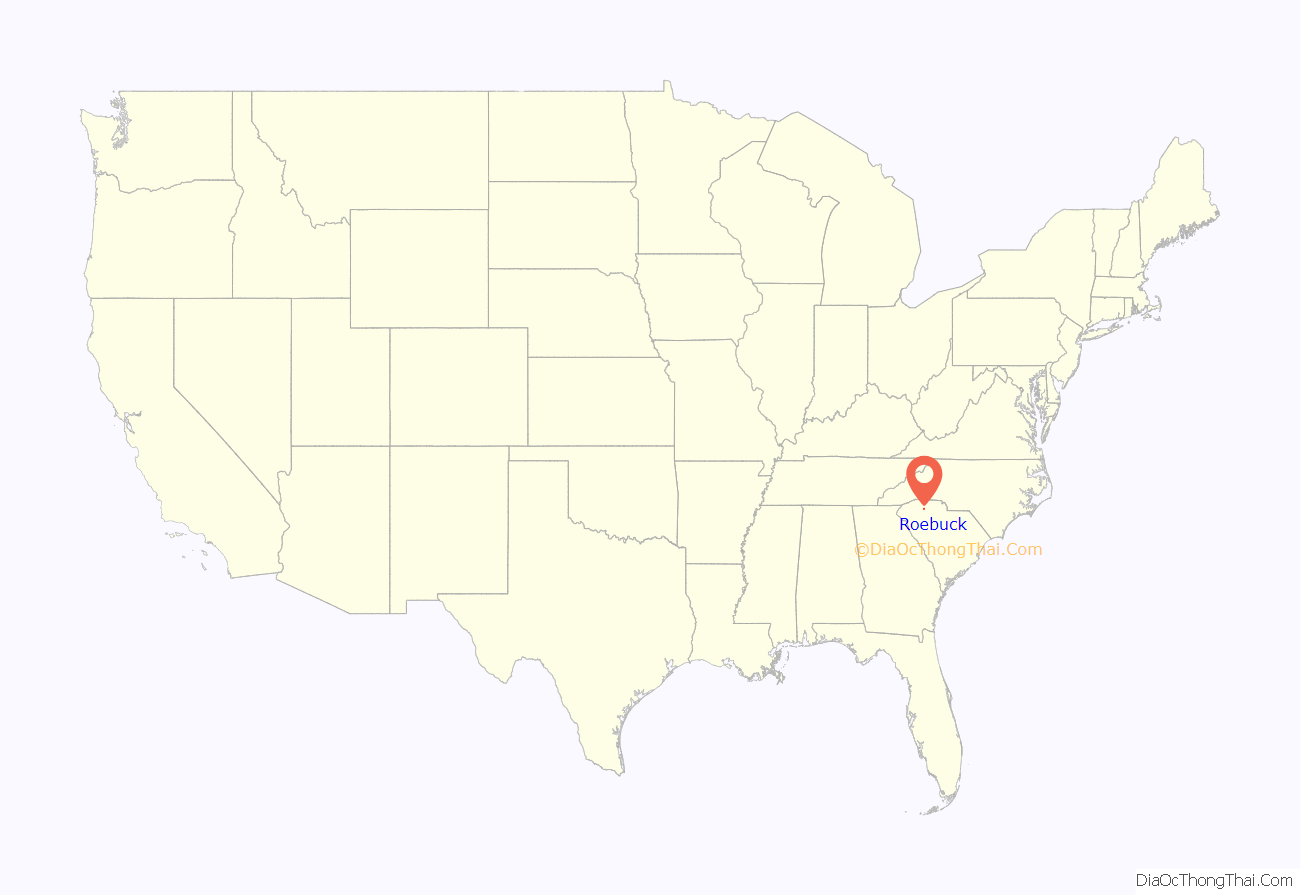
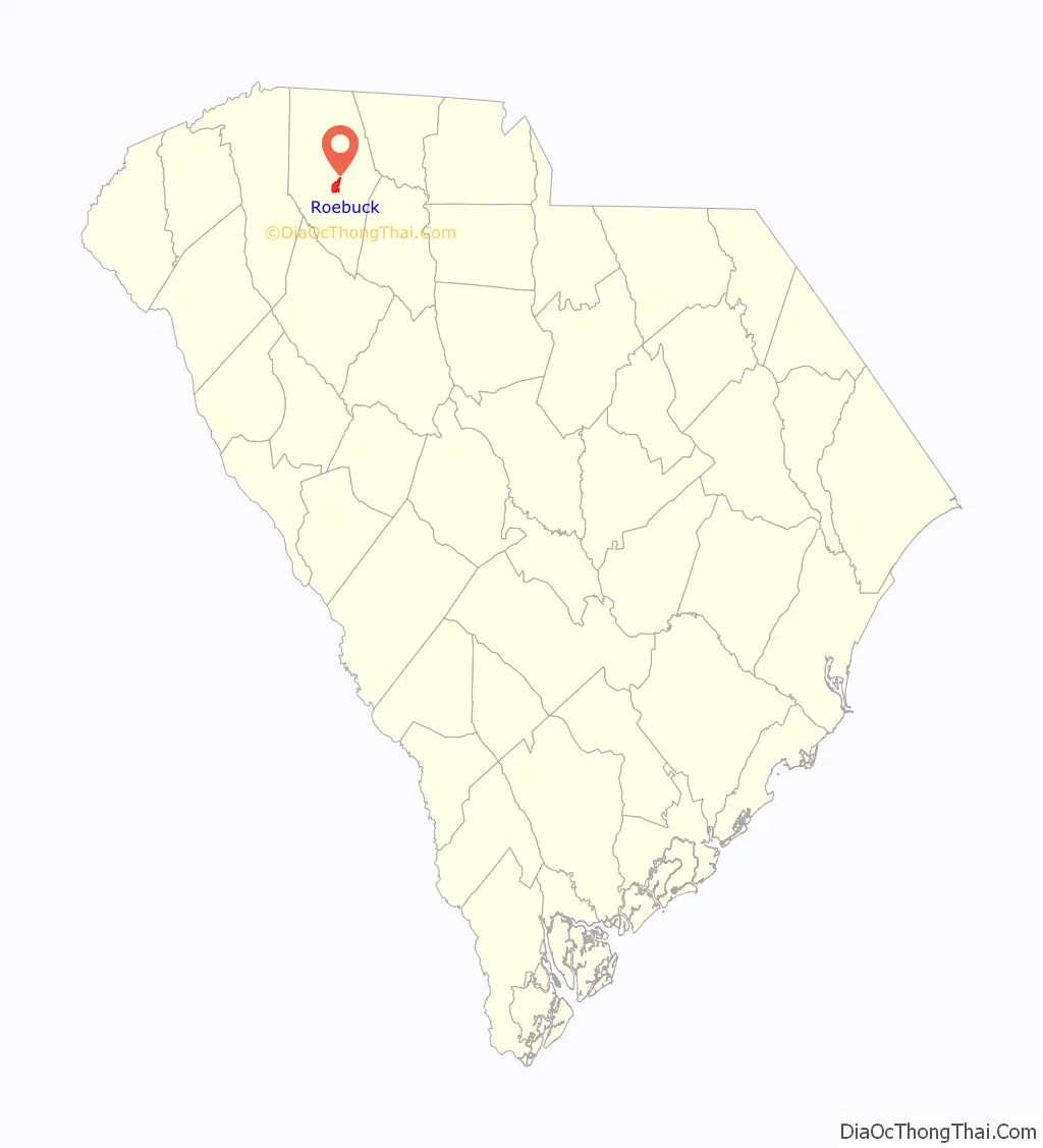
Roebuck location map. Where is Roebuck CDP?
History
The community was named for Revolutionary War Officer, Benjamin Roebuck.
Roebuck is home to the Walnut Grove Plantation, a preserved 18th-century farmhouse and tourist attraction. One of the daughters of the original owners, Kate Moore, was a scout for General Daniel Morgan during the Battle of Cowpens.
Smith’s Tavern was listed on the National Register of Historic Places in 1974.
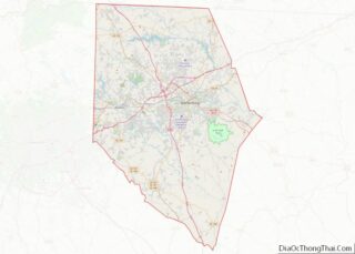
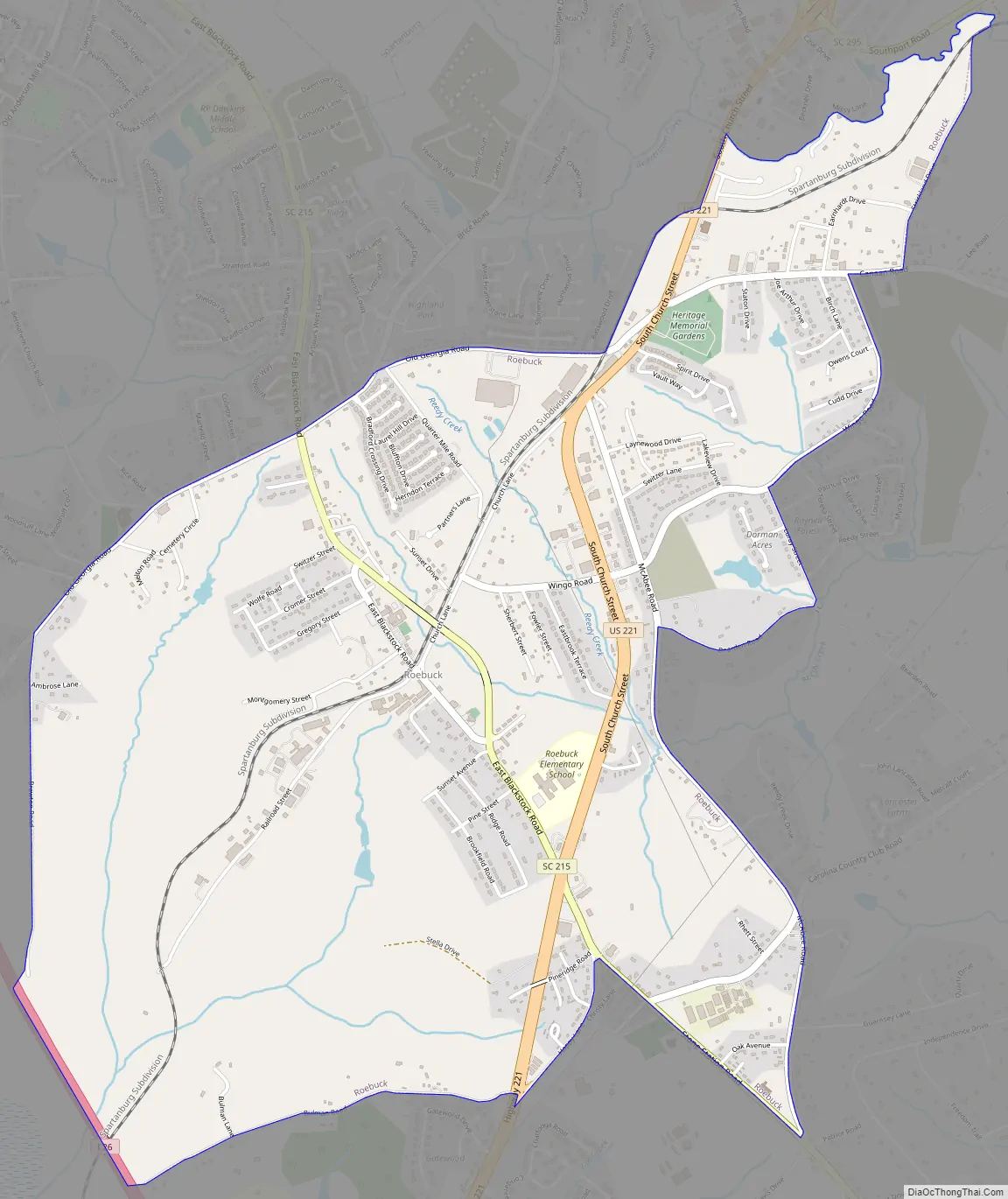
Roebuck Road Map
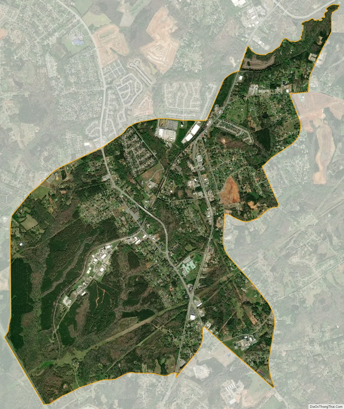
Roebuck city Satellite Map
Geography
Roebuck is located at 34°53′3″N 81°57′38″W / 34.88417°N 81.96056°W / 34.88417; -81.96056 (34.884195, -81.960597).
According to the United States Census Bureau, the CDP has a total area of 4.3 square miles (11.1 km), all land.
See also
Map of South Carolina State and its subdivision:- Abbeville
- Aiken
- Allendale
- Anderson
- Bamberg
- Barnwell
- Beaufort
- Berkeley
- Calhoun
- Charleston
- Cherokee
- Chester
- Chesterfield
- Clarendon
- Colleton
- Darlington
- Dillon
- Dorchester
- Edgefield
- Fairfield
- Florence
- Georgetown
- Greenville
- Greenwood
- Hampton
- Horry
- Jasper
- Kershaw
- Lancaster
- Laurens
- Lee
- Lexington
- Marion
- Marlboro
- McCormick
- Newberry
- Oconee
- Orangeburg
- Pickens
- Richland
- Saluda
- Spartanburg
- Sumter
- Union
- Williamsburg
- York
- Alabama
- Alaska
- Arizona
- Arkansas
- California
- Colorado
- Connecticut
- Delaware
- District of Columbia
- Florida
- Georgia
- Hawaii
- Idaho
- Illinois
- Indiana
- Iowa
- Kansas
- Kentucky
- Louisiana
- Maine
- Maryland
- Massachusetts
- Michigan
- Minnesota
- Mississippi
- Missouri
- Montana
- Nebraska
- Nevada
- New Hampshire
- New Jersey
- New Mexico
- New York
- North Carolina
- North Dakota
- Ohio
- Oklahoma
- Oregon
- Pennsylvania
- Rhode Island
- South Carolina
- South Dakota
- Tennessee
- Texas
- Utah
- Vermont
- Virginia
- Washington
- West Virginia
- Wisconsin
- Wyoming