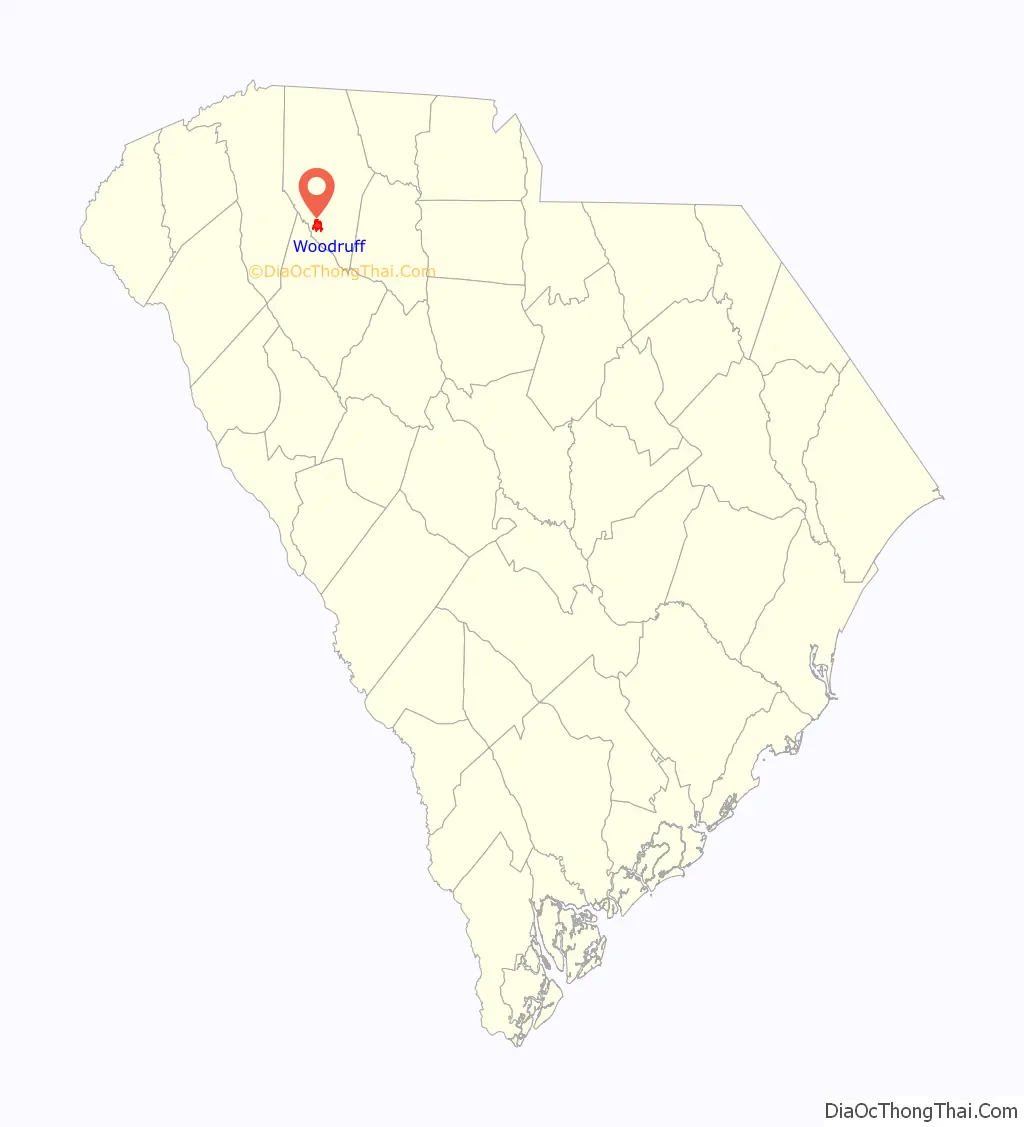
Woodruff is a city in Spartanburg County, South Carolina, United States, located in upstate South Carolina. The population was 4,333 at the 2020 census.
| Name: | Woodruff city |
|---|---|
| LSAD Code: | 25 |
| LSAD Description: | city (suffix) |
| State: | South Carolina |
| County: | Spartanburg County |
| Elevation: | 787 ft (240 m) |
| Total Area: | 5.09 sq mi (13.19 km²) |
| Land Area: | 5.07 sq mi (13.14 km²) |
| Water Area: | 0.02 sq mi (0.05 km²) |
| Total Population: | 4,212 |
| Population Density: | 830.11/sq mi (320.48/km²) |
| ZIP code: | 29388 |
| Area code: | 864 |
| FIPS code: | 4579090 |
| GNISfeature ID: | 1251504 |
| Website: | www.cityofwoodruff.com |
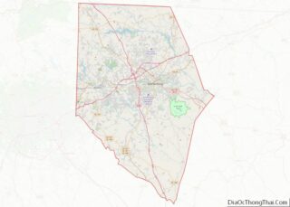
Online Interactive Map
Click on ![]() to view map in "full screen" mode.
to view map in "full screen" mode.
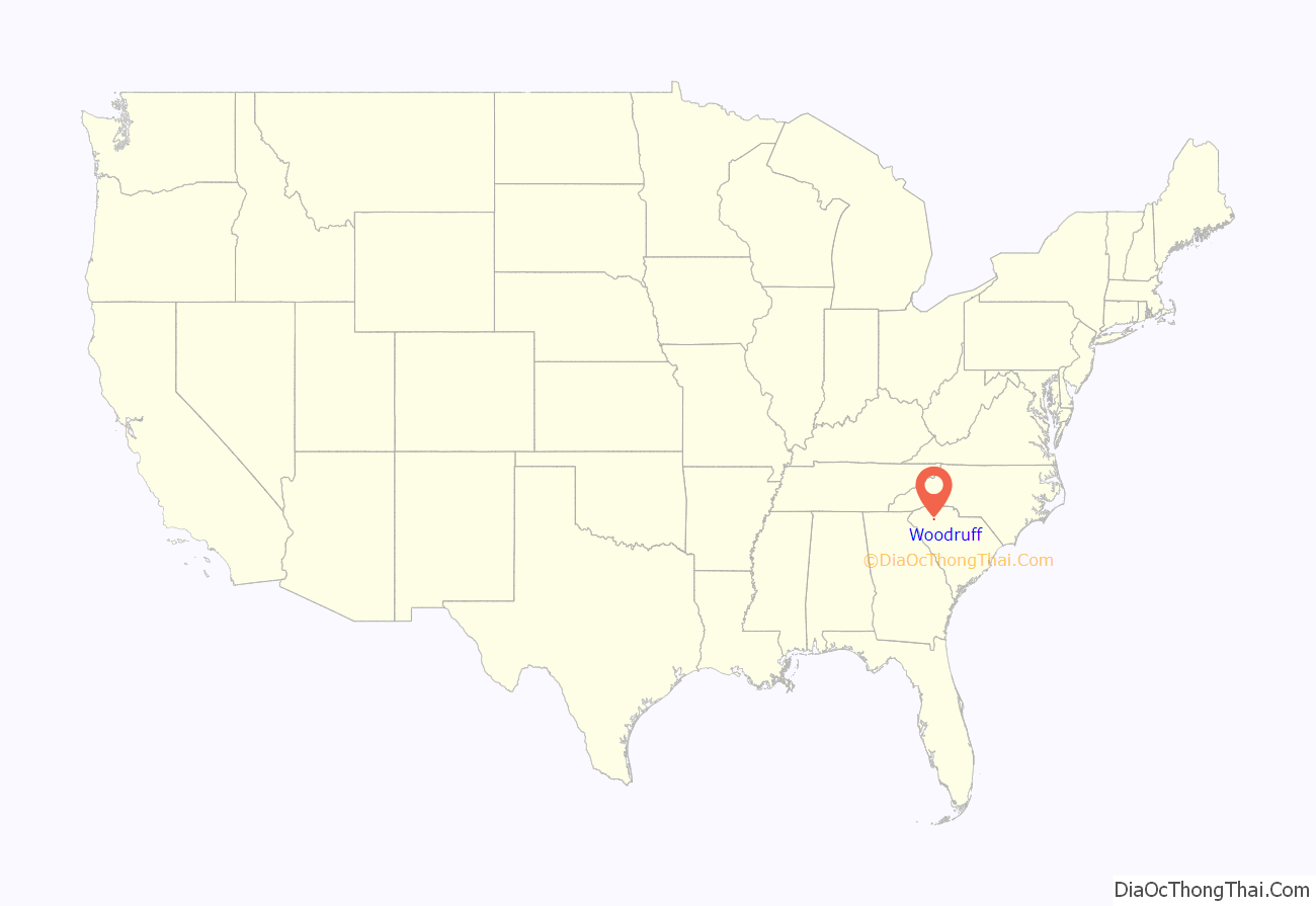
Woodruff location map. Where is Woodruff city?
History
In 1787 Joseph Woodruff, his brothers, and other family were listed as members and deacons in the earliest minutes of the Church of Christ at Jamey’s Creek, which would later become Woodruff Baptist Church. As early as 1789, Woodruff purchased two hundred acres of land on Jamey’s Creek, including the present site of Woodruff. By 1825, Woodruff post office (which took its name from the postmaster Thomas Woodruff, Joseph’s son) and Woodruff’s Tavern dominated the crossroads.
Situated in the midst of an expanding cotton region, Woodruff developed as a trade center for the rural farming communities. By the 1850s the town was hosting substantial fairs for the exchange of livestock and domestic manufactures. Woodruff was incorporated in 1874 with a population estimated at 150, but with the coming of the railroad in 1885 the population had grown to an estimated 1,600 by 1886. As a terminus on the rail line, the station at Woodruff included a turntable that would return trains to Augusta, Georgia.
A fair that began in the 1870s grew into a major annual event by the 1890s, drawing visitors from as far away as North Carolina. During the 1880s and 1890s construction steadily progressed along Main Street, with the popular Leatherwood Hotel as the focal point. Industry came to town in 1898 with the arrival of Woodruff Cotton Oil Company, and within three years the newly chartered Woodruff Cotton Mill began operation. By 1907 the W.S. Gray Cotton Mill was established, further expanding Woodruff’s residential base with additional mill houses. Until World War II the major diversion from textiles in the area was peaches, with more than 200,000 trees within a ten-mile radius. During the 1950s, with industries settling near large cities, Woodruff saw a four percent drop in population. But with the 1962 opening of the Jeffery Manufacturing Company, an industrial equipment maker, the town’s industrial base grew and diversified. New jobs attracted residents, and Woodruff ’s population reached 4,576 by 1970.
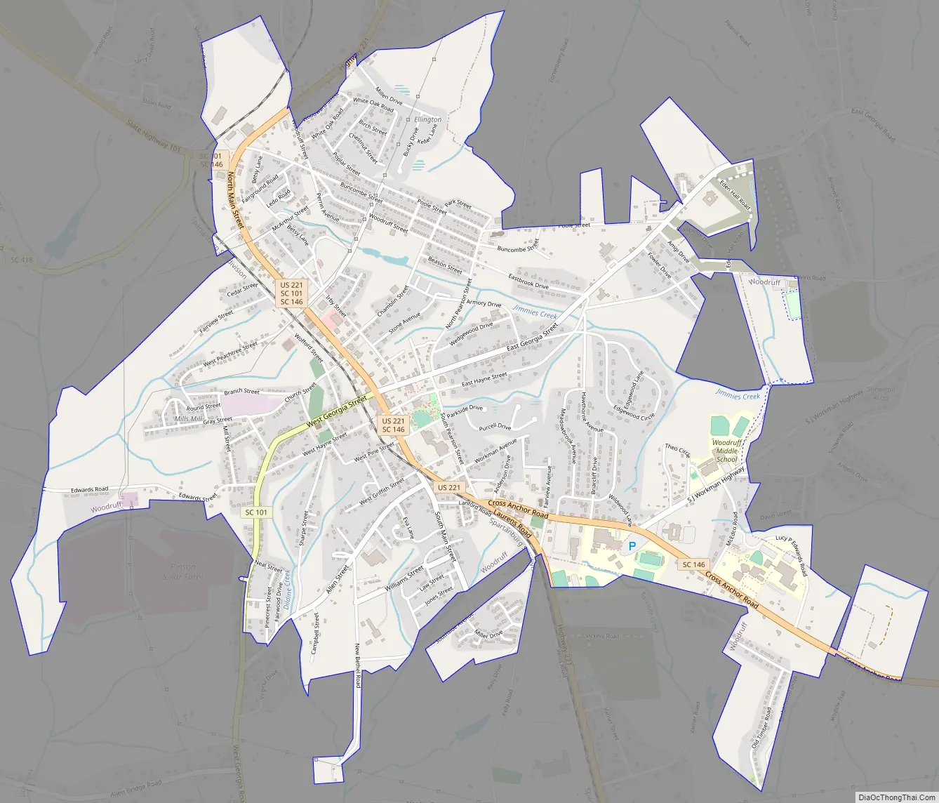
Woodruff Road Map
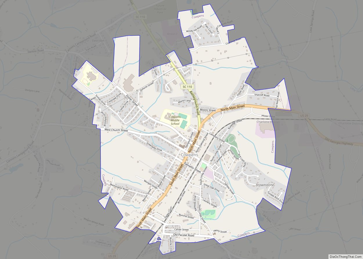
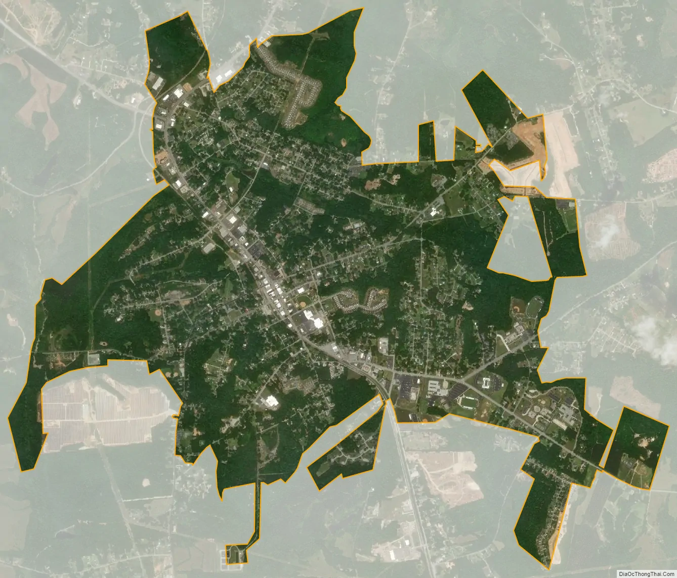
Woodruff city Satellite Map
Geography
Woodruff is located at 34°44′26″N 82°1′57″W / 34.74056°N 82.03250°W / 34.74056; -82.03250 (34.740530, -82.032580).
According to the United States Census Bureau, the city has a total area of 3.7 square miles (9.6 km), of which 0.04 square miles (0.10 km), or 0.54%, is water.
See also
Map of South Carolina State and its subdivision:- Abbeville
- Aiken
- Allendale
- Anderson
- Bamberg
- Barnwell
- Beaufort
- Berkeley
- Calhoun
- Charleston
- Cherokee
- Chester
- Chesterfield
- Clarendon
- Colleton
- Darlington
- Dillon
- Dorchester
- Edgefield
- Fairfield
- Florence
- Georgetown
- Greenville
- Greenwood
- Hampton
- Horry
- Jasper
- Kershaw
- Lancaster
- Laurens
- Lee
- Lexington
- Marion
- Marlboro
- McCormick
- Newberry
- Oconee
- Orangeburg
- Pickens
- Richland
- Saluda
- Spartanburg
- Sumter
- Union
- Williamsburg
- York
- Alabama
- Alaska
- Arizona
- Arkansas
- California
- Colorado
- Connecticut
- Delaware
- District of Columbia
- Florida
- Georgia
- Hawaii
- Idaho
- Illinois
- Indiana
- Iowa
- Kansas
- Kentucky
- Louisiana
- Maine
- Maryland
- Massachusetts
- Michigan
- Minnesota
- Mississippi
- Missouri
- Montana
- Nebraska
- Nevada
- New Hampshire
- New Jersey
- New Mexico
- New York
- North Carolina
- North Dakota
- Ohio
- Oklahoma
- Oregon
- Pennsylvania
- Rhode Island
- South Carolina
- South Dakota
- Tennessee
- Texas
- Utah
- Vermont
- Virginia
- Washington
- West Virginia
- Wisconsin
- Wyoming