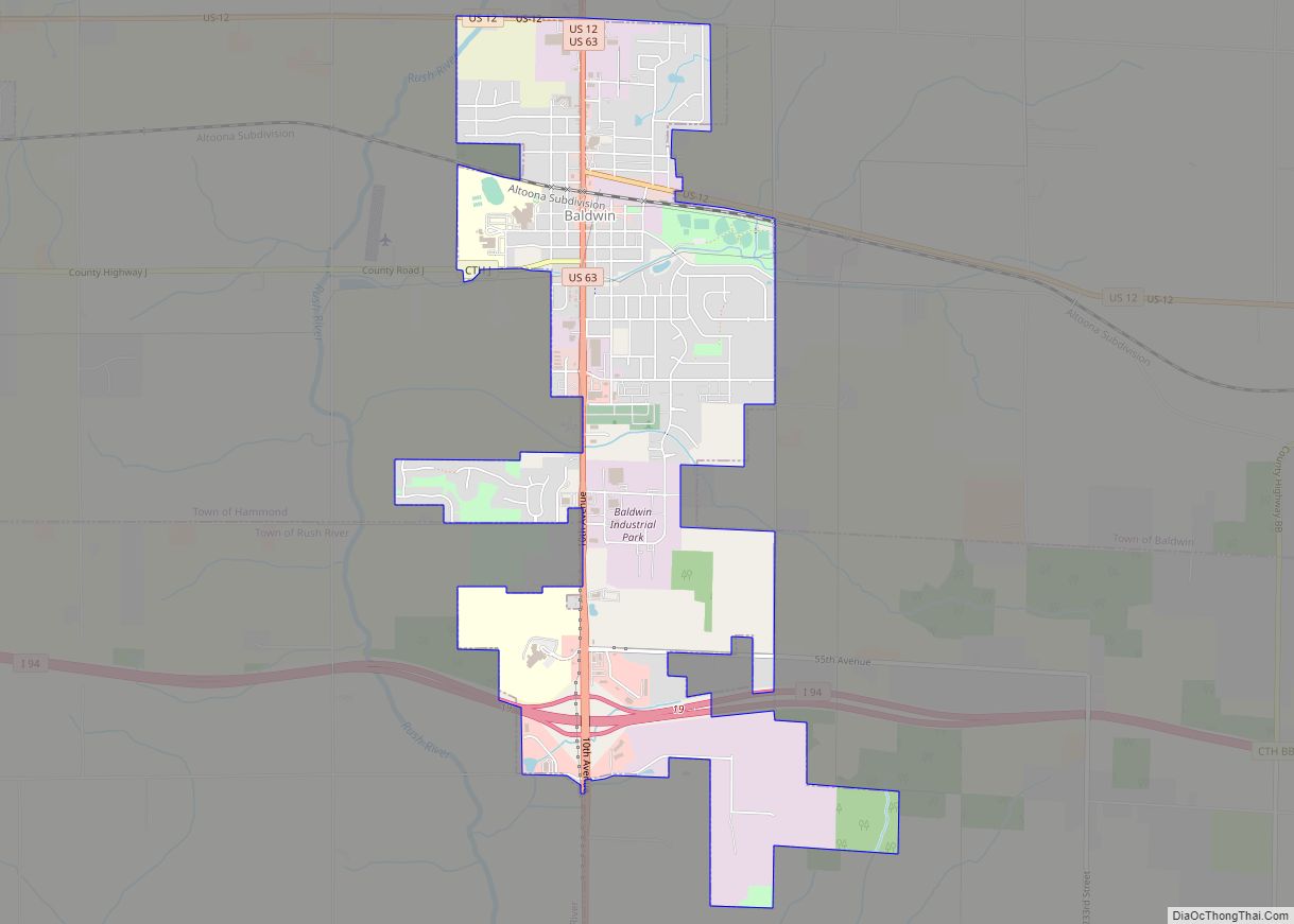
New Richmond is a city in St. Croix County, Wisconsin, United States. Its population was 10,079 as of the 2020 census.
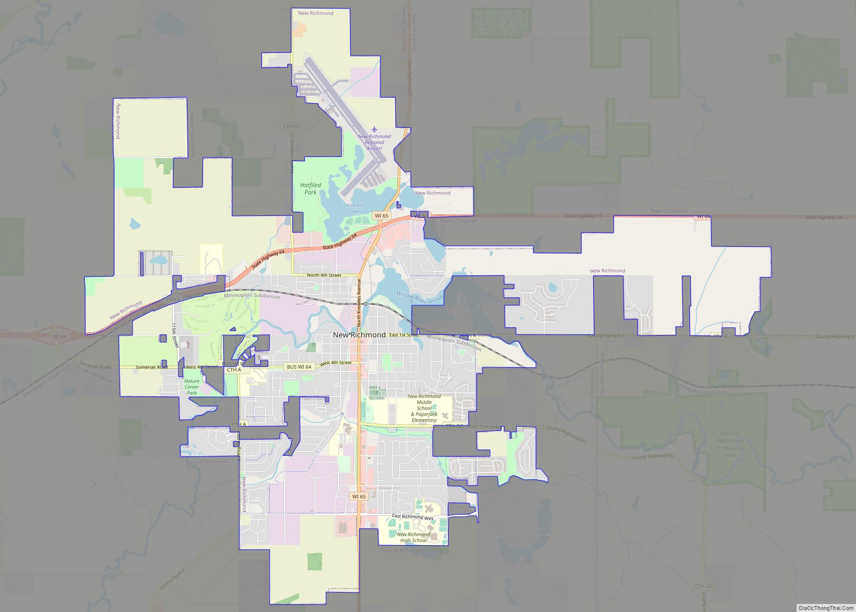
| Name: | New Richmond city |
|---|---|
| LSAD Code: | 25 |
| LSAD Description: | city (suffix) |
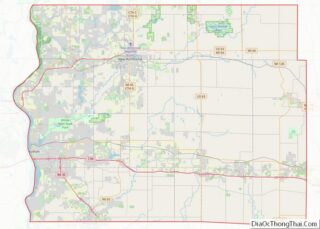
| State: | Wisconsin |
| County: | St. Croix County |
| Elevation: | 981 ft (299 m) |
| Total Area: | 11.04 sq mi (28.60 km²) |
| Land Area: | 10.79 sq mi (27.94 km²) |
| Water Area: | 0.26 sq mi (0.66 km²) |
| Total Population: | 10,079 |
| Population Density: | 912.95/sq mi (352.49/km²) |
| Area code: | 715 & 534 |
| FIPS code: | 5557100 |
| GNISfeature ID: | 1581681 |
| Website: | www.newrichmondwi.gov |
Online Interactive Map
Click on ![]() to view map in "full screen" mode.
to view map in "full screen" mode.
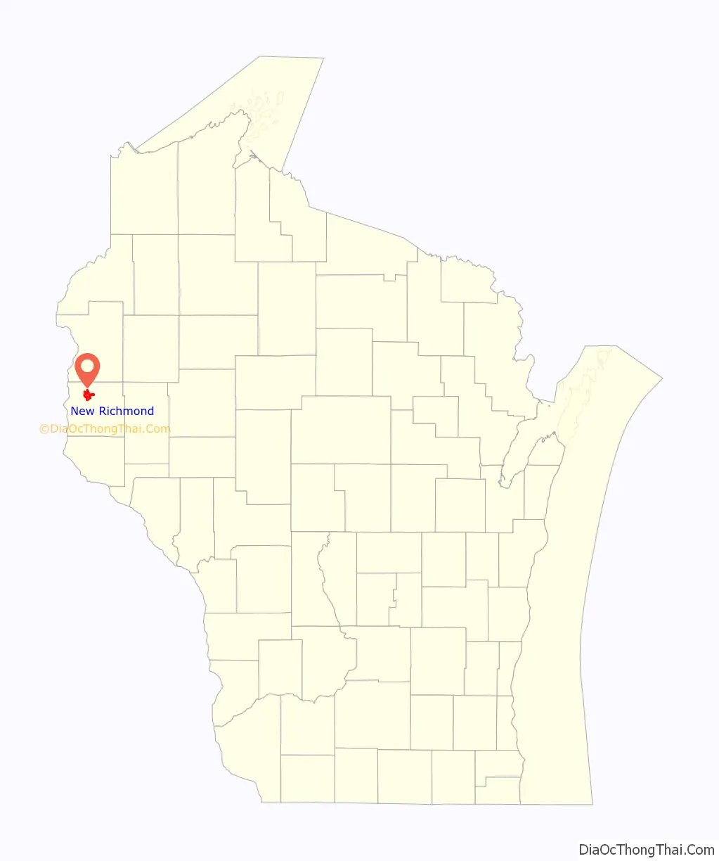
New Richmond location map. Where is New Richmond city?

History
New Richmond was founded in 1857. The first permanent settlement was established by Hiram Foster, who had led a group of settlers from Vermont into the area in search of virgin Wisconsin timber for harvesting. Foster built and operated a sawmill on the banks of the Willow River, which gradually drew more settlers from New England into the area. For the first few years the settlement was called Foster’s Crossing, and was later renamed after Richmond Day, the land surveyor who plotted the town. Because another town in Wisconsin had already taken the name Richmond, it was decided to call the town New Richmond. In 1871, New Richmond was made a station on the southwestern branch of Chicago, St. Paul, Minneapolis & Omaha Railroad’s ‘Omaha X’ network, initially working northwards from Hudson to New Richmond and providing a direct connection to St. Paul. Construction on the line continued northeast of New Richmond, reaching Spooner, Wisconsin in 1879. In addition to a steady stream of newcomers from New England, New Richmond saw an influx of Irish immigrants throughout the 1870s and early 1880s, later followed by large numbers of Germans, Norwegians and a few Swedes throughout the 1880s and 1890s. In 1885, the Wisconsin Central Railroad built a line into the north side of town westward from Chippewa Falls, from where it later continued towards Stillwater and on to St. Paul.
On the early evening of June 12, 1899, a deadly tornado tore through St. Croix, Polk and Barron counties along a 46-mile path. While most of the F5-strength storm’s path was confined to rural areas, New Richmond suffered a direct hit, with half the town’s residences leveled as well as the entire business district. In all, the tornado killed 117 people, 111 at New Richmond alone, injured more than 125, left over 1,500 people homeless and caused an estimated $18 million in damage. Due to state and federal aid and a large amount of donations, most of the homes and all but two of the businesses destroyed in the storm were able to rebuild by the following winter. Today, the tornado ranks as the deadliest ever recorded in Wisconsin and the ninth deadliest tornado in American history. Most of Main Street (Knowles Avenue) was rebuilt within five months.
New Richmond Road Map
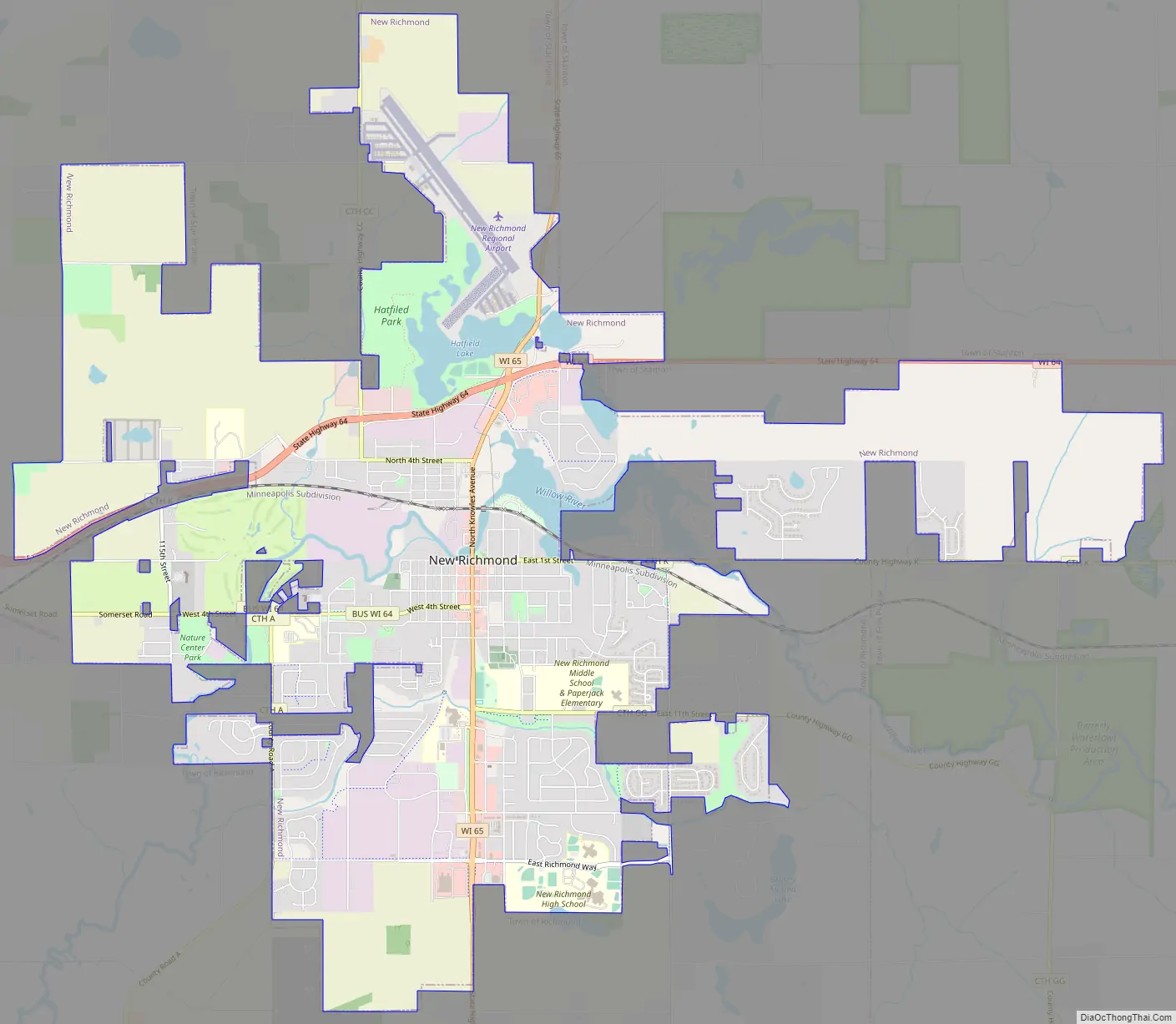
New Richmond city Satellite Map

Geography
New Richmond is located at 45°07′11″N 92°32′21″W / 45.119856°N 92.539142°W / 45.119856; -92.539142 (45.119856, −92.539142).
According to the United States Census Bureau, the city has a total area of 9.35 square miles (24.22 km), of which, 9.18 square miles (23.78 km) is land and 0.17 square miles (0.44 km) is water. A major source of hydrological water is from the Willow River, which is dammed near the center of town.
See also
Map of Wisconsin State and its subdivision:- Adams
- Ashland
- Barron
- Bayfield
- Brown
- Buffalo
- Burnett
- Calumet
- Chippewa
- Clark
- Columbia
- Crawford
- Dane
- Dodge
- Door
- Douglas
- Dunn
- Eau Claire
- Florence
- Fond du Lac
- Forest
- Grant
- Green
- Green Lake
- Iowa
- Iron
- Jackson
- Jefferson
- Juneau
- Kenosha
- Kewaunee
- La Crosse
- Lafayette
- Lake Michigan
- Lake Superior
- Langlade
- Lincoln
- Manitowoc
- Marathon
- Marinette
- Marquette
- Menominee
- Milwaukee
- Monroe
- Oconto
- Oneida
- Outagamie
- Ozaukee
- Pepin
- Pierce
- Polk
- Portage
- Price
- Racine
- Richland
- Rock
- Rusk
- Saint Croix
- Sauk
- Sawyer
- Shawano
- Sheboygan
- Taylor
- Trempealeau
- Vernon
- Vilas
- Walworth
- Washburn
- Washington
- Waukesha
- Waupaca
- Waushara
- Winnebago
- Wood
- Alabama
- Alaska
- Arizona
- Arkansas
- California
- Colorado
- Connecticut
- Delaware
- District of Columbia
- Florida
- Georgia
- Hawaii
- Idaho
- Illinois
- Indiana
- Iowa
- Kansas
- Kentucky
- Louisiana
- Maine
- Maryland
- Massachusetts
- Michigan
- Minnesota
- Mississippi
- Missouri
- Montana
- Nebraska
- Nevada
- New Hampshire
- New Jersey
- New Mexico
- New York
- North Carolina
- North Dakota
- Ohio
- Oklahoma
- Oregon
- Pennsylvania
- Rhode Island
- South Carolina
- South Dakota
- Tennessee
- Texas
- Utah
- Vermont
- Virginia
- Washington
- West Virginia
- Wisconsin
- Wyoming