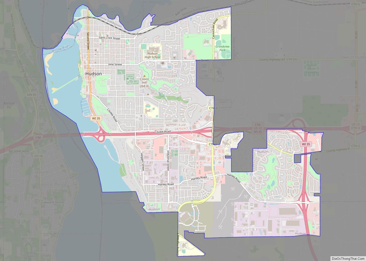
Hudson is a city in St. Croix County, Wisconsin, United States. As of the 2020 United States census, its population was 14,755. It is part of the Minneapolis–St. Paul Metropolitan Statistical Area (MSA). The village of North Hudson is directly north of Hudson.
| Name: | Hudson city |
|---|---|
| LSAD Code: | 25 |
| LSAD Description: | city (suffix) |
| State: | Wisconsin |
| County: | St. Croix County |
| Land Area: | 6.77 sq mi (17.52 km²) |
| Water Area: | 0.88 sq mi (2.28 km²) |
| Population Density: | 2,180.8/sq mi (842.0/km²) |
| ZIP code: | 54016, 54017 |
| Area code: | 715 & 534 (715 |
| FIPS code: | 5536250 |
| Website: | www.ci.hudson.wi.us |
Online Interactive Map
Click on ![]() to view map in "full screen" mode.
to view map in "full screen" mode.
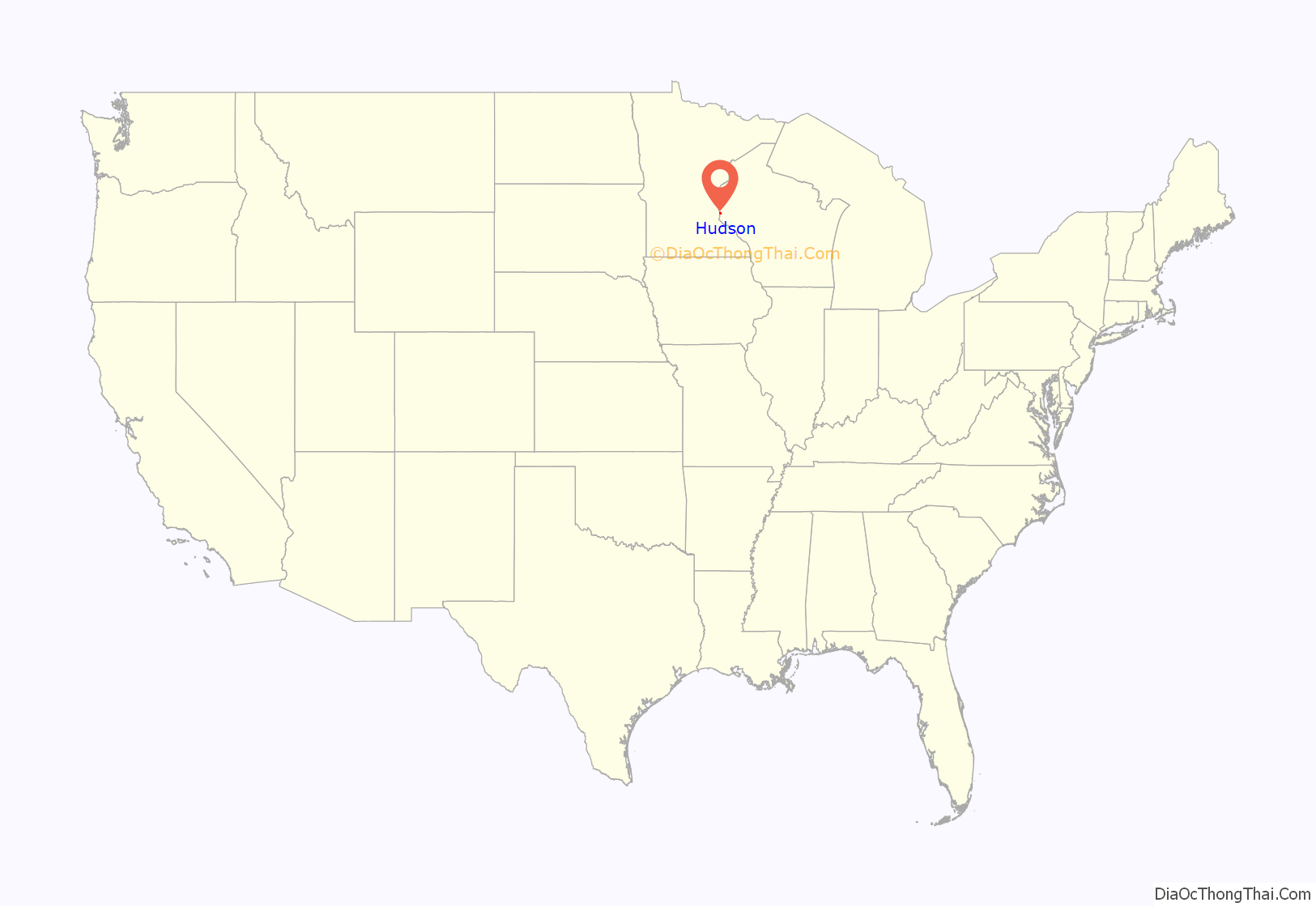
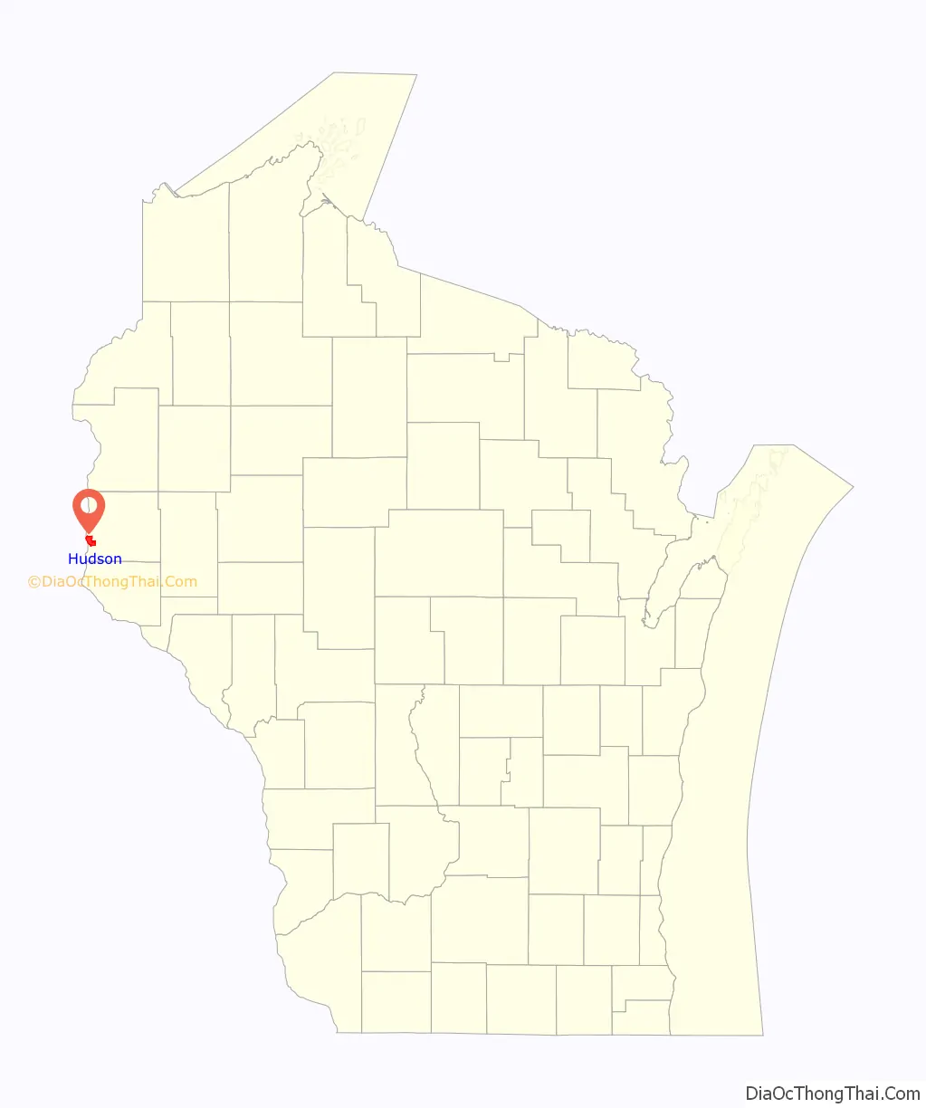
Hudson location map. Where is Hudson city?
History
Hudson was settled in 1840 by Louis Massey and his brother in-law, Peter Bouchea. William Streets arrived at about the same time. Later that year, Joseph Sauperson (commonly known as Joe LaGrue) took up residence. These four are considered Hudson’s original inhabitants. Massey and Bouchea settled at the mouth of the Willow River, near the present-day First and St. Croix Streets. They had been part of a group that lived for some time along the river below Fort Snelling, which appears on some old maps as “Massey’s Landing”.
Hudson was originally called Willow River. It was later named Buena Vista by Judge Joel Foster, founder of River Falls, after returning from the Mexican War where he fought in the Battle of Buena Vista. In 1852, Alfred D. Gray, Hudson’s first mayor, petitioned to change the city’s name to Hudson, because the bluffs along the St. Croix River reminded him of the Hudson River in his native New York.
A large number of settlers arrived in the 1850s and 1860s, many of whom were ancestors of today’s residents. The lumber industry was the area’s prime attraction, and over time sawmills were established throughout the St. Croix Valley.
The Chicago, St. Paul, Minneapolis and Omaha Railway was formed in 1881 from other railroads building between the Twin Cities and Chicago. The shops and headquarters of the Omaha Road were in Hudson. This route is now part of the Union Pacific Railroad.
On August 30, 1917, a violent mob of 1,000 held a night rally in front of the armory protesting the pacifist People’s Council of America’s attempt to hold a conference in Hudson’s prizefighting arena. The crowd then moved on the four organizers in the lobby of their hotel and threatened to hang them. Only after the pleadings of county attorney N. O. Varnum were the four allowed to leave town at once and unharmed.
U.S. Highway 12 once crossed the St. Croix River on a toll bridge between Wisconsin and Minnesota, which provided revenue for the town. With the construction of Interstate 94, the toll bridge was removed, though the long causeway extending to the former bridge location is now open to the public as a pedestrian walkway, known as “The Dike”.
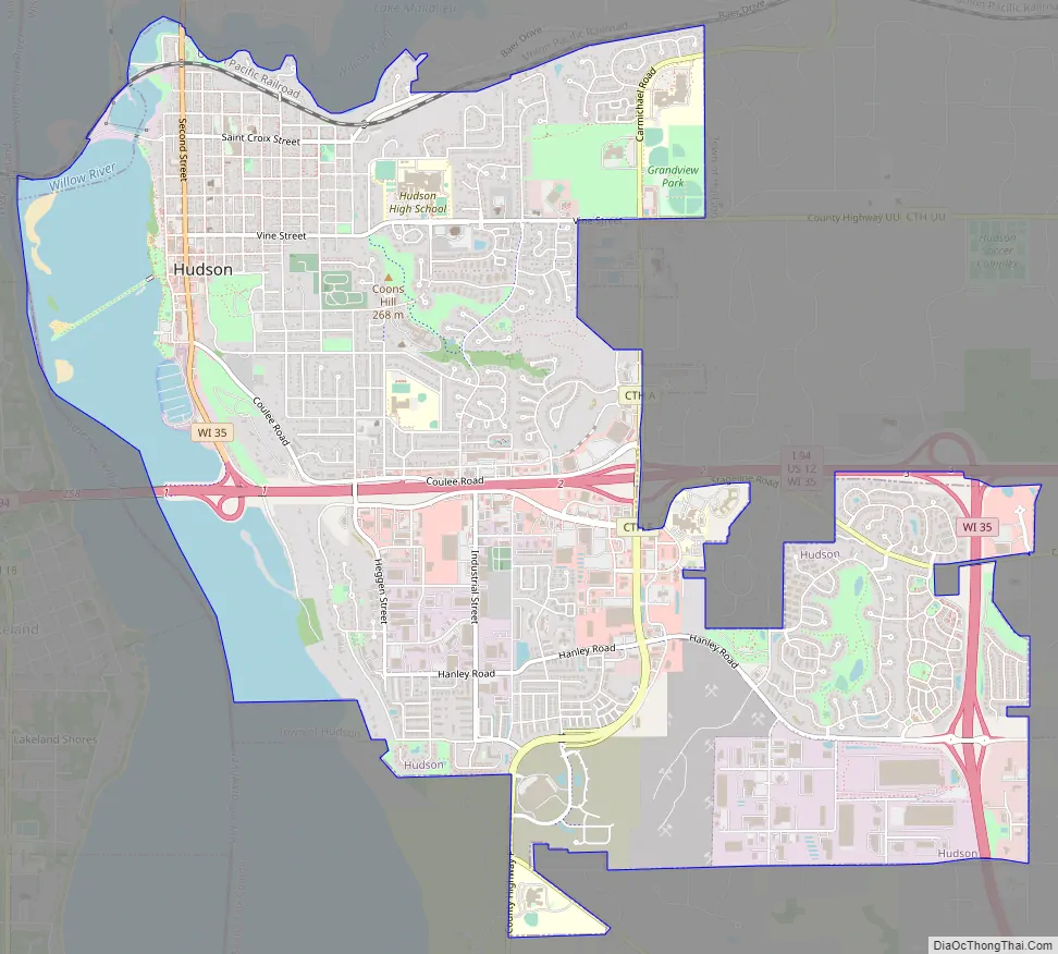
Hudson Road Map
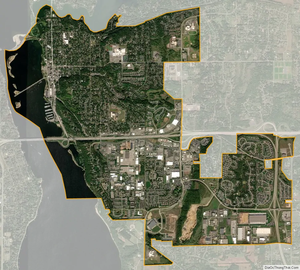
Hudson city Satellite Map
Geography
According to the United States Census Bureau, the city has an area of 7.41 square miles (19.19 km), of which 6.53 square miles (16.91 km) is land and 0.88 square miles (2.28 km) is water.
Interstate Highway 94, U.S. Route 12 and Wisconsin Highway 35 are three of the main routes in the community.
See also
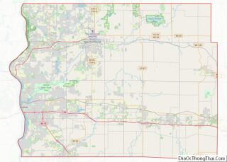
Map of Wisconsin State and its subdivision:- Adams
- Ashland
- Barron
- Bayfield
- Brown
- Buffalo
- Burnett
- Calumet
- Chippewa
- Clark
- Columbia
- Crawford
- Dane
- Dodge
- Door
- Douglas
- Dunn
- Eau Claire
- Florence
- Fond du Lac
- Forest
- Grant
- Green
- Green Lake
- Iowa
- Iron
- Jackson
- Jefferson
- Juneau
- Kenosha
- Kewaunee
- La Crosse
- Lafayette
- Lake Michigan
- Lake Superior
- Langlade
- Lincoln
- Manitowoc
- Marathon
- Marinette
- Marquette
- Menominee
- Milwaukee
- Monroe
- Oconto
- Oneida
- Outagamie
- Ozaukee
- Pepin
- Pierce
- Polk
- Portage
- Price
- Racine
- Richland
- Rock
- Rusk
- Saint Croix
- Sauk
- Sawyer
- Shawano
- Sheboygan
- Taylor
- Trempealeau
- Vernon
- Vilas
- Walworth
- Washburn
- Washington
- Waukesha
- Waupaca
- Waushara
- Winnebago
- Wood
- Alabama
- Alaska
- Arizona
- Arkansas
- California
- Colorado
- Connecticut
- Delaware
- District of Columbia
- Florida
- Georgia
- Hawaii
- Idaho
- Illinois
- Indiana
- Iowa
- Kansas
- Kentucky
- Louisiana
- Maine
- Maryland
- Massachusetts
- Michigan
- Minnesota
- Mississippi
- Missouri
- Montana
- Nebraska
- Nevada
- New Hampshire
- New Jersey
- New Mexico
- New York
- North Carolina
- North Dakota
- Ohio
- Oklahoma
- Oregon
- Pennsylvania
- Rhode Island
- South Carolina
- South Dakota
- Tennessee
- Texas
- Utah
- Vermont
- Virginia
- Washington
- West Virginia
- Wisconsin
- Wyoming