Fall River County is a county in the U.S. state of South Dakota. As of the 2020 United States Census, the population was 6,973. Its county seat is Hot Springs. The county was founded in 1883. It is named for Fall River which runs through it.
| Name: | Fall River County |
|---|---|
| FIPS code: | 46-047 |
| State: | South Dakota |
| Founded: | April 3, 1883 |
| Named for: | Fall River |
| Seat: | Hot Springs |
| Largest city: | Hot Springs |
| Total Area: | 1,749 sq mi (4,530 km²) |
| Land Area: | 1,740 sq mi (4,500 km²) |
| Total Population: | 6,973 |
| Population Density: | 4.0/sq mi (1.5/km²) |
| Time zone: | UTC−7 (Mountain) |
| Summer Time Zone (DST): | UTC−6 (MDT) |
| Website: | fallriver.sdcounties.org |
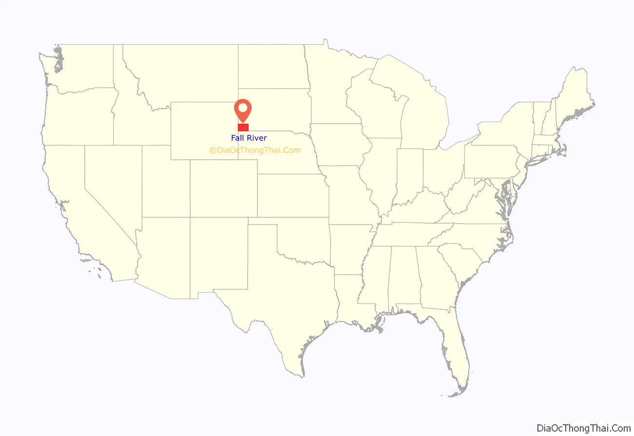
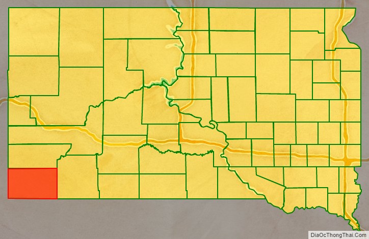
Fall River County location map. Where is Fall River County?
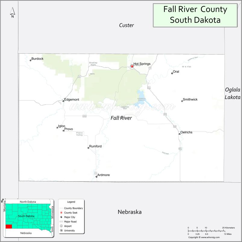
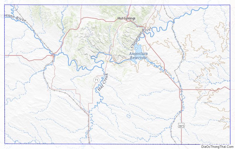
Fall River County Road Map
Geography
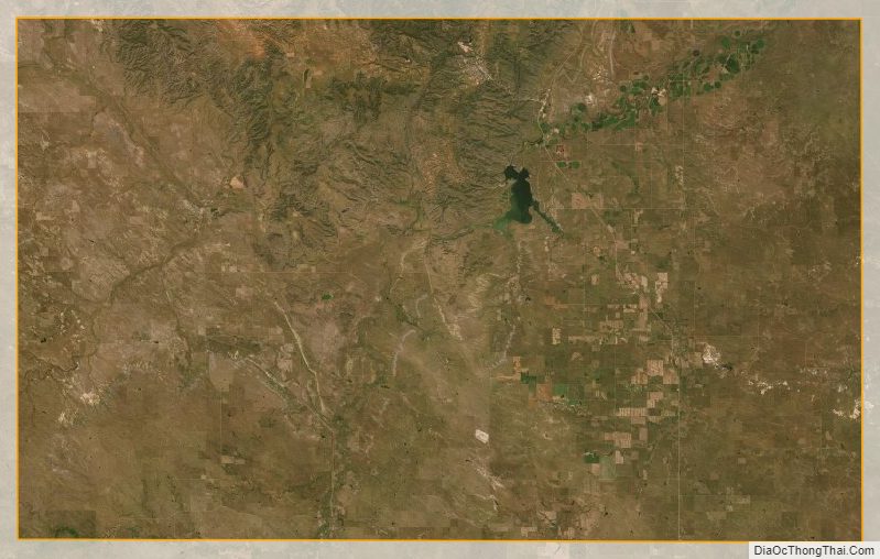
Fall River County lies at South Dakota’s SW corner. Its south borderline abuts the north borderline of the state of Nebraska, and its west borderline abuts the east borderline of the state of Wyoming. The Fall River County terrain contains a mountainous area in the north-central portion, with rolling hills in the rest of the county. Outside the mountainous area, the county’s highest point is its SW corner, at 3,970′ (1210m) ASL. Of the several peaks in the mountainous area, one in the NE portion of that zone rises to 4,646′ (1416m) ASL. The terrain slopes to the north and east. Discharging from the Angostura Reservoir, the Cheyenne River flows northeasterly through the upper part of the county, departing the county through its north boundary line into Custer County.
Fall River County has a total area of 1,749 square miles (4,530 km), of which 1,740 square miles (4,500 km) is land and 9.2 square miles (24 km) (0.5%) is water.
Major highways
- US 18
- US 385
- SD 71
- SD 79
- SD 89
- SD 471
Adjacent counties
- Custer County – north
- Oglala Lakota County – east
- Dawes County, Nebraska – southeast
- Sioux County, Nebraska – south
- Niobrara County, Wyoming – west
Protected areas
- Angostura Reservoir State Game Production Area
- Angostura State Recreation Area
- Bailey State Lakeside Use Area
- Battle Mountain State Game Production Area
- Black Hills National Forest (partial)
- Buffalo Gap National Grassland (partial)
- Friendshuh State Game Production Area (partial)
- Hill Ranch State Game Production Area
- Oral State Game Production Area
- Romey State Game Production Area
- Scherbarth State Game Production Area
- Sheps Canyon State Lakeside Use Area
- Sheps Canyon State Recreation Area
- Williams Dam State Game Production
Lakes
- Angostura Reservoir
- Coldbrook Lake
- Cottonwood Springs Lake
Fall River County Topographic Map
Fall River County Satellite Map
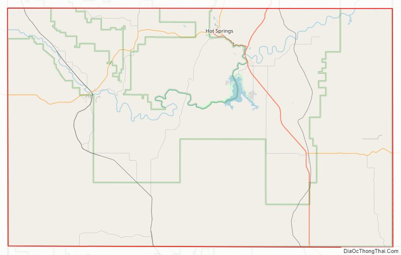
Fall River County Outline Map

See also
Map of South Dakota State and its subdivision:- Aurora
- Beadle
- Bennett
- Bon Homme
- Brookings
- Brown
- Brule
- Buffalo
- Butte
- Campbell
- Charles Mix
- Clark
- Clay
- Codington
- Corson
- Custer
- Davison
- Day
- Deuel
- Dewey
- Douglas
- Edmunds
- Fall River
- Faulk
- Grant
- Gregory
- Haakon
- Hamlin
- Hand
- Hanson
- Harding
- Hughes
- Hutchinson
- Hyde
- Jackson
- Jerauld
- Jones
- Kingsbury
- Lake
- Lawrence
- Lincoln
- Lyman
- Marshall
- McCook
- McPherson
- Meade
- Mellette
- Miner
- Minnehaha
- Moody
- Pennington
- Perkins
- Potter
- Roberts
- Sanborn
- Shannon
- Spink
- Stanley
- Sully
- Todd
- Tripp
- Turner
- Union
- Walworth
- Yankton
- Ziebach
- Alabama
- Alaska
- Arizona
- Arkansas
- California
- Colorado
- Connecticut
- Delaware
- District of Columbia
- Florida
- Georgia
- Hawaii
- Idaho
- Illinois
- Indiana
- Iowa
- Kansas
- Kentucky
- Louisiana
- Maine
- Maryland
- Massachusetts
- Michigan
- Minnesota
- Mississippi
- Missouri
- Montana
- Nebraska
- Nevada
- New Hampshire
- New Jersey
- New Mexico
- New York
- North Carolina
- North Dakota
- Ohio
- Oklahoma
- Oregon
- Pennsylvania
- Rhode Island
- South Carolina
- South Dakota
- Tennessee
- Texas
- Utah
- Vermont
- Virginia
- Washington
- West Virginia
- Wisconsin
- Wyoming