| Name: | Mesa County |
|---|---|
| FIPS code: | 08-077 |
| State: | Colorado |
| Founded: | February 14, 1883 |
| Named for: | Mesas in the area |
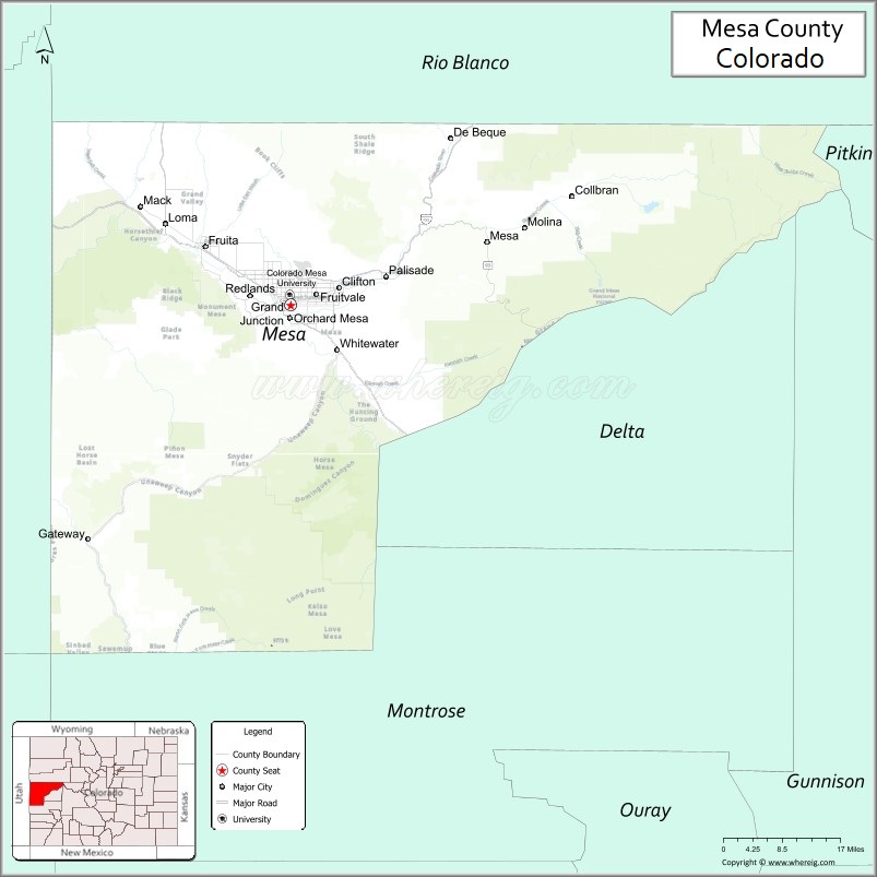
| Seat: | Grand Junction |
| Largest city: | Grand Junction |
| Total Area: | 3,341 sq mi (8,650 km²) |
| Land Area: | 3,329 sq mi (8,620 km²) |
| Total Population: | 157,335 |
| Population Density: | 47/sq mi (18/km²) |
| Time zone: | UTC−7 (Mountain) |
| Summer Time Zone (DST): | UTC−6 (MDT) |
| Website: | www.mesacounty.us |
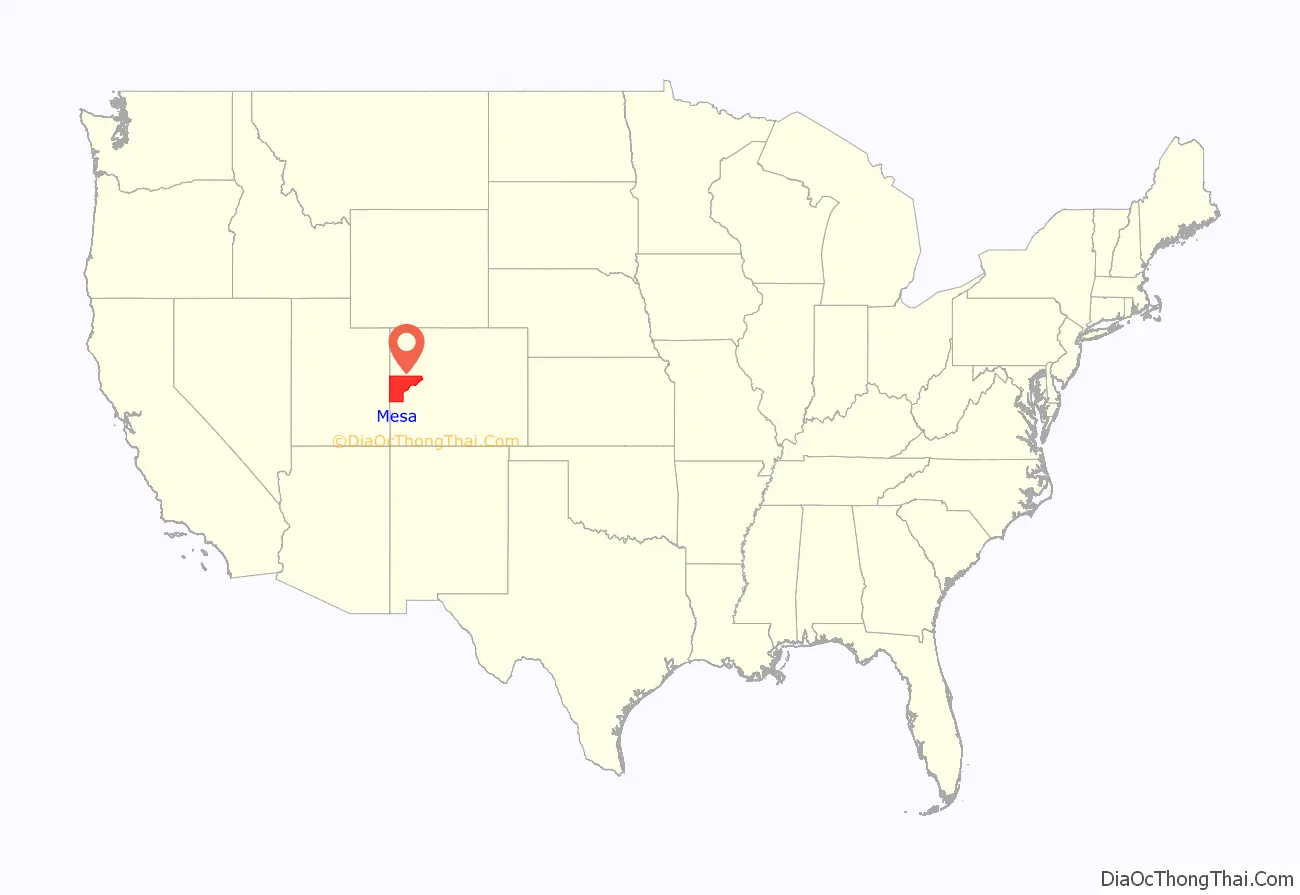
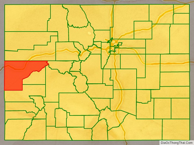
Mesa County location map. Where is Mesa County?
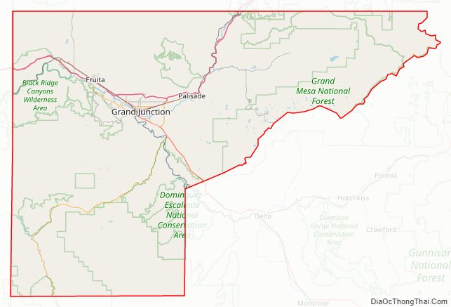
Mesa County Road Map
Geography
According to the U.S. Census Bureau, the county has a total area of 3,341 square miles (8,650 km), of which 3,329 square miles (8,620 km) is land and 12 square miles (31 km) (0.4%) is water. It is the fourth-largest county by area in Colorado.
Adjacent counties
- Garfield County – north
- Pitkin County – east
- Gunnison County – east
- Delta County – southeast
- Montrose County – south
- Grand County, Utah – west
Major highways
- Interstate 70
- I-70 BL
- I-70 BL
- U.S. Highway 6
- U.S. Highway 50
- State Highway 65
- State Highway 139
- State Highway 141
- State Highway 330
- State Highway 340
- 45 1/2 Rd
National protected areas
- Black Ridge Canyons Wilderness
- Colorado National Monument
- Dominguez Canyon Wilderness
- Dominguez-Escalante National Conservation Area (part)
- Grand Mesa National Forest
- Manti-La Sal National Forest
- McInnis Canyons National Conservation Area (part)
- Uncompahgre National Forest
- White River National Forest
State protected areas
- Highline Lake State Park
- James M. Robb – Colorado River State Park
- Vega State Park
Trails and byways
- American Discovery Trail
- Dinosaur Diamond Prehistoric Highway National Scenic Byway
- Grand Mesa National Scenic and Historic Byway
- Kokopelli Trail
- Old Spanish National Historic Trail
- Unaweep/Tabeguache Scenic and Historic Byway
- Colorado Riverfront Trail
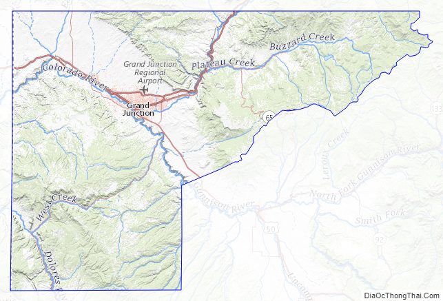
Mesa County Topographic Map
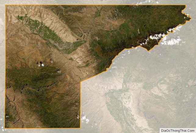
Mesa County Satellite Map
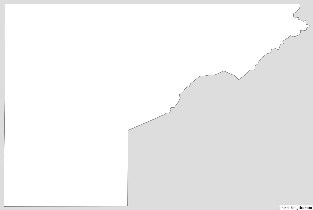
Mesa County Outline Map
See also
Map of Colorado State and its subdivision:- Adams
- Alamosa
- Arapahoe
- Archuleta
- Baca
- Bent
- Boulder
- Broomfield
- Chaffee
- Cheyenne
- Clear Creek
- Conejos
- Costilla
- Crowley
- Custer
- Delta
- Denver
- Dolores
- Douglas
- Eagle
- El Paso
- Elbert
- Fremont
- Garfield
- Gilpin
- Grand
- Gunnison
- Hinsdale
- Huerfano
- Jackson
- Jefferson
- Kiowa
- Kit Carson
- La Plata
- Lake
- Larimer
- Las Animas
- Lincoln
- Logan
- Mesa
- Mineral
- Moffat
- Montezuma
- Montrose
- Morgan
- Otero
- Ouray
- Park
- Phillips
- Pitkin
- Prowers
- Pueblo
- Rio Blanco
- Rio Grande
- Routt
- Saguache
- San Juan
- San Miguel
- Sedgwick
- Summit
- Teller
- Washington
- Weld
- Yuma
- Alabama
- Alaska
- Arizona
- Arkansas
- California
- Colorado
- Connecticut
- Delaware
- District of Columbia
- Florida
- Georgia
- Hawaii
- Idaho
- Illinois
- Indiana
- Iowa
- Kansas
- Kentucky
- Louisiana
- Maine
- Maryland
- Massachusetts
- Michigan
- Minnesota
- Mississippi
- Missouri
- Montana
- Nebraska
- Nevada
- New Hampshire
- New Jersey
- New Mexico
- New York
- North Carolina
- North Dakota
- Ohio
- Oklahoma
- Oregon
- Pennsylvania
- Rhode Island
- South Carolina
- South Dakota
- Tennessee
- Texas
- Utah
- Vermont
- Virginia
- Washington
- West Virginia
- Wisconsin
- Wyoming