Cupertino (/ˌkuːpərˈtiːnoʊ/ KOOP-ər-TEEN-oh) is a city in Santa Clara County, California, United States, directly west of San Jose on the western edge of the Santa Clara Valley with portions extending into the foothills of the Santa Cruz Mountains. The population was 60,381 as of the 2020 census. It is known for being the home of Apple Inc., headquartered at Apple Park.
| Name: | Cupertino city |
|---|---|
| LSAD Code: | 25 |
| LSAD Description: | city (suffix) |
| State: | California |
| County: | Santa Clara County |
| Incorporated: | October 10, 1955 |
| Elevation: | 236 ft (72 m) |
| Total Area: | 11.33 sq mi (29.34 km²) |
| Land Area: | 11.33 sq mi (29.34 km²) |
| Water Area: | 0.00 sq mi (0.00 km²) 0.01% |
| Total Population: | 60,381 |
| Population Density: | 5,300/sq mi (2,100/km²) |
| FIPS code: | 0617610 |
| Website: | www.cupertino.org |
Online Interactive Map
Click on ![]() to view map in "full screen" mode.
to view map in "full screen" mode.
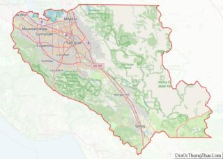
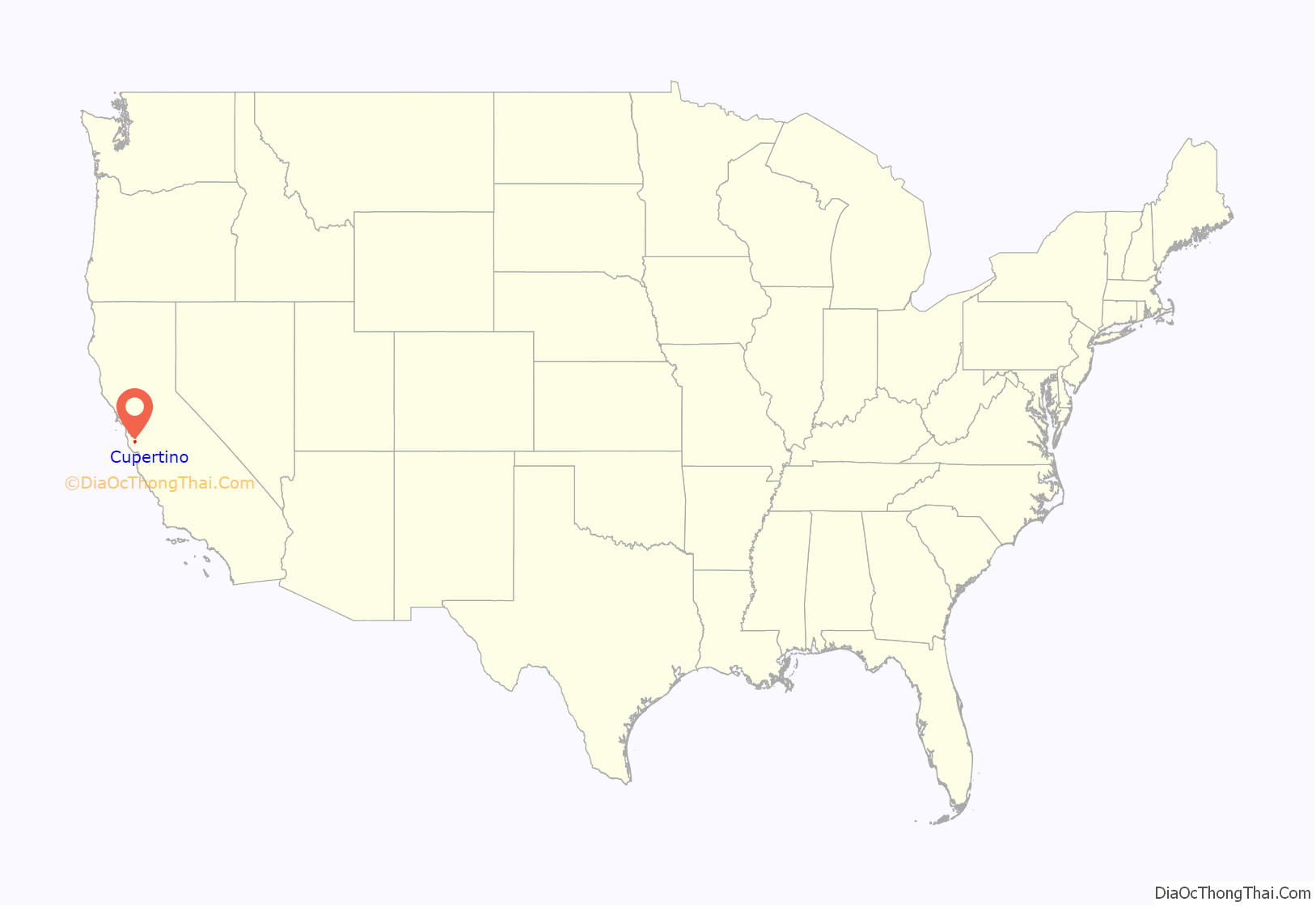
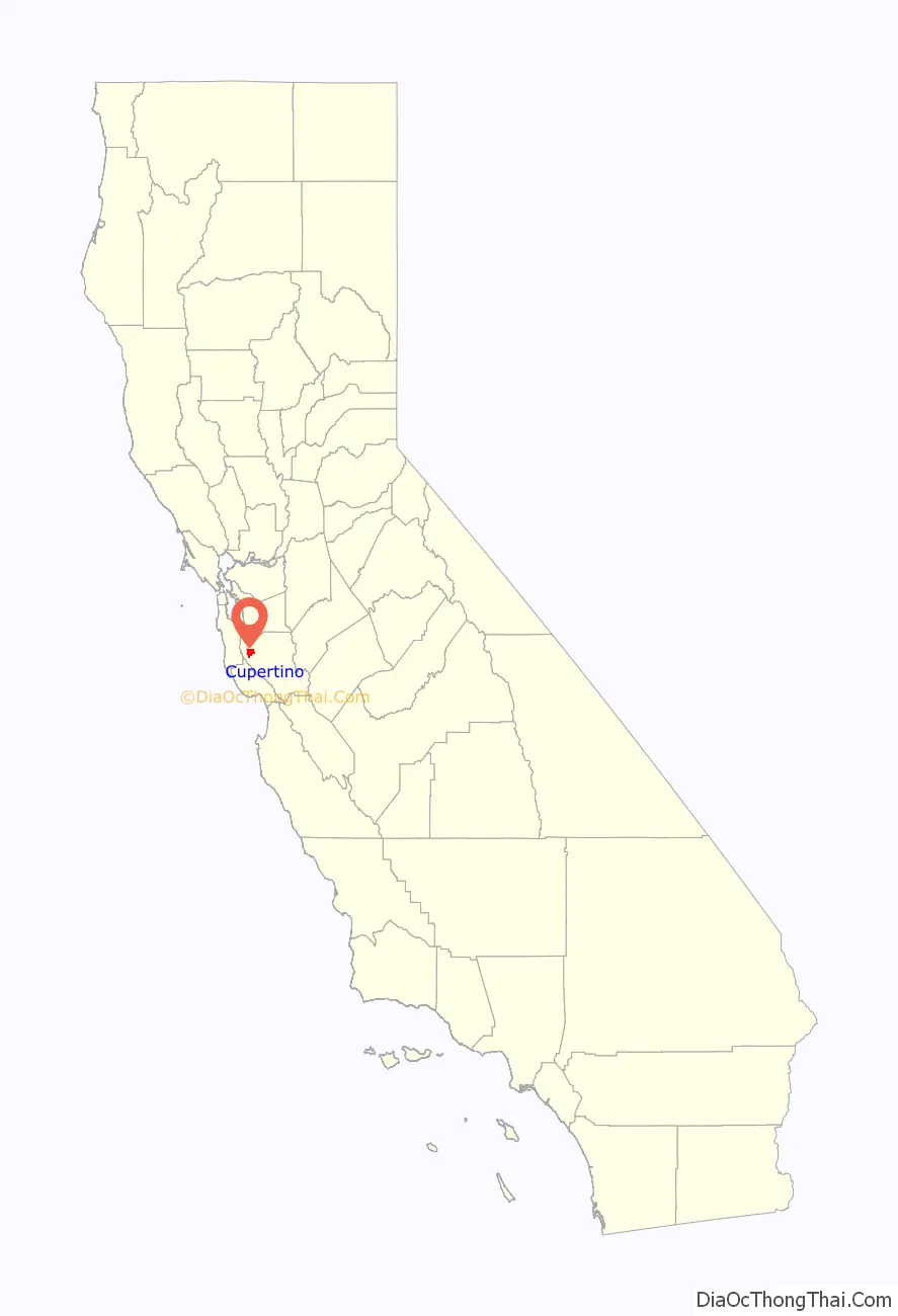
Cupertino location map. Where is Cupertino city?
History
In the 19th century, Cupertino was a small rural village at the crossroads of Stevens Creek Road and Saratoga-Mountain View Road (also known locally as Highway 9; later Saratoga–Sunnyvale Road, and then renamed to De Anza Boulevard within Cupertino city limits). For decades, the intersection was dominated on the southeast corner by the R. Cali Brothers Feed Mill, replaced today with the Cali Mill Plaza and City Hall. Back then, it was known as the West Side and was part of Fremont Township. The primary economic activity was fruit agriculture. Almost all of the land within Cupertino’s present-day boundaries was covered by prune, plum, apricot, and cherry orchards. A winery on Montebello Ridge overlooking the Cupertino valley region was also in operation by the late 19th century.
Soon railroads, electric railways, and dirt roads traversed the West Side farmlands. Monta Vista, Cupertino’s first housing tract, was developed in the mid-20th century as a result of the electric railway’s construction.
After World War II, a population and suburban housing boom dramatically shifted the demographics and economy of the Santa Clara Valley, as the “Valley of Heart’s Delight” was beginning to transform into “Silicon Valley”. In 1954, a rancher, Norman Nathanson, the Cupertino-Monta Vista Improvement Association, and the Fact Finding Committee, began a drive for incorporation. On September 27, 1955, voters approved the incorporation of the city of Cupertino (225 voted “yes” and 183 voted “no”). Cupertino officially became Santa Clara County’s 13th city on October 10, 1955.
A major milestone in Cupertino’s development was the creation by some of the city’s largest landowners of VALLCO Business and Industrial Park in the early 1960s. Of the 25 property owners, 17 decided to pool their land to form VALLCO Park, 6 sold to Varian Associates (property later sold to Hewlett-Packard), and two opted for transplanting to farms elsewhere. The name VALLCO was derived from the names of the principal developers: Varian Associates and the Leonard, Lester, Craft, and Orlando families. A neighborhood outdoor shopping center and, much later, the enclosed Vallco Fashion Park, briefly renamed Cupertino Square, were also developed.
De Anza College opened in 1967. The college, named for Juan Bautista De Anza, occupies a 112-acre (0.45 km) site that was the location of a winery built at the turn of the 20th century, called Beaulieu by its owners, Charles and Ella Baldwin. Their mansion has now become the California History Center. De Anza College now has about 22,000 students.
Housing developments were rapidly constructed in the following years as developers created neighborhoods, including Fairgrove, Garden Gate, Monta Vista, Seven Springs, and other developments. The city is known for its high real estate prices.
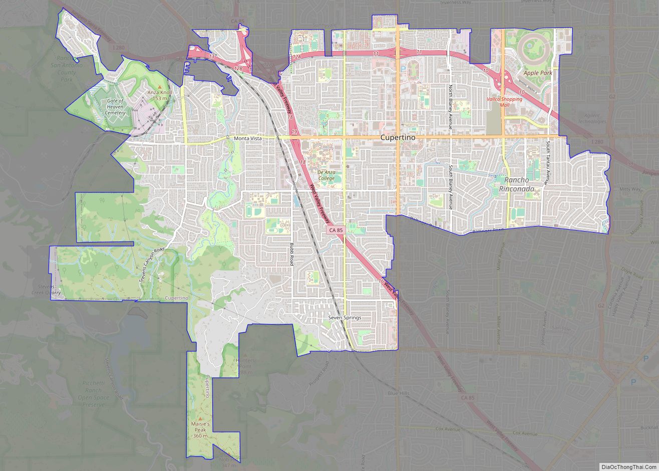
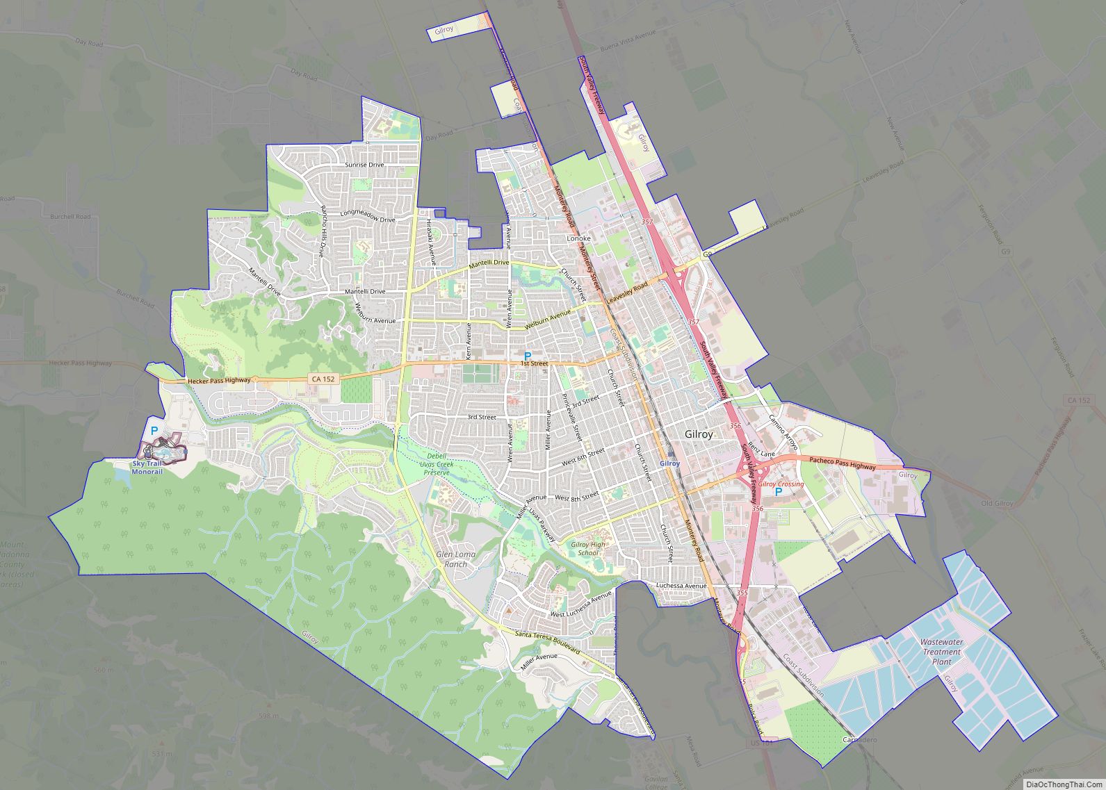
Cupertino Road Map

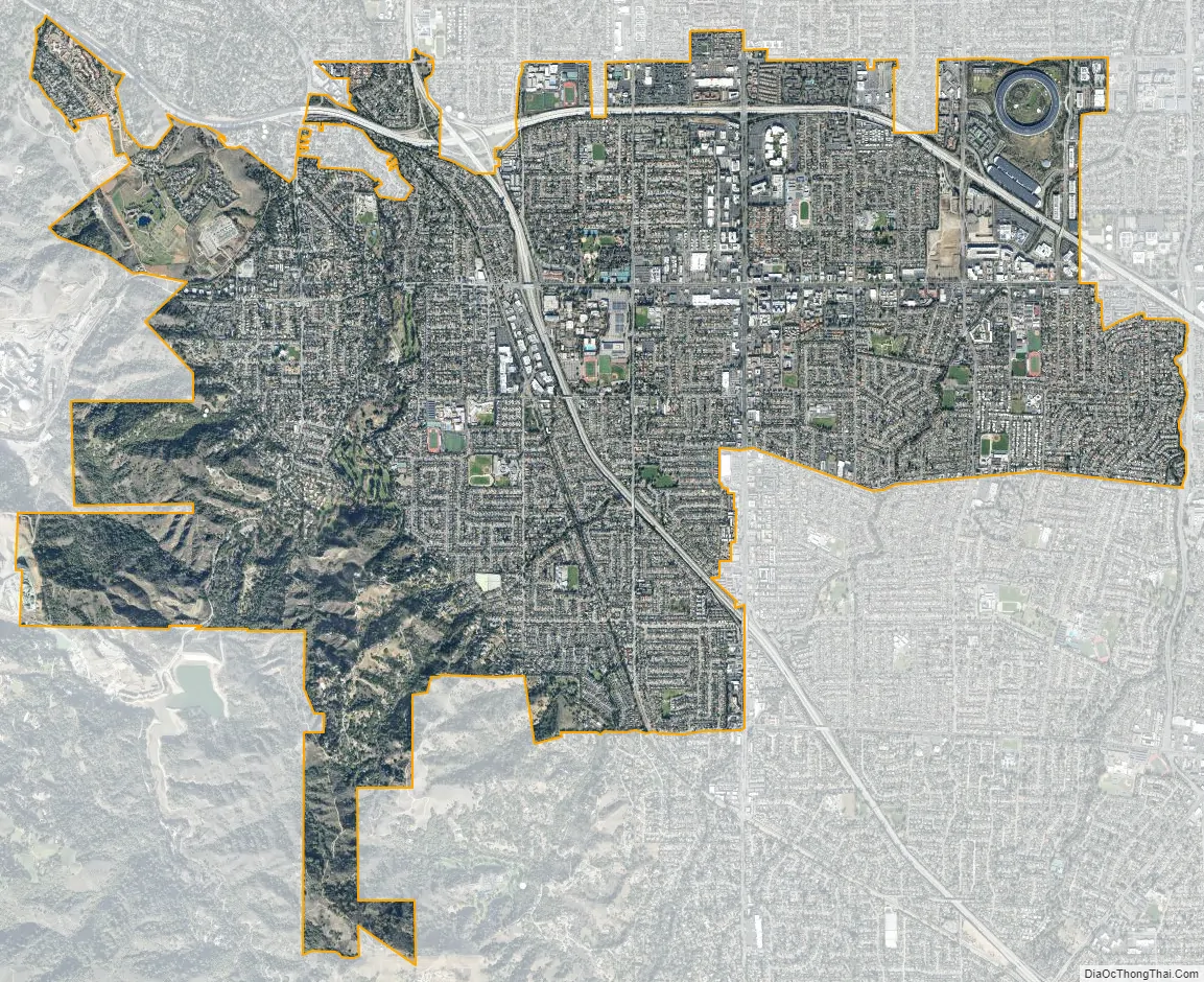
Cupertino city Satellite Map
Geography
Cupertino is located at 37°19′23″N 122°01′55″W / 37.32306°N 122.03194°W / 37.32306; -122.03194 (37.3229978, −122.0321823), at the southern end of the San Francisco Bay. The eastern part of the city, located in the Santa Clara Valley, is flat, while the western part of the city slopes into the Santa Cruz Mountains. Cupertino borders San Jose and Santa Clara to the east, Saratoga to the south, Sunnyvale and Los Altos to the north, and Loyola to the northwest.
Several streams run through Cupertino on their way to south San Francisco Bay, including (from north to south): Permanente Creek, Stevens Creek, San Tomas Aquino Creek and its Smith Creek, the Regnart Creek and Prospect Creek tributaries of Calabazas Creek, and Saratoga Creek.
According to the United States Census Bureau, the city has a total area of 11.3 square miles (29 km), 99.99% of it land and 0.01% of it water.
Climate
Cupertino has a warm-summer Mediterranean climate (Csb under the Köppen climate classification system), with warm to hot, dry summers and cool, wet winters.
Neighborhoods
Cupertino is made up of numerous subdivisions, most of them developed since the 1960s. Most of Cupertino’s contemporary properties were developed around 1960. The area between Stevens Creek Boulevard, Miller Avenue, Bollinger Road, and Lawrence Expressway contains 224 Eichler homes, built during the 1950s. Two of the newest parts of Cupertino are among its oldest housing tracts. Monta Vista and Rancho Rinconada were developed outside of the city’s boundaries in the 1950s and before. Rancho Rinconada was annexed in 1999 and the last part of Monta Vista was annexed in 2004. The neighborhood of Seven Springs is at the southwestern tip of Cupertino and was developed in the late 1980s. The newest and most northwestern neighborhood, Oak Valley, borders Rancho San Antonio Park and was developed around the turn of the millennium.
Cupertino is known for its high housing prices as the majority of residential properties are multimillion-dollar homes as of the priciest housing market peak of 2022, with the entry-point into a single-family home at around 2 million dollars in the Cupertino HS area, and the entry point at around 2.6 million dollars in the Monta Vista HS area. Many smaller homes start from the high $2 millions, mid-size homes start from the mid $3 millions, and larger executive homes start from mid $4 millions and can go up to as much as $7 million, as of the 2022 peak. However, townhouses and condos with similar square footage are relatively less expensive, owing mainly to negligible lot sizes and the many common walls and areas. Over the course of thirteen and a half years since the last late 2008 housing market crash, overall real estate prices have more than tripled.
See also
Map of California State and its subdivision:- Alameda
- Alpine
- Amador
- Butte
- Calaveras
- Colusa
- Contra Costa
- Del Norte
- El Dorado
- Fresno
- Glenn
- Humboldt
- Imperial
- Inyo
- Kern
- Kings
- Lake
- Lassen
- Los Angeles
- Madera
- Marin
- Mariposa
- Mendocino
- Merced
- Modoc
- Mono
- Monterey
- Napa
- Nevada
- Orange
- Placer
- Plumas
- Riverside
- Sacramento
- San Benito
- San Bernardino
- San Diego
- San Francisco
- San Joaquin
- San Luis Obispo
- San Mateo
- Santa Barbara
- Santa Clara
- Santa Cruz
- Shasta
- Sierra
- Siskiyou
- Solano
- Sonoma
- Stanislaus
- Sutter
- Tehama
- Trinity
- Tulare
- Tuolumne
- Ventura
- Yolo
- Yuba
- Alabama
- Alaska
- Arizona
- Arkansas
- California
- Colorado
- Connecticut
- Delaware
- District of Columbia
- Florida
- Georgia
- Hawaii
- Idaho
- Illinois
- Indiana
- Iowa
- Kansas
- Kentucky
- Louisiana
- Maine
- Maryland
- Massachusetts
- Michigan
- Minnesota
- Mississippi
- Missouri
- Montana
- Nebraska
- Nevada
- New Hampshire
- New Jersey
- New Mexico
- New York
- North Carolina
- North Dakota
- Ohio
- Oklahoma
- Oregon
- Pennsylvania
- Rhode Island
- South Carolina
- South Dakota
- Tennessee
- Texas
- Utah
- Vermont
- Virginia
- Washington
- West Virginia
- Wisconsin
- Wyoming