Folsom is a city in Sacramento County, California, United States. It is commonly known for Folsom State Prison, made famous in the song “Folsom Prison Blues” by Johnny Cash, as well as for Folsom Lake. The population was 80,454 at the 2020 census.
Folsom is part of the Sacramento−Arden-Arcade−Roseville Metropolitan Statistical Area.
| Name: | Folsom city |
|---|---|
| LSAD Code: | 25 |
| LSAD Description: | city (suffix) |
| State: | California |
| County: | Sacramento County |
| Incorporated: | April 20, 1946 |
| Elevation: | 220 ft (70 m) |
| Total Area: | 30.15 sq mi (78.09 km²) |
| Land Area: | 27.88 sq mi (72.21 km²) |
| Water Area: | 2.27 sq mi (5.88 km²) 9.69% |
| Total Population: | 80,454 |
| Population Density: | 2,700/sq mi (1,000/km²) |
| Area code: | 916/279 |
| FIPS code: | 0624638 |
| Website: | www.folsom.ca.us |
Online Interactive Map
Click on ![]() to view map in "full screen" mode.
to view map in "full screen" mode.
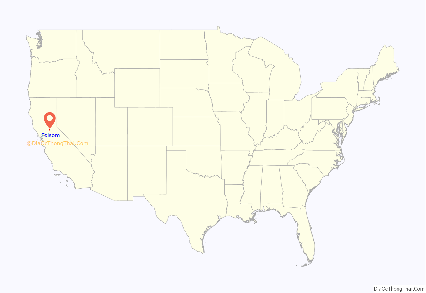
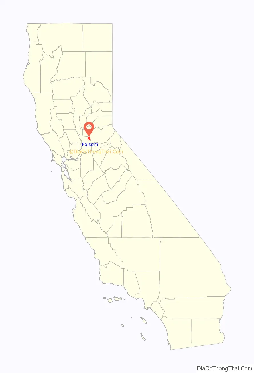
Folsom location map. Where is Folsom city?
History
Folsom is named for Joseph Libbey Folsom who purchased Rancho Rio de los Americanos from the heirs of San Francisco merchant William Alexander Leidesdorff, and laid out the town called Granite City, mostly occupied by gold miners seeking their fortune in the Sierra Nevada foothills. Though few amassed a great deal of wealth, the city prospered due to Joseph Folsom’s lobbying to get a railway to connect the town with Sacramento. Joseph died in 1855, and Granite City was later renamed Folsom in his honor. The railway was abandoned in the 1980s but opened up as the terminus of the Gold Line of Sacramento Regional Transit District’s light rail service in 2005. A few former gold-rush era towns are located within the city limits of Folsom, including Prairie City, Salmon Falls, and Mormon Island (though these towns no longer exist).
Folsom hosted a significant Chinese American community when it was first incorporated, but arsonists burned Folsom’s Chinatown in March 1886, driving Chinese Americans out of town.
The establishment of Folsom Prison came in 1880, when the Livermore family made an agreement with the state to donate land for the prison in exchange for prison labor. They planned to build a hydro-electric dam from the American River for a sawmill. Though the sawmill did not work out, the Livermores soon realized that the natural force of running water could provide enough power to transmit to Sacramento, and the Folsom Powerhouse, now a National Historic Landmark, was opened. At the time it was opened, it had the longest overhead run of electricity (22 miles) in the country. The powerhouse operated until 1952.
Folsom Dam was built in 1956, providing flood control and water rights for the Sacramento Valley and created Folsom Lake. The dam is located on the southwest corner of the lake. The lake is an estimated 4.8 miles (7.7 km) from Granite Bay to the most southern point of Folsom Lake.
In addition to Folsom Dam and Folsom Prison, Folsom is home to Folsom Lake College, Folsom High School, Vista del Lago High School and a historic downtown district. Folsom is also home to the largest private employer in the Sacramento area, Intel.
The Folsom Plan Area is a planned community development area consisting of 3,250 acres (1,320 ha) south of Highway 50 set aside for additional housing, schools and parks along with office and commercial buildings. The plan allows the construction of 11,000 homes resulting in 25,000 additional residents enlarging the city of Folsom by one-third.
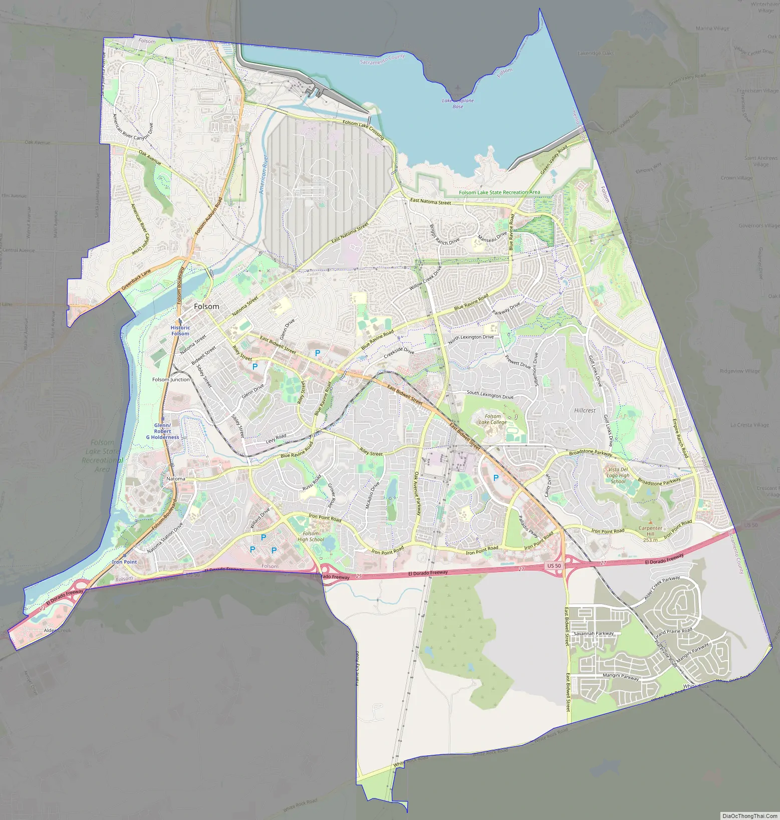
Folsom Road Map
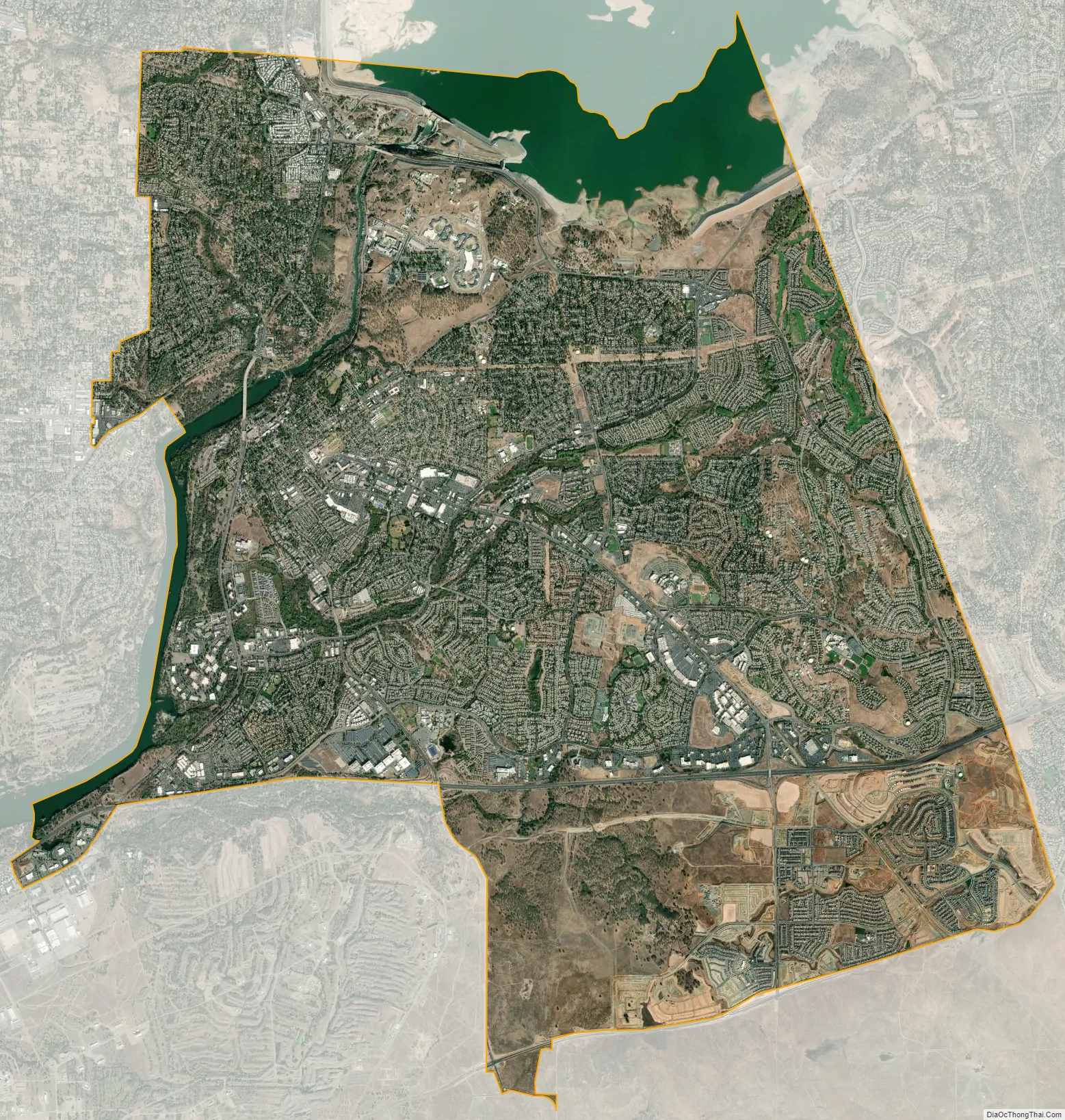
Folsom city Satellite Map
Geography
According to the United States Census Bureau, the city has a total area of 34 square miles (88 km), of which, 31.9 square miles (83 km) of it is land and 2.4 square miles (6.2 km) of it (9.69%) is water, primarily accounted for by Folsom Lake. Folsom is located in the foothills of the Sierra Nevada.
Folsom’s climate is characterized by long, hot, dry summers and cool, rainy winters.
See also
Map of California State and its subdivision:- Alameda
- Alpine
- Amador
- Butte
- Calaveras
- Colusa
- Contra Costa
- Del Norte
- El Dorado
- Fresno
- Glenn
- Humboldt
- Imperial
- Inyo
- Kern
- Kings
- Lake
- Lassen
- Los Angeles
- Madera
- Marin
- Mariposa
- Mendocino
- Merced
- Modoc
- Mono
- Monterey
- Napa
- Nevada
- Orange
- Placer
- Plumas
- Riverside
- Sacramento
- San Benito
- San Bernardino
- San Diego
- San Francisco
- San Joaquin
- San Luis Obispo
- San Mateo
- Santa Barbara
- Santa Clara
- Santa Cruz
- Shasta
- Sierra
- Siskiyou
- Solano
- Sonoma
- Stanislaus
- Sutter
- Tehama
- Trinity
- Tulare
- Tuolumne
- Ventura
- Yolo
- Yuba
- Alabama
- Alaska
- Arizona
- Arkansas
- California
- Colorado
- Connecticut
- Delaware
- District of Columbia
- Florida
- Georgia
- Hawaii
- Idaho
- Illinois
- Indiana
- Iowa
- Kansas
- Kentucky
- Louisiana
- Maine
- Maryland
- Massachusetts
- Michigan
- Minnesota
- Mississippi
- Missouri
- Montana
- Nebraska
- Nevada
- New Hampshire
- New Jersey
- New Mexico
- New York
- North Carolina
- North Dakota
- Ohio
- Oklahoma
- Oregon
- Pennsylvania
- Rhode Island
- South Carolina
- South Dakota
- Tennessee
- Texas
- Utah
- Vermont
- Virginia
- Washington
- West Virginia
- Wisconsin
- Wyoming


