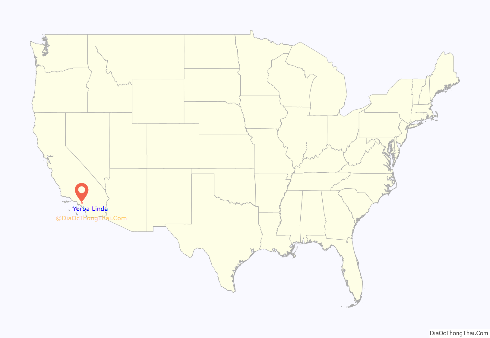
Yorba Linda is a suburban city in northeastern Orange County, California, United States, approximately 37 miles (60 km) southeast of Downtown Los Angeles. It is part of the Los Angeles metropolitan area, and had a population of 68,336 at the 2020 census.
Yorba Linda is known for its connection to Richard Nixon, the 37th president of the United States. His birthplace is a National Historic Landmark, and his presidential library and museum are also located in the city.
| Name: | Yorba Linda city |
|---|---|
| LSAD Code: | 25 |
| LSAD Description: | city (suffix) |
| State: | California |
| County: | Orange County |
| Incorporated: | November 2, 1967 |
| Elevation: | 381 ft (116 m) |
| Total Area: | 19.86 sq mi (51.44 km²) |
| Land Area: | 19.84 sq mi (51.39 km²) |
| Water Area: | 0.02 sq mi (0.05 km²) 2.67% |
| Total Population: | 68,336 |
| Population Density: | 3,400/sq mi (1,300/km²) |
| ZIP code: | 92885-92887 |
| FIPS code: | 0686832 |
| Website: | yorbalindaca.gov |
Online Interactive Map
Click on ![]() to view map in "full screen" mode.
to view map in "full screen" mode.
Yorba Linda location map. Where is Yorba Linda city?

History
Indigenous
The area is the home of the Tongva, Luiseño, and Juaneño tribal nations, who were there “as early as 4,000 years ago.” The Tongva defined their world as Tovaangar, a nation which “extended from Palos Verdes to San Bernardino, from Saddleback Mountain to the San Fernando Valley” and included the entire territory of present-day Yorba Linda. Spanish colonization between 1769 and 1840 brought “disease, invasive species, and livestock” into the area, which “upended the ecological balance of the region and forced the Tongva to resettle around three missions.” The village of Hutuknga was located in the area of Yorba Linda.
Early years
In 1810, the Spanish crown granted José Antonio Yorba 63,414 acres of land, which “spread across much of modern-day Orange County.” In 1834, following Mexico’s independence from Spain, Yorba’s most successful son, Bernardo Yorba (after whom the city would later be named), was granted the 13,328-acre (53.94 km) Rancho Cañón de Santa Ana by Mexican governor José Figueroa. Most of this original land was retained after the Mexican–American War in 1848 by descendants of the Yorba family. A portion of the city’s land is still owned and developed by descendants of Samuel Kraemer, who acquired it through his marriage to Angelina Yorba, the great-granddaughter of Bernardo Yorba. The site of the Bernardo Yorba Hacienda, referred to as the Don Bernardo Yorba Ranch House Site, is listed as a California Historical Landmark.
Near that same site sits the second oldest private cemetery in the county, the historic Yorba Cemetery. The land was given to the Roman Catholic Archdiocese of Los Angeles by Bernardo Yorba in 1858 since Orange County was not established out of Los Angeles County as a separate county until 1889. The cemetery closed in 1939 and was subsequently vandalized; however, in the 1960s, the Orange County Board of Supervisors took possession of the property to repair the damage, and tours are now available one day per month.
Agricultural era
A section of the land was sold in 1907 by the Yorba family to Fullerton businessman Jacob Stern, who used the land for barley fields and sheep grazing. Stern subsequently sold the tract to the Janss Investment Company, which first called the area Yorba Linda, and proceeded to subdivide the land and sell it for agriculture and manufacturing. In 1910, the agricultural aspect of that endeavor materialized, and the first of many lemon and orange groves were planted: at the time, the population was still less than 50. A year later, The Pacific Telephone & Telegraph Company began serving Yorba Linda, and the first school was constructed.
In 1912, several things happened in Yorba Linda: it received its first post office; the Yorba Linda Citrus Association was founded; the Southern California Edison Company began providing electricity; and the first church was constructed. The area that would later become downtown was also connected to Los Angeles by the Pacific Electric Railway in 1912, primarily for citrus transport.
In 1913, Richard Nixon was born in Yorba Linda, the chamber of commerce was set up, a library opened as part of the school, and avocado trees were first planted. A year later, a separate district was established for the library system.
In 1915, the Susanna Bixby Bryant Ranch house was constructed. It is a museum that is open to the public.
In 1917, the first street was paved, Yorba Linda Boulevard. The Yorba Linda Star began publication also. It has since become an online section of the OC Register. A printed version of the Star is available at various city buildings free of charge and is delivered to every household in Yorba Linda each Thursday. Past articles are on microfilm at the Yorba Linda Public Library.
The population exceeded 300 for the first time prior to 1920. In 1929, the citrus association’s packing house burned down, as it was made of wood. It reopened the next year. During this period, the eastern two-thirds of Yorba Linda (east of the Yorba Linda Country Club) remained part of cattle and agricultural ranches controlled by pioneer families such as the Yorba, de los Reyes, Kraemer, Travis, Dominguez, Friend, and Bryant ranches.
From 1943 to 1958, “approximately seventy thousand braceros were transported to Orange County,” used by employers to service citrus crops. Braceros lived in temporary housing projects referred to as “camps,” which were policed by local deputies throughout the county. The townspeople of Yorba Linda “refused to allow the housing of braceros in their city, forcing the nearby town of Placentia to board them within the segregated Mexican colonia.”
Population growth
The small town had grown significantly by the 1960s, with more than 1,000 residents by the 1960 Census. Three annexation attempts were made by adjoining cities: Brea in 1958 and Anaheim and Placentia in 1963. These experiences culminated in incorporation, which occurred in 1967.
The new city implemented a municipal general plan in 1972. By the 1980 Census, the population was nearing 30,000. Within ten years it exceeded 50,000.
In 1990, the Birthplace of Richard Nixon opened as a public library and museum. It would later become a federal presidential library. In 1994, the community center opened.
With over 20,000 housing units in the city as of 2016, many residents now oppose further urban development and have organized to reduce traffic congestion. The Yorba Linda Preservation Foundation seeks to protect historical buildings in the city.
Recent times
In 2005, CNN ranked Yorba Linda as the 21st best place in the U.S. to live. In 2012, Yorba Linda was ranked 42nd on Money magazine’s list of America’s best small cities. Similarly, in an article by CNN Money, Yorba Linda was one of the richest U.S. cities and the richest in Orange County as reported by the Census data, showing a median household income of more than $120K: “Among towns of between 65,000 and 250,000 in population, Yorba Linda, California, where six-figure incomes are the rule, had the highest median income at $121,075”. Yorba Linda has been identified as one of the richest cities in the U.S. by the U.S. Census Bureau, which shows a median household income of $121,075, higher than any other city in 2006.
In 2007, Yorba Linda High School broke ground after many years of planning.
In November 2008, eastern Yorba Linda suffered from fires that destroyed 113 homes and damaged 50 others. The destruction was due largely to erratic winds causing embers to fly up to half a mile away.
On February 3, 2019, at approximately 1:45 pm, a twin engine 1981 Cessna (N414RS) on route from Fullerton Municipal Airport to Nevada crashed from roughly 7500 ft into a single family residence in the 19700 block of Crestknoll Drive near Glenknoll Elementary School. The pilot (75-year-old Antonio Pastini) and four individuals in the residence were killed.
Yorba Linda Road Map

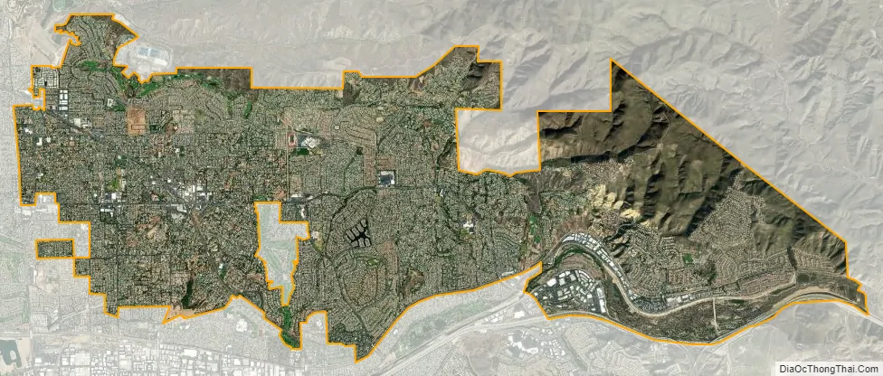
Yorba Linda city Satellite Map
Geography
According to the United States Census Bureau, the city has a total area of 20.0 square miles (52 km). 19.5 square miles (51 km) of which is land and 0.5 square miles (1.3 km) (2.67%), water.
It has two ZIP codes, 92886 and 92887, covering approximately the western and eastern portions of the city, respectively. A third, 92885, exists exclusively for PO Boxes. The city is served by area codes 657 and 714 in a geographical overlay situation, in which 714 numbers were running out, so that 657 numbers are now also being issued in the same area. Eleven-digit dialing is therefore now required for local calls.
It is bordered by Anaheim on the south, Placentia on the west and southwest, Brea on the northwest, Chino Hills State Park on the north, and Corona on the east.
The two nearest seismic faults are the Whittier Fault and the Chino Fault, both of which are part of the Elsinore Fault Zone.
Climate
The city receives 14 inches (360 mm) to 15 inches (380 mm) of rain per year on average. The average temperatures in January and July are 55 °F (13 °C) and 71 °F (22 °C), respectively, with the overall average for the year at 63 °F (17 °C). Humidity, likewise respectively, is 52%, 60%, and 56% on average. Yorba Linda is situated in a transition zone between a hot-summer Mediterranean climate (Csa) and a hot semi-arid climate (BSh).
See also
Map of California State and its subdivision:- Alameda
- Alpine
- Amador
- Butte
- Calaveras
- Colusa
- Contra Costa
- Del Norte
- El Dorado
- Fresno
- Glenn
- Humboldt
- Imperial
- Inyo
- Kern
- Kings
- Lake
- Lassen
- Los Angeles
- Madera
- Marin
- Mariposa
- Mendocino
- Merced
- Modoc
- Mono
- Monterey
- Napa
- Nevada
- Orange
- Placer
- Plumas
- Riverside
- Sacramento
- San Benito
- San Bernardino
- San Diego
- San Francisco
- San Joaquin
- San Luis Obispo
- San Mateo
- Santa Barbara
- Santa Clara
- Santa Cruz
- Shasta
- Sierra
- Siskiyou
- Solano
- Sonoma
- Stanislaus
- Sutter
- Tehama
- Trinity
- Tulare
- Tuolumne
- Ventura
- Yolo
- Yuba
- Alabama
- Alaska
- Arizona
- Arkansas
- California
- Colorado
- Connecticut
- Delaware
- District of Columbia
- Florida
- Georgia
- Hawaii
- Idaho
- Illinois
- Indiana
- Iowa
- Kansas
- Kentucky
- Louisiana
- Maine
- Maryland
- Massachusetts
- Michigan
- Minnesota
- Mississippi
- Missouri
- Montana
- Nebraska
- Nevada
- New Hampshire
- New Jersey
- New Mexico
- New York
- North Carolina
- North Dakota
- Ohio
- Oklahoma
- Oregon
- Pennsylvania
- Rhode Island
- South Carolina
- South Dakota
- Tennessee
- Texas
- Utah
- Vermont
- Virginia
- Washington
- West Virginia
- Wisconsin
- Wyoming


