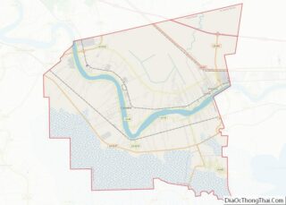
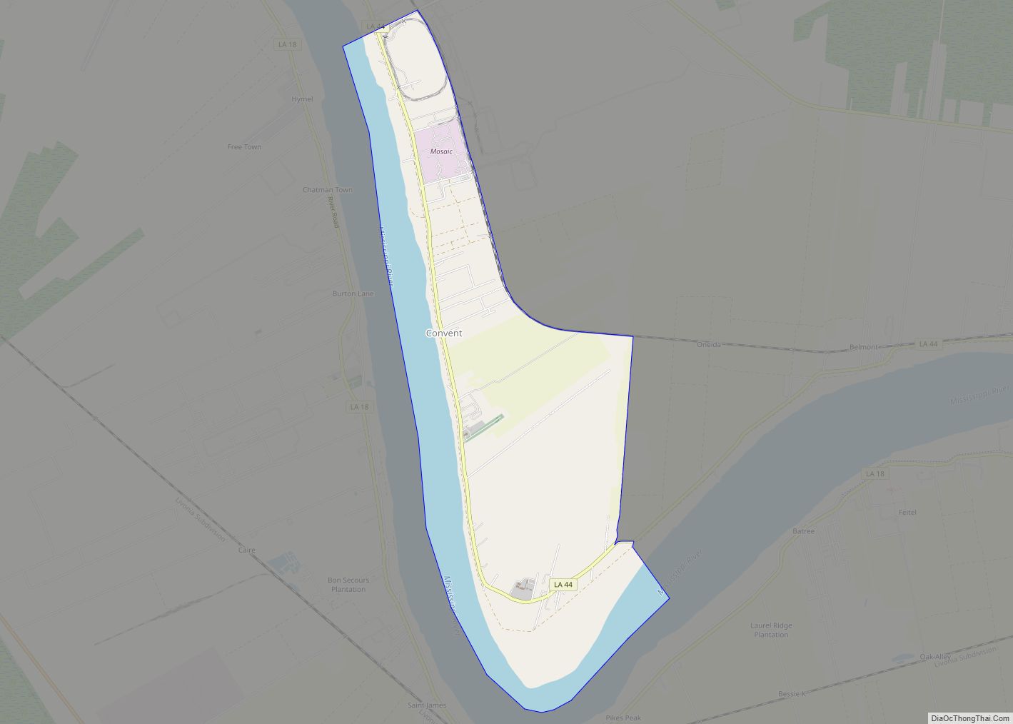
Convent (French: Couvent) is a census-designated place in and the parish seat of St. James Parish, Louisiana, United States. It has been the parish seat since 1869. It is part of the New Orleans Metropolitan Area .
As of the 2010 census, its population was 711, and 2018 estimates put the parish at 2174 people, 61% of whom were African American. The 2018 median household income was $52,292 above the state’s average.
| Name: | Convent CDP |
|---|---|
| LSAD Code: | 57 |
| LSAD Description: | CDP (suffix) |
| State: | Louisiana |
| County: | St. James Parish |
| Elevation: | 20 ft (6 m) |
| Total Area: | 5.33 sq mi (13.81 km²) |
| Land Area: | 3.89 sq mi (10.07 km²) |
| Water Area: | 1.44 sq mi (3.74 km²) |
| Total Population: | 483 |
| Population Density: | 124.26/sq mi (47.97/km²) |
| ZIP code: | 70723 |
| Area code: | 225 |
| FIPS code: | 2217180 |
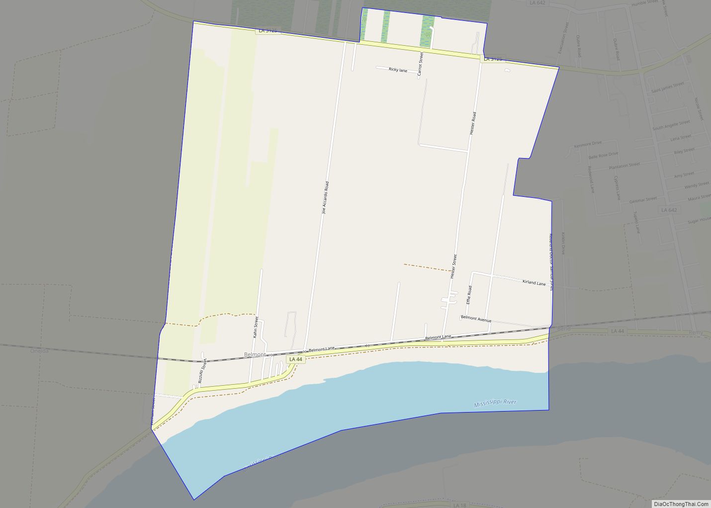
Online Interactive Map
Click on ![]() to view map in "full screen" mode.
to view map in "full screen" mode.
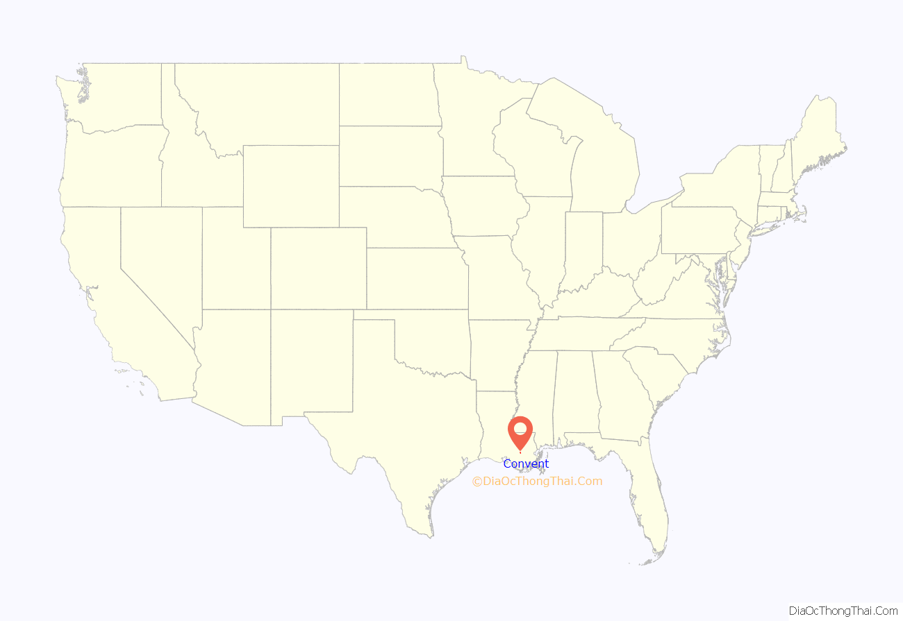
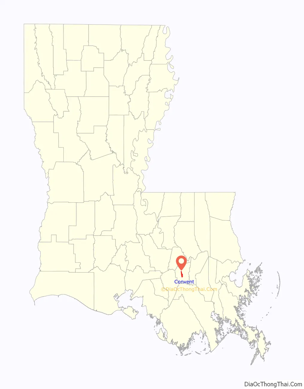
Convent location map. Where is Convent CDP?
History
The community was originally named Baron when first settled 1722 to 1739. It was the location of the St. Michael’s Convent (Order of the Sacred Heart) from 1825 to 1932 and the location of Jefferson College, 1831 to 1931.
St. Michael’s Church Historic District and Jefferson College (now a Jesuit retreat center called Manresa House of Retreats), along with several historic homes in Convent, are listed on the National Register of Historic Places.
On February 23, 2016, an extremely large wedge tornado hit the Sugar Hill RV park with two dead and several people injured.
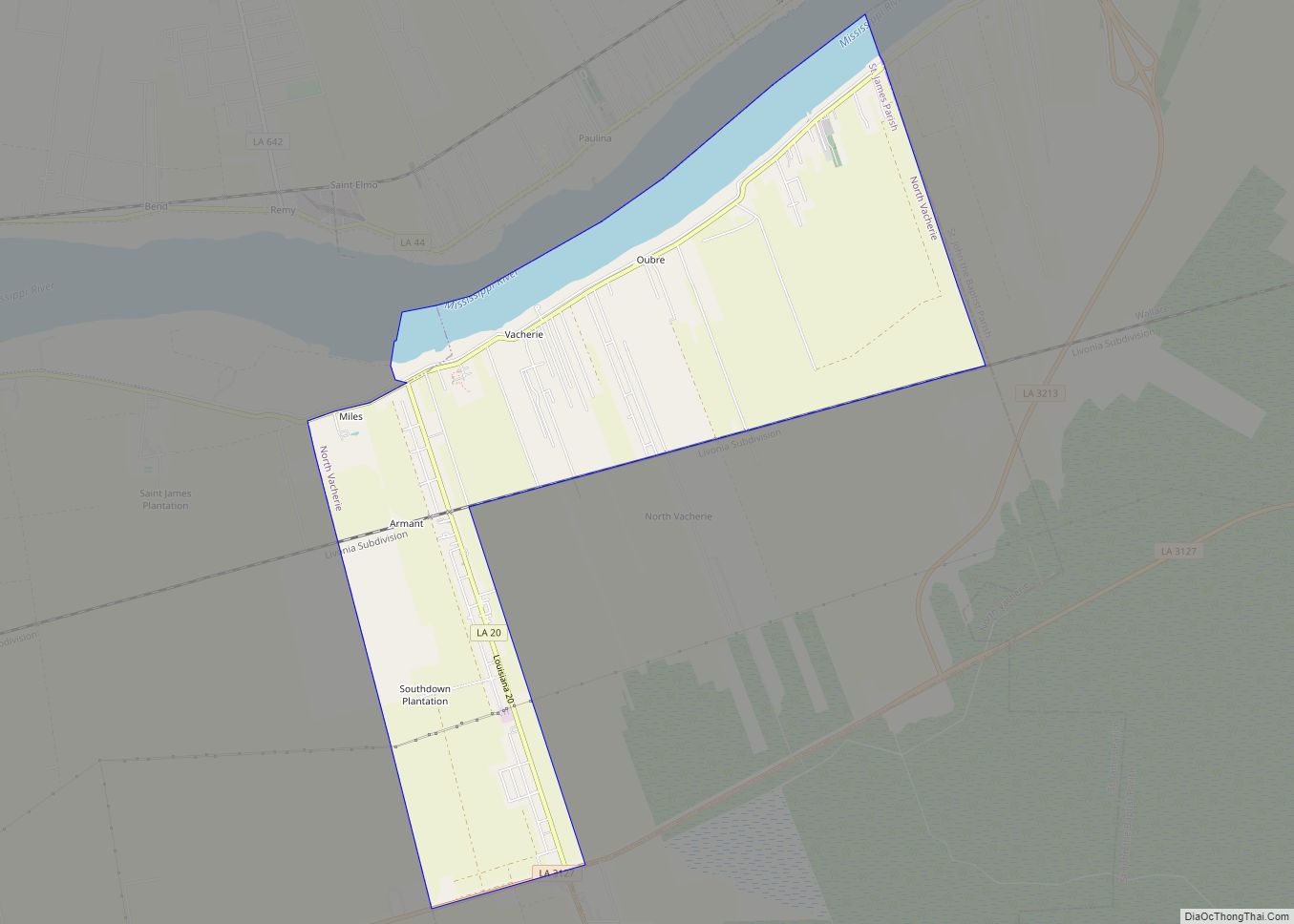
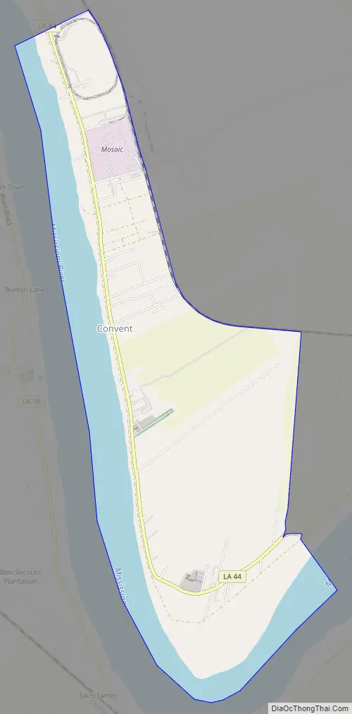
Convent Road Map
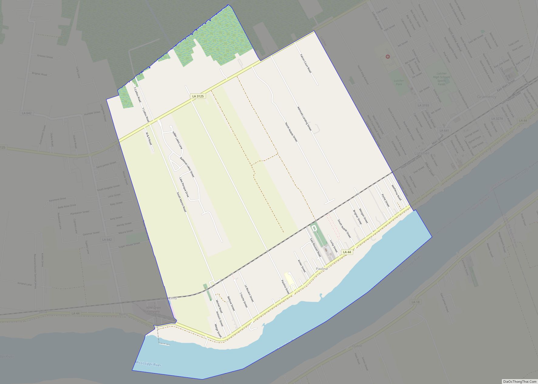
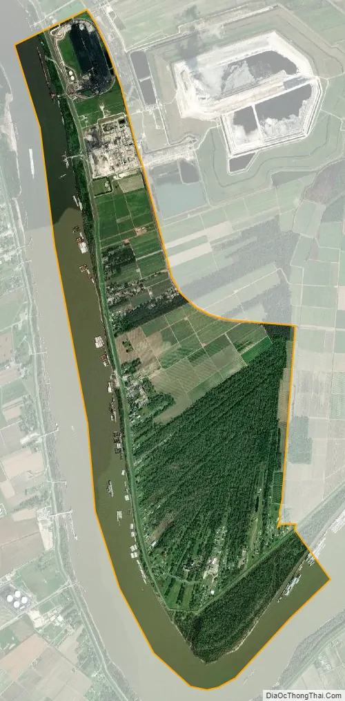
Convent city Satellite Map
Geography
Located on the east bank of the Mississippi River, the town is only 16 feet (4.9 meters) above sea level. Convent has an area of 5.331 miles (8.579 km), of which 3.887 miles (6.256 km) is land and 1.444 miles (2.324 km) is water.
See also
Map of Louisiana State and its subdivision:- Acadia
- Allen
- Ascension
- Assumption
- Avoyelles
- Beauregard
- Bienville
- Bossier
- Caddo
- Calcasieu
- Caldwell
- Cameron
- Catahoula
- Claiborne
- Concordia
- De Soto
- East Baton Rouge
- East Carroll
- East Feliciana
- Evangeline
- Franklin
- Grant
- Iberia
- Iberville
- Jackson
- Jefferson
- Jefferson Davis
- La Salle
- Lafayette
- Lafourche
- Lincoln
- Livingston
- Madison
- Morehouse
- Natchitoches
- Orleans
- Ouachita
- Plaquemines
- Pointe Coupee
- Rapides
- Red River
- Richland
- Sabine
- Saint Bernard
- Saint Charles
- Saint Helena
- Saint James
- Saint John the Baptist
- Saint Landry
- Saint Martin
- Saint Mary
- Saint Tammany
- Tangipahoa
- Tensas
- Terrebonne
- Union
- Vermilion
- Vernon
- Washington
- Webster
- West Baton Rouge
- West Carroll
- West Feliciana
- Winn
- Alabama
- Alaska
- Arizona
- Arkansas
- California
- Colorado
- Connecticut
- Delaware
- District of Columbia
- Florida
- Georgia
- Hawaii
- Idaho
- Illinois
- Indiana
- Iowa
- Kansas
- Kentucky
- Louisiana
- Maine
- Maryland
- Massachusetts
- Michigan
- Minnesota
- Mississippi
- Missouri
- Montana
- Nebraska
- Nevada
- New Hampshire
- New Jersey
- New Mexico
- New York
- North Carolina
- North Dakota
- Ohio
- Oklahoma
- Oregon
- Pennsylvania
- Rhode Island
- South Carolina
- South Dakota
- Tennessee
- Texas
- Utah
- Vermont
- Virginia
- Washington
- West Virginia
- Wisconsin
- Wyoming