Delhi (/ˈdɛl.haɪ/), originally called Deerfield, is a town in Richland Parish, Louisiana, United States. As of the 2020 census, the town population was 2,622.
| Name: | Delhi town |
|---|---|
| LSAD Code: | 43 |
| LSAD Description: | town (suffix) |
| State: | Louisiana |
| County: | Richland Parish |
| Elevation: | 89 ft (27 m) |
| Total Area: | 2.94 sq mi (7.62 km²) |
| Land Area: | 2.87 sq mi (7.44 km²) |
| Water Area: | 0.07 sq mi (0.19 km²) |
| Total Population: | 2,622 |
| Population Density: | 912.95/sq mi (352.55/km²) |
| Area code: | 318 |
| FIPS code: | 2220190 |
| Website: | townofdelhi.municipalimpact.com |
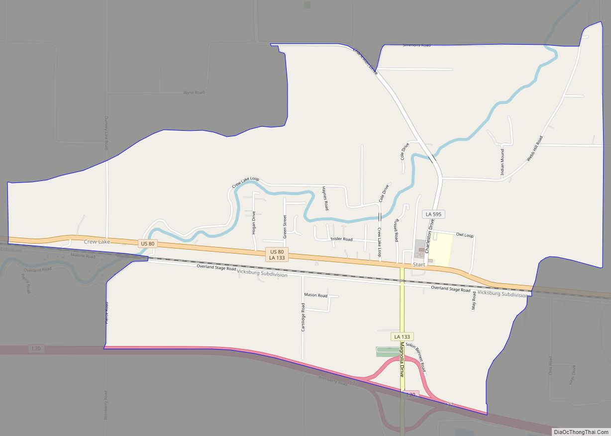
Online Interactive Map
Click on ![]() to view map in "full screen" mode.
to view map in "full screen" mode.
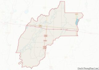
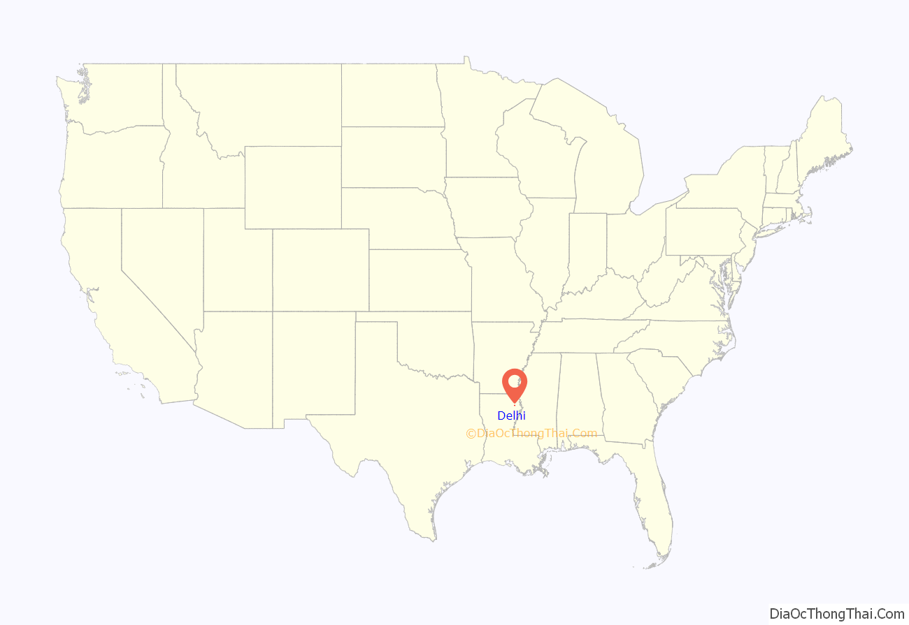
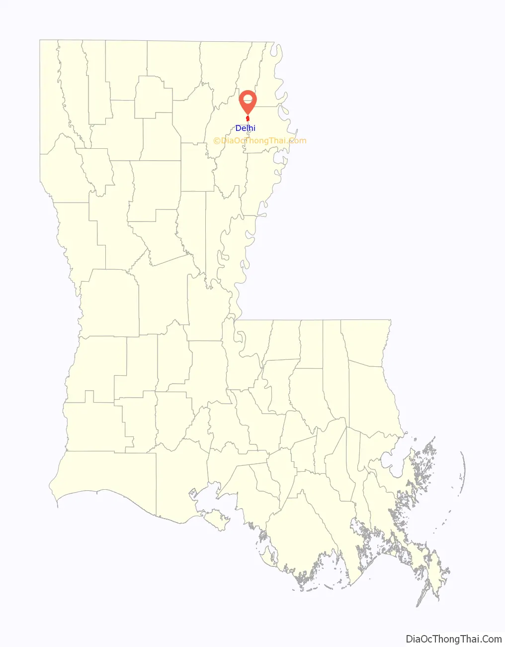
Delhi location map. Where is Delhi town?
History
In the 1940s, Delhi was the center of a large natural gas boom. Numerous workers came to work in the industry. Several functioning gas fields still surround the town.
From 1968-1969, Delhi Fire Department was home to the now defunct Louisiana State Police – Troop O. The site was abandoned in 1969 after thirteen months’ operation, with state services reverting to be provided by Troop F in Monroe.
On February 21, 1971, as part of the February 1971 Mississippi Delta tornado outbreak, Louisiana’s only recorded F5 tornado struck outside of Delhi. It resulted in forty-seven deaths and was the deadliest F5 tornado to hit the United States since the Jackson, Mississippi, Candlestick Park tornado in 1966. It was the earliest confirmed F5 tornado during a year.
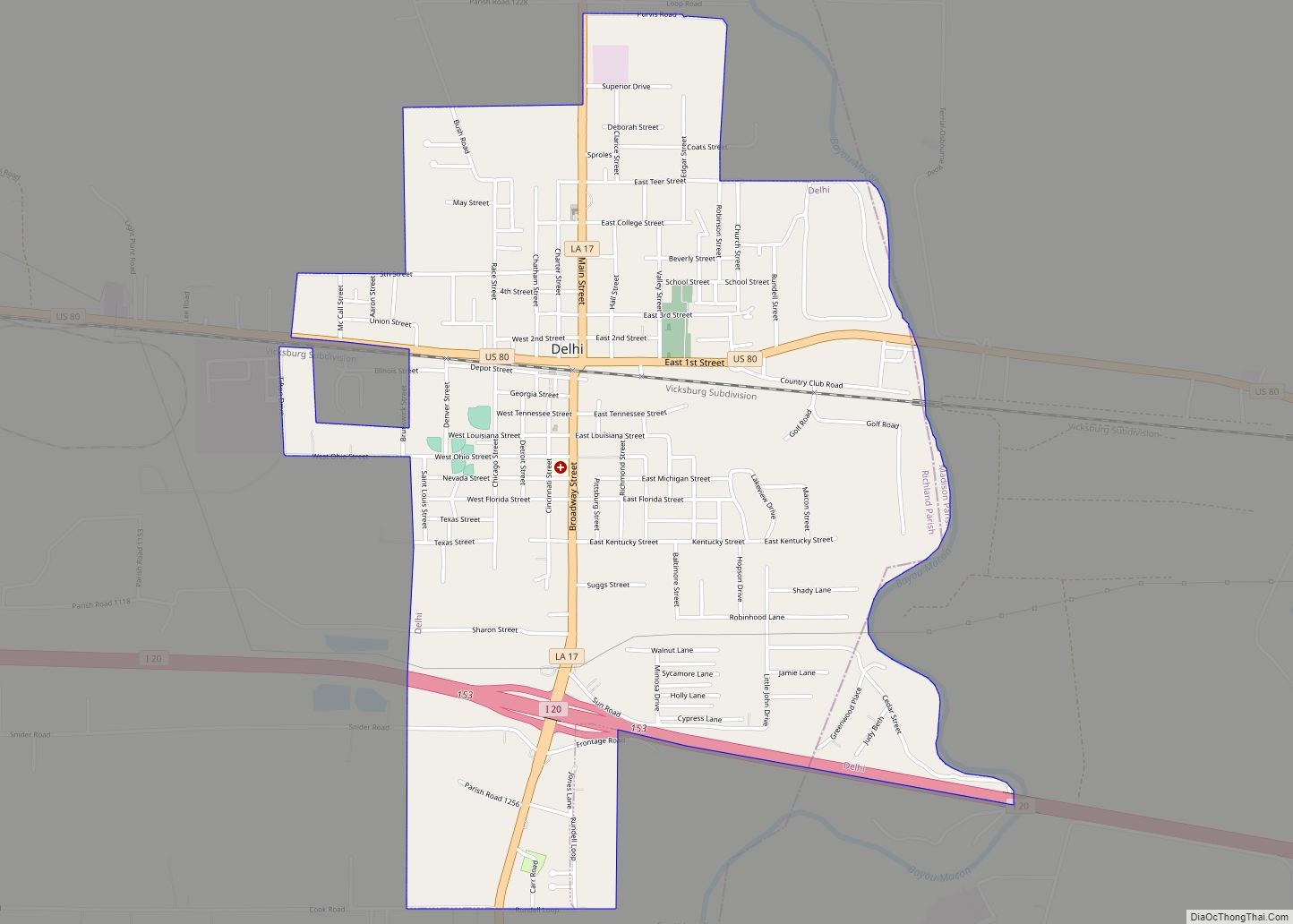
Delhi Road Map
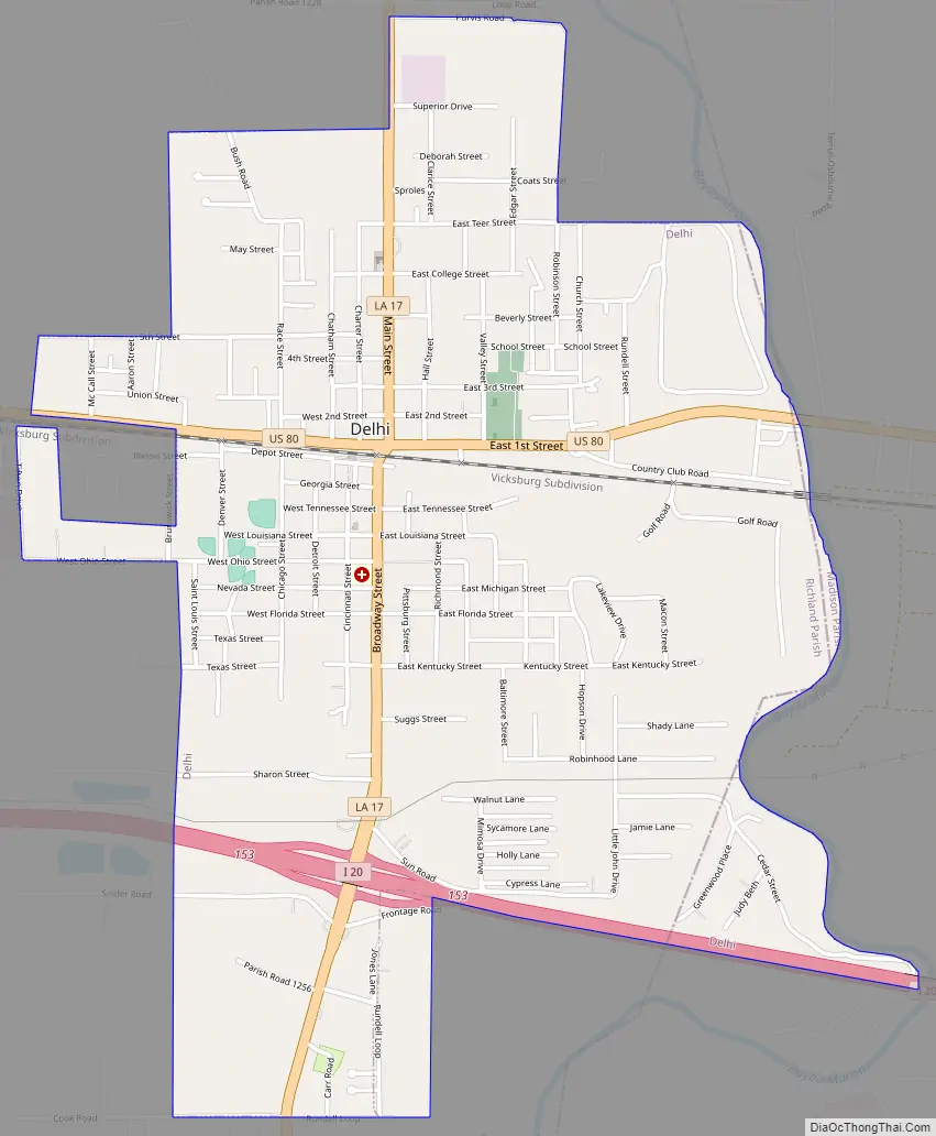
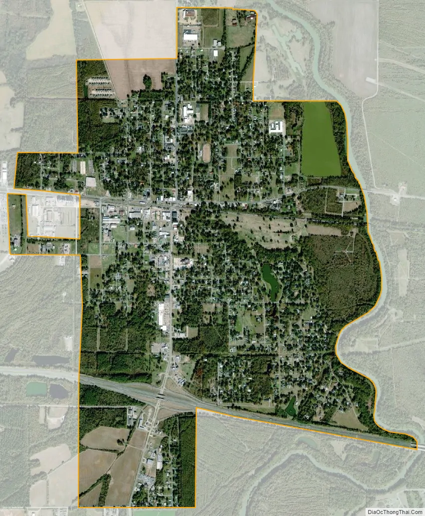
Delhi city Satellite Map
Geography
Delhi is located at 32°27′21″N 91°29′36″W / 32.45583°N 91.49333°W / 32.45583; -91.49333 (32.455948, -91.493345). The town lies at the confluence of U.S. Route 80 and Louisiana Highway 17, and near to Interstate 20.
According to the United States Census Bureau, the town has a total area of 2.6 square miles (6.7 km), of which 2.5 square miles (6.5 km) is land and 0.1 square mile (2.33%) is water.
The elevation of 89 ft (27 m) spared Delhi from the brunt of the Great Mississippi Flood of 1927 that destroyed most of the surrounding Mississippi River Delta area.
The Poverty Point Reservoir, which hosts the acclaimed Black Bear Golf Club and the Poverty Point Reservoir State Park, is located just north of Delhi on Louisiana State Highway 17 near Warden. The reservoir project was pushed to fruition by State Senator Francis C. Thompson of Delhi.
See also
Map of Louisiana State and its subdivision:- Acadia
- Allen
- Ascension
- Assumption
- Avoyelles
- Beauregard
- Bienville
- Bossier
- Caddo
- Calcasieu
- Caldwell
- Cameron
- Catahoula
- Claiborne
- Concordia
- De Soto
- East Baton Rouge
- East Carroll
- East Feliciana
- Evangeline
- Franklin
- Grant
- Iberia
- Iberville
- Jackson
- Jefferson
- Jefferson Davis
- La Salle
- Lafayette
- Lafourche
- Lincoln
- Livingston
- Madison
- Morehouse
- Natchitoches
- Orleans
- Ouachita
- Plaquemines
- Pointe Coupee
- Rapides
- Red River
- Richland
- Sabine
- Saint Bernard
- Saint Charles
- Saint Helena
- Saint James
- Saint John the Baptist
- Saint Landry
- Saint Martin
- Saint Mary
- Saint Tammany
- Tangipahoa
- Tensas
- Terrebonne
- Union
- Vermilion
- Vernon
- Washington
- Webster
- West Baton Rouge
- West Carroll
- West Feliciana
- Winn
- Alabama
- Alaska
- Arizona
- Arkansas
- California
- Colorado
- Connecticut
- Delaware
- District of Columbia
- Florida
- Georgia
- Hawaii
- Idaho
- Illinois
- Indiana
- Iowa
- Kansas
- Kentucky
- Louisiana
- Maine
- Maryland
- Massachusetts
- Michigan
- Minnesota
- Mississippi
- Missouri
- Montana
- Nebraska
- Nevada
- New Hampshire
- New Jersey
- New Mexico
- New York
- North Carolina
- North Dakota
- Ohio
- Oklahoma
- Oregon
- Pennsylvania
- Rhode Island
- South Carolina
- South Dakota
- Tennessee
- Texas
- Utah
- Vermont
- Virginia
- Washington
- West Virginia
- Wisconsin
- Wyoming