Golden Meadow French: Canal Yankee is a town along Bayou Lafourche in Lafourche Parish, Louisiana, United States. The population was 1,761 in 2020. It is part of the Houma–Bayou Cane–Thibodaux metropolitan statistical area. Its main source of revenue is the oil and gas industry. The fishing and seafood industries also have strong economic impacts, with charter fishing, restaurants, and lodging actively serving patrons. The town was once known as a speed trap, but it has since been bypassed by Hwy 3235 and city traffic has been reduced to mostly locals; however, the speed limit is reduced to 50 mph on Hwy 3235 and said highway is still patrolled heavily. As in other places in Louisiana, there is a noticeable presence of Cajun culture, music, and cuisine.
The Golden Meadow name was given by the original land grant owners, Benjamin and Louisa Hobbs Barker of Illinois. In 1839, they named it so because of the yellow flowers growing everywhere. They hoped to become wealthy selling lots to French and English settlers, but abandoned the plan.
| Name: | Golden Meadow town |
|---|---|
| LSAD Code: | 43 |
| LSAD Description: | town (suffix) |
| State: | Louisiana |
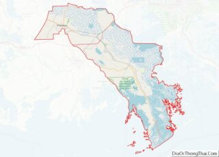
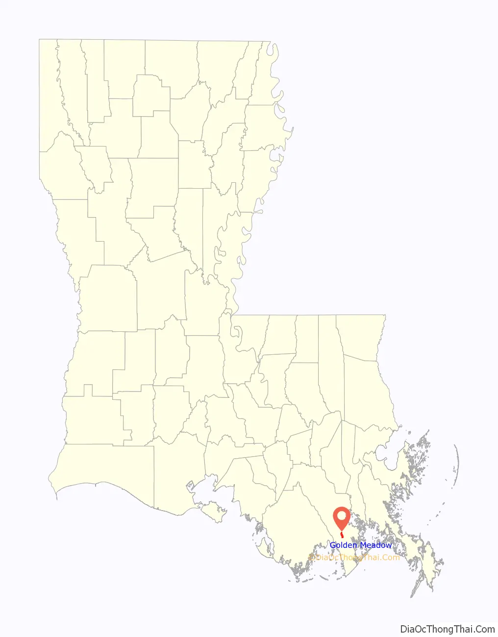
| County: | Lafourche Parish |
| Elevation: | 0 ft (0 m) |
| Total Area: | 2.93 sq mi (7.59 km²) |
| Land Area: | 2.45 sq mi (6.34 km²) |
| Water Area: | 0.48 sq mi (1.25 km²) |
| Total Population: | 1,761 |
| Population Density: | 719.66/sq mi (277.91/km²) |
| Area code: | 985 |
| FIPS code: | 2229640 |
Online Interactive Map
Click on ![]() to view map in "full screen" mode.
to view map in "full screen" mode.
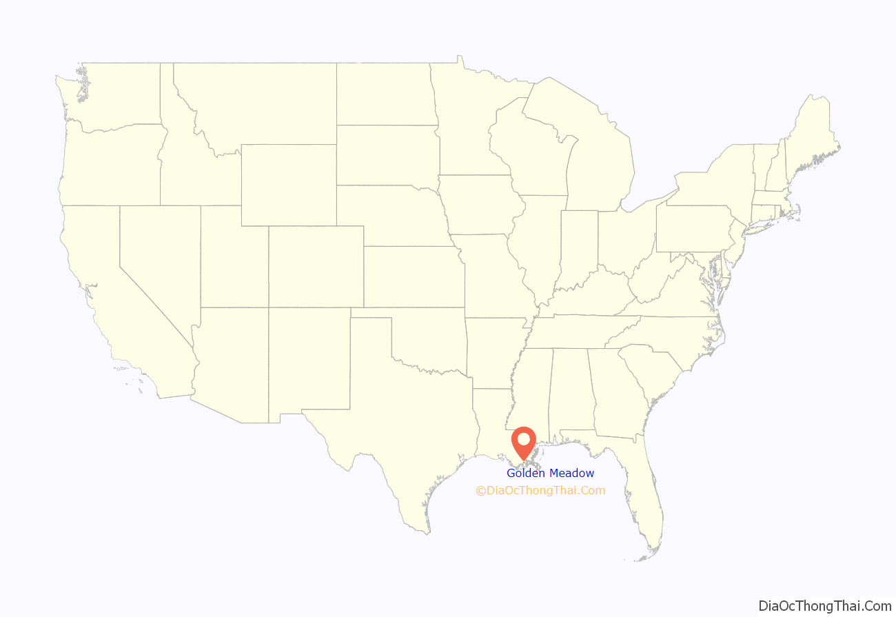
Golden Meadow location map. Where is Golden Meadow town?
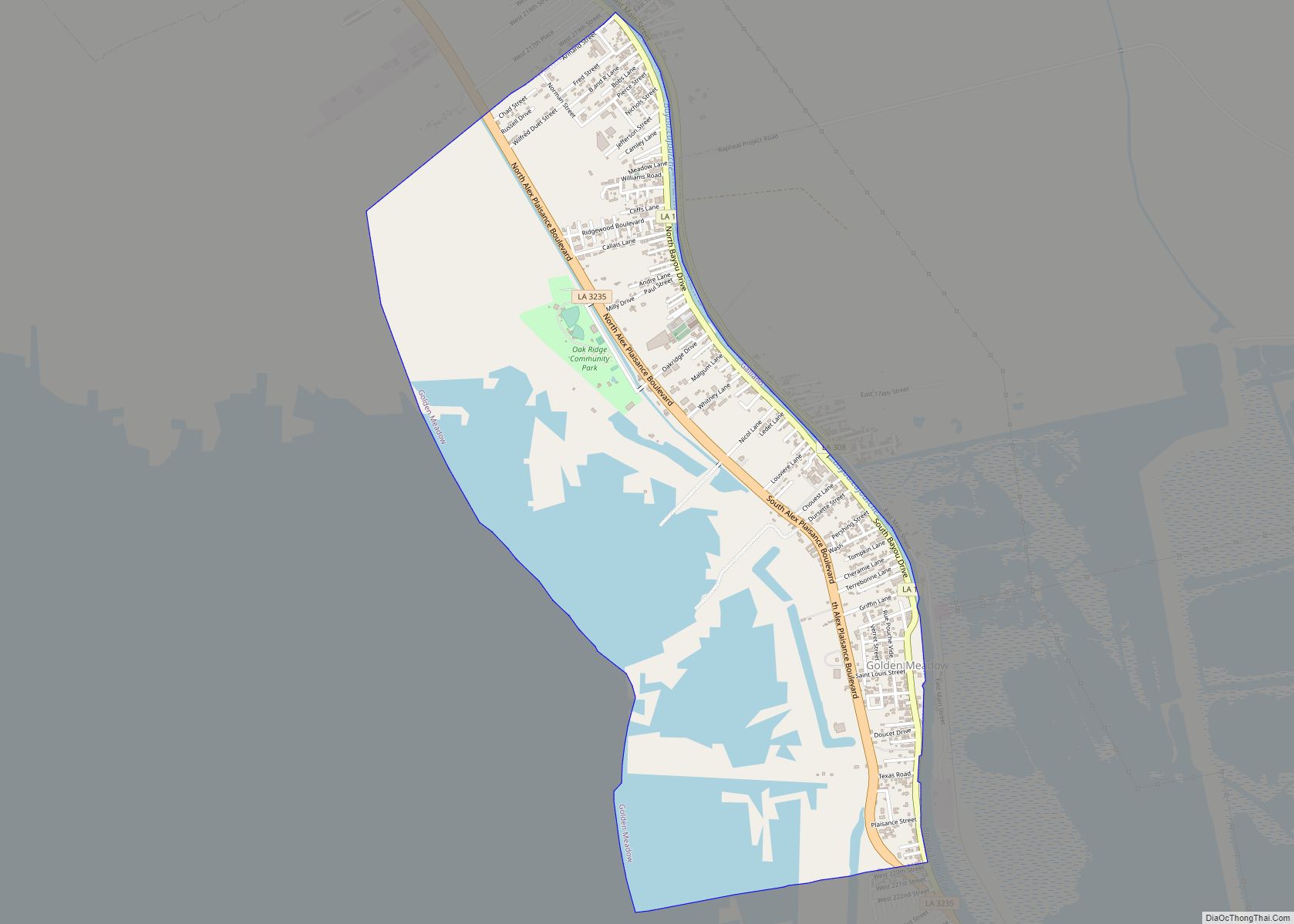
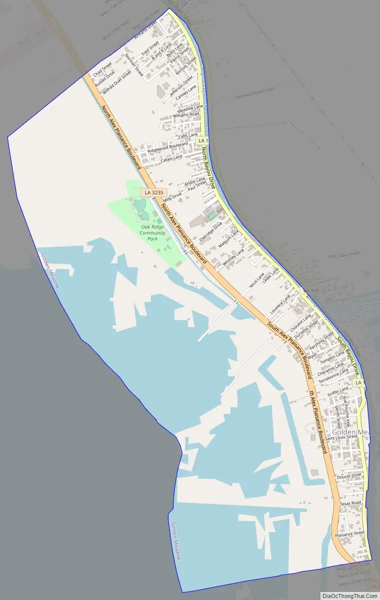
Golden Meadow Road Map
Golden Meadow city Satellite Map

Geography
Golden Meadow is located at 29°23′17″N 90°16′10″W / 29.38806°N 90.26944°W / 29.38806; -90.26944 (29.388192, -90.269457).
According to the United States Census Bureau, the town has a total area of 2.9 square miles (7.5 km), of which 2.4 square miles (6.2 km) is land and 0.5 square miles (1.3 km) (15.92%) is water.
See also
Map of Louisiana State and its subdivision:- Acadia
- Allen
- Ascension
- Assumption
- Avoyelles
- Beauregard
- Bienville
- Bossier
- Caddo
- Calcasieu
- Caldwell
- Cameron
- Catahoula
- Claiborne
- Concordia
- De Soto
- East Baton Rouge
- East Carroll
- East Feliciana
- Evangeline
- Franklin
- Grant
- Iberia
- Iberville
- Jackson
- Jefferson
- Jefferson Davis
- La Salle
- Lafayette
- Lafourche
- Lincoln
- Livingston
- Madison
- Morehouse
- Natchitoches
- Orleans
- Ouachita
- Plaquemines
- Pointe Coupee
- Rapides
- Red River
- Richland
- Sabine
- Saint Bernard
- Saint Charles
- Saint Helena
- Saint James
- Saint John the Baptist
- Saint Landry
- Saint Martin
- Saint Mary
- Saint Tammany
- Tangipahoa
- Tensas
- Terrebonne
- Union
- Vermilion
- Vernon
- Washington
- Webster
- West Baton Rouge
- West Carroll
- West Feliciana
- Winn
- Alabama
- Alaska
- Arizona
- Arkansas
- California
- Colorado
- Connecticut
- Delaware
- District of Columbia
- Florida
- Georgia
- Hawaii
- Idaho
- Illinois
- Indiana
- Iowa
- Kansas
- Kentucky
- Louisiana
- Maine
- Maryland
- Massachusetts
- Michigan
- Minnesota
- Mississippi
- Missouri
- Montana
- Nebraska
- Nevada
- New Hampshire
- New Jersey
- New Mexico
- New York
- North Carolina
- North Dakota
- Ohio
- Oklahoma
- Oregon
- Pennsylvania
- Rhode Island
- South Carolina
- South Dakota
- Tennessee
- Texas
- Utah
- Vermont
- Virginia
- Washington
- West Virginia
- Wisconsin
- Wyoming