Galliano is an unincorporated community and census-designated place (CDP) on the Bayou Lafourche in Lafourche Parish, Louisiana, United States. As of 2020, its population was 7,100. It is part of the Houma–Bayou Cane–Thibodaux metropolitan statistical area.
| Name: | Galliano CDP |
|---|---|
| LSAD Code: | 57 |
| LSAD Description: | CDP (suffix) |
| State: | Louisiana |
| County: | Lafourche Parish |
| Elevation: | 3 ft (0.9 m) |
| Total Area: | 11.15 sq mi (28.88 km²) |
| Land Area: | 11.14 sq mi (28.86 km²) |
| Water Area: | 0.01 sq mi (0.01 km²) |
| Total Population: | 7,100 |
| Population Density: | 637.11/sq mi (245.99/km²) |
| Area code: | 985 |
| FIPS code: | 2228065 |
Online Interactive Map
Click on ![]() to view map in "full screen" mode.
to view map in "full screen" mode.
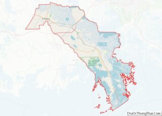
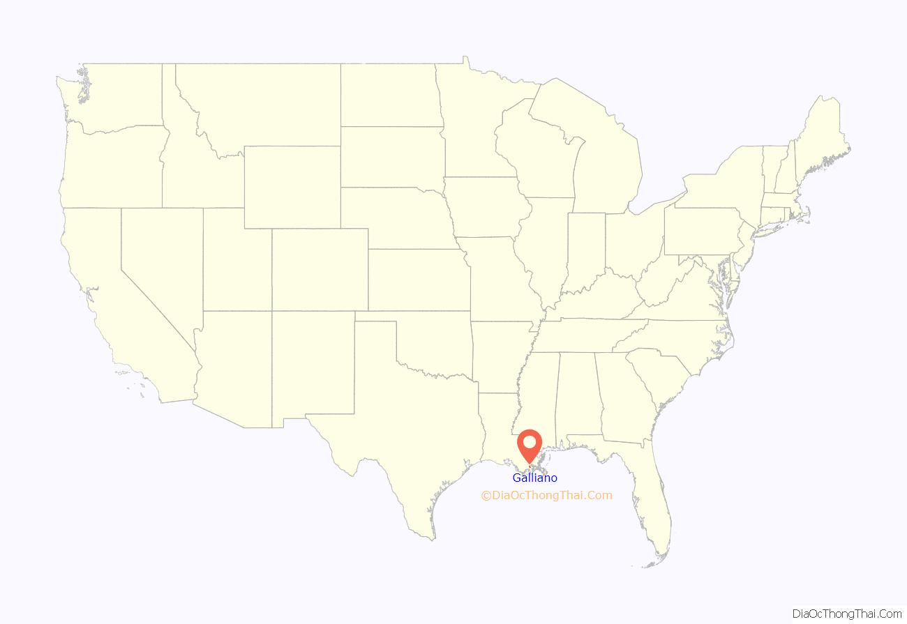
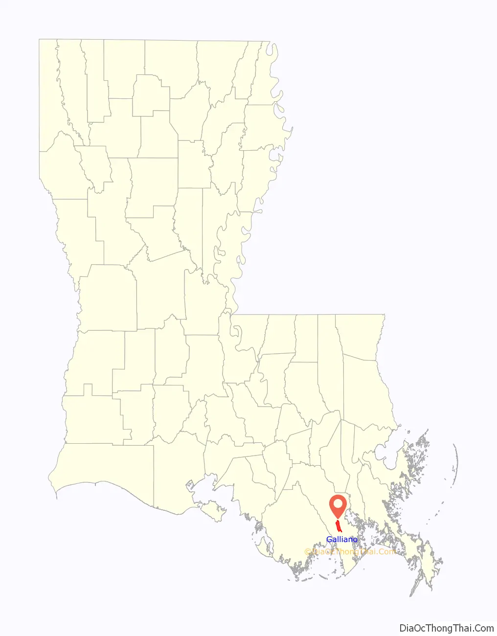
Galliano location map. Where is Galliano CDP?
History
The area was named by the late postmaster Alzec Autin, who chose the name “Galliano” in honor of an original settler in the area formerly known as Côte Cheramie. Signor Antoine Galliano settled in the vicinity in the late 1700s and had a large farm and a citrus tree orchard. He came from the Kingdom of the Two Sicilies in the vicinity of Naples, Italy, where he was in the service of the King of Spain.
A popular local legend is that his wife, Julia, had no last name and was related closely to the King of Spain. Antoine Galliano or Galiano (Spanish spelling) had fallen in love with a lady of noble birth – probably a princess, since he was in the King’s Guard. He and his wife were sent to Louisiana (New Spain) and settled in the area known now as Galliano. His descendants still live in the area, and the name Galliano is spelled in the Italian style, but some descendants spell it Galiano in the Spanish tradition.
The area was also the home of a large Acadian French or Cajun population, and Cajun French is a predominant language along with English.
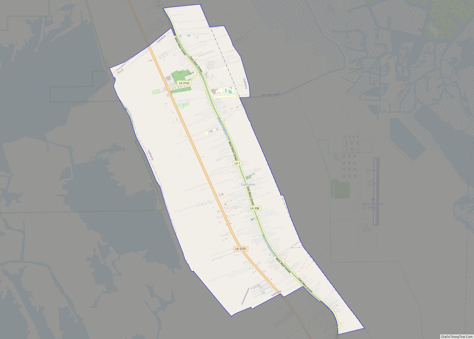
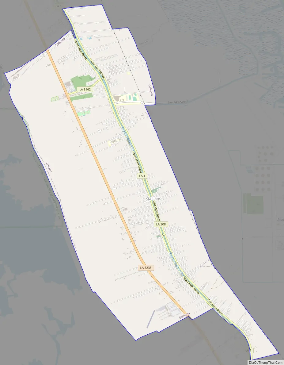
Galliano Road Map
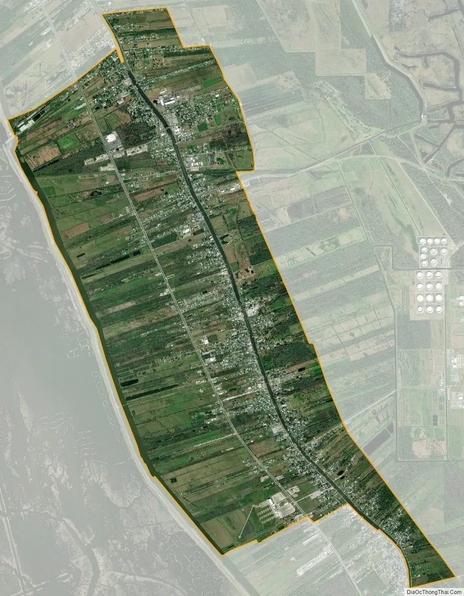
Galliano city Satellite Map
Geography
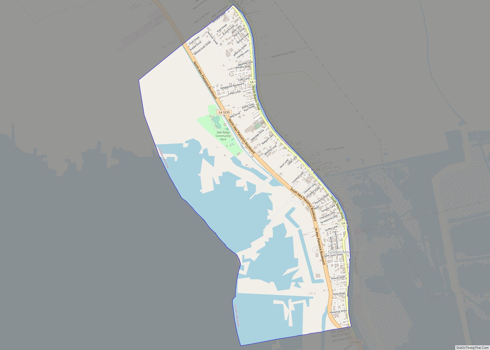
Galliano is located in southern Lafourche Parish at 29°26′55″N 90°18′26″W / 29.44861°N 90.30722°W / 29.44861; -90.30722 (29.448539, -90.307274), on both sides of Bayou Lafourche. The community is bordered to the northwest by Cut Off and to the south by Golden Meadow.
Louisiana Highway 1 runs through the community along the west bank of Bayou Lafourche, while Highway 308 runs along the east side. There are two bridges across Bayou Lafourche within the CDP. Four-lane Highway 3235 runs through the west side of the community. All three highway lead northwest (upriver) 11 miles (18 km) to Larose and south 5 miles (8 km) to Golden Meadow. Thibodaux, the parish seat, is 45 miles (72 km) to the northwest up Highway 1, while Port Fourchon on the Gulf of Mexico is 26 miles (42 km) to the south. South Lafourche Leonard Miller Jr. Airport is 2 miles (3 km) east of Galliano.
According to the United States Census Bureau, the Galliano CDP has a total area of 11.2 square miles (28.9 km), of which 0.004 square miles (0.01 km), or 0.04%, are water.
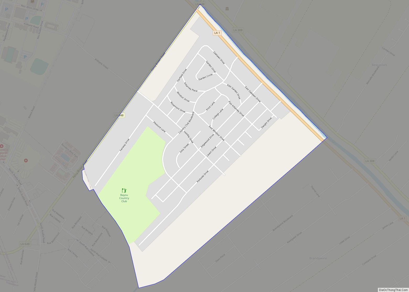
The Pointe-aux-Chenes Wildlife Management Area borders Galliano to the west. Access to the area can be had through a marina and boat launch in southwest Galliano.
Climate
The climate in this area is characterized by hot, humid summers and generally mild to cool winters. According to the Köppen Climate Classification system, Galliano has a humid subtropical climate, abbreviated “Cfa” on climate maps.
See also
Map of Louisiana State and its subdivision:- Acadia
- Allen
- Ascension
- Assumption
- Avoyelles
- Beauregard
- Bienville
- Bossier
- Caddo
- Calcasieu
- Caldwell
- Cameron
- Catahoula
- Claiborne
- Concordia
- De Soto
- East Baton Rouge
- East Carroll
- East Feliciana
- Evangeline
- Franklin
- Grant
- Iberia
- Iberville
- Jackson
- Jefferson
- Jefferson Davis
- La Salle
- Lafayette
- Lafourche
- Lincoln
- Livingston
- Madison
- Morehouse
- Natchitoches
- Orleans
- Ouachita
- Plaquemines
- Pointe Coupee
- Rapides
- Red River
- Richland
- Sabine
- Saint Bernard
- Saint Charles
- Saint Helena
- Saint James
- Saint John the Baptist
- Saint Landry
- Saint Martin
- Saint Mary
- Saint Tammany
- Tangipahoa
- Tensas
- Terrebonne
- Union
- Vermilion
- Vernon
- Washington
- Webster
- West Baton Rouge
- West Carroll
- West Feliciana
- Winn
- Alabama
- Alaska
- Arizona
- Arkansas
- California
- Colorado
- Connecticut
- Delaware
- District of Columbia
- Florida
- Georgia
- Hawaii
- Idaho
- Illinois
- Indiana
- Iowa
- Kansas
- Kentucky
- Louisiana
- Maine
- Maryland
- Massachusetts
- Michigan
- Minnesota
- Mississippi
- Missouri
- Montana
- Nebraska
- Nevada
- New Hampshire
- New Jersey
- New Mexico
- New York
- North Carolina
- North Dakota
- Ohio
- Oklahoma
- Oregon
- Pennsylvania
- Rhode Island
- South Carolina
- South Dakota
- Tennessee
- Texas
- Utah
- Vermont
- Virginia
- Washington
- West Virginia
- Wisconsin
- Wyoming