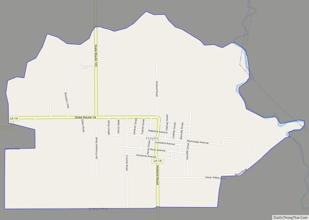
Hayes (pronounced heɪz) is an unincorporated community and census-designated place (CDP) located in Calcasieu Parish, Louisiana, United States. As of the 2010 census it had a population of 780. It is part of the Lake Charles Metropolitan Statistical Area.
Hayes also is home to the musical artist known as Rosco from the Pop duo Jaime & Rosco.
| Name: | Hayes CDP |
|---|---|
| LSAD Code: | 57 |
| LSAD Description: | CDP (suffix) |
| State: | Louisiana |
| County: | Calcasieu Parish |
| Founded: | 1832 as Dugas Pasture |
| Elevation: | 10 ft (3 m) |
| Total Area: | 2.82 sq mi (7.31 km²) |
| Land Area: | 2.78 sq mi (7.20 km²) |
| Water Area: | 0.04 sq mi (0.11 km²) |
| Total Population: | 676 |
| Population Density: | 243.17/sq mi (93.88/km²) |
| FIPS code: | 2233490 |
Online Interactive Map
Click on ![]() to view map in "full screen" mode.
to view map in "full screen" mode.
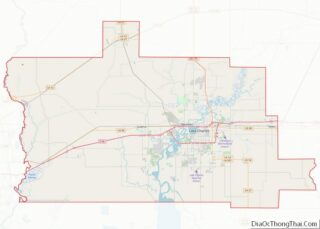
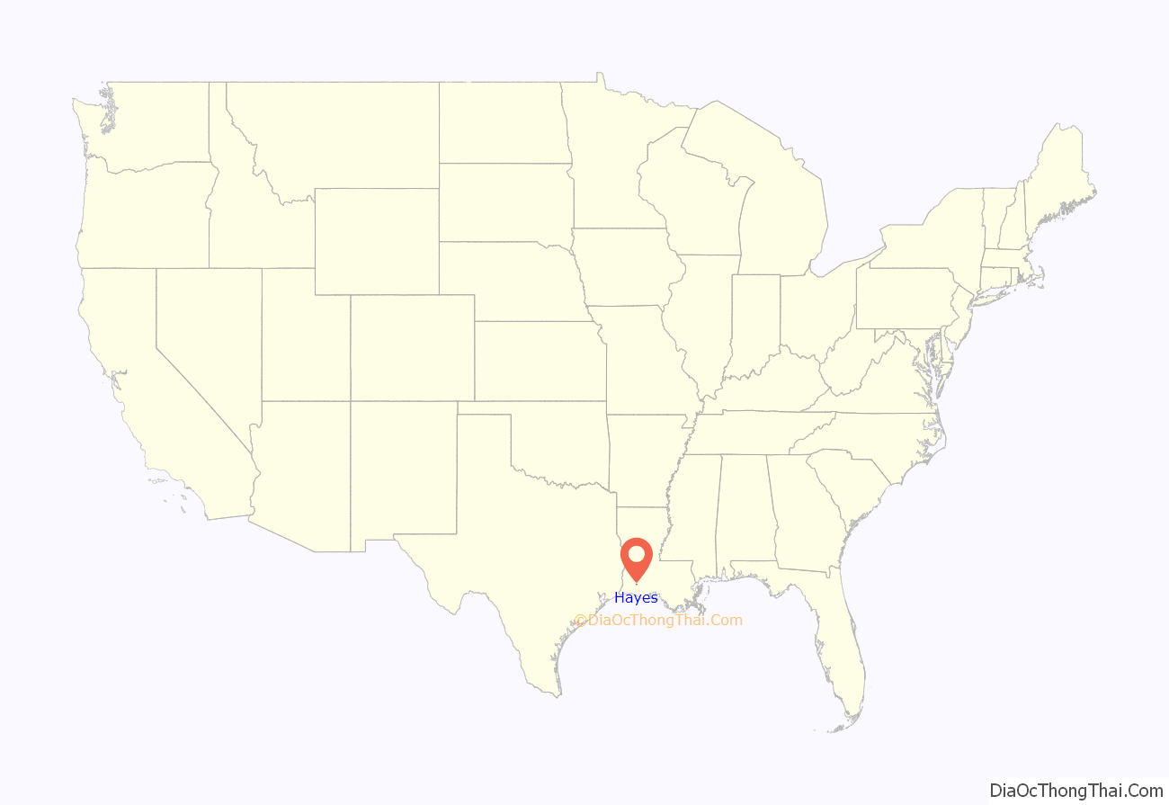
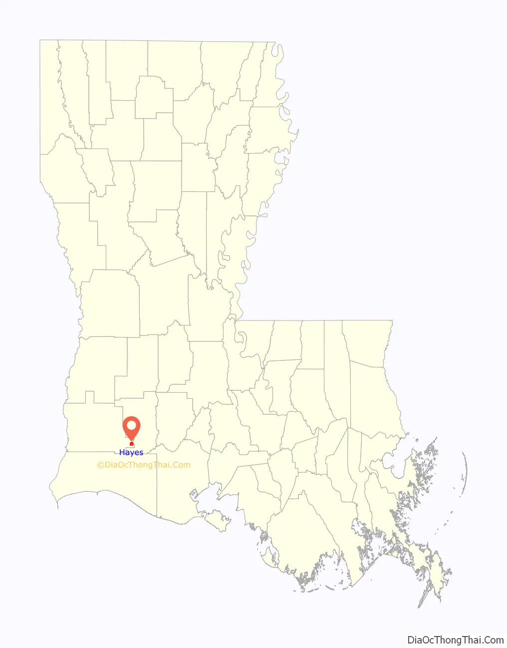
Hayes location map. Where is Hayes CDP?
History
In the beginning, Hayes was known as Dugas Pasture or “La Savanne des Dugas”, named for a cattle grazer from Andrus Cove who discovered this bountiful pasture land. Cattle could be kept here without supervision because the area was bounded on the east by the Lacassine Bayou, on the north and west by swampland, and on the south by marsh. In 1832 Thomas Hayes moved into Dugas Pasture and became the first while settler there. He married Mary Ann Foreman of Andrus Cove, and they settled near the Lacassine Bayou.
The next settler was William Holland, born in Tennessee in 1809. Holland, pioneer and father of nine children, established a school in what was now becoming known as Hayes (for Thomas Hayes, the first settler). Using a team of oxen, he moved an old slave cabin onto his properly, and he hired his friend Tom Cannon as the teacher. The next settler in Dugas Pasture was a widow with seven sons and one daughter. In 1854, Mrs. Bazeline Derouen of New Iberia bought a piece of property from the U.S. government, near the Lorrain settlement. On her property, the first Methodist church was established in 1898. It was a simple, one-room structure with a small, foot-operated organ. The first pastor was the Rev. Robert P. Howell. Prior to that, as far back as 1835, Methodist circuit riders had come into the area on horseback and held meetings in the Hayes and Holland homes. In 1905, after the railroad came to Hayes and the population shifted, the Methodist congregation decided the location was out of the way, so Bill Cox loaded the church building on a logging wagon and moved it to its present site in Hayes.
Francois, Louis, and Eugene Lorrain came from France and settled in the Hayes area in 1860, in what was known as the Lorrain Settlement. The Lorrain Settlement had a brick mill, sugar mill, grits mill and sawmill which operated before steam boilers and used two men with cross-saws to work the mill. Louis Lorrain built a school in the settlement about 1860 and hired a teacher from France named Pierre Lenoir. The school was kept open by Paul Lorrain, who hired Marcelne Goodeaux as a teacher. She boarded with the family. Other teachers were Glady Kinsey and Miss Dicarlo. Then the school was moved to Hayes; early teachers there were Helen Bienvieu, Veva Stribling (Thom), J.R. Logan, Irma Howarton and Misses Freeman, Landreneaux, and Roy. There was a post office at Lorrain around 1880, with mail brought up the bayou by schooner. Mrs. Aueline Lorrain was the postmistress.
Another family moved into the Hayes area in 1885: Ophelien Primeaux, grandfather of Eloi Primeaux. In 1875, the first Gibbs made his appearance. Mr. and Mrs. George Gibbs moved to Hayes from Lowry and opened a general store, with living quarters upstairs. Kinney Gibbs was manager of the Island Plantation near Hayes which was owned by the Rice Plantation and Canal Company.
Others settling in the area in the earliest days included families named Brown, Atkinson, Moore, Mitchell, Duhon, Verret, Lemelle, Andrus, and Trahan. They were followed, after the turn of the century, by Gossett, Morgan, Gravelle, Carmouche, Fruge, Kent, Derouen, Theriot and Walker. Groups of northern farmers were brought down by J.B. Watkins’ extensive advertising of the “Garden of Eden” in the Deep South.
This area remained isolated for many years. Midwives delivered most of the children. A Cherokee “medicine woman” used concoctions prepared from herbs and plants to treat everything from snake bites to toothaches. The first doctor, Leroy Lambert, did not come until 1916.
The Louisiana Western Railroad, through Lake Charles, Holmwood, Bell City, Hayes, and Lake Arthur, was completed in 1904. Overnight, Hayes became a thriving little community. Toliver Hayes, son of the original settler, sold the rights-of-way and a depot site to the Railroad Company and 40 acres (16 ha) of land to be used as a town site. Thus, the name of Hayes became permanent for the area. In March 1906, a new saw mill was established by Frank Dearborn and Jesse Thom called Hayes Cypress and Lumber Co. Less than two years later, J.M. Nugent of Alexandria purchased controlling interest.
A rice mill was built and a post office opened. In March 1911, Felix Hebert became postmaster after the resignation of Hayes’ first postmaster, Solomon Hayes. Jesse Leo Thom was postmaster for 20 years until his death in 1948. Evelyn Hayes, niece of the first postmaster, served through 1981.
A small school near the big “S” curve on the edge of Hayes was believed to have been established in 1895.
20th century time-line
1903 Toliver Hayes transferred to M.E. Shaddock land for First Baptist Church of Hayes.
1906 By a vote of 42 to 1 the Hayes precinct prohibited the sale of liquor, making Hayes a dry town.
1910 The first public school, under the supervision of the Calcasieu School Board, was opened.
1923 Marked the beginning of the “Lafitte Cut-Off Old Spanish Trail” highway project, extending from New Iberia to Lake Charles, via Abbeville, Kaplan, Gueydan, Lake Arthur, Hayes, and Holmwood. On the elected committee to represent Hayes in this highway project was J. W. Gardiner. By July 1925 only 3 miles (5 km) on each side of Bayou Lacassine remained incomplete.
1930 Talking and sound picture equipment was installed in the Magnolia Theater by Felix Hebert, owner. Mr. Hebert reported to the Lake Charles American Press he was convinced that Hayes, with a population of only 80 persons, is the smallest town in the U.S. to have this up-to-date type of entertainment. With no electric lines, a private power plant was established to run the theater.
1934 oil was discovered.
1938 electricity was brought into Hayes.
1941 Hayes Elementary school had 140 students
1944 The Hayes Library opened on April 10. It was located in Martin’s Store, and Mrs. Emma Martin was the first branch manager.
1946 Natural gas plant established.
1947 The first PTA was organized, with Mrs. Elias Lorrain as president.
1948 A gas heating system was installed in Hayes School.
1950 Researcher Eloi Primeaux documented 300 registered voters among the 1,200 people living in Hayes.
1953 St. Daniel Catholic Chapel was dedicated and named in honor of Father Daniel Habetz.
1955 The Hayes Branch of the Calcasieu Parish library celebrated the use of a new building. The new building was owned by Miss Evelyn Hayes, local postmaster, and Mrs. Horace Hebert was the local librarian.
1968 The Hayes Water System was incorporated. The first board of directors were Alvin Hebert, Gaston Dubrock, Clyde LaCombe, Joseph Primeaux, DW LaCombe, Ancil Hayes and Simon Breaux.
1969 Clarence Theriot, 42, was named principal of Bell City High School after serving 15 years in Hayes Elementary School as principal and teacher.
1971 January 4 Consolidation of Hayes and Bell City Schools. Gaston Dubrock, acting principal at Hayes Elementary, was made assistant principal and half-day teacher at Bell City.
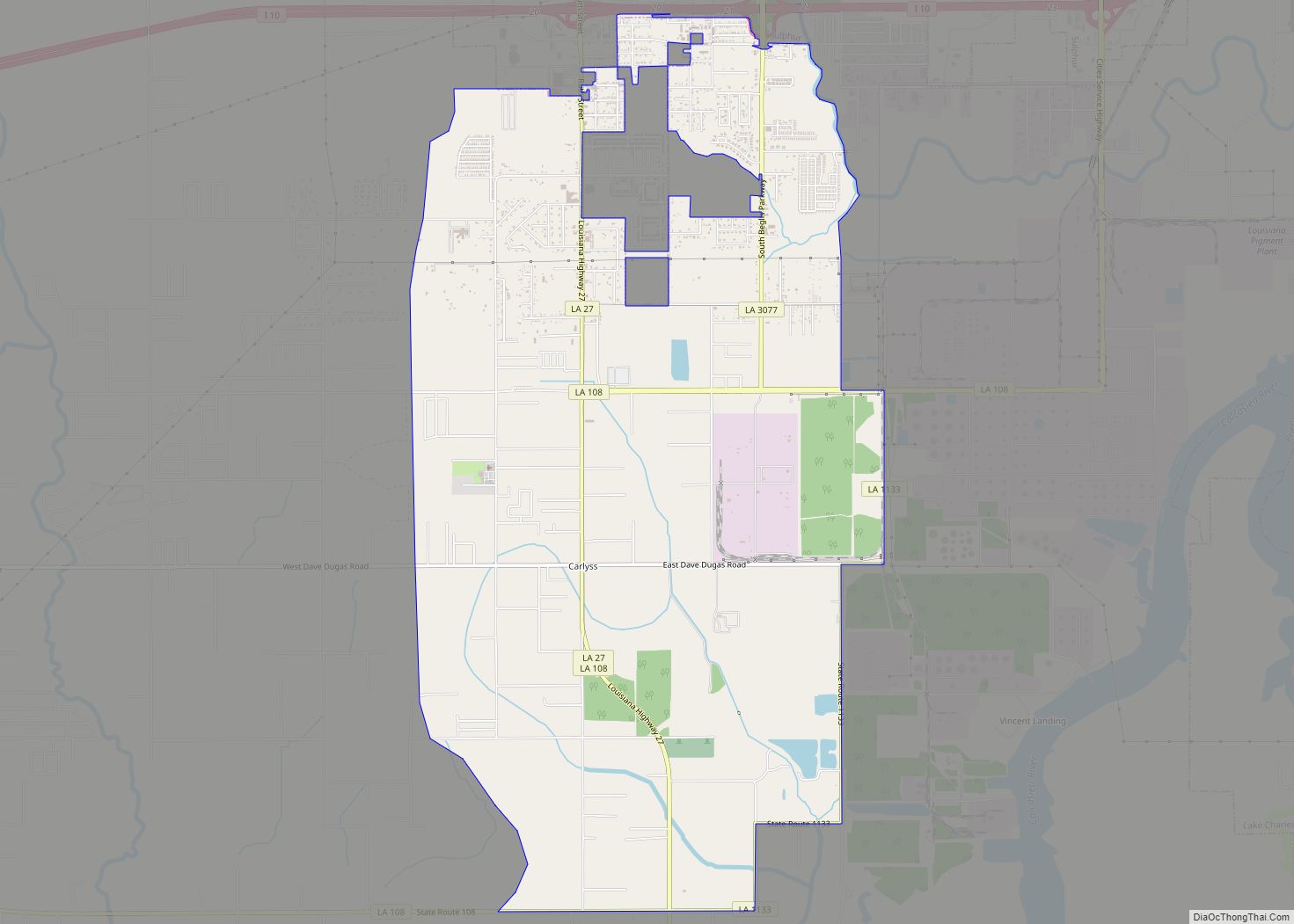
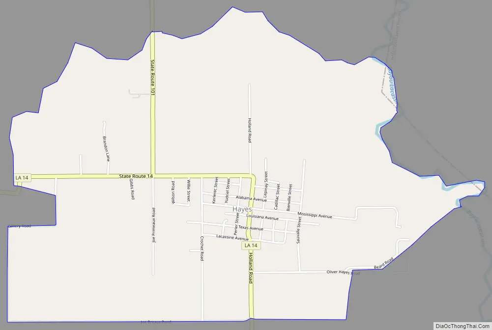
Hayes Road Map
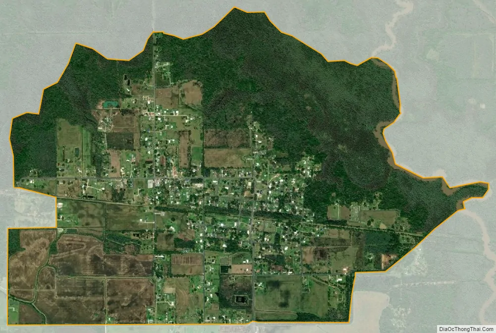
Hayes city Satellite Map
Geography
Hayes is located in the southeastern corner of Calcasieu Parish, on the west bank of Bayou Lacassine, which forms the boundary with Jefferson Davis Parish. Louisiana Highway 14 runs through the center of the community, leading west 3 miles (5 km) to Bell City and south then east 18 miles (29 km) to Lake Arthur. Lake Charles, the Calcasieu Parish seat, is 26 miles (42 km) to the northwest.
According to the U.S. Census Bureau, the community has a total area of 2.8 square miles (7.3 km), of which 0.039 square miles (0.1 km), or 1.52%, is water.
See also
Map of Louisiana State and its subdivision:- Acadia
- Allen
- Ascension
- Assumption
- Avoyelles
- Beauregard
- Bienville
- Bossier
- Caddo
- Calcasieu
- Caldwell
- Cameron
- Catahoula
- Claiborne
- Concordia
- De Soto
- East Baton Rouge
- East Carroll
- East Feliciana
- Evangeline
- Franklin
- Grant
- Iberia
- Iberville
- Jackson
- Jefferson
- Jefferson Davis
- La Salle
- Lafayette
- Lafourche
- Lincoln
- Livingston
- Madison
- Morehouse
- Natchitoches
- Orleans
- Ouachita
- Plaquemines
- Pointe Coupee
- Rapides
- Red River
- Richland
- Sabine
- Saint Bernard
- Saint Charles
- Saint Helena
- Saint James
- Saint John the Baptist
- Saint Landry
- Saint Martin
- Saint Mary
- Saint Tammany
- Tangipahoa
- Tensas
- Terrebonne
- Union
- Vermilion
- Vernon
- Washington
- Webster
- West Baton Rouge
- West Carroll
- West Feliciana
- Winn
- Alabama
- Alaska
- Arizona
- Arkansas
- California
- Colorado
- Connecticut
- Delaware
- District of Columbia
- Florida
- Georgia
- Hawaii
- Idaho
- Illinois
- Indiana
- Iowa
- Kansas
- Kentucky
- Louisiana
- Maine
- Maryland
- Massachusetts
- Michigan
- Minnesota
- Mississippi
- Missouri
- Montana
- Nebraska
- Nevada
- New Hampshire
- New Jersey
- New Mexico
- New York
- North Carolina
- North Dakota
- Ohio
- Oklahoma
- Oregon
- Pennsylvania
- Rhode Island
- South Carolina
- South Dakota
- Tennessee
- Texas
- Utah
- Vermont
- Virginia
- Washington
- West Virginia
- Wisconsin
- Wyoming