Kaplan is a city in Vermilion Parish, Louisiana, United States. The population was 4,600 at the 2010 census, and 4,345 at the 2020 population estimates program. It is part of the Abbeville micropolitan statistical area in Acadiana.
| Name: | Kaplan city |
|---|---|
| LSAD Code: | 25 |
| LSAD Description: | city (suffix) |
| State: | Louisiana |
| County: | Vermilion Parish |
| Elevation: | 16 ft (5 m) |
| Total Area: | 2.33 sq mi (6.03 km²) |
| Land Area: | 2.33 sq mi (6.03 km²) |
| Water Area: | 0.00 sq mi (0.00 km²) |
| Total Population: | 4,352 |
| Population Density: | 1,868.61/sq mi (721.59/km²) |
| Area code: | 337 |
| FIPS code: | 2239055 |
| Website: | www.kaplanla.com |
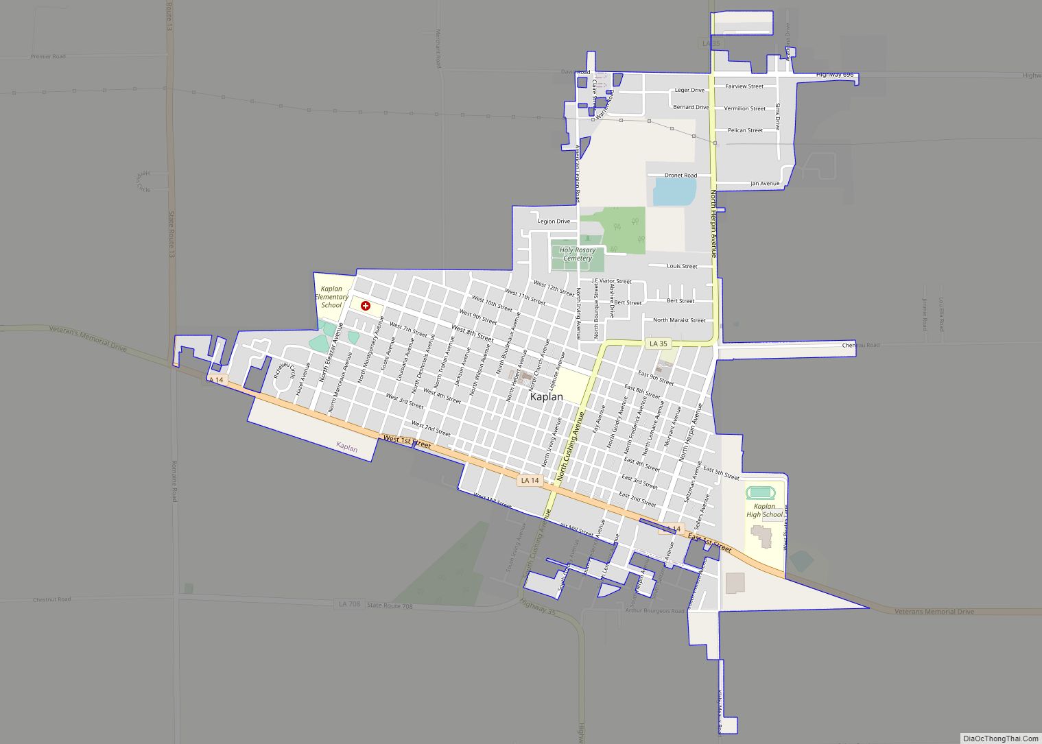
Online Interactive Map
Click on ![]() to view map in "full screen" mode.
to view map in "full screen" mode.
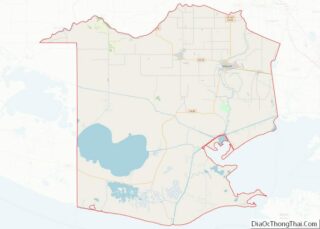
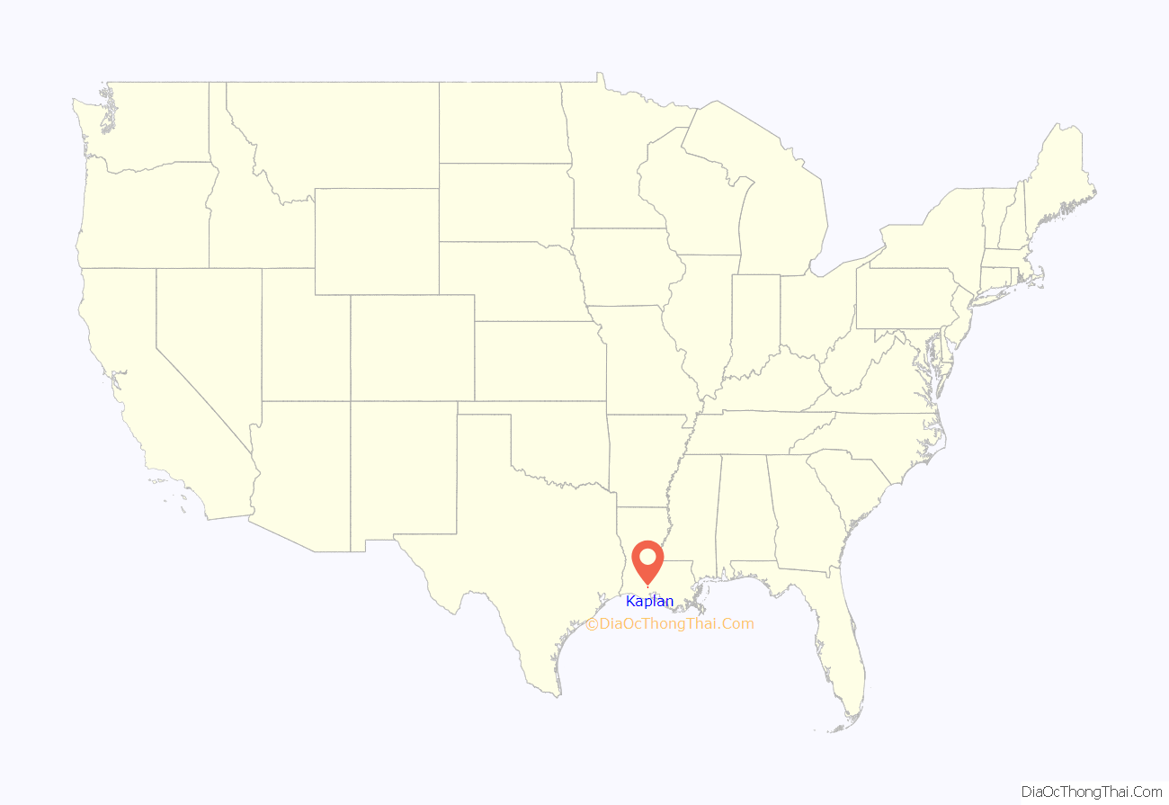
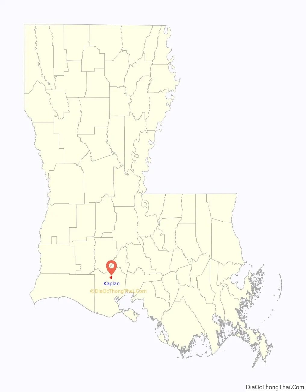
Kaplan location map. Where is Kaplan city?
History
In 1896, the Holy Rosary Catholic Church was established in the growing European-American settlement. Most of the people were Acadian, so the main language was French. The town was named after Abrom Kaplan, who bought the Jim Todd Plantation in 1901. The town of Kaplan grew quickly and was established in 1902. The following year, residents created the first school.
On July 14, 1906, the first Bastille Day Celebration was held. In 1911, the Eleazar Theater was built. In 1916, the Kaplan Telephone Company began. In 1920, the school was rebuilt.
The Kaplan Herald has been in continuous publication since 1956 as the Kaplan Journal. When Conrad Kaplan purchased the newspaper in 1965, he named it the Kaplan Herald. It remained under his ownership until his death in 1992, when Louisiana State Newspaper purchased the Kaplan Herald from his estate.
On September 10, 1961, the town was hit by a destructive F3 tornado spawned by Hurricane Carla. Most of the town was heavily damaged and one person was killed.
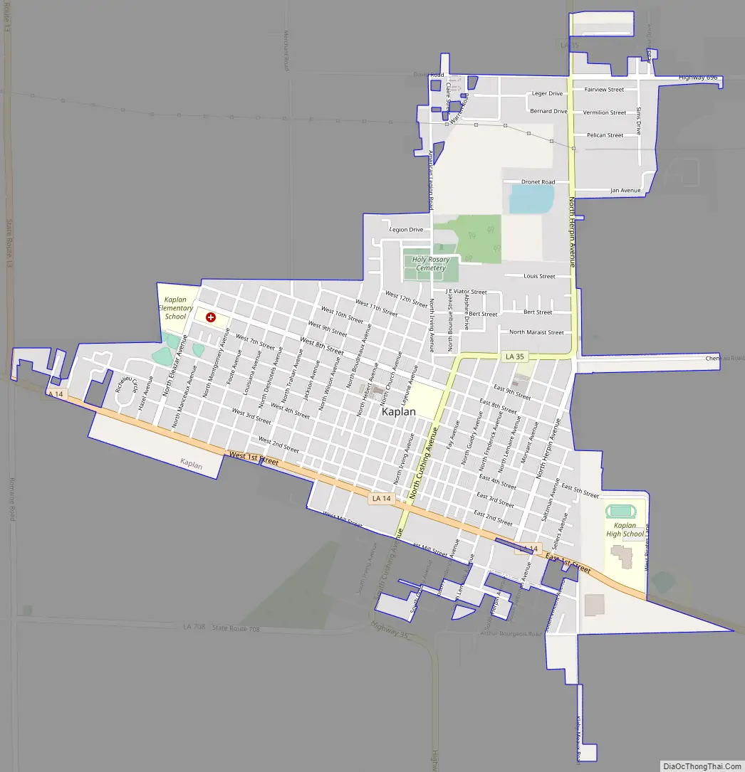
Kaplan Road Map
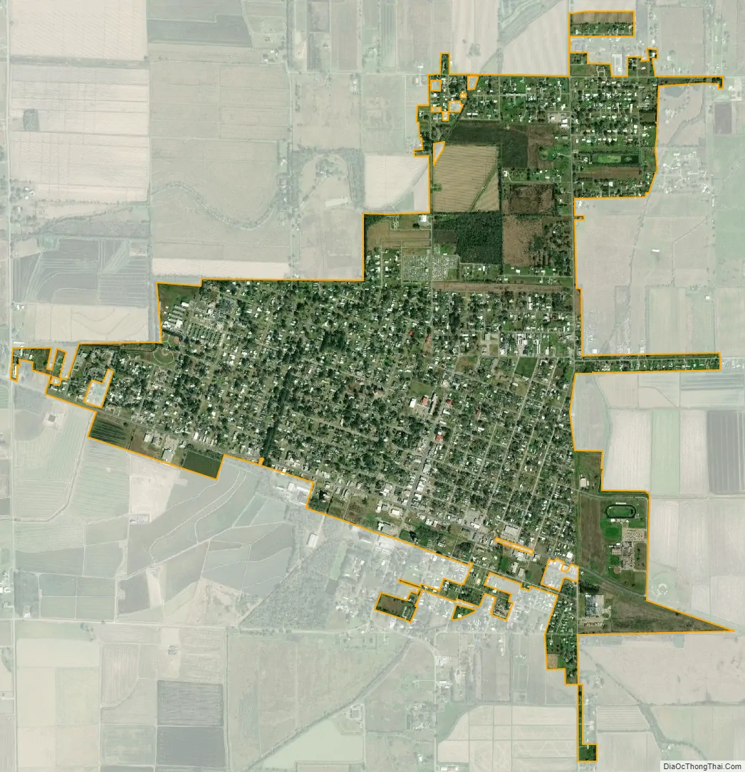
Kaplan city Satellite Map
Geography
Kaplan is located at 30°0′16″N 92°17′9″W / 30.00444°N 92.28583°W / 30.00444; -92.28583 (30.004548, -92.285964). According to the United States Census Bureau, the city has a total area of 2.2 square miles (5.7 km), all land.
Louisiana Highway 14 passes through the city which heads 10 miles (16 km) east to Abbeville, the Vermilion Parish seat, and 15 miles (24 km) west to the town of Gueydan. Louisiana Highway 13 intersects with LA-14 outside the city limits and heads north to the cities of Crowley (26 miles) and Eunice (39 miles). Louisiana Highway 35, which intersects LA-14 as North Cushing Avenue, heads north 18 miles (29 km) to Rayne.
See also
Map of Louisiana State and its subdivision:- Acadia
- Allen
- Ascension
- Assumption
- Avoyelles
- Beauregard
- Bienville
- Bossier
- Caddo
- Calcasieu
- Caldwell
- Cameron
- Catahoula
- Claiborne
- Concordia
- De Soto
- East Baton Rouge
- East Carroll
- East Feliciana
- Evangeline
- Franklin
- Grant
- Iberia
- Iberville
- Jackson
- Jefferson
- Jefferson Davis
- La Salle
- Lafayette
- Lafourche
- Lincoln
- Livingston
- Madison
- Morehouse
- Natchitoches
- Orleans
- Ouachita
- Plaquemines
- Pointe Coupee
- Rapides
- Red River
- Richland
- Sabine
- Saint Bernard
- Saint Charles
- Saint Helena
- Saint James
- Saint John the Baptist
- Saint Landry
- Saint Martin
- Saint Mary
- Saint Tammany
- Tangipahoa
- Tensas
- Terrebonne
- Union
- Vermilion
- Vernon
- Washington
- Webster
- West Baton Rouge
- West Carroll
- West Feliciana
- Winn
- Alabama
- Alaska
- Arizona
- Arkansas
- California
- Colorado
- Connecticut
- Delaware
- District of Columbia
- Florida
- Georgia
- Hawaii
- Idaho
- Illinois
- Indiana
- Iowa
- Kansas
- Kentucky
- Louisiana
- Maine
- Maryland
- Massachusetts
- Michigan
- Minnesota
- Mississippi
- Missouri
- Montana
- Nebraska
- Nevada
- New Hampshire
- New Jersey
- New Mexico
- New York
- North Carolina
- North Dakota
- Ohio
- Oklahoma
- Oregon
- Pennsylvania
- Rhode Island
- South Carolina
- South Dakota
- Tennessee
- Texas
- Utah
- Vermont
- Virginia
- Washington
- West Virginia
- Wisconsin
- Wyoming