Walker is a city in Livingston Parish, Louisiana, United States. As of the 2010 census the population was placed at 6,138 (up 28% over the past decade), making Walker and Denham Springs the only parish municipalities classified as cities.
| Name: | Walker town |
|---|---|
| LSAD Code: | 43 |
| LSAD Description: | town (suffix) |
| State: | Louisiana |
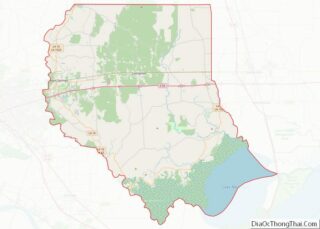
| County: | Livingston Parish |
| Elevation: | 46 ft (14 m) |
| Total Area: | 6.62 sq mi (17.15 km²) |
| Land Area: | 6.59 sq mi (17.08 km²) |
| Water Area: | 0.03 sq mi (0.07 km²) |
| Total Population: | 6,374 |
| Population Density: | 966.64/sq mi (373.22/km²) |
| Area code: | 225 |
| FIPS code: | 2279240 |
Online Interactive Map
Click on ![]() to view map in "full screen" mode.
to view map in "full screen" mode.
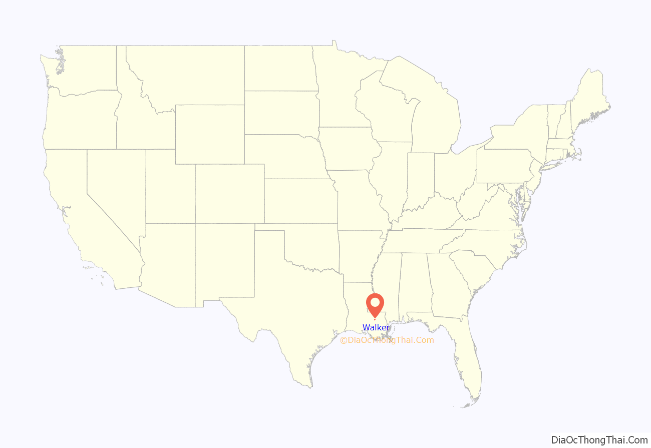
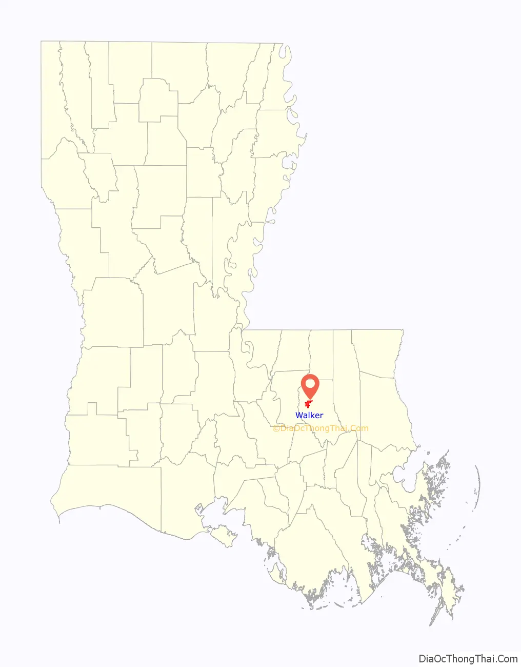
Walker location map. Where is Walker town?
History
The area now known as Walker was founded by Michael Joseph Milton, Jr. (1795-1863) and “several slaves” in 1825. Michael Milton married in 1832 in Livingston Parish. He and his wife, Martha Clark Milton (1803-1878) developed 343 acres from a Land Grant for his service in the War of 1812. The Milton family was a pioneering family from North Carolina who settled an area in Alabama, before establishing the new community in the piney woods east of the Amite River and Denham Springs. In this sense, Walker, Louisiana, by virtue of its establishment, traces its roots to the founding of the nation in Jamestown, Virginia. The Federal government recognized the growth of the settlement and opened a post office as Milton Old Field in 1856. Michael Milton was appointed as postmaster in 1858. In 1890, the post office was renamed after Dr. William Elliott Walker, M.D., a legislator from nearby Springfield, who had also served as a lieutenant colonel in the Confederate States of America.
Walker became a city in 2011, by proclamation of Louisiana Governor Bobby Jindal.
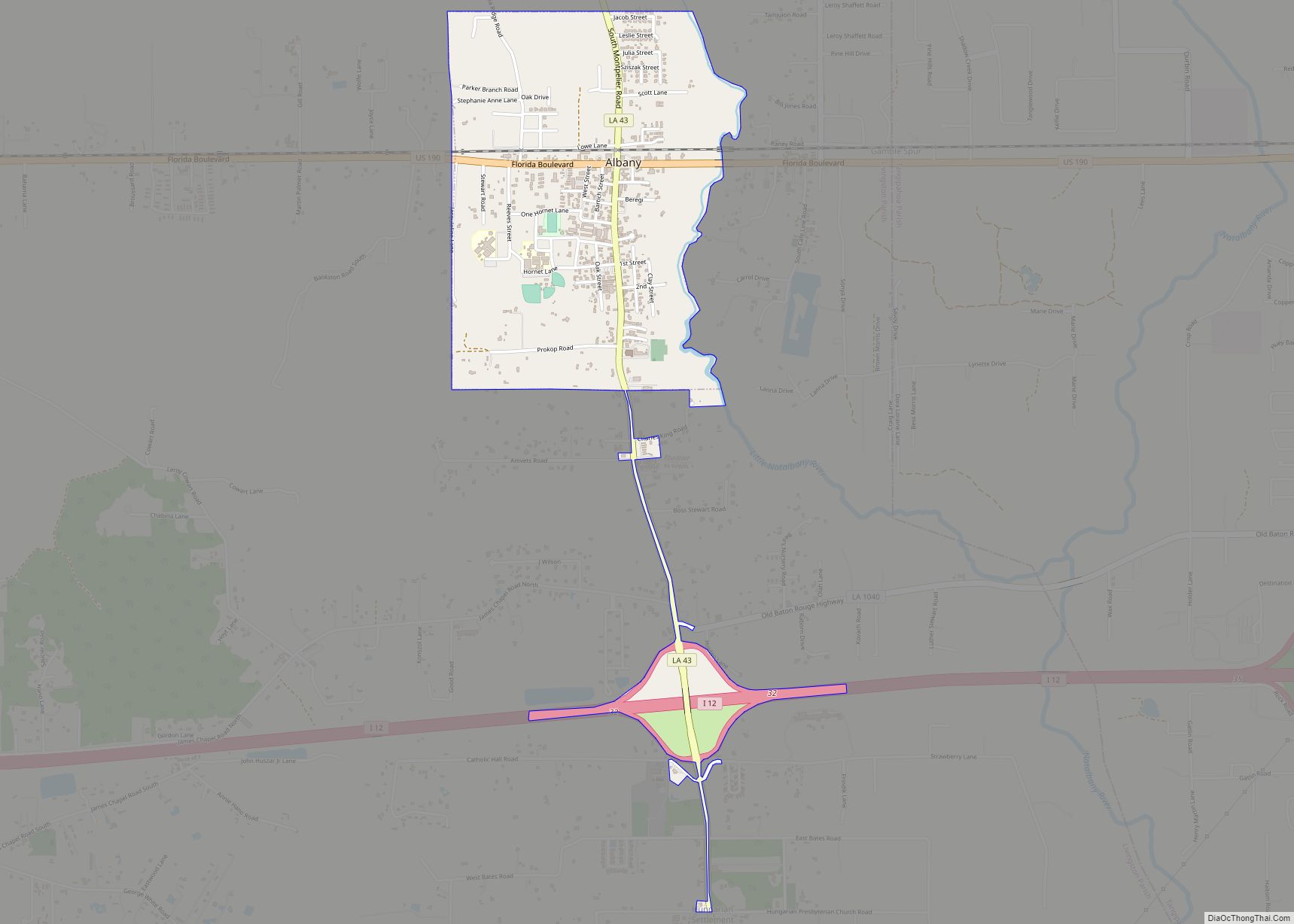
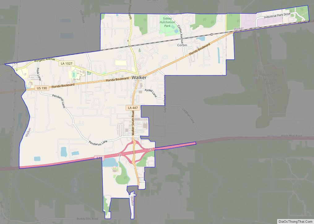
Walker Road Map

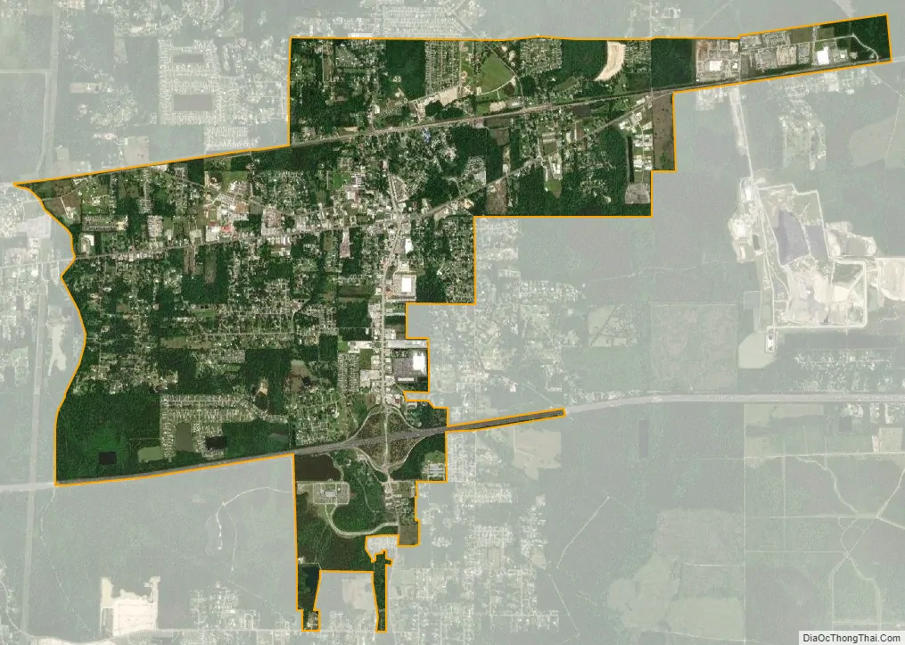
Walker city Satellite Map
Geography
Walker is located at 30°29′22″N 90°51′46″W / 30.48944°N 90.86278°W / 30.48944; -90.86278 (30.489423, -90.862872). According to the United States Census Bureau, the city has a total area of 5.8 square miles (14.9 km), all land.
The city is located roughly 20 miles east of Baton Rouge, the Louisiana State Capitol.
See also
Map of Louisiana State and its subdivision:- Acadia
- Allen
- Ascension
- Assumption
- Avoyelles
- Beauregard
- Bienville
- Bossier
- Caddo
- Calcasieu
- Caldwell
- Cameron
- Catahoula
- Claiborne
- Concordia
- De Soto
- East Baton Rouge
- East Carroll
- East Feliciana
- Evangeline
- Franklin
- Grant
- Iberia
- Iberville
- Jackson
- Jefferson
- Jefferson Davis
- La Salle
- Lafayette
- Lafourche
- Lincoln
- Livingston
- Madison
- Morehouse
- Natchitoches
- Orleans
- Ouachita
- Plaquemines
- Pointe Coupee
- Rapides
- Red River
- Richland
- Sabine
- Saint Bernard
- Saint Charles
- Saint Helena
- Saint James
- Saint John the Baptist
- Saint Landry
- Saint Martin
- Saint Mary
- Saint Tammany
- Tangipahoa
- Tensas
- Terrebonne
- Union
- Vermilion
- Vernon
- Washington
- Webster
- West Baton Rouge
- West Carroll
- West Feliciana
- Winn
- Alabama
- Alaska
- Arizona
- Arkansas
- California
- Colorado
- Connecticut
- Delaware
- District of Columbia
- Florida
- Georgia
- Hawaii
- Idaho
- Illinois
- Indiana
- Iowa
- Kansas
- Kentucky
- Louisiana
- Maine
- Maryland
- Massachusetts
- Michigan
- Minnesota
- Mississippi
- Missouri
- Montana
- Nebraska
- Nevada
- New Hampshire
- New Jersey
- New Mexico
- New York
- North Carolina
- North Dakota
- Ohio
- Oklahoma
- Oregon
- Pennsylvania
- Rhode Island
- South Carolina
- South Dakota
- Tennessee
- Texas
- Utah
- Vermont
- Virginia
- Washington
- West Virginia
- Wisconsin
- Wyoming