Antelope is a census-designated place (CDP) in Sheridan County, Montana, United States. The population was 51 at the 2010 census.
| Name: | Antelope CDP |
|---|---|
| LSAD Code: | 57 |
| LSAD Description: | CDP (suffix) |
| State: | Montana |
| County: | Sheridan County |
| Elevation: | 2,044 ft (623 m) |
| Total Area: | 0.20 sq mi (0.52 km²) |
| Land Area: | 0.20 sq mi (0.52 km²) |
| Water Area: | 0.00 sq mi (0.00 km²) |
| Total Population: | 74 |
| Population Density: | 366.34/sq mi (141.37/km²) |
| ZIP code: | 59211 |
| Area code: | 406 |
| FIPS code: | 3002050 |
| GNISfeature ID: | 0768269 |
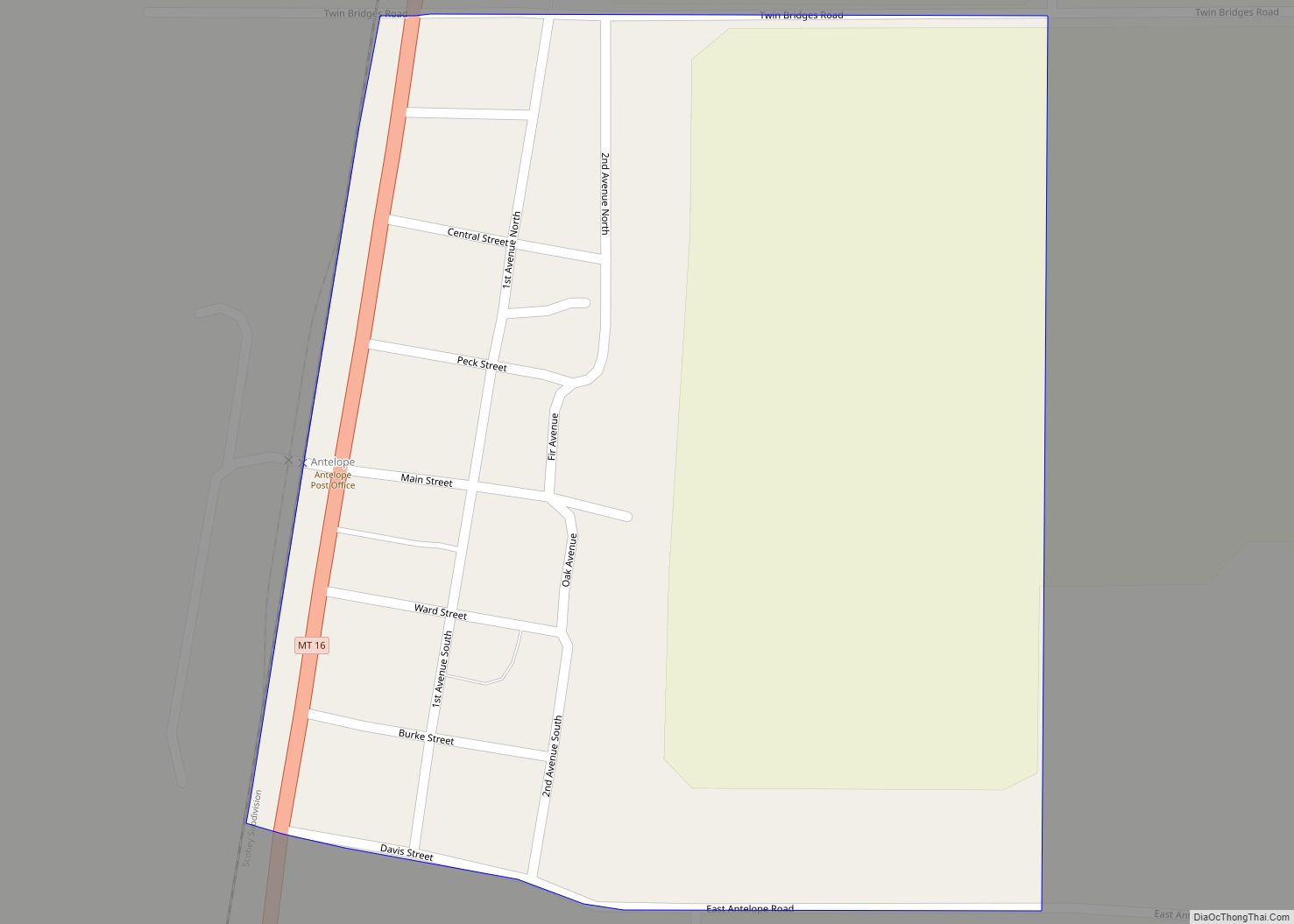
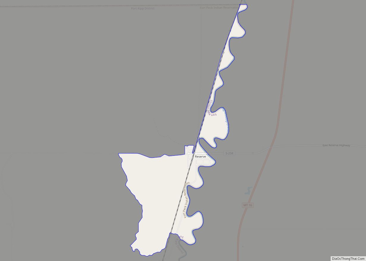
Online Interactive Map
Click on ![]() to view map in "full screen" mode.
to view map in "full screen" mode.
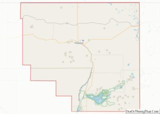
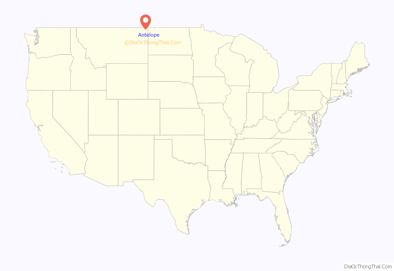
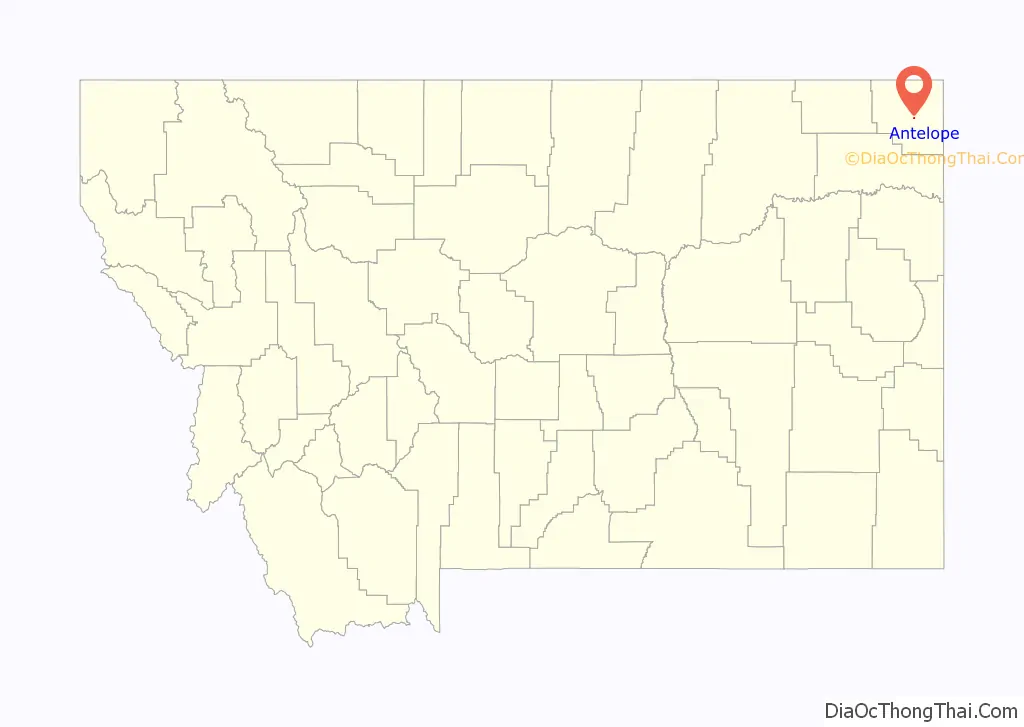
Antelope location map. Where is Antelope CDP?
History
Named for the nearby creek, Antelope began as a tiny community along the Great Northern Railway’s Bainville to Scobey branch line in 1910. That year, John and Richard Grayson built a hardware store next to the Antelope Creek Lutheran Church. A post office, bank, lumberyard, and saloon soon followed. The town was incorporated in 1913. The community thrived during its first decade, adding general mercantiles, a butcher shop, a concrete plant, restaurants, and other businesses to serve the region’s growing homesteader population. Over the years, however, better roads to the south siphoned off business, and the “Biggest Little City in Eastern Montana” sank into decline.
In 1967 a U.S. Navy gunboat was named the “Antelope”. To mark the occasion crew members came to the town of Antelope and some of the town’s citizens went to Tacoma, Washington.
School
Antelope School was built in 1916, the gym was finished in 1945. The school burned on October 20,1978, students attended Plentywood school for the remainder of the year. The school graduated 522 students from 1922 to 1979 (the 1979 graduating class was graduated at Plentwyood school but consider Antelope school their Alma mater).
Centennial Celebration
Antelope celebrated 100 years as a community on July 3, 2010. They had a parade, lunch, a skit about the history of town, and a street dance, among time for people to catch up with one another and blow up games for the kids in the park. The bar was also re-opened for the celebration as a gathering place and place to get a drink.
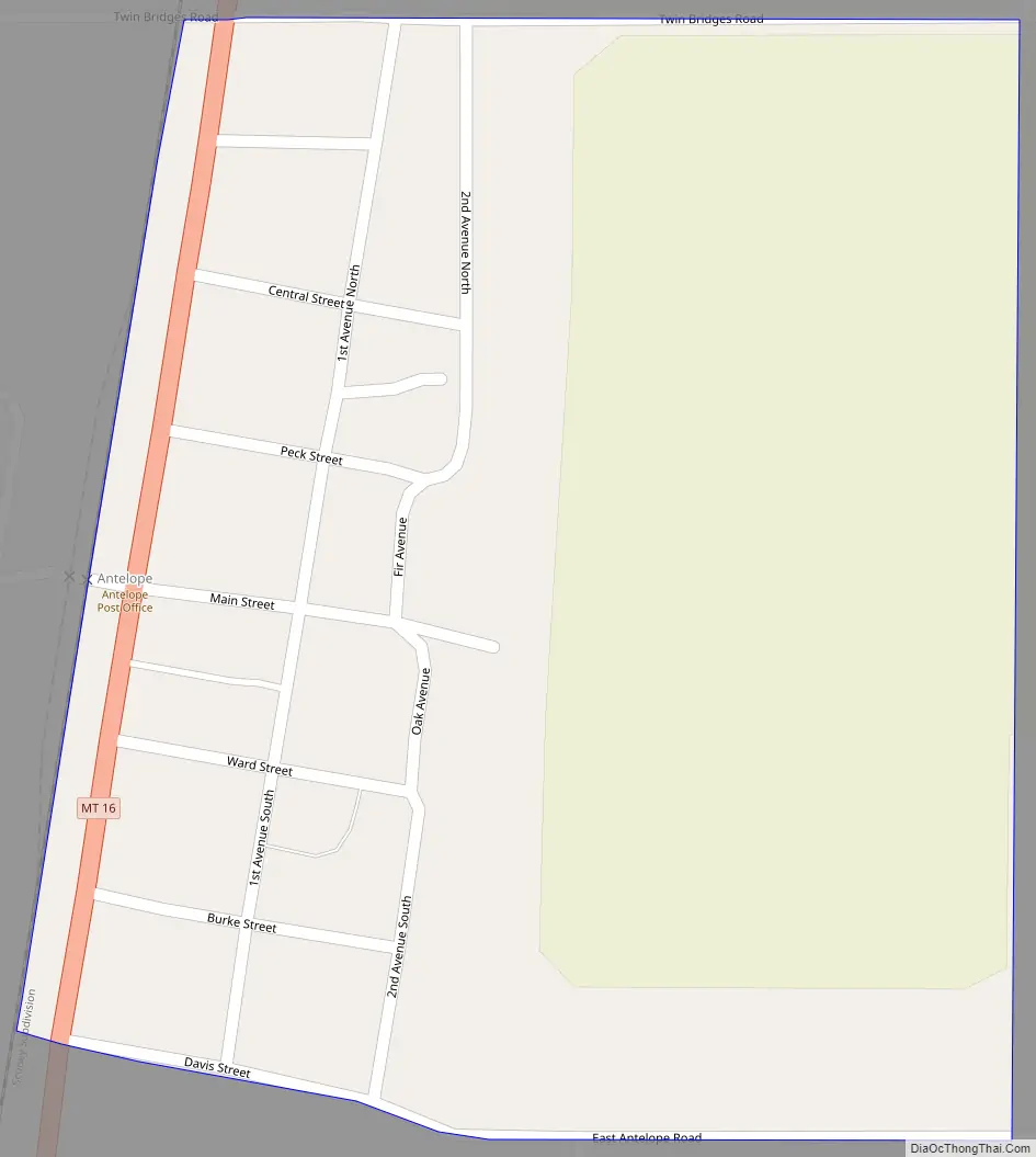
Antelope Road Map
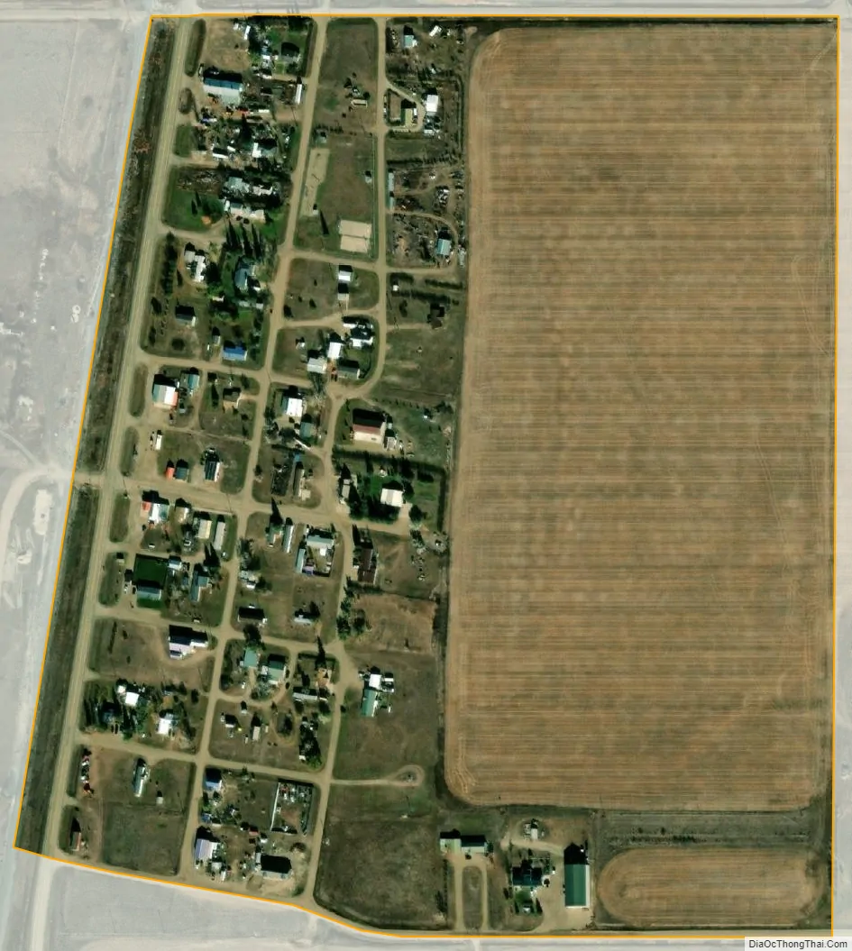
Antelope city Satellite Map
Geography
According to the United States Census Bureau, the CDP has a total area of 0.1 square miles (0.26 km), all land.
See also
Map of Montana State and its subdivision:- Beaverhead
- Big Horn
- Blaine
- Broadwater
- Carbon
- Carter
- Cascade
- Chouteau
- Custer
- Daniels
- Dawson
- Deer Lodge
- Fallon
- Fergus
- Flathead
- Gallatin
- Garfield
- Glacier
- Golden Valley
- Granite
- Hill
- Jefferson
- Judith Basin
- Lake
- Lewis and Clark
- Liberty
- Lincoln
- Madison
- McCone
- Meagher
- Mineral
- Missoula
- Musselshell
- Park
- Petroleum
- Phillips
- Pondera
- Powder River
- Powell
- Prairie
- Ravalli
- Richland
- Roosevelt
- Rosebud
- Sanders
- Sheridan
- Silver Bow
- Stillwater
- Sweet Grass
- Teton
- Toole
- Treasure
- Valley
- Wheatland
- Wibaux
- Yellowstone
- Alabama
- Alaska
- Arizona
- Arkansas
- California
- Colorado
- Connecticut
- Delaware
- District of Columbia
- Florida
- Georgia
- Hawaii
- Idaho
- Illinois
- Indiana
- Iowa
- Kansas
- Kentucky
- Louisiana
- Maine
- Maryland
- Massachusetts
- Michigan
- Minnesota
- Mississippi
- Missouri
- Montana
- Nebraska
- Nevada
- New Hampshire
- New Jersey
- New Mexico
- New York
- North Carolina
- North Dakota
- Ohio
- Oklahoma
- Oregon
- Pennsylvania
- Rhode Island
- South Carolina
- South Dakota
- Tennessee
- Texas
- Utah
- Vermont
- Virginia
- Washington
- West Virginia
- Wisconsin
- Wyoming