Ballantine is a census-designated place (CDP) in Yellowstone County, Montana, United States. It lies approximately nine miles (14 km) northeast of Billings on Interstate 94. The population was 346 at the 2000 census. Ballantine, along with the communities of Pompey’s Pillar, Worden, and Huntley, is part of the Huntley Project, an irrigation district created by the United States Bureau of Reclamation. The majority of Ballantine’s population lives on scattered farms and ranches surrounding the actual townsite.
| Name: | Ballantine CDP |
|---|---|
| LSAD Code: | 57 |
| LSAD Description: | CDP (suffix) |
| State: | Montana |
| County: | Yellowstone County |
| Elevation: | 2,995 ft (913 m) |
| Total Area: | 0.91 sq mi (2.36 km²) |
| Land Area: | 0.91 sq mi (2.36 km²) |
| Water Area: | 0.00 sq mi (0.00 km²) |
| Total Population: | 293 |
| Population Density: | 321.98/sq mi (124.32/km²) |
| ZIP code: | 59006 |
| Area code: | 406 |
| FIPS code: | 3003625 |
| GNISfeature ID: | 0768484 |
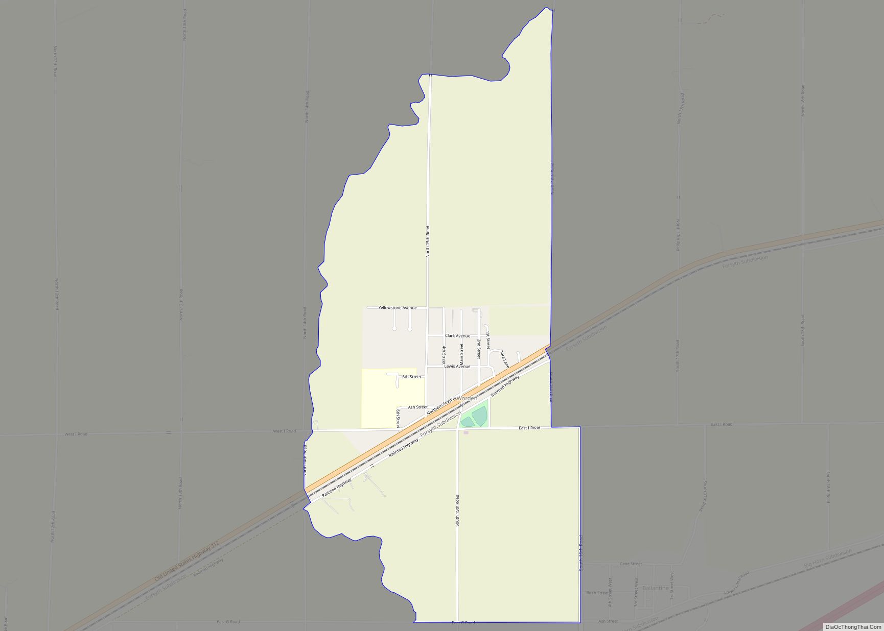
Online Interactive Map
Click on ![]() to view map in "full screen" mode.
to view map in "full screen" mode.
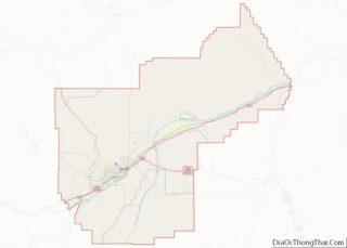
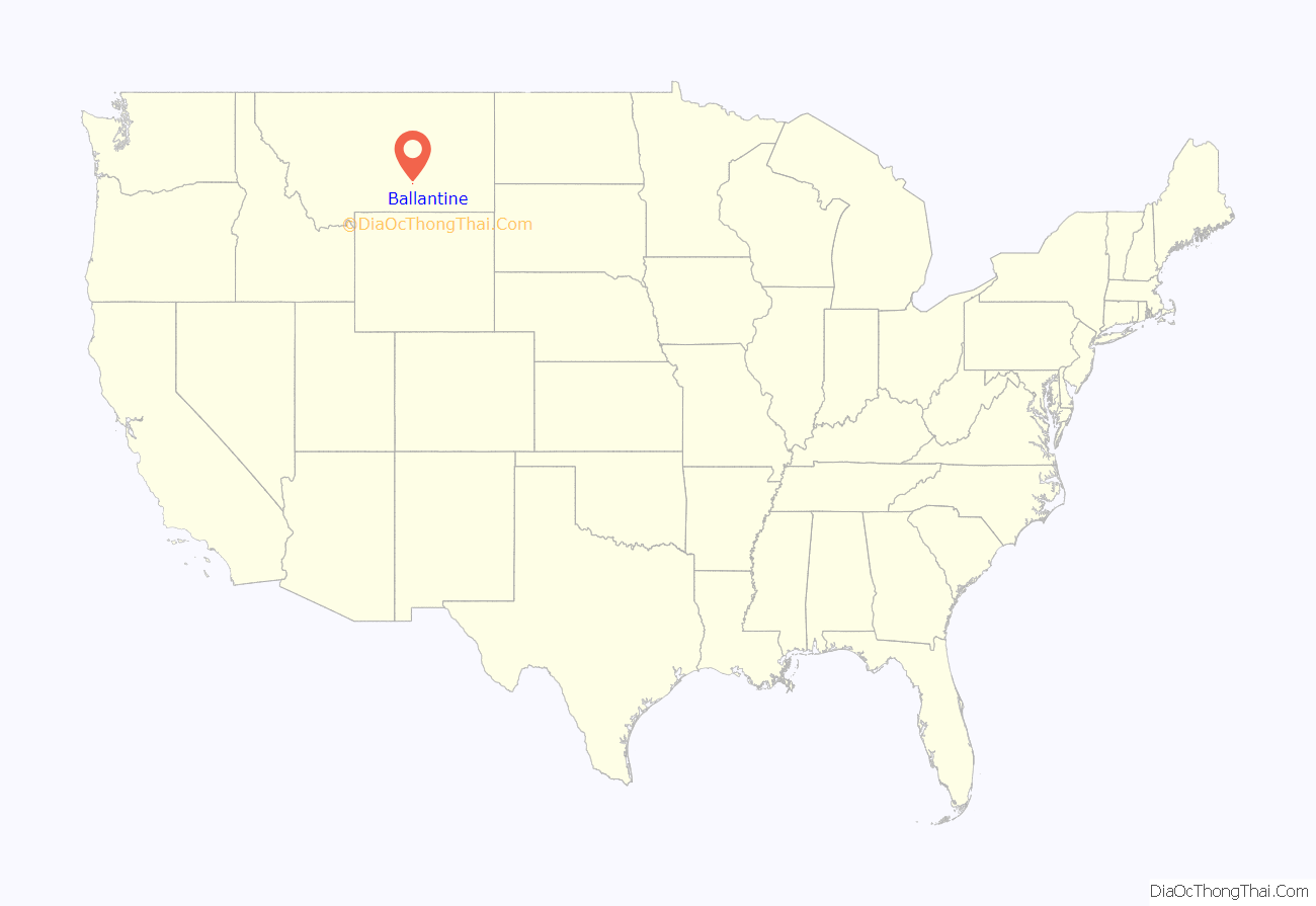
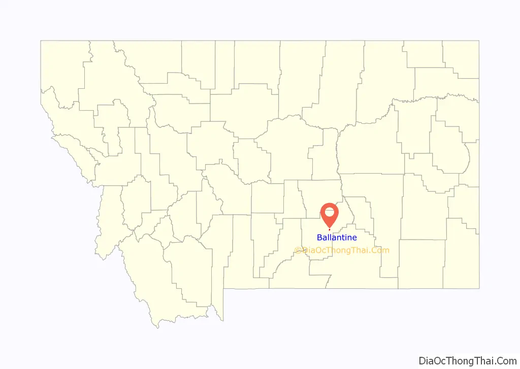
Ballantine location map. Where is Ballantine CDP?
History
Ballantine was founded on land that had been part of the Crow Indian Reservation. In 1896, the Burlington & Missouri River Railroad established Ballantine as a station, named for homesteader E. P. Ballantine. By 1907 the town had a post office and the Chicago, Burlington & Quincy Railroad had taken over rail operations.
It was in 1907 that Ballantine became part of a federally funded irrigation district, the Huntley Project. Irrigation slowly changed the sagebrush landscape into farms growing sugar beets, alfalfa, and other crops. The population grew slowly and included many European immigrants. Both Catholic and Lutheran religious services were held here, and a Congregational Church was built. The Anita Dam and Reservoir project, about six miles southeast of Ballantine, was completed in 1937 by Civilian Conservation Corps workers.
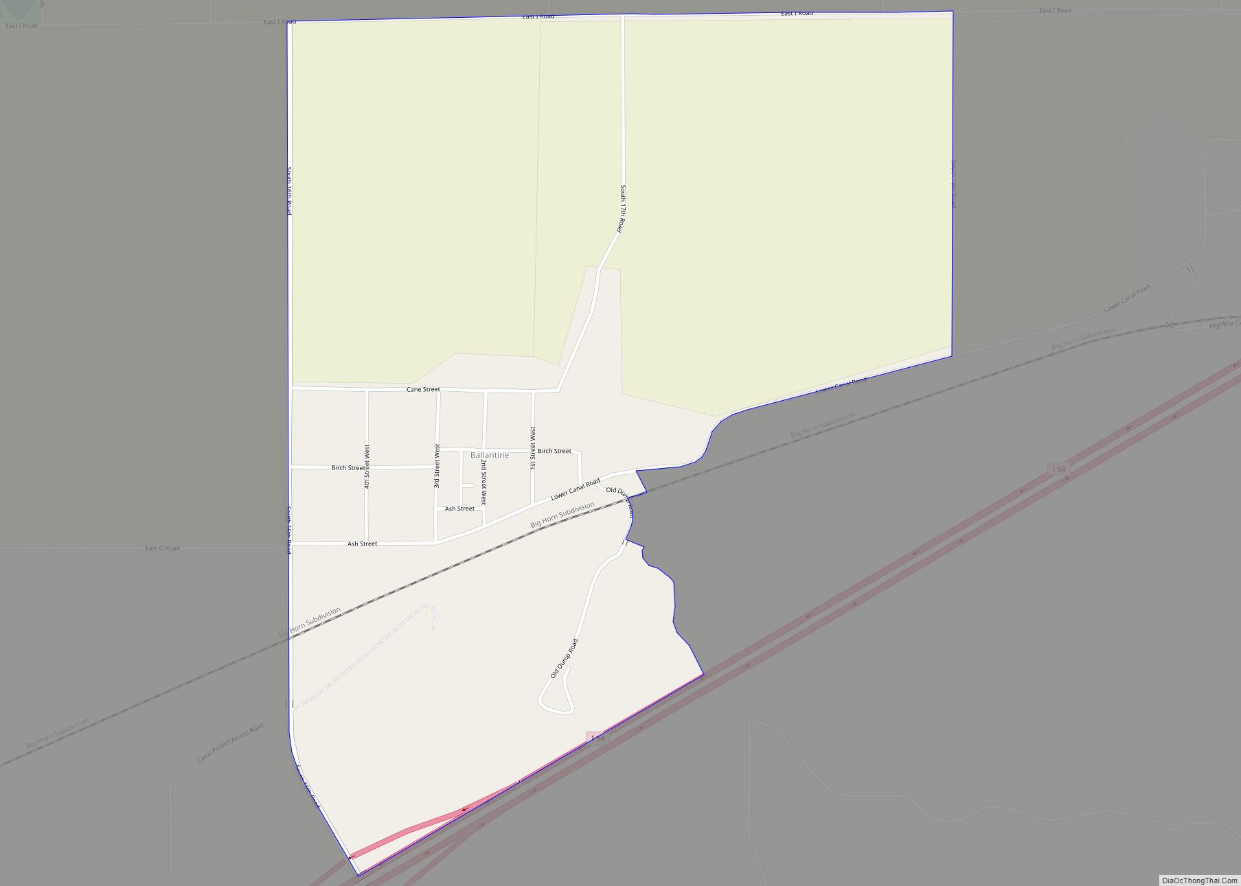
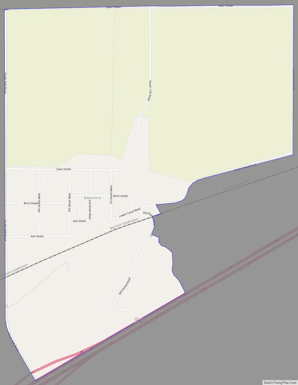
Ballantine Road Map
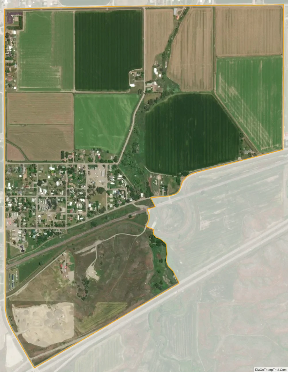
Ballantine city Satellite Map
Geography
Ballantine is located at 45°56′55″N 108°8′44″W / 45.94861°N 108.14556°W / 45.94861; -108.14556 (45.948587, -108.145650).
According to the United States Census Bureau, the CDP has a total area of 0.9 square miles (2.3 km), all land.
Ballantine is located near Interstate 94, approximately thirty miles east of Billings.
Climate
According to the Köppen Climate Classification system, Ballantine has a semi-arid climate, abbreviated “BSk” on climate maps. The hottest temperature recorded in Ballantine was 110 °F (43 °C) on July 5, 1936, while the coldest temperature recorded was −50 °F (−46 °C) on February 15, 1936.
See also
Map of Montana State and its subdivision:- Beaverhead
- Big Horn
- Blaine
- Broadwater
- Carbon
- Carter
- Cascade
- Chouteau
- Custer
- Daniels
- Dawson
- Deer Lodge
- Fallon
- Fergus
- Flathead
- Gallatin
- Garfield
- Glacier
- Golden Valley
- Granite
- Hill
- Jefferson
- Judith Basin
- Lake
- Lewis and Clark
- Liberty
- Lincoln
- Madison
- McCone
- Meagher
- Mineral
- Missoula
- Musselshell
- Park
- Petroleum
- Phillips
- Pondera
- Powder River
- Powell
- Prairie
- Ravalli
- Richland
- Roosevelt
- Rosebud
- Sanders
- Sheridan
- Silver Bow
- Stillwater
- Sweet Grass
- Teton
- Toole
- Treasure
- Valley
- Wheatland
- Wibaux
- Yellowstone
- Alabama
- Alaska
- Arizona
- Arkansas
- California
- Colorado
- Connecticut
- Delaware
- District of Columbia
- Florida
- Georgia
- Hawaii
- Idaho
- Illinois
- Indiana
- Iowa
- Kansas
- Kentucky
- Louisiana
- Maine
- Maryland
- Massachusetts
- Michigan
- Minnesota
- Mississippi
- Missouri
- Montana
- Nebraska
- Nevada
- New Hampshire
- New Jersey
- New Mexico
- New York
- North Carolina
- North Dakota
- Ohio
- Oklahoma
- Oregon
- Pennsylvania
- Rhode Island
- South Carolina
- South Dakota
- Tennessee
- Texas
- Utah
- Vermont
- Virginia
- Washington
- West Virginia
- Wisconsin
- Wyoming