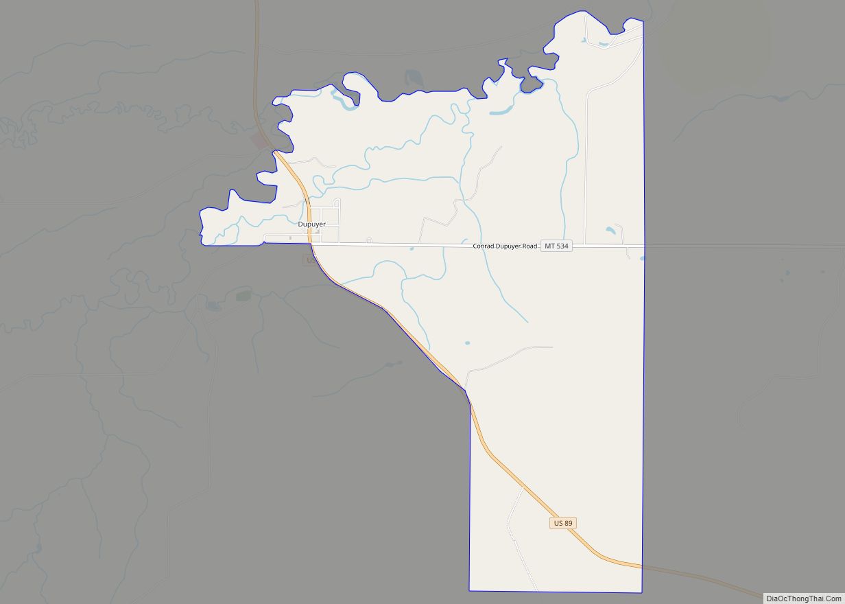
Dupuyer (/dəpuːˈjər/) is a census-designated place and unincorporated community in Pondera County, Montana, United States. Its population was 86 as of the 2010 census. The community is located along U.S. Route 89 and Dupuyer Creek. Dupuyer has a post office with ZIP code 59432.
The town takes its name from Dupuyer Creek, which borders the town. It began as a stagecoach stop in 1877 on the Fort Benton–Fort Browning road.
| Name: | Dupuyer CDP |
|---|---|
| LSAD Code: | 57 |
| LSAD Description: | CDP (suffix) |
| State: | Montana |
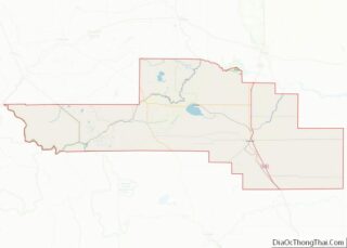
| County: | Pondera County |
| Elevation: | 4,117 ft (1,255 m) |
| Total Area: | 4.65 sq mi (12.05 km²) |
| Land Area: | 4.65 sq mi (12.04 km²) |
| Water Area: | 0.01 sq mi (0.01 km²) |
| Total Population: | 93 |
| Population Density: | 20.01/sq mi (7.73/km²) |
| ZIP code: | 59432 |
| Area code: | 406 |
| FIPS code: | 3022450 |
| GNISfeature ID: | 770915 |
Online Interactive Map
Click on ![]() to view map in "full screen" mode.
to view map in "full screen" mode.
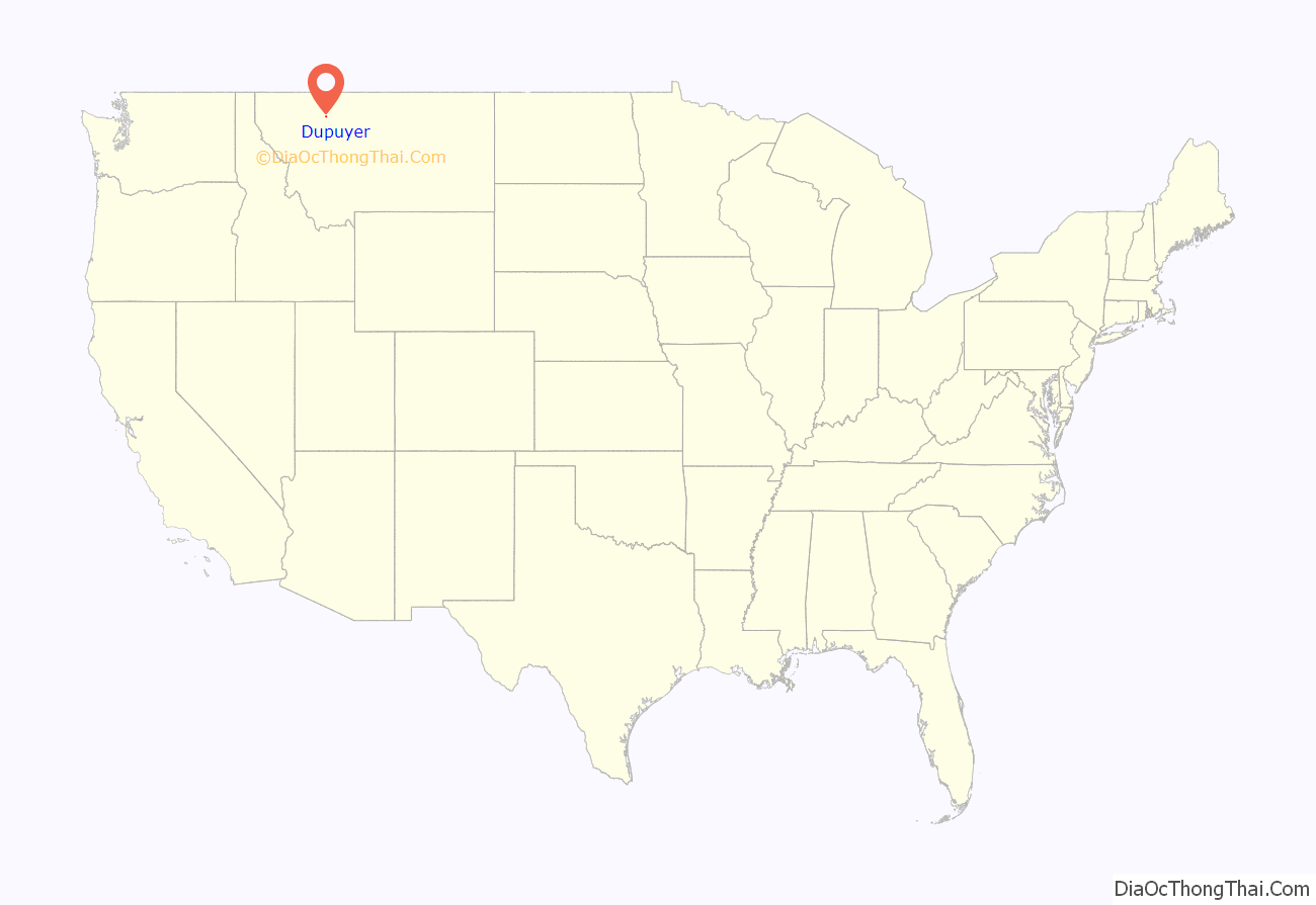
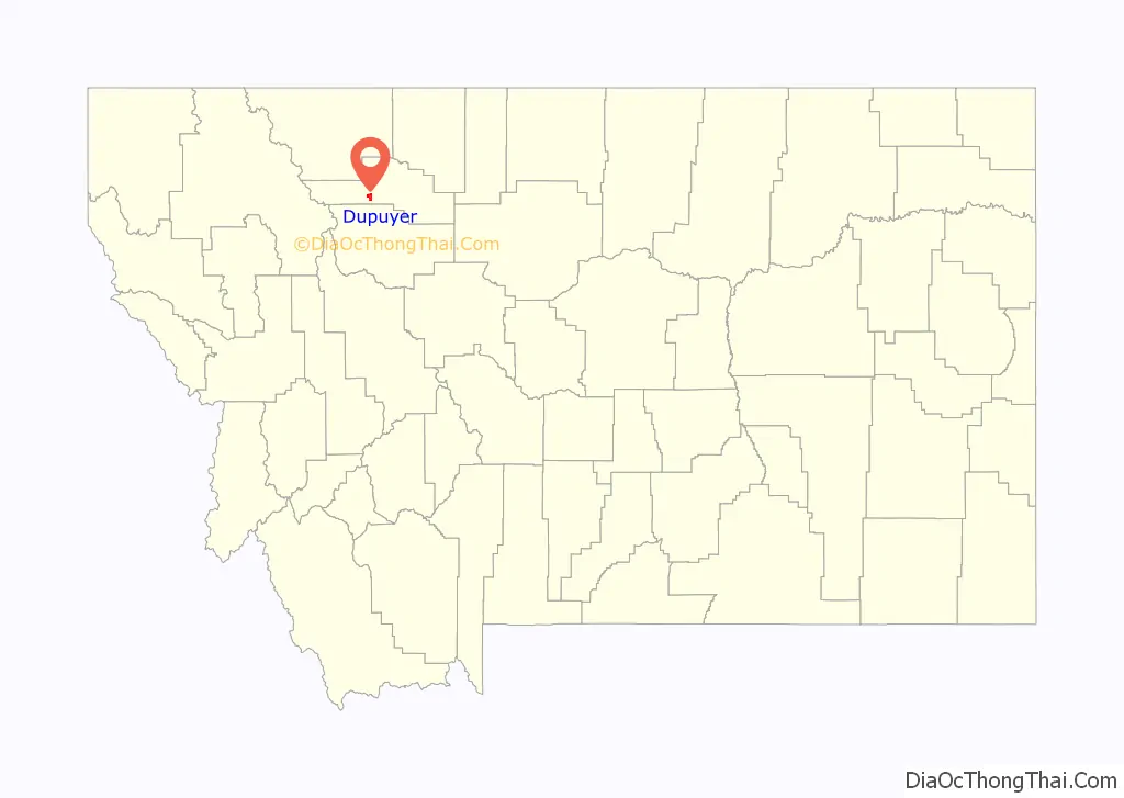
Dupuyer location map. Where is Dupuyer CDP?
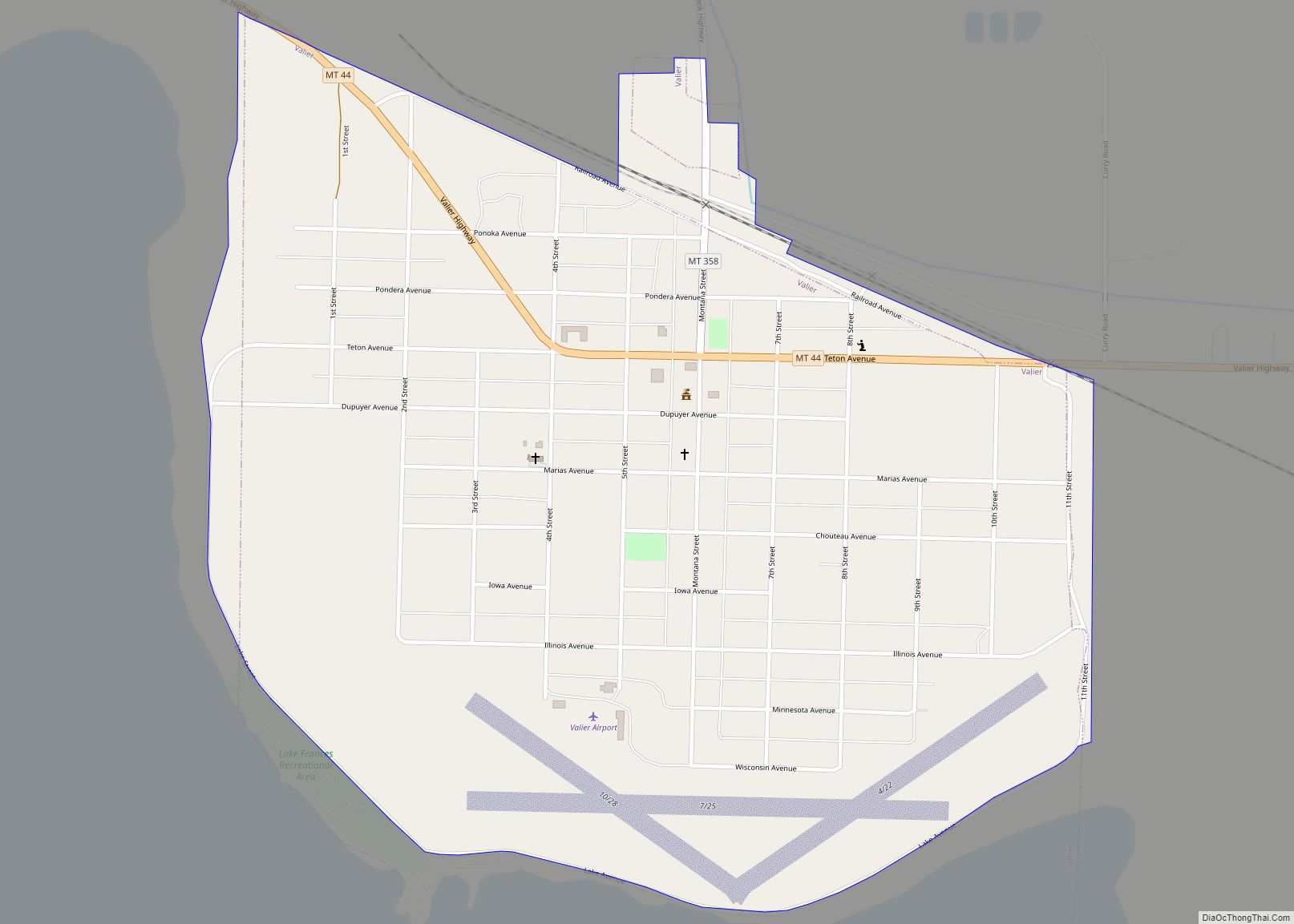
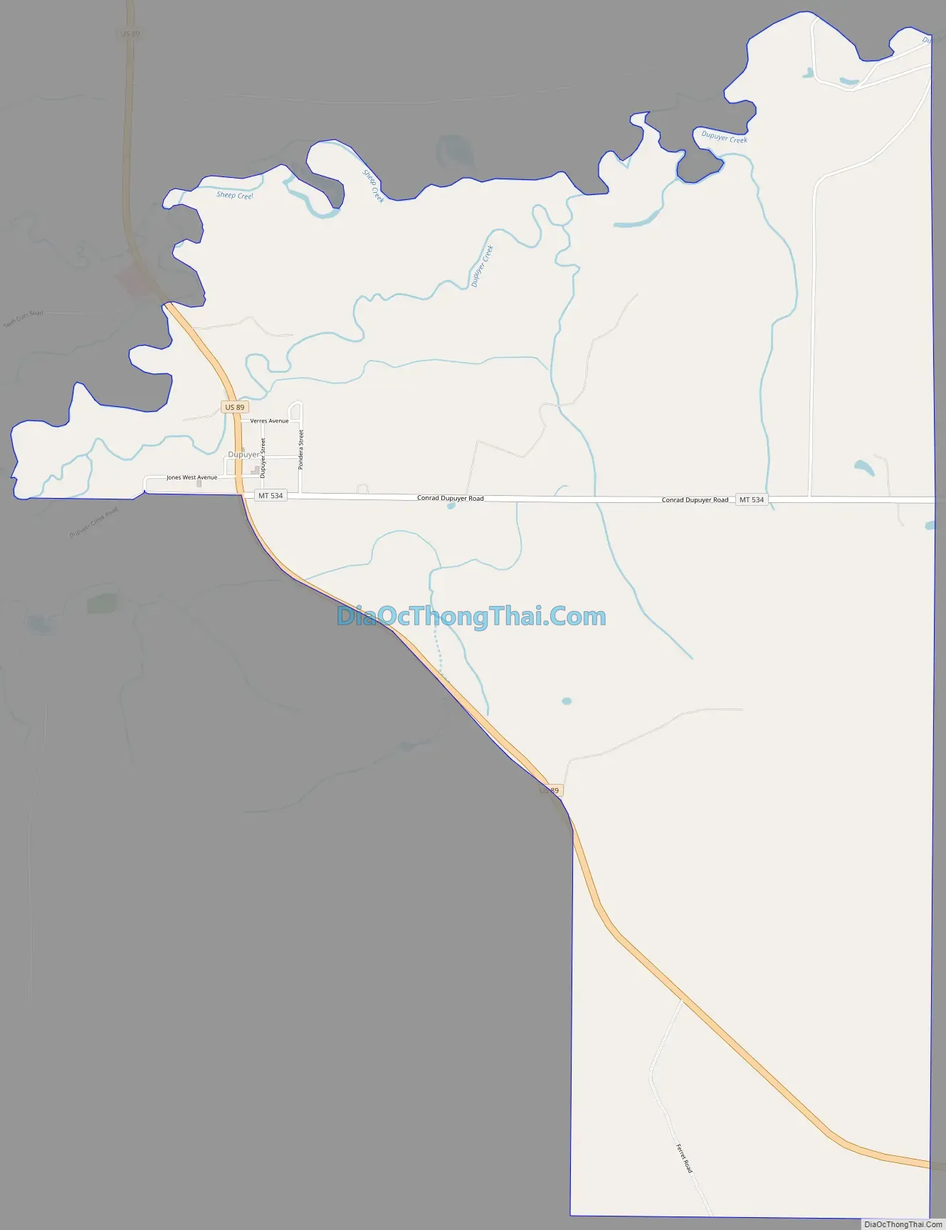
Dupuyer Road Map
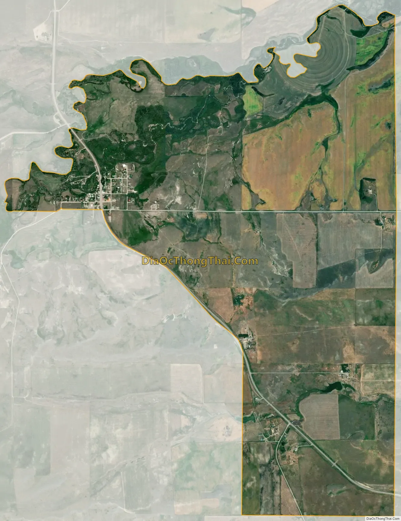
Dupuyer city Satellite Map
See also
Map of Montana State and its subdivision:- Beaverhead
- Big Horn
- Blaine
- Broadwater
- Carbon
- Carter
- Cascade
- Chouteau
- Custer
- Daniels
- Dawson
- Deer Lodge
- Fallon
- Fergus
- Flathead
- Gallatin
- Garfield
- Glacier
- Golden Valley
- Granite
- Hill
- Jefferson
- Judith Basin
- Lake
- Lewis and Clark
- Liberty
- Lincoln
- Madison
- McCone
- Meagher
- Mineral
- Missoula
- Musselshell
- Park
- Petroleum
- Phillips
- Pondera
- Powder River
- Powell
- Prairie
- Ravalli
- Richland
- Roosevelt
- Rosebud
- Sanders
- Sheridan
- Silver Bow
- Stillwater
- Sweet Grass
- Teton
- Toole
- Treasure
- Valley
- Wheatland
- Wibaux
- Yellowstone
- Alabama
- Alaska
- Arizona
- Arkansas
- California
- Colorado
- Connecticut
- Delaware
- District of Columbia
- Florida
- Georgia
- Hawaii
- Idaho
- Illinois
- Indiana
- Iowa
- Kansas
- Kentucky
- Louisiana
- Maine
- Maryland
- Massachusetts
- Michigan
- Minnesota
- Mississippi
- Missouri
- Montana
- Nebraska
- Nevada
- New Hampshire
- New Jersey
- New Mexico
- New York
- North Carolina
- North Dakota
- Ohio
- Oklahoma
- Oregon
- Pennsylvania
- Rhode Island
- South Carolina
- South Dakota
- Tennessee
- Texas
- Utah
- Vermont
- Virginia
- Washington
- West Virginia
- Wisconsin
- Wyoming