Froid is a town in Roosevelt County, Montana, United States. The population was 195 at the 2020 census. Froid was named for the French word for “cold”.
| Name: | Froid town |
|---|---|
| LSAD Code: | 43 |
| LSAD Description: | town (suffix) |
| State: | Montana |
| County: | Roosevelt County |
| Elevation: | 2,031 ft (619 m) |
| Total Area: | 0.62 sq mi (1.62 km²) |
| Land Area: | 0.62 sq mi (1.62 km²) |
| Water Area: | 0.00 sq mi (0.00 km²) |
| Total Population: | 195 |
| Population Density: | 312.50/sq mi (120.74/km²) |
| ZIP code: | 59226 |
| Area code: | 406 |
| FIPS code: | 3029500 |
| GNISfeature ID: | 0771647 |
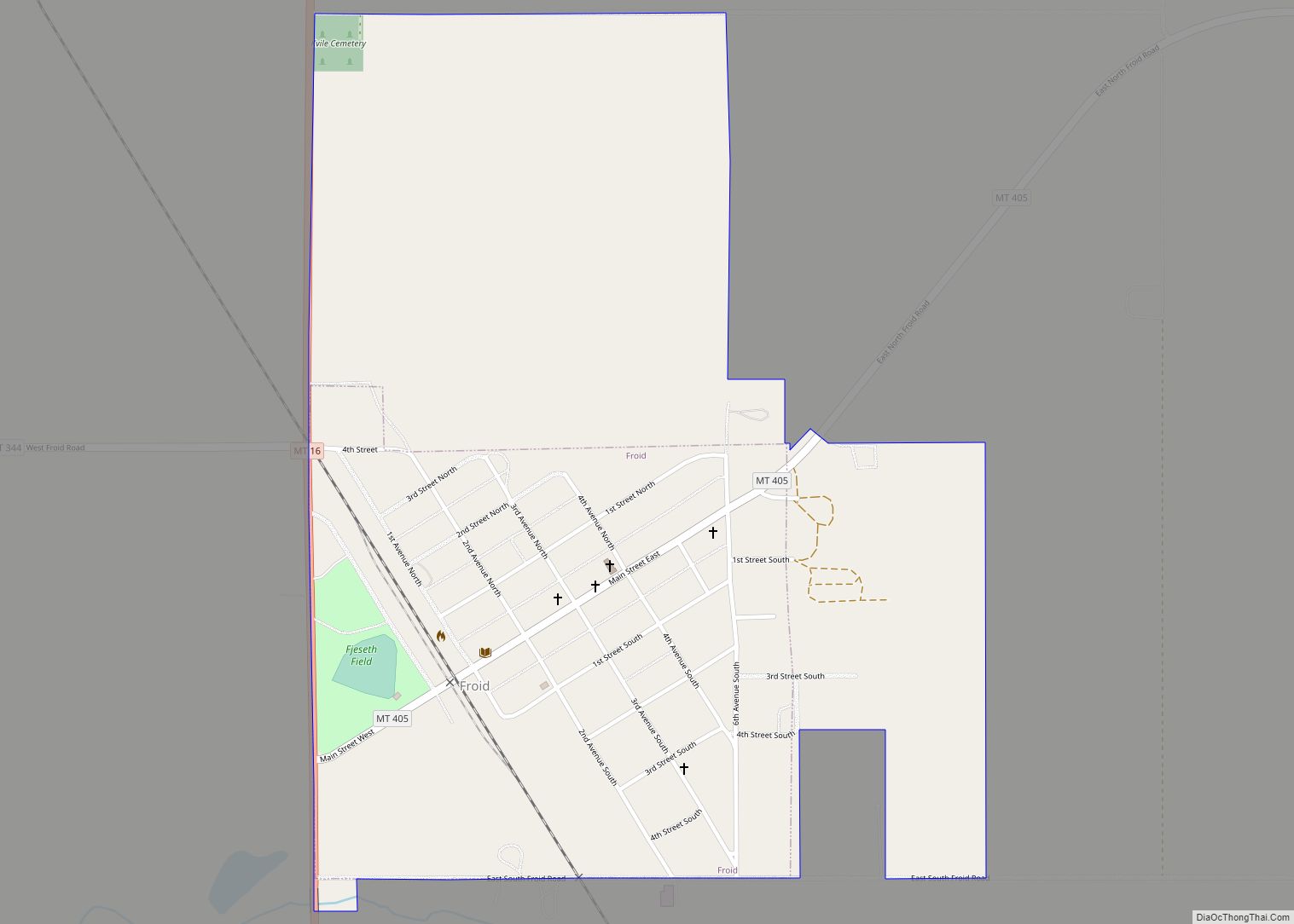
Online Interactive Map
Click on ![]() to view map in "full screen" mode.
to view map in "full screen" mode.
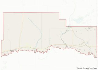
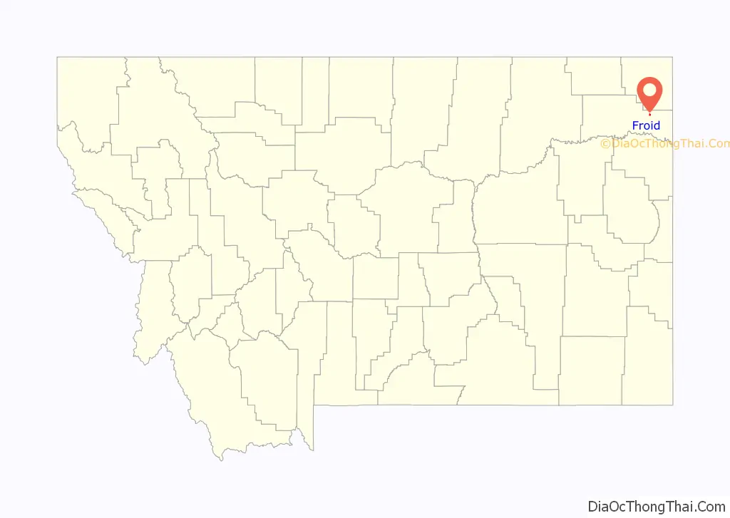
Froid location map. Where is Froid town?

History
The land that is now Froid was homesteaded by James and Alice Baker, and who erected a building that housed a dry goods store, livery stable, and meat house. One family currently residing in Froid (the Johnsons) are descendants of this couple.
Froid was incorporated in 1910. The town made headlines in 2007, when Governor Brian Schweitzer gave the commencement address to the high school graduating class, which consisted entirely of one student, Roxie Britton. The act received considerable soft news coverage for this distinction.
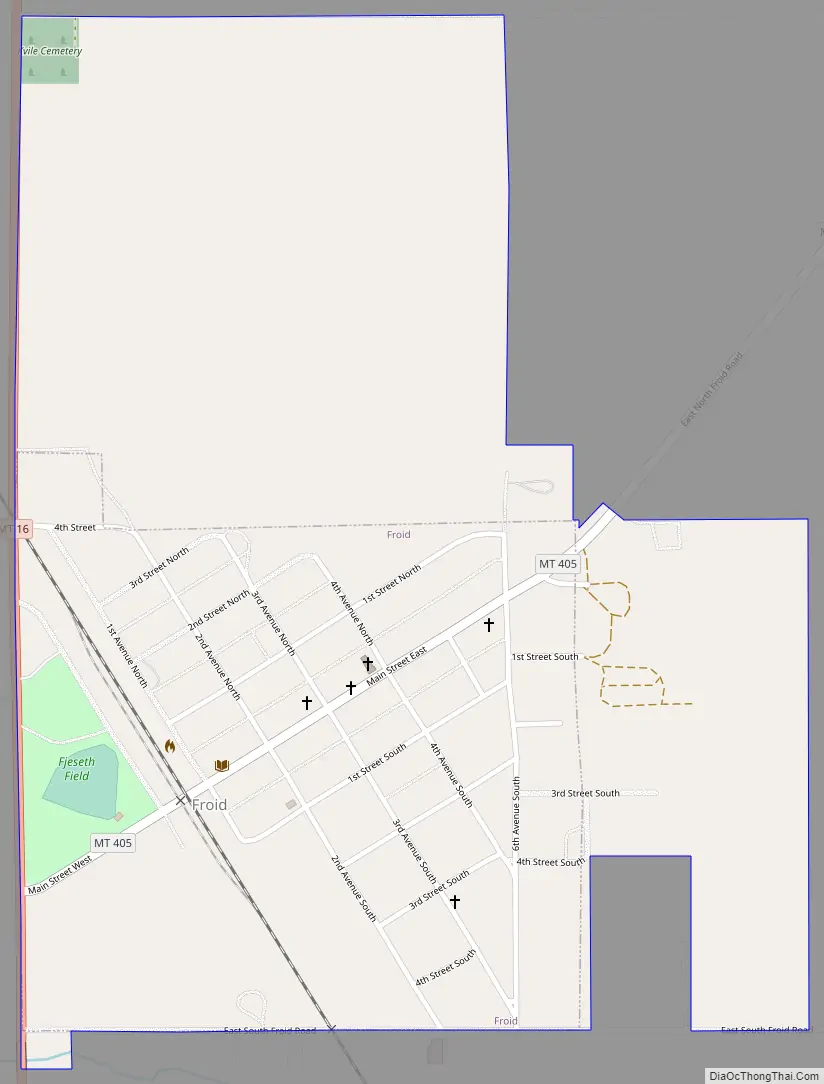
Froid Road Map
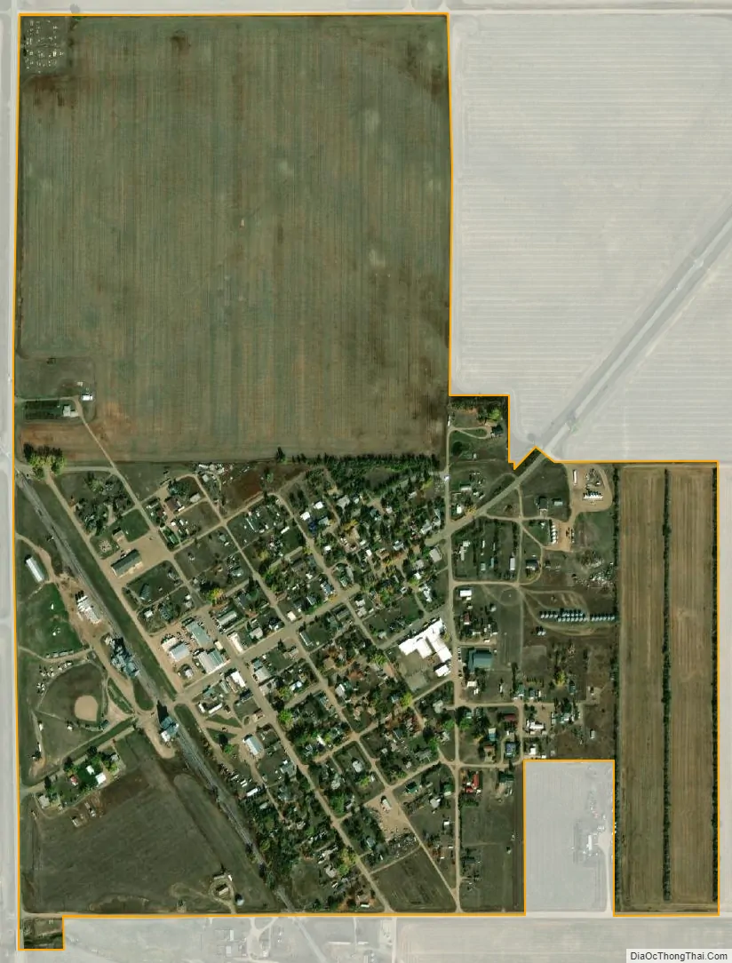
Froid city Satellite Map
Geography
Froid is located at 48°20′9″N 104°29′25″W / 48.33583°N 104.49028°W / 48.33583; -104.49028 (48.335950, -104.490264), near the North Dakota border and north of Culbertson, on Highway 16.
According to the United States Census Bureau, the town has a total area of 0.28 square miles (0.73 km), all land.
See also
Map of Montana State and its subdivision:- Beaverhead
- Big Horn
- Blaine
- Broadwater
- Carbon
- Carter
- Cascade
- Chouteau
- Custer
- Daniels
- Dawson
- Deer Lodge
- Fallon
- Fergus
- Flathead
- Gallatin
- Garfield
- Glacier
- Golden Valley
- Granite
- Hill
- Jefferson
- Judith Basin
- Lake
- Lewis and Clark
- Liberty
- Lincoln
- Madison
- McCone
- Meagher
- Mineral
- Missoula
- Musselshell
- Park
- Petroleum
- Phillips
- Pondera
- Powder River
- Powell
- Prairie
- Ravalli
- Richland
- Roosevelt
- Rosebud
- Sanders
- Sheridan
- Silver Bow
- Stillwater
- Sweet Grass
- Teton
- Toole
- Treasure
- Valley
- Wheatland
- Wibaux
- Yellowstone
- Alabama
- Alaska
- Arizona
- Arkansas
- California
- Colorado
- Connecticut
- Delaware
- District of Columbia
- Florida
- Georgia
- Hawaii
- Idaho
- Illinois
- Indiana
- Iowa
- Kansas
- Kentucky
- Louisiana
- Maine
- Maryland
- Massachusetts
- Michigan
- Minnesota
- Mississippi
- Missouri
- Montana
- Nebraska
- Nevada
- New Hampshire
- New Jersey
- New Mexico
- New York
- North Carolina
- North Dakota
- Ohio
- Oklahoma
- Oregon
- Pennsylvania
- Rhode Island
- South Carolina
- South Dakota
- Tennessee
- Texas
- Utah
- Vermont
- Virginia
- Washington
- West Virginia
- Wisconsin
- Wyoming