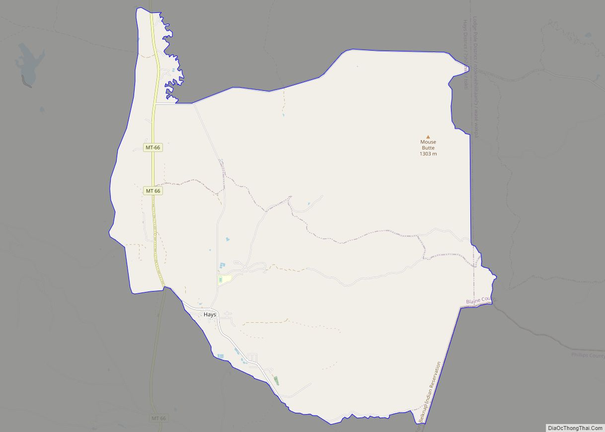
Hays is a census-designated place (CDP) in Blaine County, Montana, United States. The population was 843 at the 2010 census. The community lies within the Fort Belknap Indian Reservation, near the reservation’s southern end. The nearby community of Lodge Pole lies to the east.
The town was named for Major Hays. The Bureau of Catholic Indian Missions built St. Paul’s Mission Church at Hays in 1887.
| Name: | Hays CDP |
|---|---|
| LSAD Code: | 57 |
| LSAD Description: | CDP (suffix) |
| State: | Montana |
| County: | Blaine County |
| Elevation: | 3,533 ft (1,077 m) |
| Total Area: | 27.10 sq mi (70.18 km²) |
| Land Area: | 27.10 sq mi (70.18 km²) |
| Water Area: | 0.00 sq mi (0.00 km²) |
| Total Population: | 996 |
| Population Density: | 36.76/sq mi (14.19/km²) |
| ZIP code: | 59527 |
| Area code: | 406 |
| FIPS code: | 3035275 |
| GNISfeature ID: | 0772273 |
Online Interactive Map
Click on ![]() to view map in "full screen" mode.
to view map in "full screen" mode.
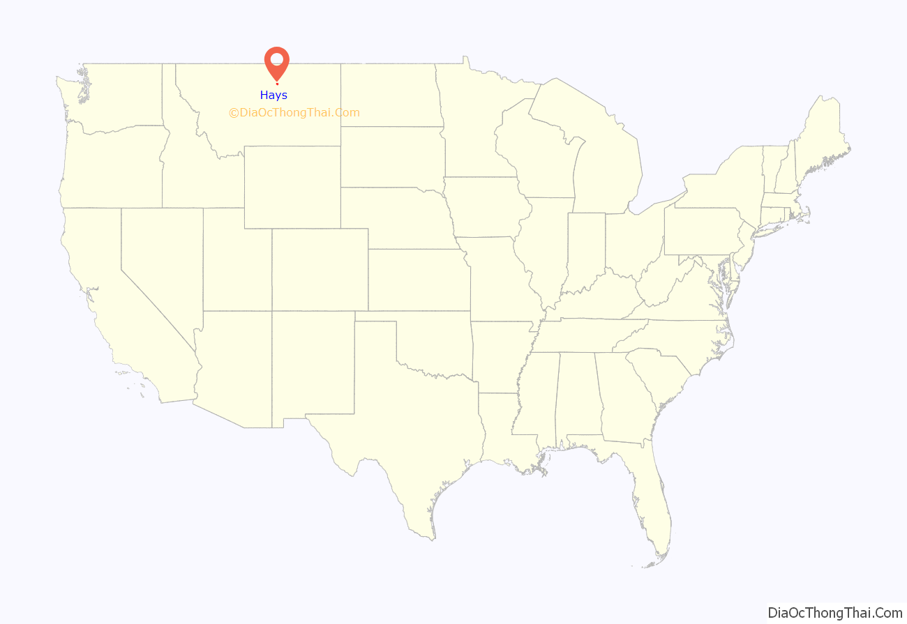
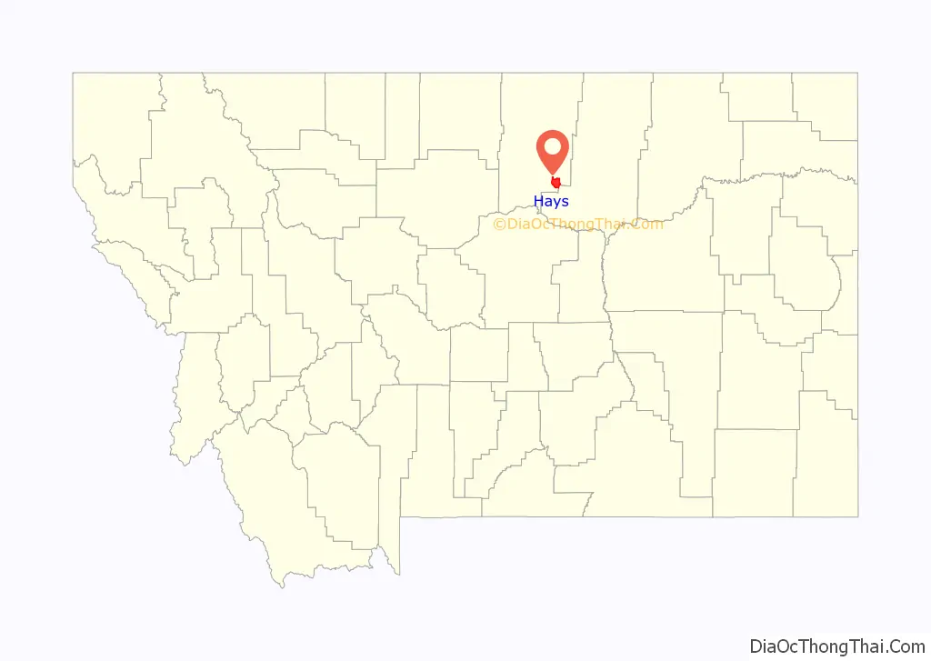
Hays location map. Where is Hays CDP?
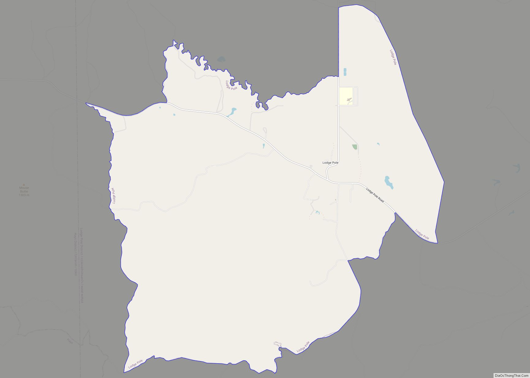
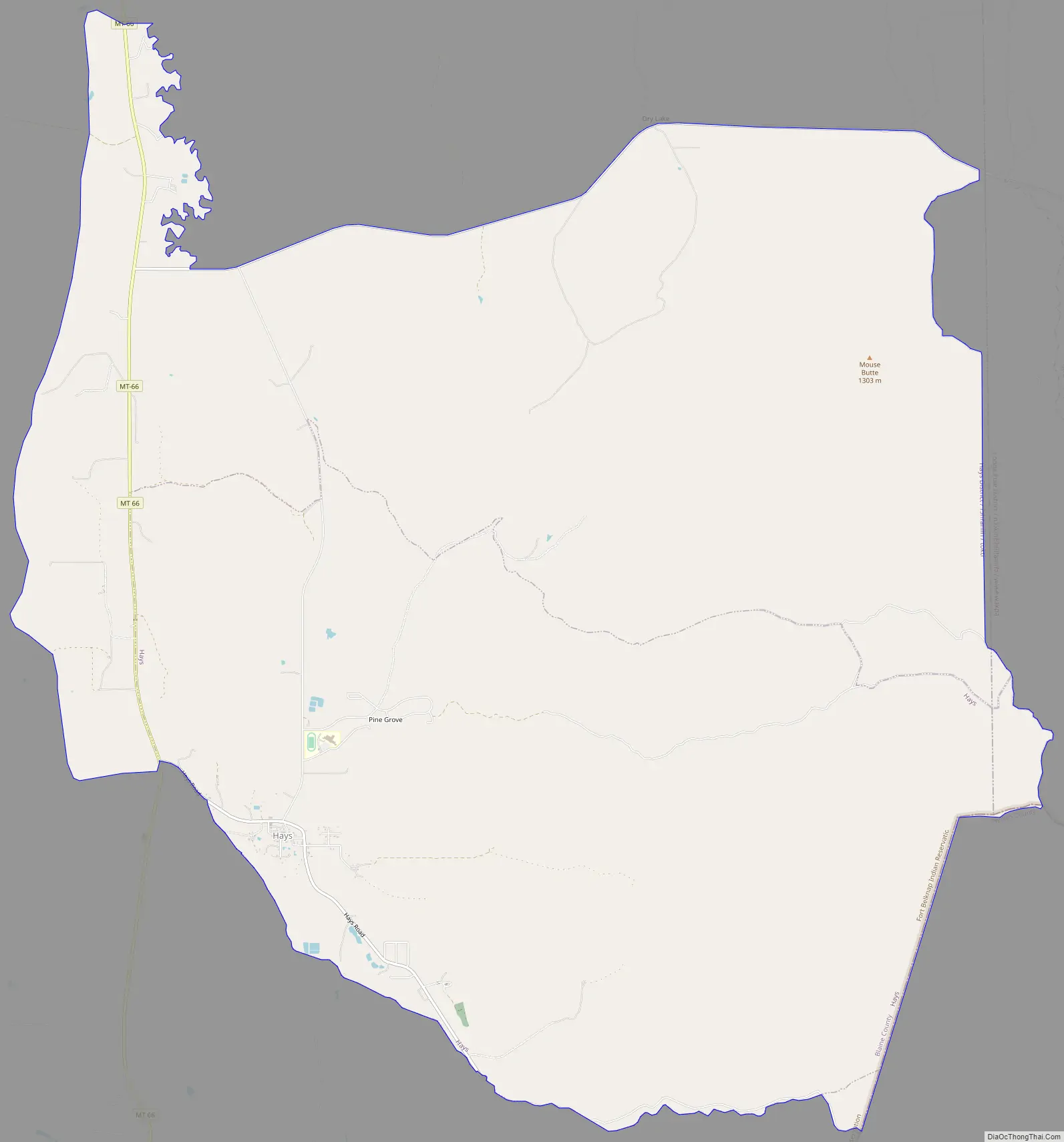
Hays Road Map
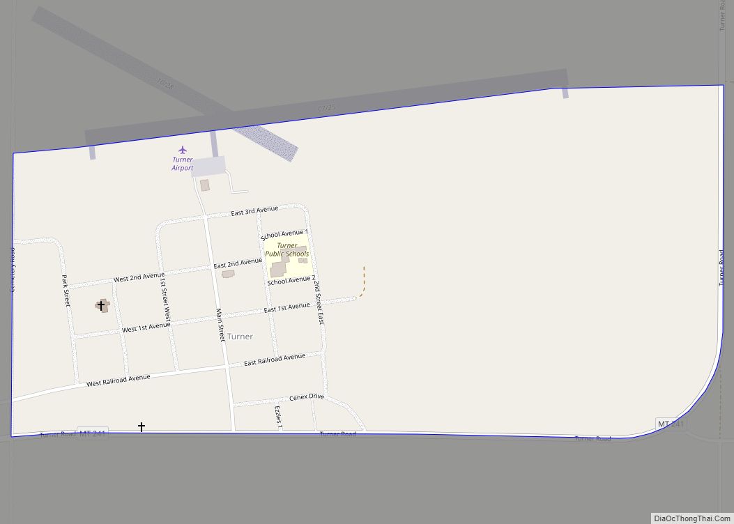
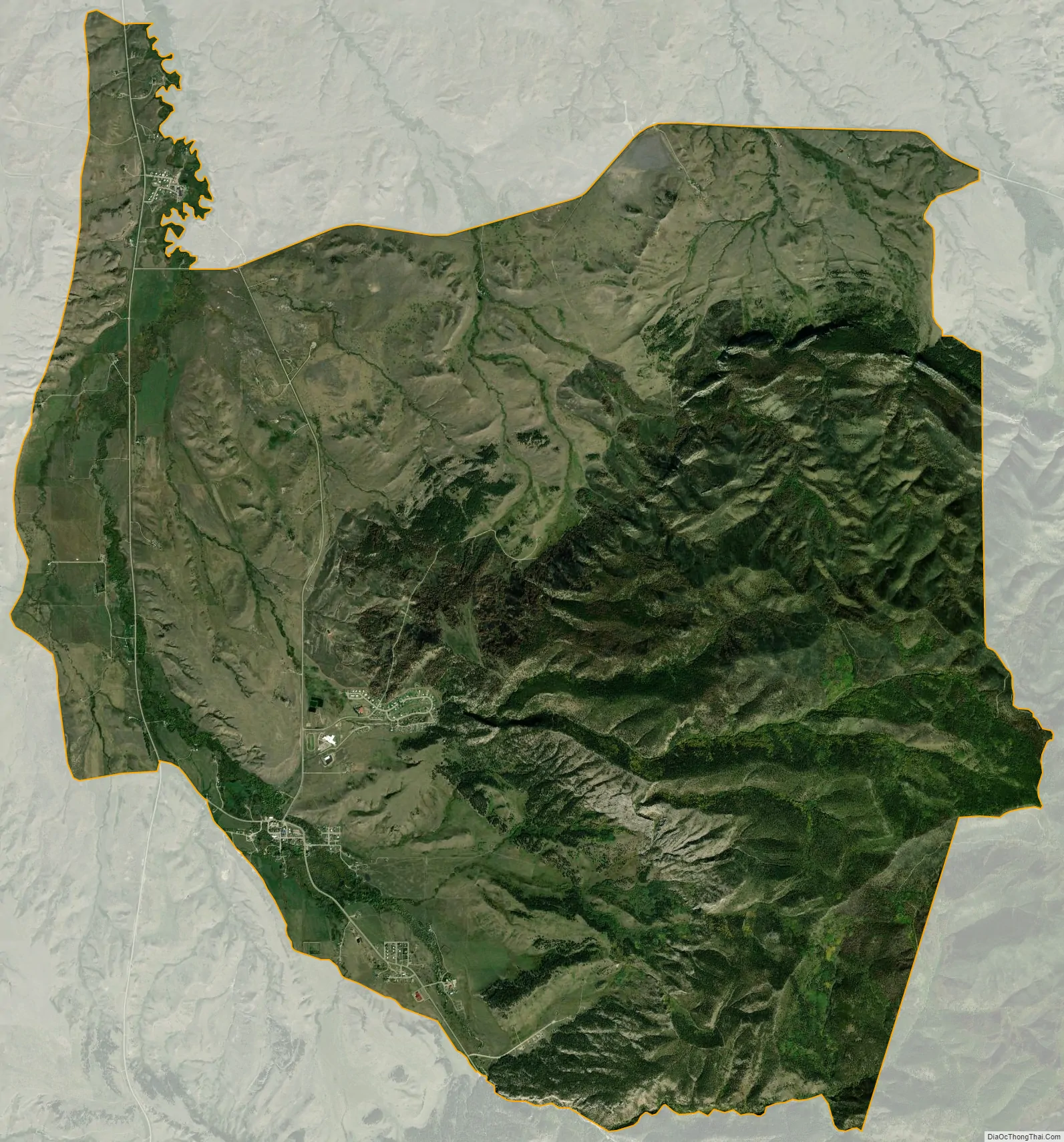
Hays city Satellite Map
Geography
Hays is located at 47°59′21″N 108°41′15″W / 47.98917°N 108.68750°W / 47.98917; -108.68750 (47.989164, -108.687493).
According to the United States Census Bureau, the CDP has a total area of 27.1 square miles (70.1 km), all land.
See also
Map of Montana State and its subdivision:- Beaverhead
- Big Horn
- Blaine
- Broadwater
- Carbon
- Carter
- Cascade
- Chouteau
- Custer
- Daniels
- Dawson
- Deer Lodge
- Fallon
- Fergus
- Flathead
- Gallatin
- Garfield
- Glacier
- Golden Valley
- Granite
- Hill
- Jefferson
- Judith Basin
- Lake
- Lewis and Clark
- Liberty
- Lincoln
- Madison
- McCone
- Meagher
- Mineral
- Missoula
- Musselshell
- Park
- Petroleum
- Phillips
- Pondera
- Powder River
- Powell
- Prairie
- Ravalli
- Richland
- Roosevelt
- Rosebud
- Sanders
- Sheridan
- Silver Bow
- Stillwater
- Sweet Grass
- Teton
- Toole
- Treasure
- Valley
- Wheatland
- Wibaux
- Yellowstone
- Alabama
- Alaska
- Arizona
- Arkansas
- California
- Colorado
- Connecticut
- Delaware
- District of Columbia
- Florida
- Georgia
- Hawaii
- Idaho
- Illinois
- Indiana
- Iowa
- Kansas
- Kentucky
- Louisiana
- Maine
- Maryland
- Massachusetts
- Michigan
- Minnesota
- Mississippi
- Missouri
- Montana
- Nebraska
- Nevada
- New Hampshire
- New Jersey
- New Mexico
- New York
- North Carolina
- North Dakota
- Ohio
- Oklahoma
- Oregon
- Pennsylvania
- Rhode Island
- South Carolina
- South Dakota
- Tennessee
- Texas
- Utah
- Vermont
- Virginia
- Washington
- West Virginia
- Wisconsin
- Wyoming