Jette is a census-designated place (CDP) in Lake County, Montana, United States. The population was 253 at the 2010 census.
| Name: | Jette CDP |
|---|---|
| LSAD Code: | 57 |
| LSAD Description: | CDP (suffix) |
| State: | Montana |
| County: | Lake County |
| Elevation: | 2,936 ft (895 m) |
| Total Area: | 0.62 sq mi (1.60 km²) |
| Land Area: | 0.62 sq mi (1.60 km²) |
| Water Area: | 0.00 sq mi (0.00 km²) |
| Total Population: | 273 |
| Population Density: | 441.75/sq mi (170.49/km²) |
| Area code: | 406 |
| FIPS code: | 3039627 |
| GNISfeature ID: | 1853180 |
Online Interactive Map
Click on ![]() to view map in "full screen" mode.
to view map in "full screen" mode.
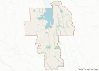
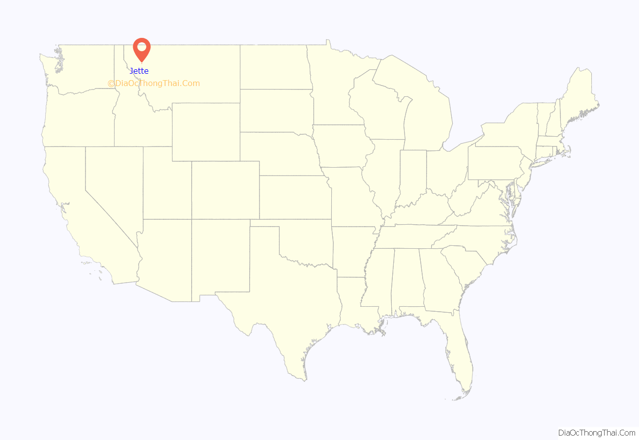
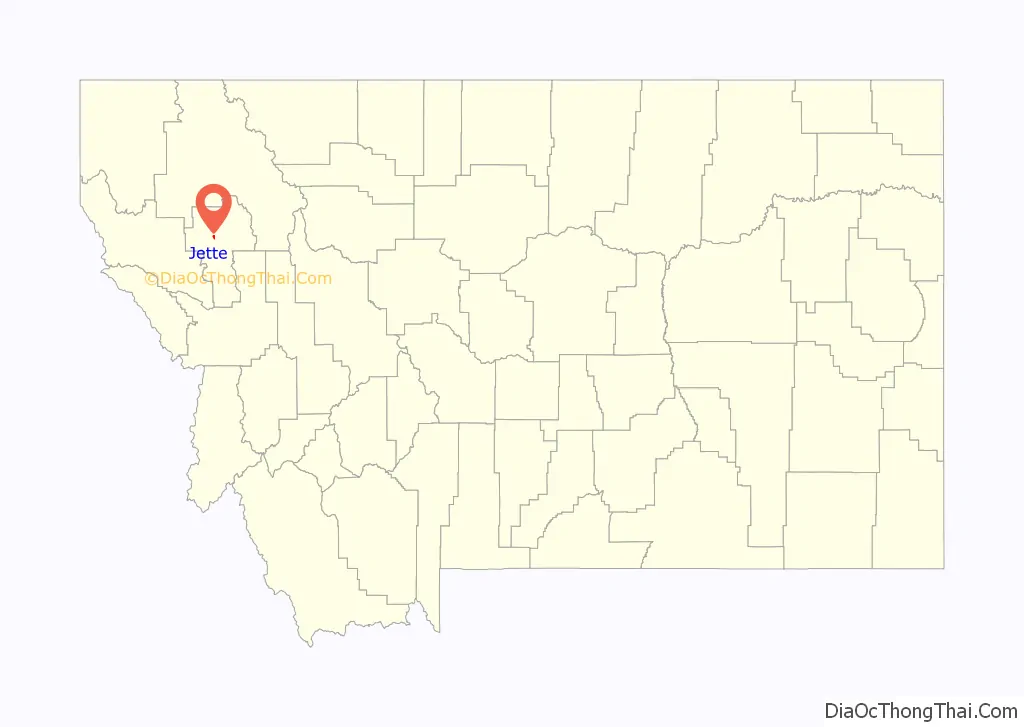
Jette location map. Where is Jette CDP?
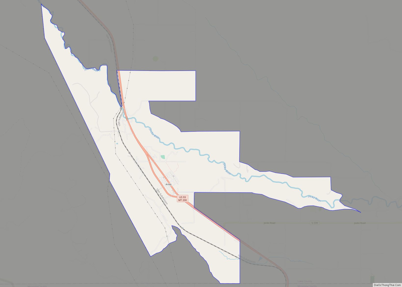
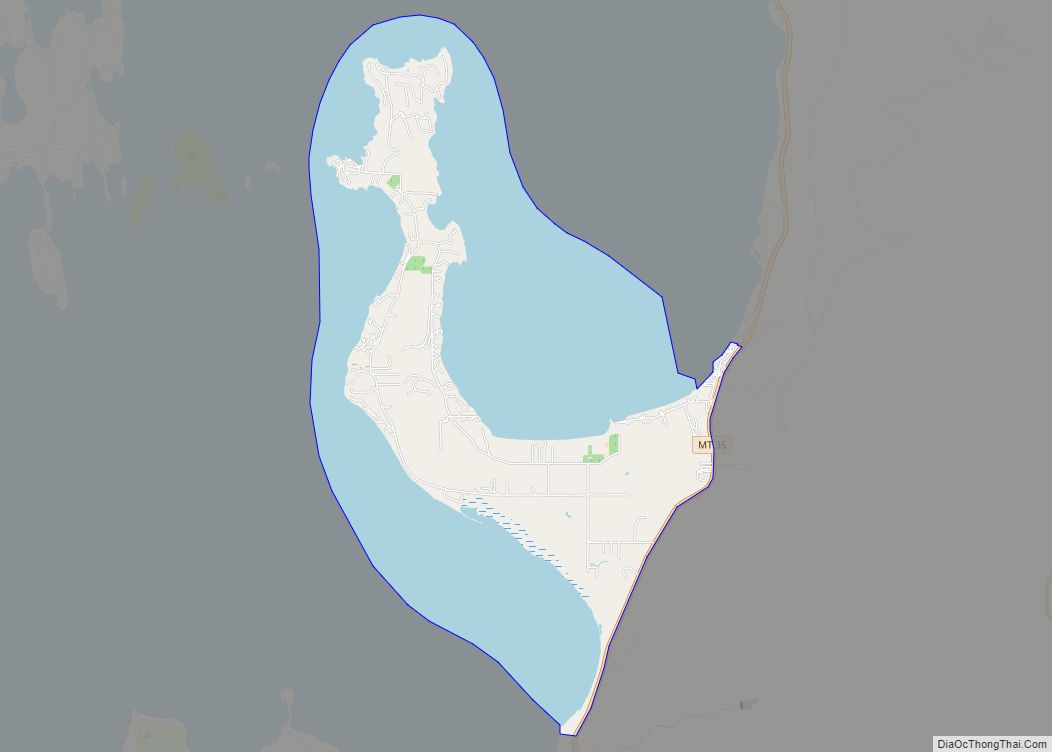
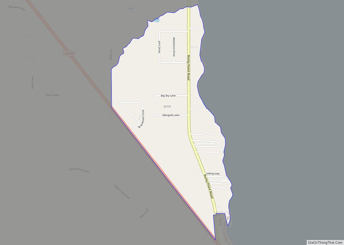
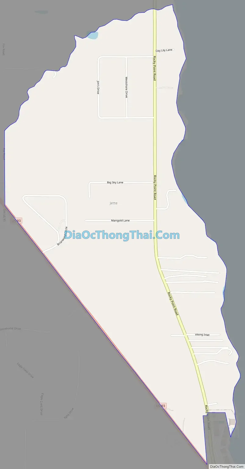
Jette Road Map
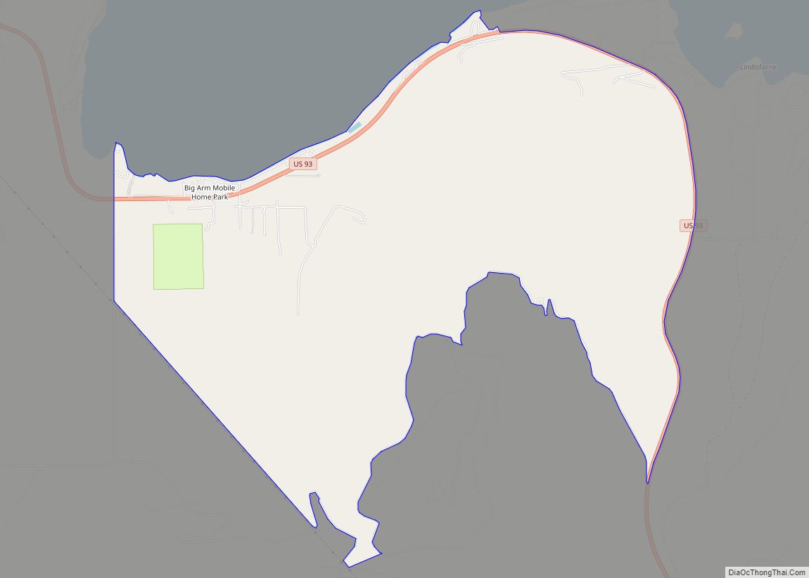
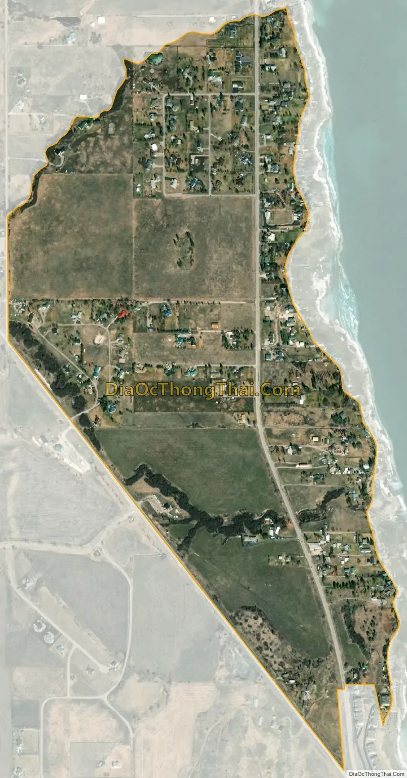
Jette city Satellite Map
Geography
Jette is located in north-central Lake County at 47°43′2″N 114°11′14″W / 47.71722°N 114.18722°W / 47.71722; -114.18722 (47.717170, -114.187267), on the western side of Flathead Lake near its southern end. The community is bordered to the south by Polson, the county seat, and to the north by the community of Rocky Point. U.S. Route 93 forms the southwestern edge of the Jette CDP, leading northwest 14 miles (23 km) to Elmo and southeast 2 miles (3 km) to the center of Polson and a further 36 miles (58 km) to Ravalli.
According to the United States Census Bureau, the CDP has a total area of 0.62 square miles (1.6 km), all land.
See also
Map of Montana State and its subdivision:- Beaverhead
- Big Horn
- Blaine
- Broadwater
- Carbon
- Carter
- Cascade
- Chouteau
- Custer
- Daniels
- Dawson
- Deer Lodge
- Fallon
- Fergus
- Flathead
- Gallatin
- Garfield
- Glacier
- Golden Valley
- Granite
- Hill
- Jefferson
- Judith Basin
- Lake
- Lewis and Clark
- Liberty
- Lincoln
- Madison
- McCone
- Meagher
- Mineral
- Missoula
- Musselshell
- Park
- Petroleum
- Phillips
- Pondera
- Powder River
- Powell
- Prairie
- Ravalli
- Richland
- Roosevelt
- Rosebud
- Sanders
- Sheridan
- Silver Bow
- Stillwater
- Sweet Grass
- Teton
- Toole
- Treasure
- Valley
- Wheatland
- Wibaux
- Yellowstone
- Alabama
- Alaska
- Arizona
- Arkansas
- California
- Colorado
- Connecticut
- Delaware
- District of Columbia
- Florida
- Georgia
- Hawaii
- Idaho
- Illinois
- Indiana
- Iowa
- Kansas
- Kentucky
- Louisiana
- Maine
- Maryland
- Massachusetts
- Michigan
- Minnesota
- Mississippi
- Missouri
- Montana
- Nebraska
- Nevada
- New Hampshire
- New Jersey
- New Mexico
- New York
- North Carolina
- North Dakota
- Ohio
- Oklahoma
- Oregon
- Pennsylvania
- Rhode Island
- South Carolina
- South Dakota
- Tennessee
- Texas
- Utah
- Vermont
- Virginia
- Washington
- West Virginia
- Wisconsin
- Wyoming