Jordan is a town in and the county seat of Garfield County, Montana, United States. The population was 356 at the 2020 census. It is Garfield County’s only incorporated community.
| Name: | Jordan town |
|---|---|
| LSAD Code: | 43 |
| LSAD Description: | town (suffix) |
| State: | Montana |
| County: | Garfield County |
| Elevation: | 2,602 ft (793 m) |
| Total Area: | 0.35 sq mi (0.90 km²) |
| Land Area: | 0.35 sq mi (0.90 km²) |
| Water Area: | 0.00 sq mi (0.00 km²) |
| Total Population: | 356 |
| Population Density: | 1,020.06/sq mi (393.88/km²) |
| ZIP code: | 59337 |
| Area code: | 406 |
| FIPS code: | 3039925 |
| GNISfeature ID: | 0772903 |
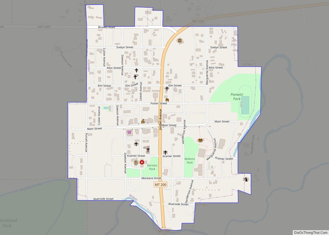
Online Interactive Map
Click on ![]() to view map in "full screen" mode.
to view map in "full screen" mode.
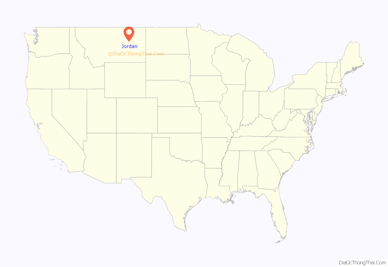
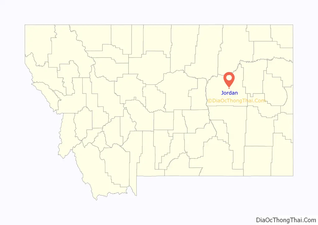
Jordan location map. Where is Jordan town?
History
Jordan was settled in 1896. The founder, Arthur Jordan, had hunted the area and decided to settle with his family in 1896 along the banks of the Big Dry Creek.
A post office was opened in Jordan on July 11, 1899. Afterward, a town began building around the post office. There were saloons, rooming houses, livery stables, blacksmiths, and stores. In the later part of the 1910s, the homestead boom hit Garfield County, which was then actually part of Dawson County to the east. By 1919, the citizens reached a consensus to form a county of their own, therefore establishing Garfield County. Jordan was finally chosen as the county seat, by popular vote. The Great Northern Railroad had proposed a route starting from Lewiston, MT eastbound through Winnett, MT and Jordan, MT, and connecting to their line at Richey, MT. Grading had been completed between Lewiston, MT and Winnett, MT but no track was laid. [1]
Jordan was incorporated as a town in 1951.
On March 25, 1996, an 81-day-long standoff between an anti-government gang known as the Montana Freemen and federal officers began near Jordan.
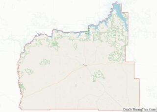
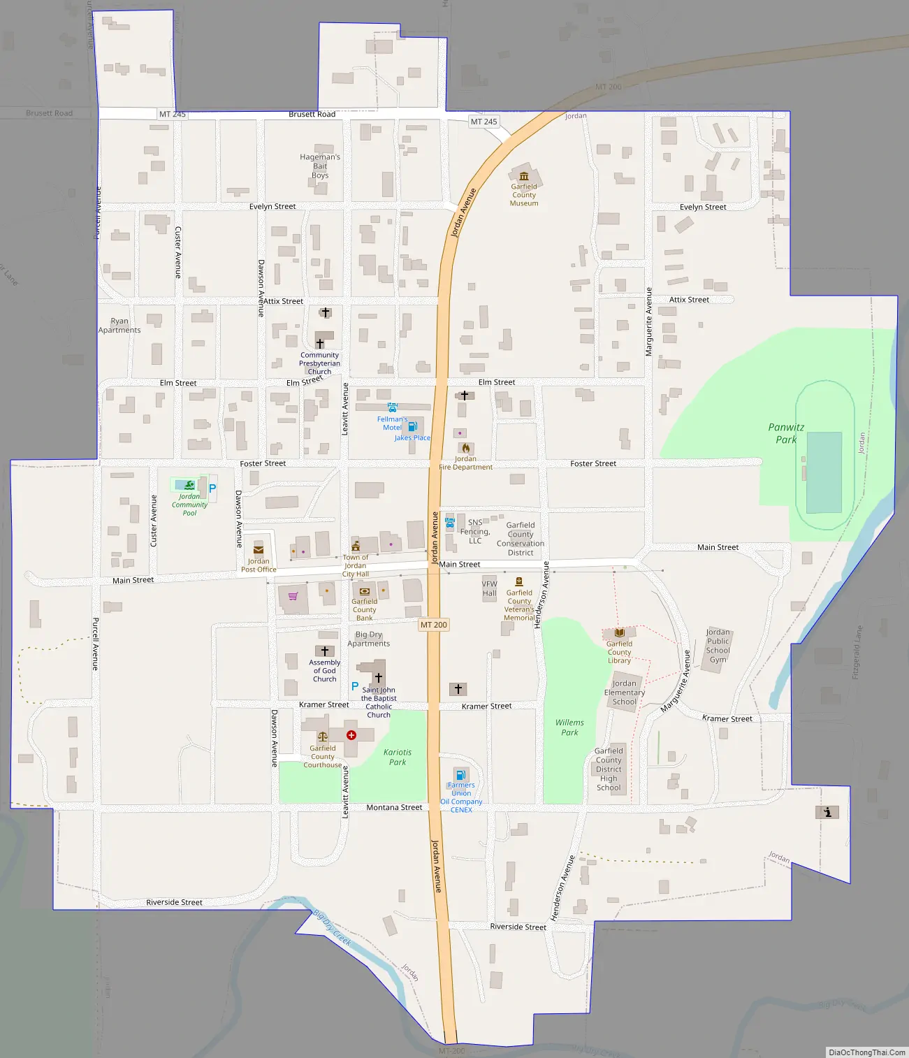
Jordan Road Map
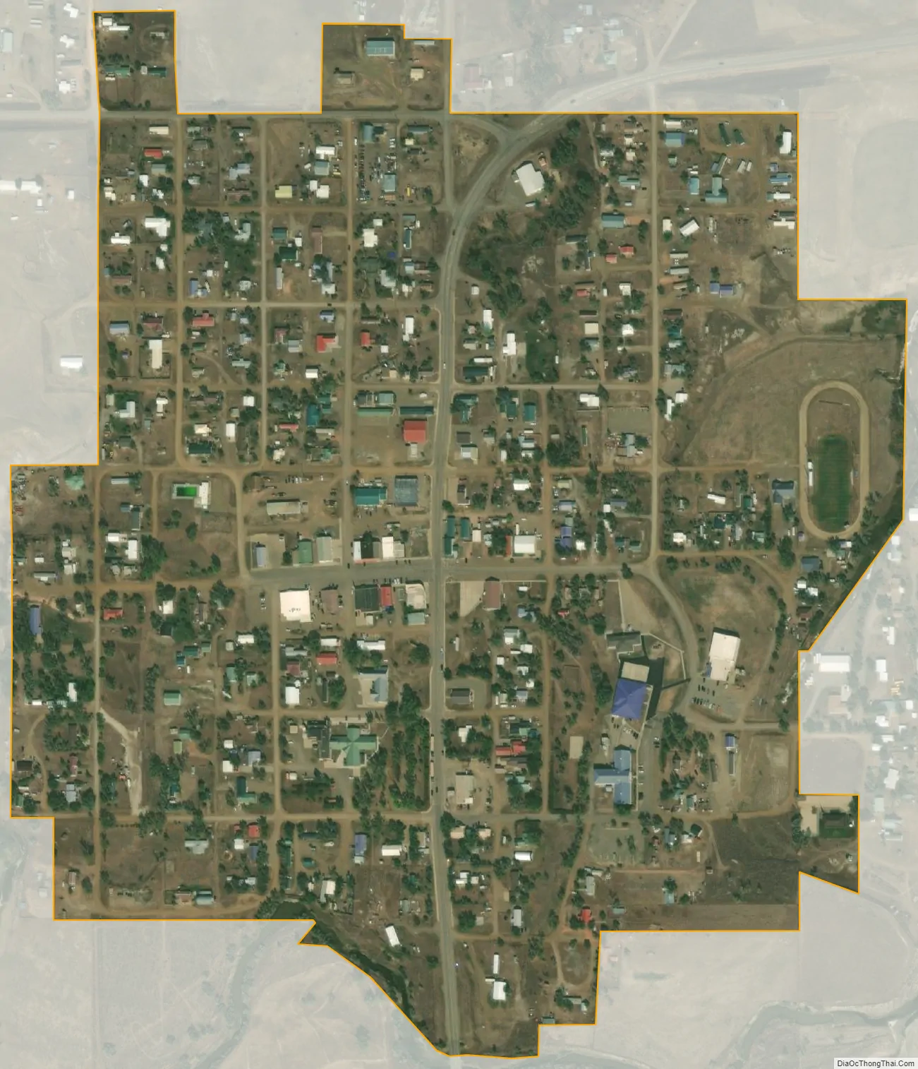
Jordan city Satellite Map
Geography
Jordan is located at 47°19.3′N 106°54.6′W / 47.3217°N 106.9100°W / 47.3217; -106.9100 (47.3212, -106.9106). Montana Highway 59 and Montana Highway 200 intersect just south of town. Fort Peck Lake is nearby.
According to the United States Census Bureau, the town has a total area of 0.34 square miles (0.88 km), all land.
Climate
Jordan experiences a semi-arid climate (Köppen BSk) with long, freezing although exceedingly variable, and dry winters alongside hot, wetter summers. The town is noted for its extreme weather: on December 15, 2009, the low was −40 °F (−40 °C).
Jordan ranks 10th in the U.S. in temperature range, from its lowest at −58 °F (−50 °C), to its highest at 112 °F (44.4 °C), a range of 170 °F (94 °C), and within February alone the range is 132 °F or 73.3 °C. An illustration of the extreme year-to-year winter climate variability can be seen in February 1936 averaging −9.5 °F (−23.1 °C), whereas February 1954 averaged 36.9 °F (2.7 °C), or a whopping 46.4 °F (25.8 °C) warmer.
See also
Map of Montana State and its subdivision:- Beaverhead
- Big Horn
- Blaine
- Broadwater
- Carbon
- Carter
- Cascade
- Chouteau
- Custer
- Daniels
- Dawson
- Deer Lodge
- Fallon
- Fergus
- Flathead
- Gallatin
- Garfield
- Glacier
- Golden Valley
- Granite
- Hill
- Jefferson
- Judith Basin
- Lake
- Lewis and Clark
- Liberty
- Lincoln
- Madison
- McCone
- Meagher
- Mineral
- Missoula
- Musselshell
- Park
- Petroleum
- Phillips
- Pondera
- Powder River
- Powell
- Prairie
- Ravalli
- Richland
- Roosevelt
- Rosebud
- Sanders
- Sheridan
- Silver Bow
- Stillwater
- Sweet Grass
- Teton
- Toole
- Treasure
- Valley
- Wheatland
- Wibaux
- Yellowstone
- Alabama
- Alaska
- Arizona
- Arkansas
- California
- Colorado
- Connecticut
- Delaware
- District of Columbia
- Florida
- Georgia
- Hawaii
- Idaho
- Illinois
- Indiana
- Iowa
- Kansas
- Kentucky
- Louisiana
- Maine
- Maryland
- Massachusetts
- Michigan
- Minnesota
- Mississippi
- Missouri
- Montana
- Nebraska
- Nevada
- New Hampshire
- New Jersey
- New Mexico
- New York
- North Carolina
- North Dakota
- Ohio
- Oklahoma
- Oregon
- Pennsylvania
- Rhode Island
- South Carolina
- South Dakota
- Tennessee
- Texas
- Utah
- Vermont
- Virginia
- Washington
- West Virginia
- Wisconsin
- Wyoming