Kalispell (/ˈkæləˌspɛl, ˌkæləˈspɛl/, Montana Salish: Ql̓ispé, Kutenai language: kqayaqawakⱡuʔnam) is a city in and the county seat of Flathead County, Montana, United States. The 2020 census put Kalispell’s population at 24,558. In Montana’s northwest region, it is the largest city and the commercial center of the Kalispell Micropolitan Statistical Area. The name Kalispell is a Salish word meaning “flat land above the lake”.
| Name: | Kalispell city |
|---|---|
| LSAD Code: | 25 |
| LSAD Description: | city (suffix) |
| State: | Montana |
| County: | Flathead County |
| Elevation: | 2,956 ft (901 m) |
| Land Area: | 12.56 sq mi (32.52 km²) |
| Water Area: | 0.09 sq mi (0.22 km²) |
| Population Density: | 1,955.88/sq mi (755.20/km²) |
| ZIP code: | 59901-59904 |
| Area code: | 406 |
| FIPS code: | 3040075 |
| GNISfeature ID: | 0785622 |
| Website: | www.kalispell.com |
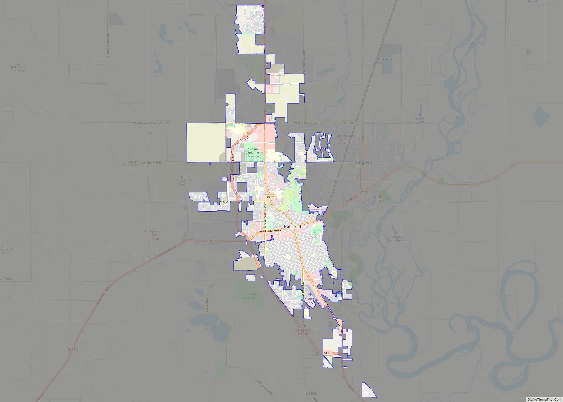
Online Interactive Map
Click on ![]() to view map in "full screen" mode.
to view map in "full screen" mode.
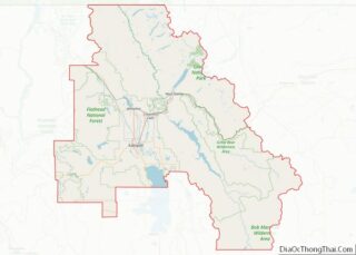
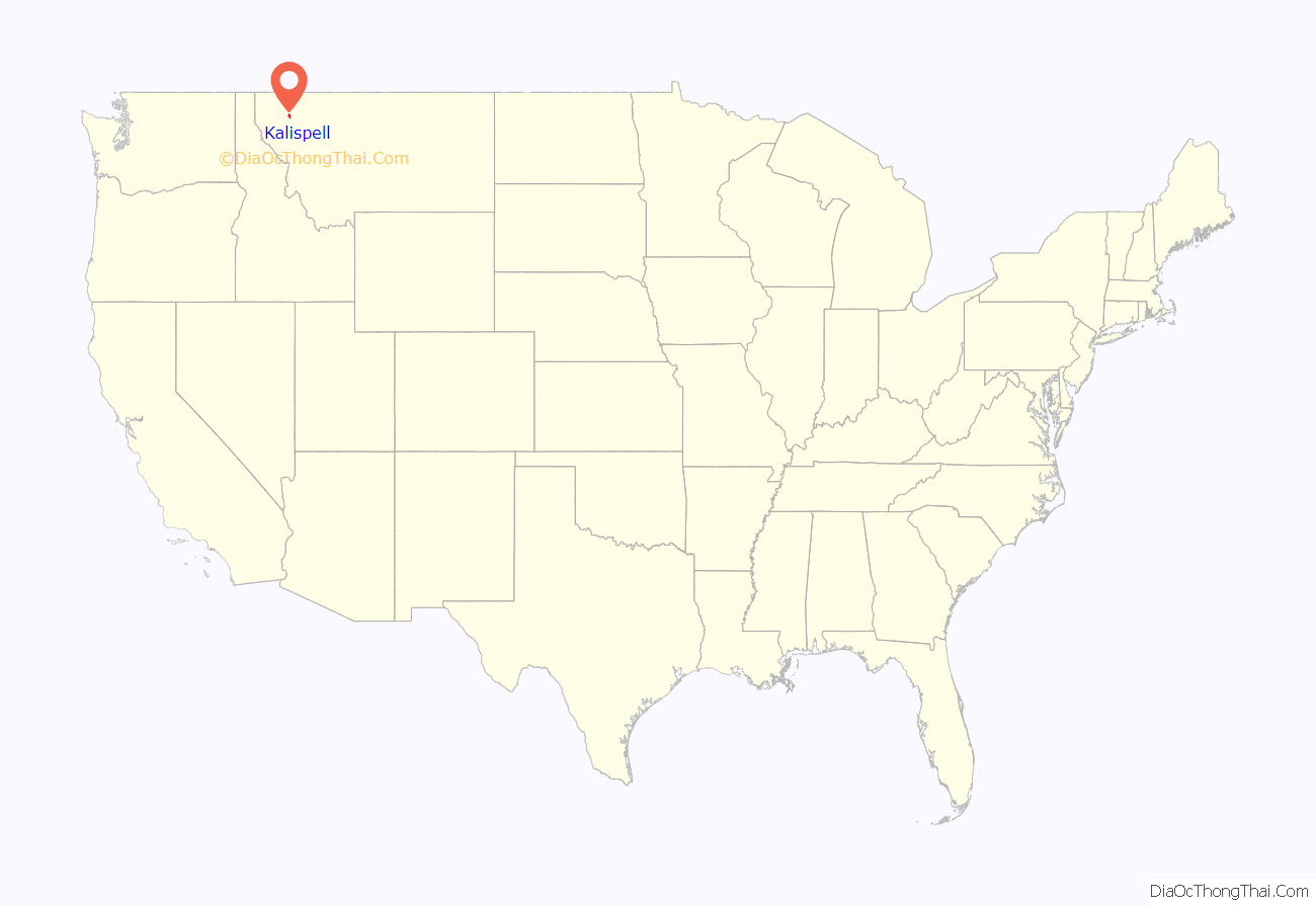
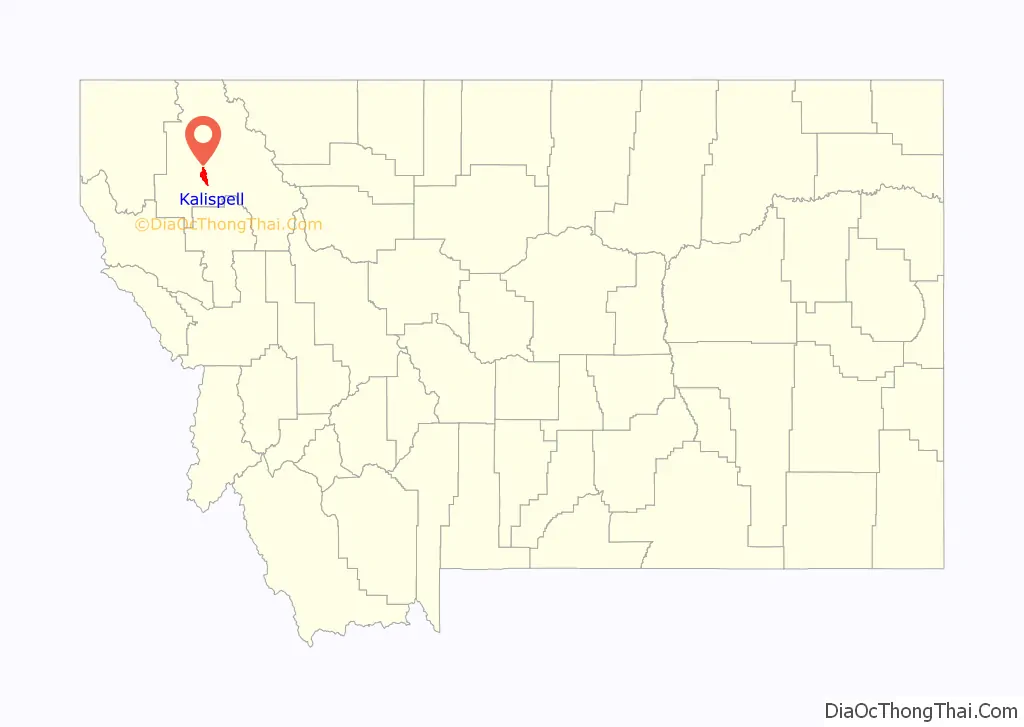
Kalispell location map. Where is Kalispell city?
History
Using his own capital, Charles Edward Conrad, a businessman and banker from Fort Benton, Montana, formed the Kalispell Townsite Company with three other men. The townsite was quickly platted and lots began selling by the spring of 1891. Conrad built a large mansion in Kalispell in 1895. Kalispell was officially incorporated as a city in 1892. Since that time, the city has continued to grow in population, reaching 19,927 in 2010. As the largest city in northwest Montana, Kalispell serves as the county seat and commercial center of Flathead County. The city is considered a secondary trade center with a trade area of approximately 130,000. The city is home to Logan Health Medical Center, which has a 150-bed hospital facility.
Nestled in the Flathead valley, Kalispell is 31 miles (50 km) from Glacier National Park and 22 miles (35 km) from Hungry Horse Dam. Skiers have access to Whitefish Mountain Resort on Big Mountain and Blacktail Mountain Ski Area, each 17 miles (27 km) away. Flathead Lake, the largest freshwater lake west of the Mississippi river, is 7 miles (11 km) away. Buffalo Hill Golf Club, designed by Robert Muir Graves, serves golfers in the region.
The tribal schools nearby offer classes in the Kalispel–Spokane–Flathead language, a language nest, and intensive language training for adults. There is a Salish language school and training center in nearby Arlee, Montana.
Heaven’s Gate (1980), an American western epic, was filmed in and around Kalispell.
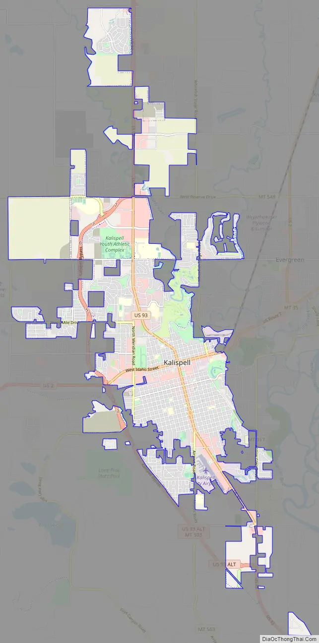
Kalispell Road Map
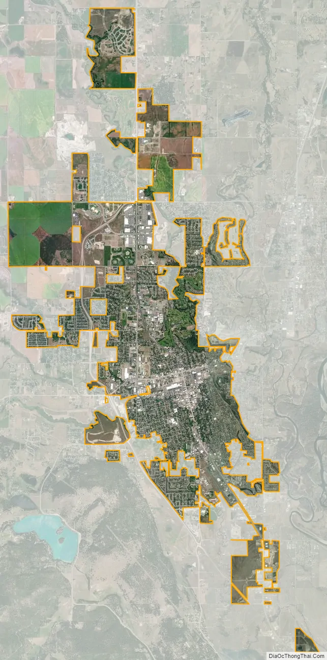
Kalispell city Satellite Map
Geography
Kalispell is located at 48°11′52″N 114°18′58″W / 48.19778°N 114.31611°W / 48.19778; -114.31611 (48.197801, −114.316068), at an elevation of 2,956 feet (901 m).
According to the United States Census Bureau, the city has an area of 11.73 square miles (30.38 km), of which 11.64 square miles (30.15 km) is land and 0.09 square miles (0.23 km) is water.
Kalispell is 7 miles (11 km) north of Flathead Lake, the largest natural freshwater lake in the western U.S.
The city has a warm-summer humid continental climate (Köppen Dfb), with long, cold, and moderately snowy winters, hot and dry summers, and short springs and autumns. Snow usually occurs from late October/early November to March.
See also
Map of Montana State and its subdivision:- Beaverhead
- Big Horn
- Blaine
- Broadwater
- Carbon
- Carter
- Cascade
- Chouteau
- Custer
- Daniels
- Dawson
- Deer Lodge
- Fallon
- Fergus
- Flathead
- Gallatin
- Garfield
- Glacier
- Golden Valley
- Granite
- Hill
- Jefferson
- Judith Basin
- Lake
- Lewis and Clark
- Liberty
- Lincoln
- Madison
- McCone
- Meagher
- Mineral
- Missoula
- Musselshell
- Park
- Petroleum
- Phillips
- Pondera
- Powder River
- Powell
- Prairie
- Ravalli
- Richland
- Roosevelt
- Rosebud
- Sanders
- Sheridan
- Silver Bow
- Stillwater
- Sweet Grass
- Teton
- Toole
- Treasure
- Valley
- Wheatland
- Wibaux
- Yellowstone
- Alabama
- Alaska
- Arizona
- Arkansas
- California
- Colorado
- Connecticut
- Delaware
- District of Columbia
- Florida
- Georgia
- Hawaii
- Idaho
- Illinois
- Indiana
- Iowa
- Kansas
- Kentucky
- Louisiana
- Maine
- Maryland
- Massachusetts
- Michigan
- Minnesota
- Mississippi
- Missouri
- Montana
- Nebraska
- Nevada
- New Hampshire
- New Jersey
- New Mexico
- New York
- North Carolina
- North Dakota
- Ohio
- Oklahoma
- Oregon
- Pennsylvania
- Rhode Island
- South Carolina
- South Dakota
- Tennessee
- Texas
- Utah
- Vermont
- Virginia
- Washington
- West Virginia
- Wisconsin
- Wyoming