Martin City is an unincorporated community and census-designated place (CDP) in Flathead County, Montana, United States. As of the 2010 census, it had a population of 500, up from 331 in 2000.
Martin City owes its existence to the early 1950s construction of the Hungry Horse Dam.
| Name: | Martin City CDP |
|---|---|
| LSAD Code: | 57 |
| LSAD Description: | CDP (suffix) |
| State: | Montana |
| County: | Flathead County |
| Elevation: | 3,206 ft (977 m) |
| Total Area: | 1.76 sq mi (4.56 km²) |
| Land Area: | 1.73 sq mi (4.48 km²) |
| Water Area: | 0.03 sq mi (0.08 km²) |
| Total Population: | 461 |
| Population Density: | 266.78/sq mi (102.99/km²) |
| ZIP code: | 59926 |
| Area code: | 406 |
| FIPS code: | 3048100 |
| GNISfeature ID: | 0786878 |
Online Interactive Map
Click on ![]() to view map in "full screen" mode.
to view map in "full screen" mode.
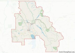
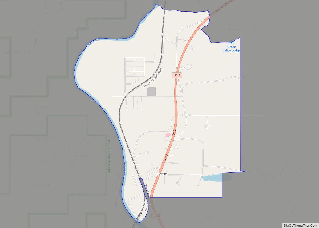
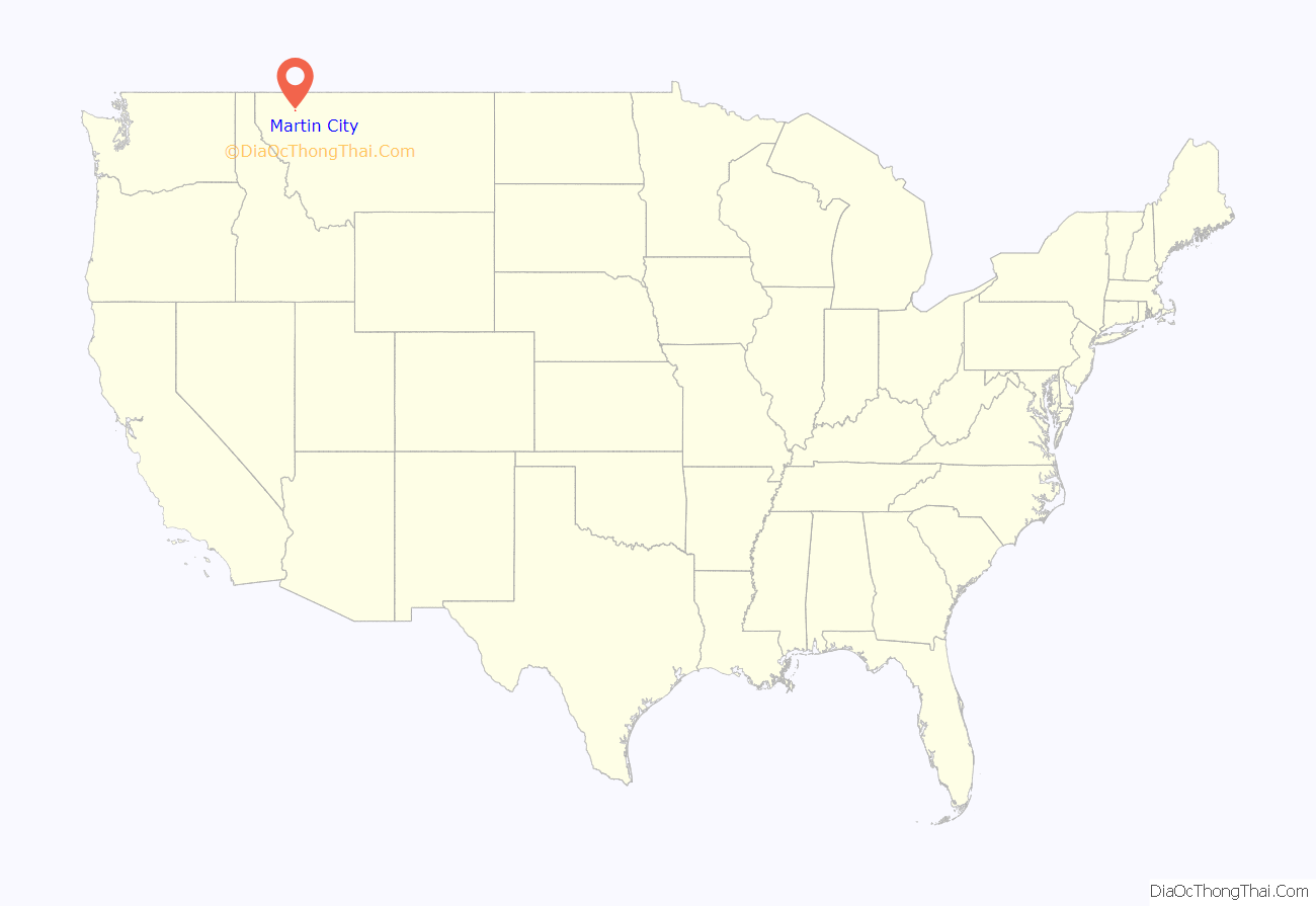
Martin City location map. Where is Martin City CDP?
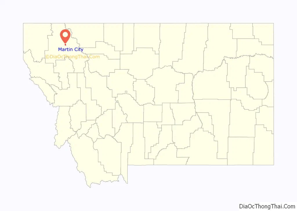
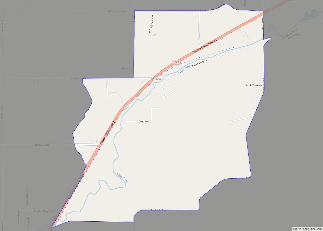
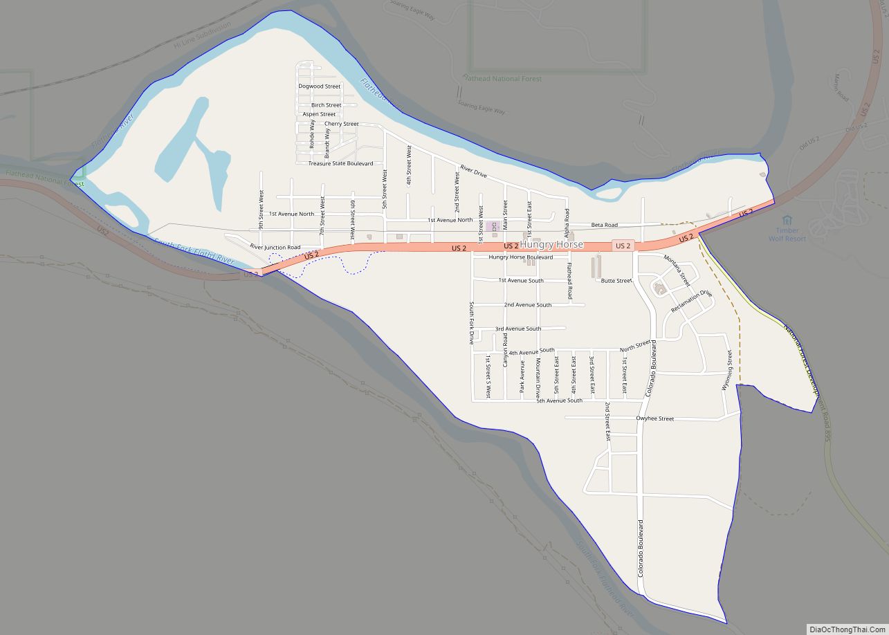
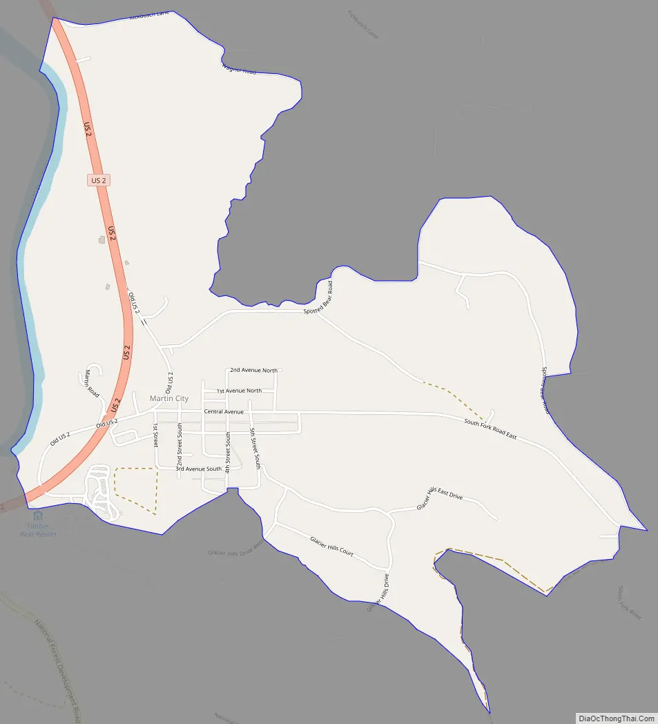
Martin City Road Map
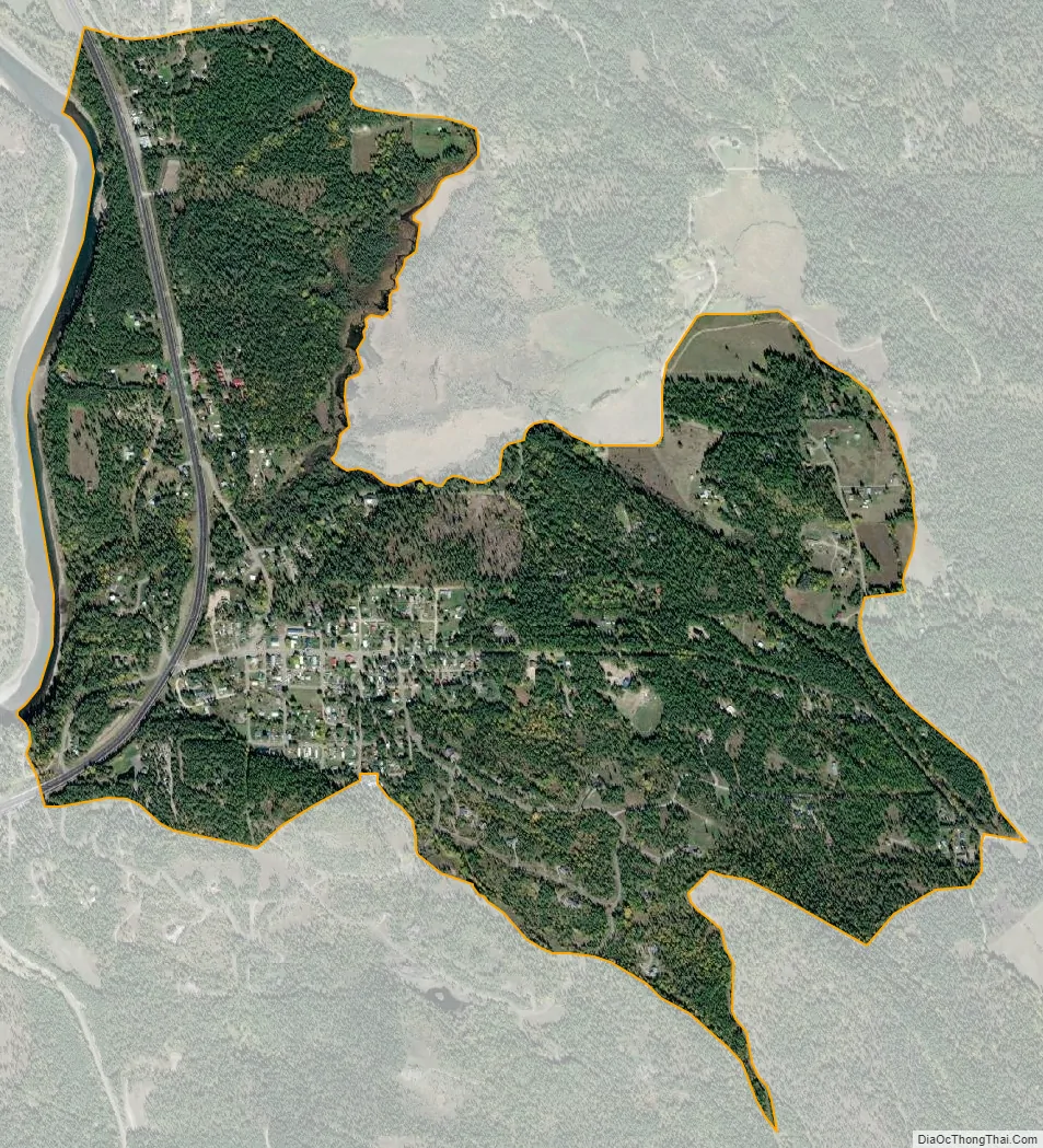
Martin City city Satellite Map
Geography
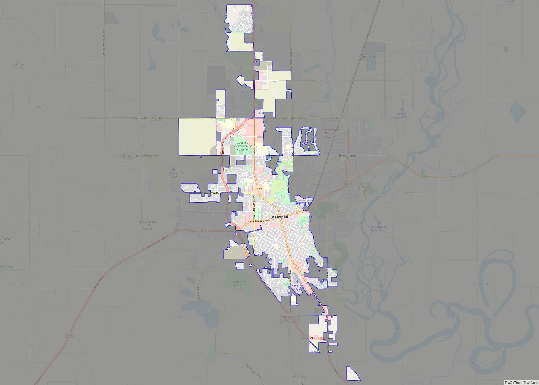
Martin City is located in central Flathead County at 48°23′26″N 114°2′7″W / 48.39056°N 114.03528°W / 48.39056; -114.03528 (48.390443, -114.035250), between Hungry Horse to the southwest and Coram to the north. U.S. Route 2 passes through the community, leading northeast 9 miles (14 km) to West Glacier and southwest 24 miles (39 km) to Kalispell.
According to the United States Census Bureau, the CDP has a total area of 1.7 square miles (4.5 km), of which 0.02 square miles (0.05 km), or 1.16%, is water. Martin City is located on the east side of the Flathead River.
See also
Map of Montana State and its subdivision:- Beaverhead
- Big Horn
- Blaine
- Broadwater
- Carbon
- Carter
- Cascade
- Chouteau
- Custer
- Daniels
- Dawson
- Deer Lodge
- Fallon
- Fergus
- Flathead
- Gallatin
- Garfield
- Glacier
- Golden Valley
- Granite
- Hill
- Jefferson
- Judith Basin
- Lake
- Lewis and Clark
- Liberty
- Lincoln
- Madison
- McCone
- Meagher
- Mineral
- Missoula
- Musselshell
- Park
- Petroleum
- Phillips
- Pondera
- Powder River
- Powell
- Prairie
- Ravalli
- Richland
- Roosevelt
- Rosebud
- Sanders
- Sheridan
- Silver Bow
- Stillwater
- Sweet Grass
- Teton
- Toole
- Treasure
- Valley
- Wheatland
- Wibaux
- Yellowstone
- Alabama
- Alaska
- Arizona
- Arkansas
- California
- Colorado
- Connecticut
- Delaware
- District of Columbia
- Florida
- Georgia
- Hawaii
- Idaho
- Illinois
- Indiana
- Iowa
- Kansas
- Kentucky
- Louisiana
- Maine
- Maryland
- Massachusetts
- Michigan
- Minnesota
- Mississippi
- Missouri
- Montana
- Nebraska
- Nevada
- New Hampshire
- New Jersey
- New Mexico
- New York
- North Carolina
- North Dakota
- Ohio
- Oklahoma
- Oregon
- Pennsylvania
- Rhode Island
- South Carolina
- South Dakota
- Tennessee
- Texas
- Utah
- Vermont
- Virginia
- Washington
- West Virginia
- Wisconsin
- Wyoming