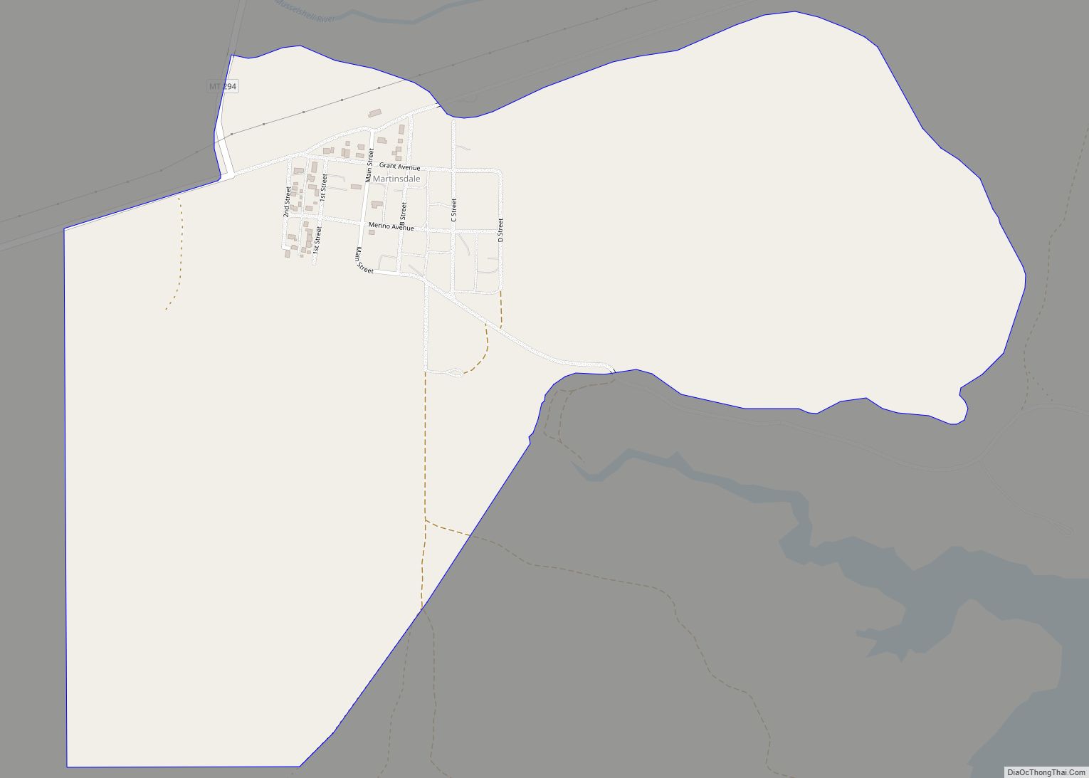
Martinsdale is a census-designated place in southeastern Meagher County, Montana, United States. The town was a station stop on the now-abandoned transcontinental main line of the Chicago, Milwaukee, St. Paul and Pacific Railroad (“the Milwaukee Road”), and is a community center for nearby ranches and farms. Martinsdale was the home of the poet Grace Stone Coates, author of Black Cherries, Mead & Mangel-Wurzel, and Portulacas in the Wheat. It was also the home of Charles M. Bair, one of the largest and most successful sheep ranchers in the United States, and the former Bair family home is now a museum.
The Gordon Butte Pumped Storage Project is a planned pumped hydroelectric power plant that will be constructed in Martinsdale.
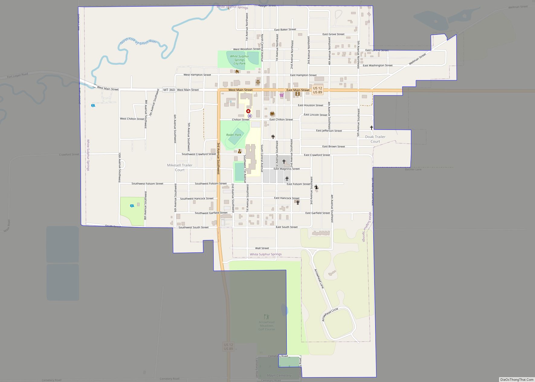
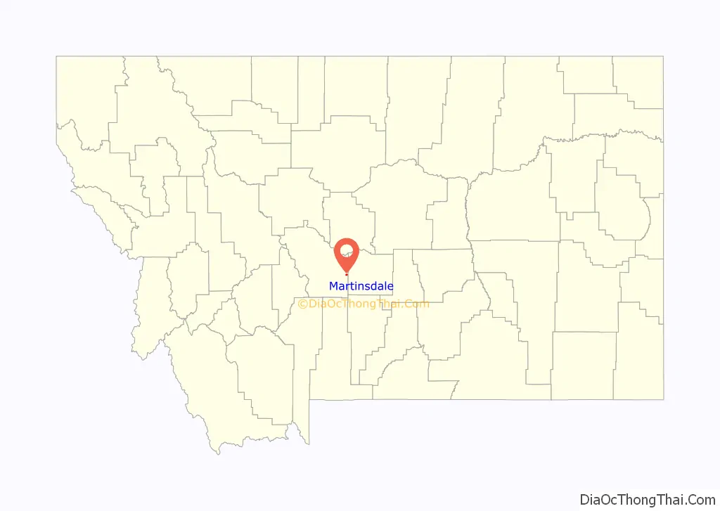
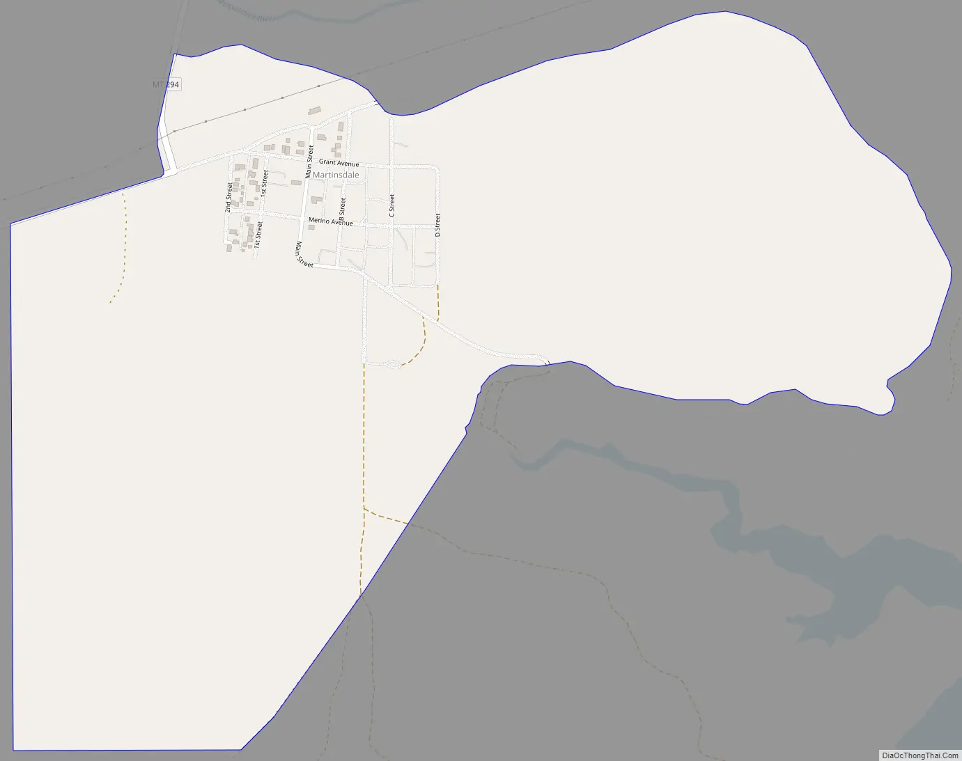
Martinsdale is on Highway 294, just south of U.S. Route 12, and 44 miles east of White Sulphur Springs.
| Name: | Martinsdale CDP |
|---|---|
| LSAD Code: | 57 |
| LSAD Description: | CDP (suffix) |
| State: | Montana |
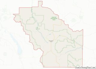
| County: | Meagher County |
| Elevation: | 4,820 ft (1,470 m) |
| FIPS code: | 3048175 |
| GNISfeature ID: | 773906 |
Online Interactive Map
Click on ![]() to view map in "full screen" mode.
to view map in "full screen" mode.
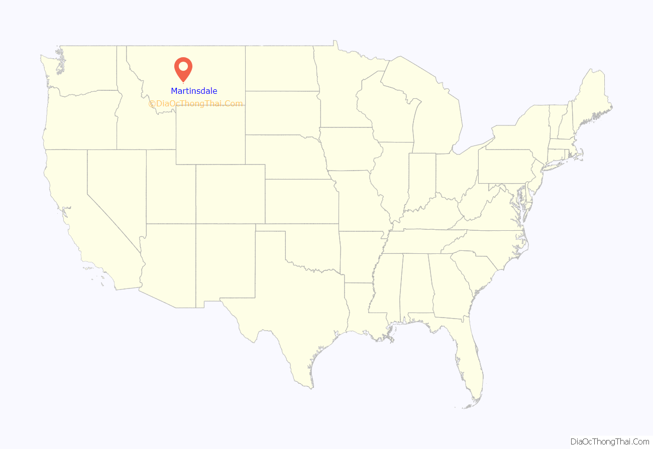
Martinsdale location map. Where is Martinsdale CDP?
History
Originally named Gauglersville, the town changed to Martinsdale in 1878. The name was after Martin Maginnis, Montana Territory’s delegate to Congress, who assisted the town in getting a post office.
Martinsdale Road Map
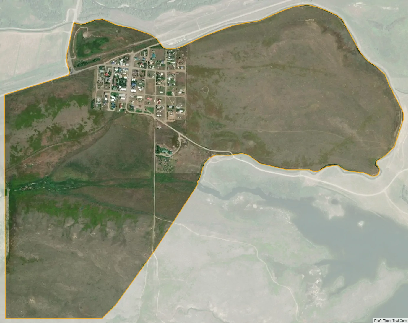
Martinsdale city Satellite Map
See also
Map of Montana State and its subdivision:- Beaverhead
- Big Horn
- Blaine
- Broadwater
- Carbon
- Carter
- Cascade
- Chouteau
- Custer
- Daniels
- Dawson
- Deer Lodge
- Fallon
- Fergus
- Flathead
- Gallatin
- Garfield
- Glacier
- Golden Valley
- Granite
- Hill
- Jefferson
- Judith Basin
- Lake
- Lewis and Clark
- Liberty
- Lincoln
- Madison
- McCone
- Meagher
- Mineral
- Missoula
- Musselshell
- Park
- Petroleum
- Phillips
- Pondera
- Powder River
- Powell
- Prairie
- Ravalli
- Richland
- Roosevelt
- Rosebud
- Sanders
- Sheridan
- Silver Bow
- Stillwater
- Sweet Grass
- Teton
- Toole
- Treasure
- Valley
- Wheatland
- Wibaux
- Yellowstone
- Alabama
- Alaska
- Arizona
- Arkansas
- California
- Colorado
- Connecticut
- Delaware
- District of Columbia
- Florida
- Georgia
- Hawaii
- Idaho
- Illinois
- Indiana
- Iowa
- Kansas
- Kentucky
- Louisiana
- Maine
- Maryland
- Massachusetts
- Michigan
- Minnesota
- Mississippi
- Missouri
- Montana
- Nebraska
- Nevada
- New Hampshire
- New Jersey
- New Mexico
- New York
- North Carolina
- North Dakota
- Ohio
- Oklahoma
- Oregon
- Pennsylvania
- Rhode Island
- South Carolina
- South Dakota
- Tennessee
- Texas
- Utah
- Vermont
- Virginia
- Washington
- West Virginia
- Wisconsin
- Wyoming